Sunday, December 16, 2018

Looking for Lookout Mountain


If I throw myself off Lookout Mountain
No More for my soul to keep
I wonder who will drive my car
I wonder if my Mom will weap
~Lookout Mountain, Drive By Truckers

The other morning, I found myself out in Pomona during the work-week which is not a typical occurrence. So after taking care of business, I decided to leverage the unusual situation and go hunting for an alternate cross-country route to Lookout Mountain that David R and dima, two characters I know, had blogged about on the San Gabriel Mountains Discussion Forum. I don't know whether I was doing the route correctly or not, but I didn't achieve the objective. So at least on one level, I was doing it wrong. On the other hand, you really can’t do the outdoors “wrong,” especially when the alternative is sitting behind a desk.

I parked in the village in front of the visitor's center and started up Bear Canyon. Along the way, I admired the quaint cabins and day-dreamed about what daily life was like there. I followed the road until it became a footpath and then followed that to the point where it begins the short series of switchbacks climbing eastward just below where the last two cabins in the canyon are situated. Immediately adjacent to this spot, a lateral drainage enters the main canyon from the west. Here, I crossed the creek bed and started up the drainage which had been traveled by others as I saw blue tape and rock cairns along the way. So I figured if I wasn't on the right route, at least I was on a route.

I rock-hopped up the drainage to a point where a subsidiary drainage entered from the west. I figured this couldn't be the right drainage because it appeared too narrow and its entrance obstructed with deadfall. So I continued my up the "main" channel passing and posing for a trail cam mounted to a tree along the way. Beyond that point, I noticed that the blue tape and rock cairns had disappeared. Ignoring that, I pushed on and finally came to a dry waterfall that was probably 20 feet high. The falls were climbable and there appeared to be a steep bypass on the right, but since I was solo, I figured discretion was the better part of adventure and so I turned tail here. I also reasoned that there was a good chance I was on the wrong trajectory anyway, so I backtracked to the junction with the subsidiary canyon and began my way up that drainage instead. 


"Lookout" Canyon

Ascending the Main Branch


The Main Branch After the Split

Waterfall Obstacle
Ascending this drainage, I saw signs of travel by others so I was optimistic I was now where I was supposed to be. There was deadfall and rocks to negotiate, but nothing insurmountable. Then I came to a huge tree that had fallen across the creek bed. This is where I think things went awry. Instead of going under or around this tree and continuing upward in the channel, I climbed on top of the fallen behemoth and used it to cross to the south side of the gully as the going looked easier there. And I saw discernable signs that others had done the same. So I left the drainage and began ascending the steep, forested slope, following in the footsteps of previous visitors as best as possible.

But where others had been was apparently not where I wanted to be. As I neared what appeared to be ridgeline leading north from Pt. 5696, the brush got thicker. Then it became an impenetrable wall at every turn so I finally abandoned the fool’s effort. Reflecting on it now, I probably should have made my way back to the channel and continued upward, but figured I'd save that for another day. Marveling at how much easier it was descending then ascending, I retreated back to the main trail and decided to go to Bear Flats to see if I could locate the beginning of another fabled cross-country route to Lookout Mountain. 


Mouth of the Lateral Drainage

Drainage Ascending to the Saddle Just North of Pt. 5696
Bear Flats seems like a misnomer to me. I didn't see any bears and it’s not particularly flat. I also didn't see any trace of a use trail that could be used as an access point for a cross-country route to Lookout Mountain. All I saw was more brush. Since I’d already had enough of that for the day, I found a rock to sit on and have a snack while I licked the wounds to my ego and contemplated my navigational loserdom.


View South from the Bear Canyon Trail

Ontario Peak Dressed in Winter Finery

The LBC from the Bear Flats Trail

Monday, November 19, 2018

Chamise, the Woolsey Fire, Fucked-Up Priorities, and Gratitude


As you may know from my last blog-post, I’ve effectively adopted a little Chamise plant that lives in a fissure atop a sandstone outcropping in the hills overlooking my neighborhood. For the past year or so, I’ve fawned over this little guy like a doting parent, showering him with attention and water and protecting him against foreign invaders intent on claiming and occupying his homey crack. While other nearby plants have either withered or retreated into dormancy during what seems like perpetual drought, mi chamisa has flourished. He bloomed late into the season this year and is looking quite robust despite his rather harsh and austere surroundings.

So when the Woolsey Fire raced through the area and ravaged the local hillsides, I thought of mi chamisa and was immediately sick with worry. I realize how quirky and perhaps douchey it may sound to be worried about a single fucking plant while entire neighborhoods and biomes are burning. But I’ve invested a lot of emotional capital in this single plant, and rightly or wrongly, I was concerned about him.  If that makes me sound like a crackpot with misplaced priorities, I suppose that’s only because I’m a crackpot with misplaced priorities. I accept that.

So last Friday night, I raced home after work and scampered up the familiar trail in the fading light to do a welfare check on my friend. As I climbed the trail, a heaviness fell upon me. Both sides of the trail were charred black and the odor of smoke still hung heavy in the air. Most of the vegetation, including the despised Russian Thistle, had been completely obliterated by the flames. The landscape was deathly still and devoid of life. I wondered about the Western Toads I had inexplicably seen trailside before all hell broke loose. I was astonished they were there in the first place. What could possibly be their fate now?

Lost in thought and feeling a bit melancholy, I crested the ridge to discover that the trail sign and wooden bench were still there and intact. Stunned, I stood there for a brief moment trying to process what I was seeing. Everything around the bench and trail sign was completely gone, but they were still there. I hurried to the top of the hill where the sandstone outcropping sits, approaching it reverentially and with some hesitancy. Now that I was there, I wasn’t really sure whether I wanted to see what I had come to look at. But I quickly noticed that the rounded top of this hillock seemed to have avoided the worst of the flames. It was hard to tell for certain in the dusky darkness, but I thought I could detect living, breathing plants as I made my way up the spur to the summit.

At the base of the sandstone outcropping, I readied my flashlight and scurried to the top. Hesitating for a moment, I surveyed the cliff edge before turning on the light. I could see something in the darkness, but I couldn’t tell if it was alive or dead. I asked the universe for a miracle and then switched on the light. And there he was, mi chamisa, sitting there stoically in the sandstone crack as he always had, untouched by the flames.

I was overwhelmed by emotion. Tears began to well up but I held them back. Nobody was around to see, but I still felt a bit embarrassed about getting weepy over a solitary plant. I texted my daughter 400 miles away to tell her that mi chamisa had survived. She responded immediately with relief telling me that she had seen the destruction in the burn areas and had been thinking about my Chamise. She is her father’s daughter. She has inherited my idiosyncrasies.

I quickly pulled some water from my pack and offered some to my friend. He gratefully accepted. I then sat alone in the inky stillness sipping a beer and feeling content. Sometimes, the universe delivers.

Sunday, September 16, 2018

How I Became a Guerrilla Soldier in the War on Russian Thistle


There is a rocky sandstone prominence in the hills above my house that I hike to virtually every night. I generally pack some cheese and a can of beer and sit up on this outcropping to watch darkness creep over the landscape as the light dies in the west. My throne is pretty damn barren and inhospitable…it’s rock after all. But it is fractured and creased in places and some of those crevices collect and hold a bit of sandy soil.

In one of those crevices, life has implausibly taken hold. A solitary Chamisa has sprouted from the sandstone and against all odds, is somehow eking out an existence. I’ve become quite attached to this little Chamisa for some reason, and I’ll share some water with him occasionally to make sure he gets through the long, Southern California dry season. He’s my buddy, at least in my mind, and I’ve become obsessed with checking on his health every time I go into the hills.


One day when I went to visit, I noticed he had an unwanted neighbor. A Russian Thistle had taken hold in the crack and was threatening to hog all the water I provided and to crowd out mi chamisa. Furious, I yanked the invader from the crack roots and all and tossed it unceremoniously over the edge of the outcropping. It relinquished its hold in the crack surprisingly easily.


Russian Thistle, a non-native invasive, is pervasive in the hills of Southern California. I’ve always known it was there, but like Black Mustard, it is so ubiquitous and so integrated into in the landscape that I never gave it much attention.  But after my clash with it on the sandstone outcropping, I took a hard look at the areas immediately adjacent to the trail leading to and from the prominence. The area is carpeted with the offending stuff. It’s easy to spot right now because it blooms in late summer-early fall and consequently is one of the few plants that is currently green.


That’s when it hit me. I was going to yank some of that shit out. I knew getting rid of all of it was a fantastic crack-pipe dream, a moron’s errand, but I figured eliminating it from portions of the trail was a battle I might be able to win. So, the following weekend, I bought sexy-looking black pick-axe from Lowe’s and became a guerrilla soldier in the war on Russian Thistle.


Later that night, I packed leather gloves, water, and beer into my pack, grabbed my new implement of death, and headed for the hills. At first, I was a bit reticent about hiking with a pick-axe, not knowing how folks would react. I thought maybe someone might challenge whether my removal of non-native invasives had been appropriately “sanctioned” by whomever it is that sanctions these types of activities. I got a few curious looks, but nobody said shit. I guess I looked official. In reality, I was just some beer-swilling dude with a fucking vendetta.


Since that day, I’ve removed thistle from the area surrounding the sandstone rock on which mi chamisa resides as well as the upper stretches of the trail leading to the outcropping. I honestly don’t know whether my efforts will have any positive effect, but I figure at a minimum, I’m giving space for native plants to sweep in and re-occupy the areas that were being hogged by the thistle. Beyond that, it just makes me feel happy and satisfied. And best of all, the crack that mi chamisa calls home remains Russian Thistle free.

Saturday, August 4, 2018

Chased Out of the Miter Basin

The Miter Basin
I’ve got a Tom Harrison map of the Whitney Zone that I unfurl now and then so that I can daydream about all of the nooks and crannies on that map that I still need to visit. One of the places I’ve stared at and imagined for a long time is the Miter Basin. Surrounded by an assemblage of white granite peaks, spires, and domes, and dotted with lakes with names like “Sky Blue” and “Iridescent,” I always found this trackless and relatively remote area irresistibly alluring. And I wanted to visit it.

So I finally conceived a plan and convinced my daughter and a friend from Utah to join me on a romp into the heart of the basin. The loose itinerary involved a loop of sorts beginning at the Cottonwood Pass trailhead. The plan was to spend the first night a lower Soldier Lake, a second night a Sky Blue Lake, and a third night in the Cottonwood Lakes Basin. We’d make the short walk out and back to the car on the morning of the fourth day.

So on a Wednesday afternoon we loaded up and headed for the Alabama Hills where we car-camped at Tuttle Creek. The next morning we were up early for coffee and permits. We didn’t actually have permits reserved, so we had to wait until the Eastern Sierra Interagency Visitor Center opened at 8 a.m. for the lottery. When we got there around 7:45 a.m. there was already a line of about 30 folks doing the same. I sauntered up to the entrance and was innocently milling about when a dude with his girlfriend barked at me for trying to cut the line. I told the guy that there was no line, and that we’d all draw numbers from a hat to determine our order. Shortly after that, a Ranger appeared with a bucket and made me look like a sage. We then all drew numbers. I pulled number 3; the guy that barked at me pulled something much worse. We got permits no problem. I don’t know about the other guy.

Car Camping in the Alabama Hills
Forty-five minutes later we were on the trail and making our way up to Cottonwood Pass. If you’re an old man living at sea level, one of the nice things about the trails departing from Horseshoe Meadow is that you’re already at elevation. You of course still end up climbing with a fully-loaded pack, but it’s a kinder, gentler climb that allows your body a bit of time to acclimate to both the weight of the pack and the less oxygen-nutrient air.

At Cottonwood Pass, we paused briefly for snacks and to snap pictures for a group that had spent a week or so making the circuit around the Big Whitney Meadow area. We then jumped onto the PCT and made our way to Chicken Spring Lake to tank up on water since it wasn’t evident whether we’d have another chance before we reached lower Soldier Lake.

Horseshoe Meadow
Cottonwood Pass

PCT
Chicken Spring Lake
From Chicken Spring Lake, the PCT climbs briefly out of a shallow cirque and then remains relatively level at about the 11,300’ contour until it crests a low rise and begins a slow descent into the vast Siberian Outpost. Here we stopped briefly to admire the stark landscape and the interplay of sun and shadows being cast by storm clouds to the west. A harbinger of things to come.

A mile or so beyond this is a well-marked trail junction. Going south will take you up over the Siberian Pass and into the Big Whitney Meadow area. Continuing west along the PCT leads to Rock Creek and beyond. We veered north on the pleasant connector which ultimately intersects with the path that leads east up over New Army Pass and northwest to lower Soldier Lake. Just before that intersection, the connector crosses a stream which was running strongly and could serve as a good source for replenishing water supplies. We were still good in that regard, so we pushed on to our destination.

The spur leading to lower Soldier Lake is dotted with campsites and a single bear box. There are additional sites immediately adjacent to the lake as well, but we didn’t know when we first arrived. As we inched along the spur, we were somewhat surprised to find that every single site was occupied. One large site housed a group of ten 20-somethings from Ohio State who told us they’d been on the trail for 26 days. The last site before the lake was taken by a sole older gentleman who offered to split the site with us. We gratefully accepted and shared our whiskey with him as recompense. Turns out our camp host was enjoying his first night of a solo hike of the JMT. The following day he was headed for Guitar Lake so that the day after he could summit Mt. Whitney and officially begin his through-hike.

PCT Views

Rock Field

Siberian Outpost
Connector to Lower Soldier Lake

Camp View at Lower Soldier Lake
The next morning we had planned to penetrate the Miter Basin. The intended route was the “short-cut” which follows a use trail that skirts the west side of lower Soldier Lake and then climbs the low rise on the north-west end of the lake. Upon seeing the route, my daughter expressed a bit of trepidation so we back-tracked to the main trail and tacked southwest to the mouth of the Rock Creek drainage.

There is supposed to be an obvious use trail leading up drainage, but it wasn’t obvious to us. We ran into a couple of young ladies looking to do the same thing we were doing and we all fumbled around a bit looking for the non-existent use trail. Finally, we forded Rock Creek and began ascending the west side on something that kinda, sorta resembled a faint use path or game trail. After bashing through brush for a bit and climbing obstacles, our female companions apparently called it quits because we didn’t see them again. Determined or obstinate, we continued forward for about ¼ mile when we burst into a wide, open meadow bisected by Rock Creek. One the east side of the creek, we finally saw the well-trod use trail we’d been searching for and jumped the creek to beat its path.

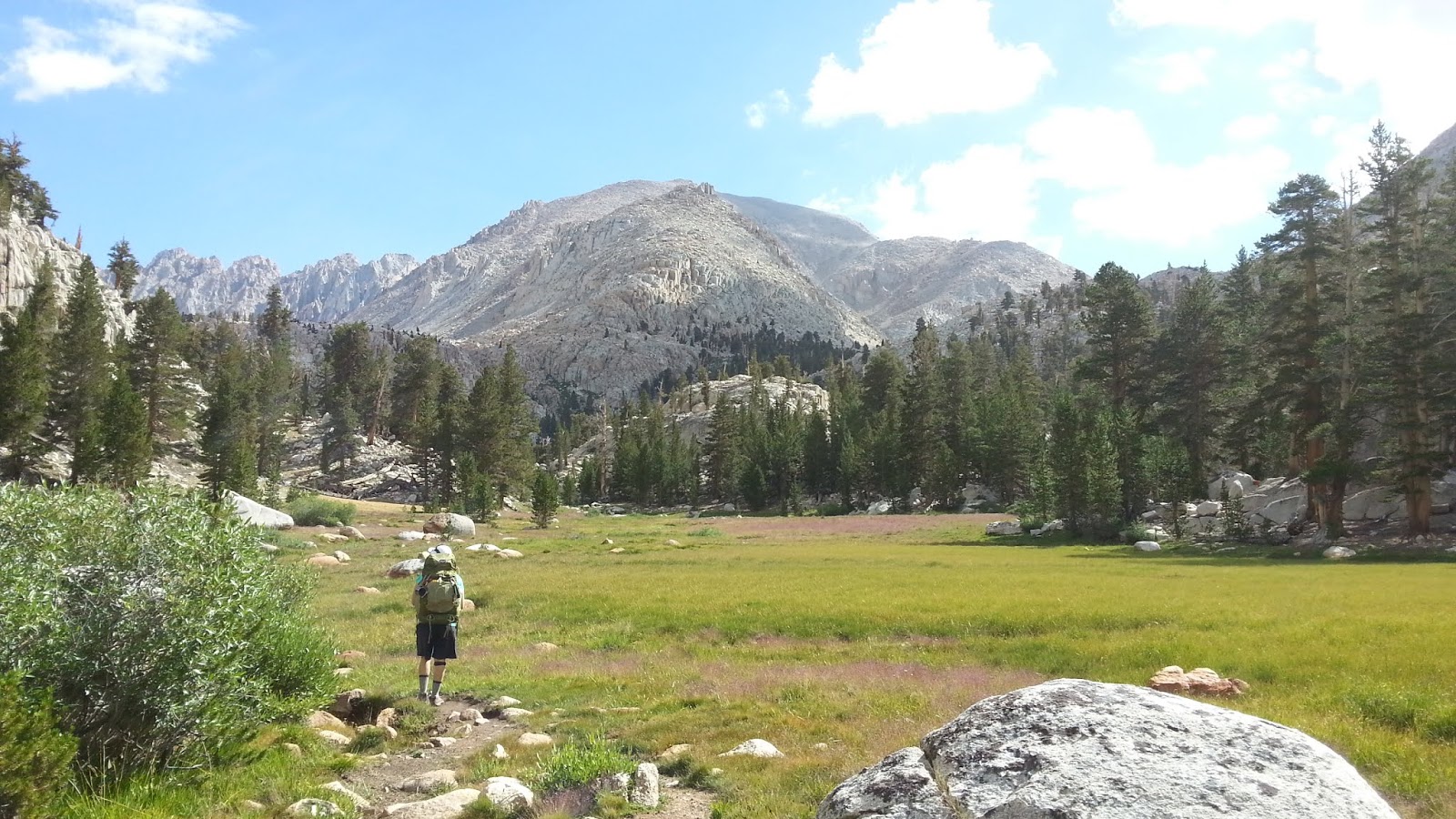
Meadow Near Rock Creek Junction

Rock Creek as it Flows Out of the Miter Basin

The Meadow - Use Trail to the Right
From here, the route forward was pretty simple: continue up the basin. We occasionally lost then relocated the use trail, but it’s pretty hard to get truly lost here as there is only one way in and one way out. Ok, that’s not entirely true, but practically speaking it is for most mortals, and that included us.

The scenery here is as sublime and glorious as I had imagined it. The Major General sits high on your right. Mt. Corcoran, Mt. LeConte, and the Shark Tooth, all 13,000’+ dominate the skyline to the northeast. The spikey Miter scrapes the sky to the north. And an unnamed granite spire and 12,000’ solid granite walls hem you in on the west. Our intended destination Sky Blue Lake, sits in a bowl above a series of cascades sandwiched between the Miter and Peak 13,221’.

But about ½ mile out, as we approached the final ascent to Sky Blue Lake, the sky after which the lake is named became ominous. The wind, which had been still throughout the day, began to howl. The temperature dropped. We started to hear the crack of lightning and the rumble of thunder. And then the heavens opened up and it began to rain. Then it hailed hard enough to coat the ground with tiny balls of ice. Then it rained again, harder this time.

We stopped to evaluate the situation and ponder the night ahead. My trail companions looked dubious. My daughter, the more level-headed of the two of us, was reluctant and urged retreat to lower ground. Dejected, I relented and we started to beat a retreat back to Soldier Lake.

On the way out, we bumped into a young lady that was part of the Ohio State contingent. She had gone into the basin on a day exploration and was retreating to Soldier Lake as well. When we discovered that she was returning via the “shortcut,” we stalked her all the way back to the lake which in fact shaved off a fair amount of distance and time.

Granite Cliffs Abound

Pushing Deeper Into the Basin

Typical Basin Views
Lower Soldier Lake from Atop the Shortcut
Back where we started the day, we set up camp lakeside on the peninsula of sorts that juts into the lake on its south side. As soon as our tents were up, the rain began and we took shelter. And then it rained, and it rained, and it rained. And it hailed again. And then it rained again. For three straight hours, the rain relentlessly pummeled our sad little fabric shelters which finally wetted out despite a valiant struggle to keep us dry. At dusk, the precipitation finally subsided and the clouds gradually began to move along and ruin someone else’s party.

The next morning was brisk and clear. We took our time breaking camp in order to allow our gear to dry some. Then we were back on the trail ascending the stunningly gorgeous valley that climbs to New Army Pass from the east. As the climb stiffened, and the suffering began in earnest, the beauty of my surroundings began to fade. Actually, the surroundings didn’t change at all. It was just my frame of mind. The Buckeyes were in front of us, and I tried to use them as my rabbit, but I couldn’t keep pace with the youngsters, including my daughter who blasted the ascent with no problems. Finally atop the 12,310’ pass, we stopped to refuel and to immerse ourselves in the moment. It was chilly and breezy at the pass and billowy clouds were starting to accumulate on the horizon.

The climbing for the trip complete, we descended the spare cirque that cradles appropriately-named High Lake. A fair number of hikers were struggling up as we came down, including a guy attempting to prod, poke, and cajole a group of adolescent boys up to the pass. We offered encouragement, but the boys just looked at us with utter contempt. I laughed because I knew how they felt. At Long Lake, we stopped again to pump water and solidify our plans for the evening. Charcoal gray thunderheads were now boiling up over the peaks to the northwest and the skies to the east and south were darkening. Remembering the onslaught we endured the night before, we determined to admit defeat and walk the rest of the way out. Midway back it began to rain again.

Back in Lone Pine, we figured we’d salvage the remainder of the trip by getting eats, beer, and firewood for another night of car-camping at Tuttle Creek. But even here, the weather refused to cooperate. While we were in town, the wind kicked up and the sky turned black. Lightning cackled and thunder thundered in the distance. We knew our fate was sealed. So we jumped in the car and made the long drive back to predictably and reliably dry civilization. 

Lower Soldier Lake Campsite

Climbing to New Army Pass

Approaching Near New Army Pass

Mt. Langley from the New Army Pass Trail
High Lake, Long Lake, and South Fork Lakes from New Army Pass

Descending the East Side of New Army Pass

Stunning Rock Formations
Long Lake

Cottonwood Lakes Basin