|
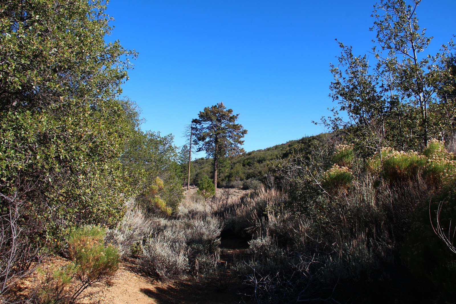
| Lower Falling Rock Canyon |
Falling Rock Canyon is one of those places that I felt the entire local hiking community had visited except me. I had looked at it on maps and glanced at it numerous times on my way up Icehouse Canyon, but I had never ventured into its rugged and shady depths. Some other peak or destination always took precedence. So last weekend I decided to fill that embarrassing gap in my San Gabriel Mountains experience. There's a ton of good route descriptions on-line so I'll dispense with that. To paraphrase Cracker,
what the world needs now is another route description, like I need a hole in my head.
I rolled into the parking lot at Icehouse late to find it packed to the gills as usual. To my great fortune, however, there was an open spot right of front which I dutifully snagged. A good omen. Out of the car and up the trail that was heavy with weekend warriors like myself, I broke ranks with the herd just beyond the first switch-back and dropped into the stream-bed. There I was compelled to pause for a moment to absorb the colorful foliage and listen to the water music from Icehouse Creek. Leaf litter littered the ground and obscured the faint path forward, so I just aimed for the obvious gash in the side of the canyon whose entrance was choked with fallen rocks. Yeah, this had to be the way.
 |
| Icehouse Canyon |
 |
| Sunburst in the Forest |
 |
| Entrance to Falling Rock Canyon |
Once in the confines of the canyon, I quickly encountered the first and second dry waterfalls. After a false start that left me more exposed than I was comfortable with, I gingerly backtracked a bit, tacked left, and then ascended some scree before rejoining the canyon above the second falls. Here, the narrow canyon climbs steadily up before moderating some in its higher reaches. This is a really an enjoyable stretch, one of the nicer places I've been in the San Gabriels, so I slowed my pace here as I picked my way through the rocks. I was only going as far as Sugarloaf so there was really no need to rush things.
The route descriptions I had read told me that I would ultimately exit Falling Rock Canyon on the right at the first scree field. Cairns marked the spot I was told. In short order, I came upon a cairn at the base of a steep slope coming in from the right that I told myself could be characterized as a scree field. Looking at the hillside, it was evident that folks had either been up or had come down here so I surmised this was the exit point. Thus, I began to climb but with some uncertainty.
The sledding here was tough. The angle was very steep. The rock was loose and crumbly. And every two steps forward resulted in one step back. I soldered on for about 20 minutes and then stopped to take stock of the situation. This didn't feel right. Either everyone else is more capable than me (which I admit is a distinct possibility), or I had taken a wrong turn. So I slowly made my way back into the canyon bottom resigned to the possibility that I might not make it to Sugarloaf.
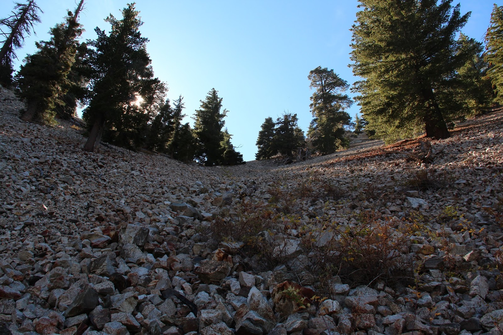
But the day was still relatively young, and I was already here, so I figured there was no harm in continuing up the canyon just to see what was there. After rock-hopping for a bit in the slowly narrowing canyon, a bigger and more defined scree field spilled in from the right. There was no cairn to mark the location, but looking up it appeared to top out at a saddle. With nothing to lose, and a new belief that this must be the place, I began picking my way up the rock pile.
As it turned out, this in fact was the place. After a relatively short but steep rock slog, I topped out at a saddle between Ontario Peak and Sugarloaf. Here, a distinct use trail veered northwest toward Sugarloaf and the southern ridge route to Ontario was in view. I stopped to take in water and peer into the deep recesses of Cherry Canyon.
 |
| Lower Falling Rock Canyon |
 |
| Looking Down Falling Rock Canyon |
 |
| The Correct Scree Field |
 |
| Use Trail to Sugarloaf |
 |
| The North Side of Ontario Peak |
 |
| Mt. Baldy from the Saddle |
 |
| View South Into Cherry Canyon |
From the saddle, it was just a short hop, skip, and jump over a false bump or two to Sugarloaf. On the flat, rocky summit I found a well-maintained register which I dutifully signed. Flipping through the pages I saw several names I recognized. Hikerhodi was in there several times. Dima Kogan had logged in after scaling Ontario Peak from Cascade Canyon. Feeling inferior, I put the register back in its canister home and enjoyed the fine scenery that Sugarloaf affords. To the northeast, the 3 Ts were plainly in site. Telegraph Peak loomed particularly large. To the northwest across Icehouse Canyon, Mt. San Antonio dominated the skyline. And to the south, was a unique look at Ontario Peak.
After lazing about for awhile, I picked myself up and made my way back to the saddle. Then it was a quick scree-ski into the shade of Falling Rock Canyon and a rock-hop back to Icehouse. In the car and out of San Antonio Canyon, I realized the
Claremont Craft Ales was conveniently and dangerously nearby. So of course I made a visit to sample their Grapefruit IPA before calling it a day. For you beer aficionados, Claremont's Grapefruit IPA is decent, but I'd personally use a lighter hand on the grapefruit if I was brewing. I did sample their
Mosaic Dry IPA which I found to be exceptional. I'll probably order that on my next visit. Cheers!
 |
| Upper San Antonio Canyon |
 |
| The 3 T's - Thunder, Telegraph, and Timber |
 |
| Ontario's Peak's North Side |
 |
| Mt. San Antonio, Up Close and Personal |
 |
| Telegraph Peak |
 |
| Grapefruit IPA at Claremont Craft Ales |