I've had enough ticks and poison oak in my time that I'm going to avoid that and get out of the proverbial ditch, at least for today, Instead, I'm staying in the middle of the road and sticking to a plain, vanilla trail report. No navel-gazing (or at least limited navel-gazing). No asides (or at least limited asides). No pontificating (or at least limited pontificating). No curse words (or at least limited curse words). And no bitching (is that a curse word?). Well, I may do some bitching. As a grumpy, old curmudgeon that's my job.
So anyway, there was a time when I was going to the Angeles National Forest every single weekend to explore. The ANF was new to me then so every outing was an exciting adventure. But eventually, all the driving wore me down and I finally hit a wall. If hiking meant a 70 mile drive to the trailhead, I wasn't interested. So I stopped going, opting instead for more hyper-local, yet ultimately shorter trails. Sometimes those "trails" even ended up being the NordicTrack elliptical sitting in my garage. Physically satisfying, yet soul-crushing.
On Sunday, I sought to change that dynamic a bit by getting out for a good, long jaunt in the hills. But because it was one of those hot, summer November days we have here in Southern California, going inland wasn't that appealing. So I looked to the
Santa Monica Mountains where I figured it would be cooler. It was, but not by much.
The track I settled on was the "
Zuma Canyon Loop." The route starts at the top of Busch Drive in Malibu, ascends the Zuma Ridge Trail, drops into Zuma Canyon via the Zuma-Edison Road, climbs back out to the Zuma Canyon Connector trail, descends and joins Kanan-Edison Road, returns to the bottom of Zuma Canyon by way of the Ocean View Trail, and then returns to the trailhead on the Zuma-Loop Trail. Total mileage for the loop is approximately 10.6. The app I use (
View Ranger) registered 4,100 feet of gain. AllTrails says total gain is 2,755 feet. Neither is probably accurate, but the gain did feel like it was significantly greater than 2,755.
There is very little shade on this route. There is a bit in the bowels of Zuma Canyon along the dry creek-bed where Sycamore trees grow, and then there's the occasional
Laurel Sumac that you can shelter beneath. Otherwise, it's an dry, hot slog. For that reason, it isn't an optimal summertime day-hike. It's also not one of those hikes where you carry nothing but a single 20 oz. plastic water bottle that you discard trailside. I carried a bladder containing 3 liters and essentially drained it.
Zuma Ridge Trail
The Zuma Ridge Trail is somewhat of a misnomer. The term "trail" normally conjures up images of narrow single-track, but in this particular instance, the trail is actually a roadbed that climbs steadily northward out of the small parking area at the trailhead. The climb isn't particularly steep at any point in time, but it is sustained, and flat areas before the junction with the Zuma-Edison Road are few and far between. If the climb isn't enough for you, opportunity exist along the way to bag a couple of unnamed "peaks" (e.g., Peak 1260, Peak 1791, and a few other unmarked bumps).
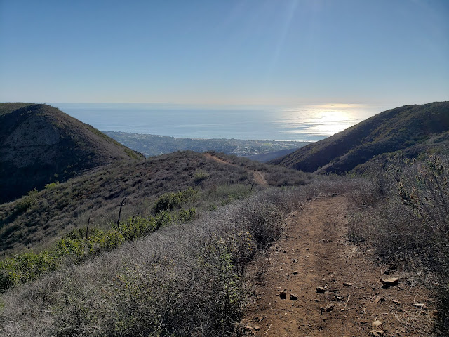
As you continue to climb, the views of the mighty Pacific get more impressive. On a clear day, the Palos Verdes Peninsula, Santa Catalina Island, Santa Barbara Island, San Nicholas Island, and the remaining Channel Islands are all visible. On the day I went, you could also see a number of container ships sitting in the Santa Barbara Channel waiting their turn to off-load containers full of iPhones and automobiles and television sets and clothing and other "stuff" at the Port of Los Angeles. A number of squid boats were also congregated just off the coast where the soft-bodied molluscs were apparently boiling.
At approximately 3.2 miles, you reach the intersection with the Zuma-Edison Road that comes in from the right. Here, you have a couple of options. You can continue up the Zuma Ridge Trail to Buzzard's Roost. You can turn around, return to your car, and go have a cold beer. Or you can continue with the loop by descending Zuma-Edison Road. If you choose the latter option, make sure you have enough juice in both the tank and your water bottles. This is the point of no return. There is no way out of the canyon bottom that doesn't involve either a 1,000 climb or an off-trail sufferfest.
Zuma-Edison Road
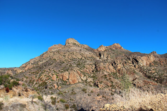
The Zuma-Edison Road descends quickly into Zuma Canyon as you give back most of the elevation you just gained. Once again, you're walking a maintained fire road that is used to access Edison's towers that host the high-tension wires that hang across the canyon. As you continue to loose elevation, you get more nice looks at the Buzzard's Roost, this time from the east. At the last tower on the descent, the maintenance stops and the road deteriorates into a defacto trail until you reach the next tower on the other side. At the bottom of the canyon, the path crosses dry Zuma Creek where Sycamore trees provide some shade relief from the unrelenting sun. There is no established trail along the creek in the canyon-bottom, but it is feasible to rock-hop and brush-bash down-canyon back to the trailhead at Bonsall Drive. Not knowing the conditions, I decided against launching off on such an exciting adventure, opting instead for the long, boring road walk up the other side to the junction with the Zuma Canyon Connector Trail.


Zuma Canyon Connector Trail
Just beyond the crest of the high-point on the other side of the canyon, the Zuma Canyon Connector Trail intersects the road. The trail is obvious, and the junction is marked with a sign telling you dogs and motorcycles are not permitted, but there are no other marking telling you that this, in fact, is the Zuma Canyon Connector. Even though I wasn't entirely certain that was the correct route, the single-track was so inviting after all the road-walking I'd done, that I didn't really care. The trail was heading generally in the right direction so I crossed my fingers, hoped for the best, and launched off down the path. This is a really enjoyable stretch of the route as you roller-coaster along the undulating ridgeline and catch nice views of the Malibu coastline.
Down trail, I ran into a pleasant young lady that was on her way up. Because it was late afternoon and I told her she still had a long way to go, she turned around and we walked back to the bottom of Zuma Canyon together. We continued along the trail until it merged with and became the Kanan-Edison Road. About 1.3 miles later, we branched off and descended dusty Ocean View Trail which is heavily used by equestrians. In fact, on the descent, crossed paths with a train of about 10 equestrians who were coming up trail as we were going down.
When the trail ultimately bottoms out in Zuma Canyon, you might hope and think you're finished. But you'd be mistaken if you believed that. That's because you still have another half-mile to go. And it's all uphill which is disheartening. It's isn't steep, but after grinding for 10 miles, it's not necessarily what you want to encounter.
Here, my hiking companion, who was parked at the Zuma Canyon trailhead, offered to give me a lift back to my car where I started. That was an enticing offer and I briefly contemplated accepting. But I figured that would be cheating (because it would be cheating), so I graciously declined and began the crawl up the Zuma Loop Trial back to where I started. Ultimately, that was a good decision because the trail is well maintained and the ascent gentle, so the climb really wasn't as bad as I had imagined.
A short while later I was back at the trailhead as the afternoon shadows began to get long. My total time out was about 4.5 hours which included a few stops along the way to goof around and explore.


