Wednesday, December 21, 2016

Observation Point: Zion National Park

Bridge Mountain
Over the long Thanksgiving weekend, I was fortunate to find myself in the spectacular red-rock playground that is Southern Utah. Early winter is really a superb time to be there. The days are relatively warm, the nights are cool, and the sky is always a brilliant blue. What else to do than visit iconic Zion National Park?

The day after Thanksgiving seemed like the best day to go since we were driving back to Southern California on Saturday instead of Sunday. I've driven the I-15 on the Sunday after Thanksgiving many times and it is not something I care to repeat ever again. That stretch of road from Las Vegas to Victorville is a dangerous and crowded gambit under the best of circumstances, but on the Thanksgiving weekend it becomes a frustrating death crawl. As it turned out, making that drive back on Saturday involved ten hours in the car and clawing our way through a 50-mile parking lot from Vegas to the California state line. So that traffic-avoidance strategy failed miserably. But I digress.

Friday morning we were up and out of the house much later than anticipated. Forty-five minutes later we were in Springdale sitting in a traffic jam heading into the Park. Instead of waiting in that interminable line, we ditched the car along the main drag and walked the rest of the way to the Park entrance. I've done this before and the benefit was a substantially discounted entry fee. This time, when I stepped up to the kiosk to pay, the Ranger rung me up at the full $30. Before paying, I told him I thought the Park charged a lesser fee to those who walk or bike in to encourage that type of thing. That was true, I was informed, but not on days like this day when the parking lot was already bursting to capacity. Hmmm. A harbinger of things to come.

Past the kiosk, we headed toward the boarding area for the mandatory shuttle that would take us into Zion Canyon. There, we encountered a long line of about 500 folks waiting to do the same. Someone nearby crabbed that the experience was more akin to Disneyland than a National Park and I shook my head in knowing agreement. Our outdoor public places are being loved to death. We need more of them, not less.
Big Bend and the Organ

Observation Point

My Two Favorite Hiking Buddies

Daddy - Daughter Date
After what seemed an eternity, we finally boarded a shuttle and were on our way. Before getting to our destination at Weeping Rock, however, the shuttle had to first go through the motions of making stops at the Zion Museum, Canyon Junction, and the Court of the Patriarchs where absolutely nobody got off and nobody got on.

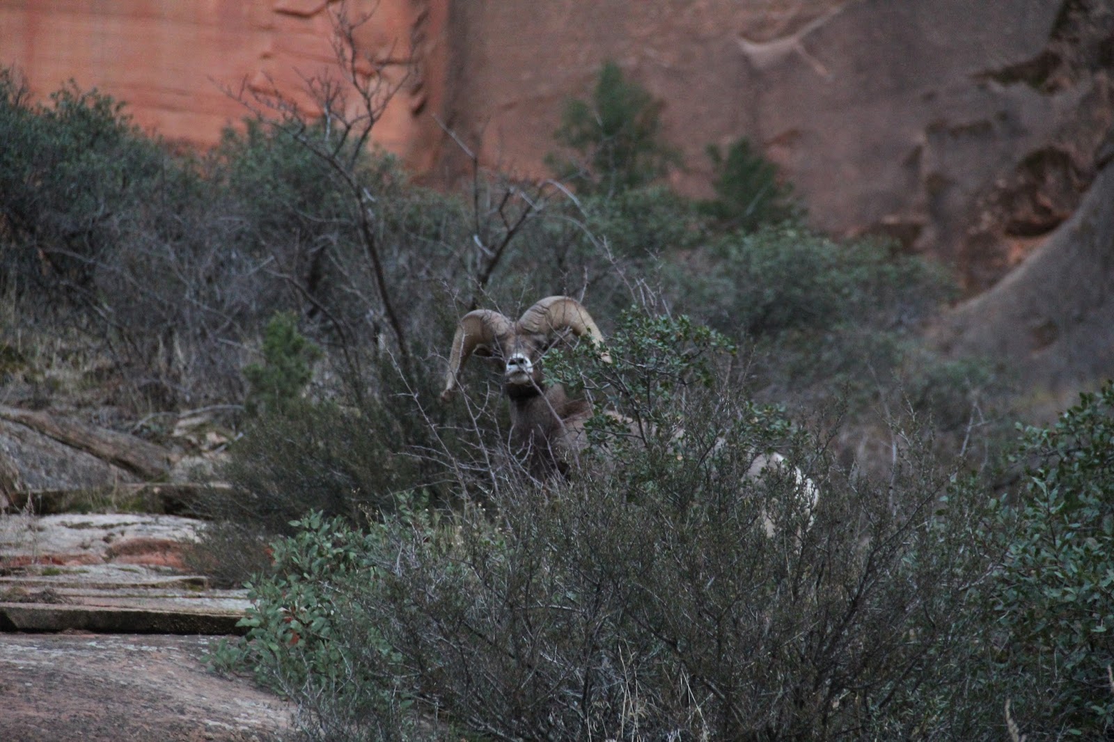
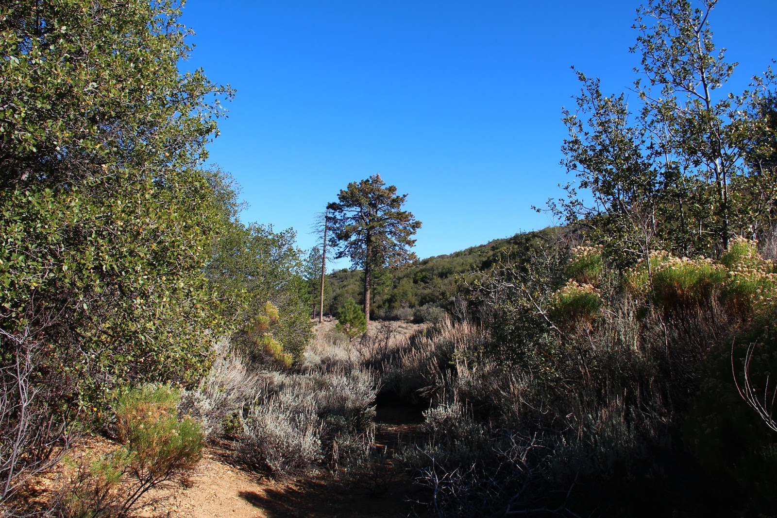
At Weeping Rock (Shuttle Stop No. 7), we de-boarded the shuttle, secured our gear, and started up the East Rim Trail that would take us to Observation Point. The climb out of the canyon begins immediately as the path switch-backs up the imposing sandstone wall on the east side of Virgin River. Cable Mountain and the Great White Throne tower overhead as pretty views of the Big Bend and the Organ open below. A short distance up, a trail splits off to the right and climbs stoutly ala Walters Wiggles into cool Hidden Canyon. We continued on the main path which ultimately levels out some and then enters beautiful Echo Canyon, tracking the creek that has carved a deep gash in the soft red rock. On the cliffs high above us, we caught glimpses of Big Horn Sheep foraging precariously on the steep hillside.

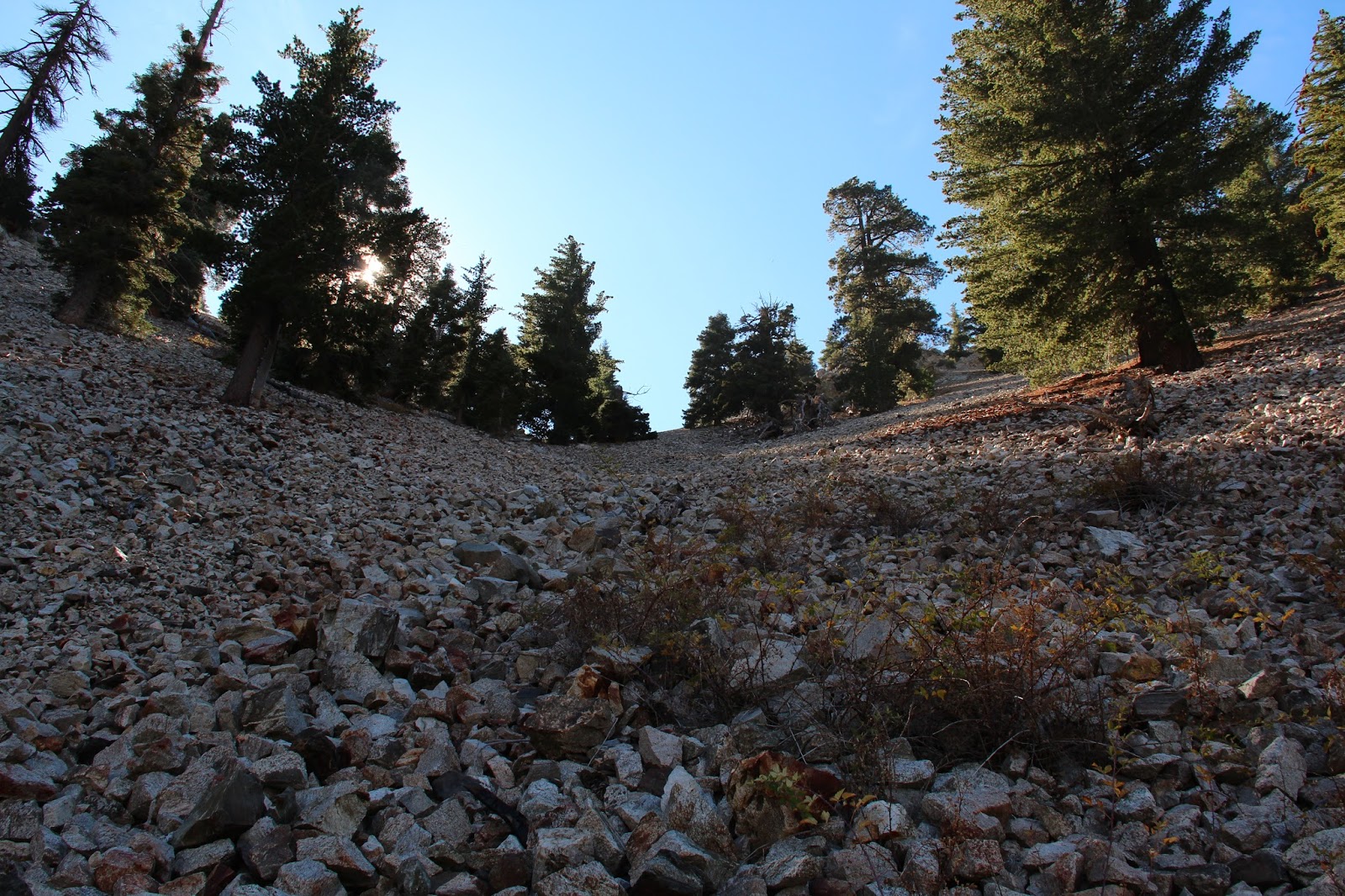
Out of the creek-bed and through a narrow slot in the orange sandstone, the walls fall away and the character of the canyon suddenly changes. Here, the rock is cream-colored and the flora is evergreen. A trail into upper Echo Canyon and ultimately, Cable Mountain branches off to the east, but it doesn't appear to see much use even though it is well marked. Beyond this point, the path steepens again as it climbs vigorously to the top of plateau. Once on top, we had a short, flat stroll out to Observation Point which affords the best views of Zion Canyon. Yeah, yeah, I know. What about Angel's Landing? Angel's Landing, the crowd favorite, is cool and should be experienced, but Observation Point has superior views and is far from the madding crowds.
Desert Bighorn High on the Hillside

Oh, Hello

Sandstone Wonderland - East Mesa Trail

Trail Views

Looking Into Echo Canyon

The Valley from Observation Point. Angel's Landing in the Lower Right Foreground

Observation Point Benchmark - Elevation 6,508'

Oh, the Views

Om
Unfortunately, because it was so late in the day, the light was not optimal so our pics of Zion Canyon from above do not reflect the awesomeness of this place. For that same reason, we didn't have much time to spend on top because we had to hustle back down while we still had light and the shuttles were running. So after a late lunch and a zen moment, we turned tail and began the trek back to Weeping Rock.

On the way back through Echo Canyon, we saw some Big Horn Sheep tracks in the soft sand and spoke about how fortunate we were to see one on the way up. Twenty minutes later, as we were descending the switchbacks into Zion Canyon, two young rams bounded across the trail about 20 yards in front of us. As we furiously clicked away, they grazed on the spare hillside forage completely unconcerned with us and our cameras. One even cut across the hillside about 10 yards above us and peered over the edge which was both exhilarating and frightening. Up close, they are huge and imposing animals.

Late Afternoon Shadows in Echo Canyon

Cable Mountain

More Desert Bighorn Sheep

Up Close and Personal

Look at Those Beautiful Horns

Walk Away. Yeah, That's Right

You Lookin' at Me?

Done Playing with the Humans
Back in the canyon, we boarded one of the last shuttles out as the sky faded to black. The contraption was packed to the gills so we stood. As more and more folks loaded on at each stop, we were slowly forced to the rear as our personal space compressed down to nothing. With everyone putting out their own thermal energy, the shuttle was already quite warm, but the driver had the heat blasting which made it an unbearable furnace. And then it happened. Like it always happens in these situations. Someone cracked one. The nauseating stench permeated the bus and enveloped us all, but nobody said anything. It's not what you do in polite company. So we all sat and/or stood there in the oppressive heat and the foul air hanging on in quiet desperation and pretending all was well. Finally, someone unlatched a window a bit and cool, clean air came filtering in. I would have kissed the guy on the lips if I could have, but he was out of reach and was with his wife. 

Twenty minutes or so later, after having stopped at the Zion Museum once again on the off chance that someone in the over-crowded shuttle wanted to get on or off (which they didn't), we pulled into the parking lot of the Visitor's Center where we all poured out of the bus and into the chill of the inviting Southern Utah night.


Sunday, November 20, 2016

Ambling Along the Dry Lakes Ridge

The First Dry Lake Along Dry Lake Ridge
You will follow me and we will ride to glory, way up, the middle of the air!
And I'll call down thunder and speak the same and my work fills the sky with flame
And might and glory gonna be my name and men gonna light my way.

Just out of Ojai and beyond the point where the Maricopa Highway squeezes through the slot of Wheeler Gorge, a high mountainous barrier towers above the roadway to the north. The unmistakable geologic feature with an east-west orientation is so impenetrable that the road-builders were to forced snake around it when the road (originally designated Highway 399, but now Highway 33) was surveyed and constructed in the early part of the last century. This imposing obstacle is Dry Lakes Ridge.

In my many forays into the Ventura County back-country, I've admired this ridge with wonder and awe. Based upon the many good trip reports published by my fellow wilderness travelers, I knew the ridge was comprised of a series of dry lakes or basins, and that the area atop the ridge was designated as a botanical area because of the unique flora that it harbors, but never having experienced it myself, I was left to imagine what it was like to travel along its spine.

Well, I now have to imagine no more. Last week, a friend and I decided to tackle the ridge in order to get a first hand look. Given its configuration, and depending upon your definition of the term, there really is no "easy" way to gain the ridge. There are only gradations of steepness. Stated differently, from a topographic perspective, the spread between the contour lines for the ridge range from almost non-existent in some areas to merely close together in other areas. Despite this, there is an obvious and traveled route to the top which involves ascending an old fire-break that runs down the eastern tongue of the ridge to intersect Highway 33 where it tops out near the Heliport benchmark at elevation 3736.

From the highway to the top of the ridge, the way forward is fairly obvious although there is no established trail. The initial climb is stout but it mellows some once you attain the ridge. There, you get nice looks at the Pine Mountain Ridge, the upper Sespe drainage, the Nordhoff ridge, Lake Casitas, and the coast. The track then continue upward, wending it's way through the ubiquitous manzanita to the high point and your first glimpse of the eastern-most dry lake.

The Pine Mountain Ridge

Piedra Blanca and the Upper Sespe Drainage
Zoom of Pine Mountain Ridge

The Abandoned Fire Lookout on Nordhoff Peak

Nordhoff Ridge, Lake Casitas, and the Channel Islands

Toward the Coast
Dropping into the first basin, the "correct" way to go became a bit muddled as various tracks zigzag through the manzanita, buckthorn, wild rose, yucca, and an assortment of other spiky flora that like to jab and grab. We veered left, aiming for an open spot in the sea of brush and what appeared to be "the path." As it turns out, this route terminated in a clump trees which we fought through, ending up in the first dry lake bed itself. We then did battle with the plentiful sage that populates the basin until we picked up the faint use path again on the western edge of the lake. Note to self: go right time.

Once we got back on track, we wandered through the second and third basins which are very similar in character to the first. Beyond the third lake, the path squeezed through some trees before cresting a small hill and revealing the big, open, grassy basin of the fourth lake below. We enthusiastically dropped into the lake bed aiming for the big evergreens in the middle. Here we found shade, a fallen log on which to enjoy lunch, and an old ice can stove, a remnant of a bygone trail camp. This is a really neat spot and we lingered here enjoying the solitude and the sound of the wind rustling through the grass.

Yellow - yes; Red - no

In the First Dry Lake
Looking Back Toward the Third Lake

The Fourth Dry Lake

In the Grassy Bed of the Fourth Lake

Looking Back at the "Trail" Into the Fourth Lake

Sitting in the Shade

Vestiges of the Old Trail Camp
Just beyond and west of the fourth lake, sits the tiny fifth lake. Had I spent more time studying my maps, I would have known this. But I didn't so I didn't. So instead of visiting this last dry lake while we were in the neighborhood, we instead turned tail here and retraced our steps back to Highway 33. Recognizing the error and stupidity of my ways back in the car, we headed for Institution Ale Company in Camarillo where I drowned my sorrows in a pint of Citra pale ale and planned a return to the ridge to pick up that last dry lake.  

Citra Pale Ale at Institution Ale Company. Go Here for the Best Beer Anywhere.

Saturday, November 12, 2016

Falling Rock Canyon

Lower Falling Rock Canyon
Falling Rock Canyon is one of those places that I felt the entire local hiking community had visited except me. I had looked at it on maps and glanced at it numerous times on my way up Icehouse Canyon, but I had never ventured into its rugged and shady depths. Some other peak or destination always took precedence. So last weekend I decided to fill that embarrassing gap in my San Gabriel Mountains experience. There's a ton of good route descriptions on-line so I'll dispense with that. To paraphrase Cracker, what the world needs now is another route description, like I need a hole in my head.

I rolled into the parking lot at Icehouse late to find it packed to the gills as usual. To my great fortune, however, there was an open spot right of front which I dutifully snagged. A good omen. Out of the car and up the trail that was heavy with weekend warriors like myself, I broke ranks with the herd just beyond the first switch-back and dropped into the stream-bed. There I was compelled to pause for a moment to absorb the colorful foliage and listen to the water music from Icehouse Creek. Leaf litter littered the ground and obscured the faint path forward, so I just aimed for the obvious gash in the side of the canyon whose entrance was choked with fallen rocks. Yeah, this had to be the way.

Icehouse Canyon

Sunburst in the Forest

Entrance to Falling Rock Canyon
Once in the confines of the canyon, I quickly encountered the first and second dry waterfalls. After a false start that left me more exposed than I was comfortable with, I gingerly backtracked a bit, tacked left, and then ascended some scree before rejoining the canyon above the second falls. Here, the narrow canyon climbs steadily up before moderating some in its higher reaches. This is a really an enjoyable stretch, one of the nicer places I've been in the San Gabriels, so I slowed my pace here as I picked my way through the rocks. I was only going as far as Sugarloaf so there was really no need to rush things.

The route descriptions I had read told me that I would ultimately exit Falling Rock Canyon on the right at the first scree field. Cairns marked the spot I was told. In short order, I came upon a cairn at the base of a steep slope coming in from the right that I told myself could be characterized as a scree field. Looking at the hillside, it was evident that folks had either been up or had come down here so I surmised this was the exit point. Thus, I began to climb but with some uncertainty.

The sledding here was tough. The angle was very steep. The rock was loose and crumbly. And every two steps forward resulted in one step back. I soldered on for about 20 minutes and then stopped to take stock of the situation. This didn't feel right. Either everyone else is more capable than me (which I admit is a distinct possibility), or I had taken a wrong turn. So I slowly made my way back into the canyon bottom resigned to the possibility that I might not make it to Sugarloaf.

But the day was still relatively young, and I was already here, so I figured there was no harm in continuing up the canyon just to see what was there. After rock-hopping for a bit in the slowly narrowing canyon, a bigger and more defined scree field spilled in from the right. There was no cairn to mark the location, but looking up it appeared to top out at a saddle. With nothing to lose, and a new belief that this must be the place, I began picking my way up the rock pile.

As it turned out, this in fact was the place. After a relatively short but steep rock slog, I topped out at a saddle between Ontario Peak and Sugarloaf. Here, a distinct use trail veered northwest toward Sugarloaf and the southern ridge route to Ontario was in view. I stopped to take in water and peer into the deep recesses of Cherry Canyon.

Lower Falling Rock Canyon

Looking Down Falling Rock Canyon

The Correct Scree Field

Use Trail to Sugarloaf

The North Side of Ontario Peak

Mt. Baldy from the Saddle

View South Into Cherry Canyon
From the saddle, it was just a short hop, skip, and jump over a false bump or two to Sugarloaf. On the flat, rocky summit I found a well-maintained register which I dutifully signed. Flipping through the pages I saw several names I recognized. Hikerhodi was in there several times. Dima Kogan had logged in after scaling Ontario Peak from Cascade Canyon. Feeling inferior, I put the register back in its canister home and enjoyed the fine scenery that Sugarloaf affords. To the northeast, the 3 Ts were plainly in site. Telegraph Peak loomed particularly large. To the northwest across Icehouse Canyon, Mt. San Antonio dominated the skyline. And to the south, was a unique look at Ontario Peak.

After lazing about for awhile, I picked myself up and made my way back to the saddle. Then it was a quick scree-ski into the shade of Falling Rock Canyon and a rock-hop back to Icehouse. In the car and out of San Antonio Canyon, I realized the Claremont Craft Ales was conveniently and dangerously nearby. So of course I made a visit to sample their Grapefruit IPA before calling it a day. For you beer aficionados, Claremont's Grapefruit IPA is decent, but I'd personally use a lighter hand on the grapefruit if I was brewing. I did sample their Mosaic Dry IPA which I found to be exceptional. I'll probably order that on my next visit. Cheers!

Upper San Antonio Canyon
The 3 T's - Thunder, Telegraph, and Timber

Ontario's Peak's North Side

Mt. San Antonio, Up Close and Personal

Telegraph Peak 

Grapefruit IPA at Claremont Craft Ales