Showing posts with label Los Padres National Forest. Show all posts

Saturday, July 8, 2017

Liyikshup: A Journey to the Center of the World

The View North from Iwihinmu'u
Mahk jchi tahm buooi yahmi gidi
Mahk jchi taum buooi kan spewa ebi
Mahmpi wah hoka yee monk
Tahond tani kiyee tiyee
Gee we-me eetiyee
Nanka yaht yamoonieah wajitse*
~Mahk Jchi (Heartbeat Drum Song)

Mt. Pinos sits among the butterscotch-scented Ponderosa pines in the high country where the transverse ranges begin to bleed into the Central Valley. At 8,831' in elevation, it is the highest point of Ventura County. As a result of this distinction, it has been leveraged by modern man like a number of other prominent Southern California peaks to facilitate modern communications. An unsightly radio tower adorns its hump-backed summit. 

But those who came before us treasured Mt. Pinos for other reasons. To the native Chumash Indians who occupied this land for generations before the arrival of the Californios, Mt. Pinos, or Iwihinmu'u in the language of the Samala, was Liyikshup, the center of the world. This was a place of black bear and mule dear, of white fir and Jeffrey pine, of buckwheat and lupine, of Almiyi. This was a sacred place where life was in balance.

It's not difficult to see why the Chumash believed this. If you ignore the modern intrusions atop Mt. Pinos proper, and push on a short distance to the "Wildlife Viewing Area" to the immediate west of the summit, it is possible to experience the awe that the Chumash must have had for this place. The natural world has a distinct rhythm and hum. This hum is not audible. It is not visible. You can't feel it. But close your eyes. Be still here. The hum is very plainly present at the center of the world. The energy here is palpable.

Directly west of Iwihinmu'u, located in the aptly named Chumash Wilderness, sits Sawmill Mountain. The two are connected by the Tumamait Trail, named for Vincent Tumamait a Chumash spiritual leader and storyteller who passed in 1992. To get to Sawmill, follow the Tumamait Trail west as it drops gently off the shoulders of Mt. Pinos to a shallow saddle at roughly 8,400. The trail then regains the elevation just lost as it climbs to the broad, rounded summit of Sawmill Mountain at elevation 8,813'.

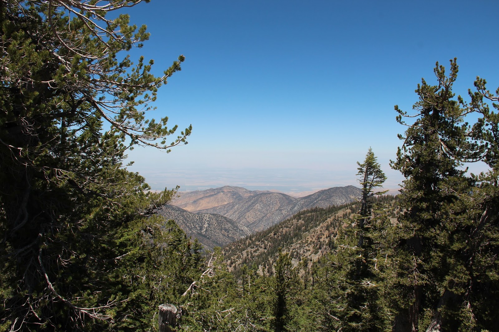
Unlike its slightly taller brother, Sawmill Mountain is not fouled with electronic equipment and other amenities. Instead, its summit is bedecked with a huge cairn made from flat stones that litter the area. And that energy you felt on Iwihinmu'u? That palpable natural hum that can neither be heard nor felt? Well its present here too, focused perhaps by the large spirit tower that masquerades as a summit monument. Sit quietly on this exposed summit. Listen to the wind. Absorb the expansive views north toward the San Emigdio Mountains and the flats of the southern San Joaquin Valley. Record your thoughts in the summit register hidden within the recesses of the monument.

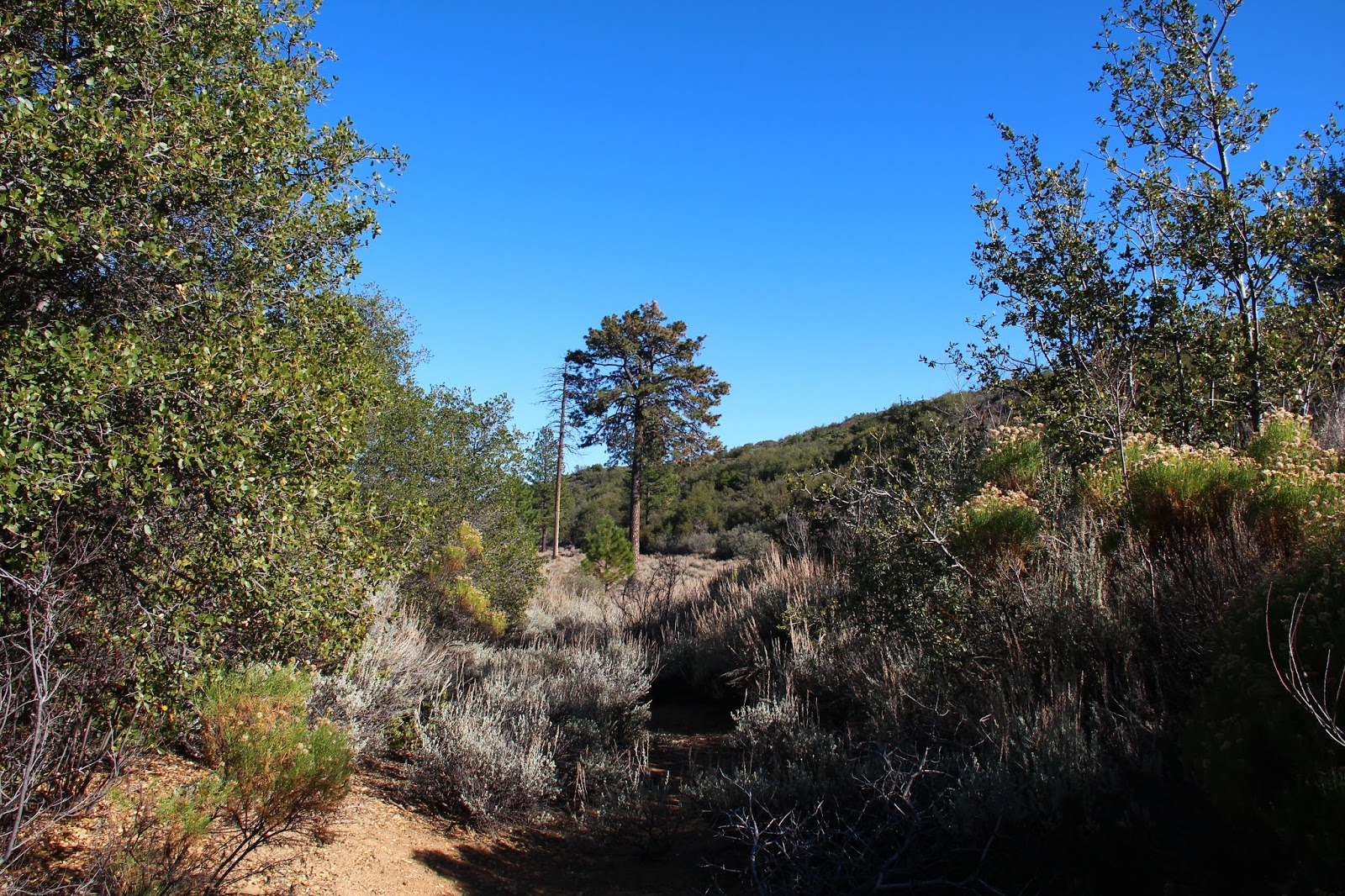
Re-energized, retrace your steps through the numerous twisted and strangely contorted trees back to the large parking area at the terminus of Mt. Pinos Road where you began. Or continue west from Sawmill along the Tumamait Trail through the Puerta del Suelo to Campo Alto atop Cerro Noroeste where you can spend the night under the bright moon and diamond stars that adorn the evening sky above the center of the world. And like the Chumash, live a hundred thousand years.

*A hundred years have passed
Yet I hear the distant beat of my father's drums.
I hear his drums throughout the land.
His beat I feel within my heart.
The drum shall beat
so my heart shall beat
And I shall live a hundred thousand years.


Thursday, June 29, 2017

A Man Could Lose His Way in a Country Like This

San Guillermo Peak
A man can lose his past in a country like this
Wandering aimless
Parched and nameless
A man could lose his way in a country like this
Canyons and cactus
Endless and trackless
~Rush, Seven Cities of Gold

I spend a considerable amount of time virtually exploring places I’ve never been by pouring over images on Google Earth and searching topographic maps on CalTopo. For better or worse, I’ve passed this idiosyncratic trait onto my eldest daughter who now carries on the tradition. Most of these “out of body” explorations involve the wild places close to home, the Los Padres National Forest and the Angeles National Forest, but I frequently stray beyond these boundaries to the San Bernardino National Forest, the Sierra Nevada, and to other far-away places I’ll probably never go other than in my fervent imagination.

Recently, while staring at the computer screen and time-traveling across the magnificent canyons and ridgelines that texture the southern flanks of Mt. Pinos, I noticed a narrow slot in the lower sections of the Middle Fork of Lockwood Creek that piqued my interest. Some online searching unearthed a short YouTube video clip posted several years back by a guy who had visited this area which he described as “the narrows of the Middle Fork of Lockwood Creek.” Additional scouring of the interwebs revealed nothing about this little canyon.

So this past weekend, my daughter and I drove to the Lockwood Valley in hopes of getting into the narrows. Much of this area is a crazy-quilt of public and private land that is crisscrossed by a network of mostly dirt roads. One or more of these roads, I surmised, would allow us easy access to the Middle Fork of Lockwood Creek which we would then ascend to the narrows. 

Along Boy Scout Camp Road, we swung off the pavement and tracked north on a gravel road adjacent to the Middle Fork. A short distance later, we encountered private property and a chain blocking our forward progress. Back-tracking to Boy Scout Camp Road, we tried a different dirt road on the other side of the Middle Fork. But to call this track a road is being generous with the term. It was narrow and soft, and the encroaching sagebrush scraped the side of the car as we proceeded forward. Ultimately, this option failed us too.

The preordained back-up plan was Mt. Pinos. But as we headed back to Lockwood Valley Road, San Guillermo Mountain and dark storm clouds loomed nearby to the south. So that of course became our new objective.

We found Pine Springs Campground mostly deserted except for a few hardy souls that were toughing it out in the oppressive midday heat. A couple of small RVs occupied the lower spaces. A tent and assorted gear filled the upper-most site in the loop. A woman peered at us over her bikini top as we circled the campground, a plume of dust trailing us. Looking at this moisture-deprived place, it's easy to forget the big winter we just had.

The air was still and the heat withering as we dropped into the dry drainage adjacent to the campground. On our way, we passed a plastic bucket topped with a section of pool noodle. Toilet paper was strewn hither and yon, while a shovel lay nearby at the ready. A make-shift privy, necessary I suppose since the outhouses at Pine Spring were boarded up tight for some odd reason.

In the drainage, we boulder-hopped west for a short distance, following cairns and the occasional piece of brightly-colored tape hanging limply from encroaching tree limbs. Little black flies buzzed us incessantly. A short distance later, we left the creek bed for a low ridge that splits San Guillermo from Pt. 6,324 to the immediate south. Here, the flies disappeared, chased off by occasional wind gusts heralding the imminent arrival of high-country thunder-showers. Ominous dark clouds hung leaden in the sky, neither advancing toward nor retreating from us. We stopped, looked skyward, and checked wind direction, contemplating the possibility of being caught on an exposed ridgeline during an electrical storm. But sometimes storm clouds are like bullies, threatening but ultimately pulling their punches. And so it was with these clouds. We faced the threat and pressed forward while the storm retreated to the northeast.

Atop the ridge leading to San Guillermo, the impressive expanse of the Sespe Wilderness unfolded before us. The trackless sweep of Wagon Park Canyon spread west to the horizon. To the south lay the boundless headwaters of the Piru Creek drainage. Eastward sat Mutau Flat and the big empty. Mt. Pinos and the beginnings of the Cuyama Badlands buffered the north. This is vast and vacant terrain that doesn’t give up its history or its secrets easily. A man could lose his way in a country like this.

Ultimately, we didn’t go deep enough or long enough to lose our way. We were ill-equipped for that type of undertaking. But the prospect and promise of that very sort of adventure exits in a place this unspoiled, this magical. It’s a compelling proposition, isn’t it? To have a grand adventure. To walk into the wilds and back in time. To get completely lost, if only within one's self. To experience the raw fear and magic that only the remote backcountry is capable of manufacturing. The certainty of all of that is just too tantalizing to pass on. We will return. To secure the missed reward. To collect on the promise.


Sunday, November 20, 2016

Ambling Along the Dry Lakes Ridge

The First Dry Lake Along Dry Lake Ridge
You will follow me and we will ride to glory, way up, the middle of the air!
And I'll call down thunder and speak the same and my work fills the sky with flame
And might and glory gonna be my name and men gonna light my way.

Just out of Ojai and beyond the point where the Maricopa Highway squeezes through the slot of Wheeler Gorge, a high mountainous barrier towers above the roadway to the north. The unmistakable geologic feature with an east-west orientation is so impenetrable that the road-builders were to forced snake around it when the road (originally designated Highway 399, but now Highway 33) was surveyed and constructed in the early part of the last century. This imposing obstacle is Dry Lakes Ridge.

In my many forays into the Ventura County back-country, I've admired this ridge with wonder and awe. Based upon the many good trip reports published by my fellow wilderness travelers, I knew the ridge was comprised of a series of dry lakes or basins, and that the area atop the ridge was designated as a botanical area because of the unique flora that it harbors, but never having experienced it myself, I was left to imagine what it was like to travel along its spine.

Well, I now have to imagine no more. Last week, a friend and I decided to tackle the ridge in order to get a first hand look. Given its configuration, and depending upon your definition of the term, there really is no "easy" way to gain the ridge. There are only gradations of steepness. Stated differently, from a topographic perspective, the spread between the contour lines for the ridge range from almost non-existent in some areas to merely close together in other areas. Despite this, there is an obvious and traveled route to the top which involves ascending an old fire-break that runs down the eastern tongue of the ridge to intersect Highway 33 where it tops out near the Heliport benchmark at elevation 3736.

From the highway to the top of the ridge, the way forward is fairly obvious although there is no established trail. The initial climb is stout but it mellows some once you attain the ridge. There, you get nice looks at the Pine Mountain Ridge, the upper Sespe drainage, the Nordhoff ridge, Lake Casitas, and the coast. The track then continue upward, wending it's way through the ubiquitous manzanita to the high point and your first glimpse of the eastern-most dry lake.

The Pine Mountain Ridge

Piedra Blanca and the Upper Sespe Drainage
Zoom of Pine Mountain Ridge

The Abandoned Fire Lookout on Nordhoff Peak

Nordhoff Ridge, Lake Casitas, and the Channel Islands

Toward the Coast
Dropping into the first basin, the "correct" way to go became a bit muddled as various tracks zigzag through the manzanita, buckthorn, wild rose, yucca, and an assortment of other spiky flora that like to jab and grab. We veered left, aiming for an open spot in the sea of brush and what appeared to be "the path." As it turns out, this route terminated in a clump trees which we fought through, ending up in the first dry lake bed itself. We then did battle with the plentiful sage that populates the basin until we picked up the faint use path again on the western edge of the lake. Note to self: go right time.

Once we got back on track, we wandered through the second and third basins which are very similar in character to the first. Beyond the third lake, the path squeezed through some trees before cresting a small hill and revealing the big, open, grassy basin of the fourth lake below. We enthusiastically dropped into the lake bed aiming for the big evergreens in the middle. Here we found shade, a fallen log on which to enjoy lunch, and an old ice can stove, a remnant of a bygone trail camp. This is a really neat spot and we lingered here enjoying the solitude and the sound of the wind rustling through the grass.

Yellow - yes; Red - no

In the First Dry Lake
Looking Back Toward the Third Lake

The Fourth Dry Lake

In the Grassy Bed of the Fourth Lake

Looking Back at the "Trail" Into the Fourth Lake

Sitting in the Shade

Vestiges of the Old Trail Camp
Just beyond and west of the fourth lake, sits the tiny fifth lake. Had I spent more time studying my maps, I would have known this. But I didn't so I didn't. So instead of visiting this last dry lake while we were in the neighborhood, we instead turned tail here and retraced our steps back to Highway 33. Recognizing the error and stupidity of my ways back in the car, we headed for Institution Ale Company in Camarillo where I drowned my sorrows in a pint of Citra pale ale and planned a return to the ridge to pick up that last dry lake.  

Citra Pale Ale at Institution Ale Company. Go Here for the Best Beer Anywhere.