 |
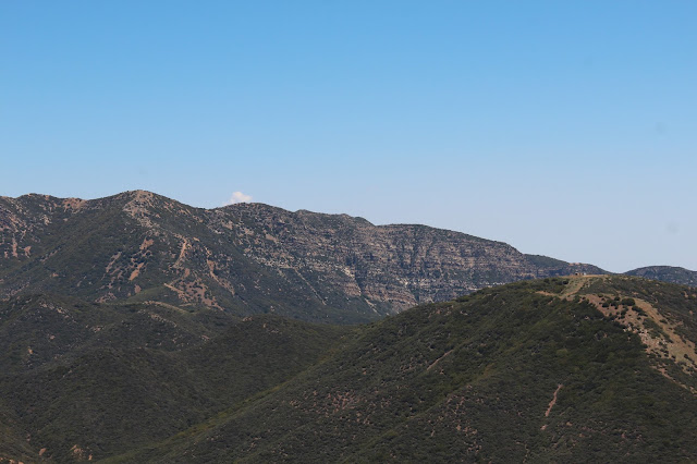
| Nordhoff Peak from Howard Creek Trail-Nordhoff Ridge Road Junction |
Looking at Tom Harrison's map of the Sespe, there are basically three established routes to the summit of Nordhoff Peak: the Pratt Trail, Gridley Canyon, and Howard Creek. The first two options begin low in the Ojai Valley and ascend the hot south side of the Nordhoff Ridge. The third option, Howard Creek, begins higher up (at roughly 3,500 feet) in Rose Valley and climbs the cooler north side of the ridge. This latter route is the shortest and most direct established path to the summit of Nordhoff Peak.
The trailhead for the Howard Creek Trail is located on the right (south) side of Rose Valley Road about 0.4 mile beyond the junction with Highway 33. The route begins on a gated fire road from which a foot-path subsequently branches left (east) approximately 0.2 from the obvious parking area. Although I had passed this trailhead numerous times on my way to Piedra Blanca, I had never stopped to explore it so Sunday I decided to give it a go.
 |
| Typical Trail Conditions on the North Side of Point 4677 |
 |
| Pond at Rancho Grande in Lower Howard Creek Canyon |
 |
| Thorn Point and Piedra Blanca from the Howard Creek Trail |
Based upon my past experiences on the south side of the Nordhoff Ridge, I was expecting Howard Creek to be a bit of a slog. But I was pleasantly surprised to discover that the trail was well defined, easy to follow, and quite gentle (dare I say "easy?"). That last conclusion is probably a bit of an over-statement, but if a 50-something, desk-bound guy with a paunch can cover the 2.8 miles and 1,000 feet of gain from trailhead to ridgeline in an hour and fifteen (with stops along the way to smell the flowers), you youngsters ought to be able to blaze this trail in under an hour.
Speaking of flowers, I had thought spring had already sprung and the wildflowers had already done their thing. Not so. There were still plenty of active blooms on the north side of Nordhoff Ridge, including the spectacular Matilija Poppy which is currently in full display mode. Other flora is also exploding with shaggy exuberance onto and across the trail in places. But there is a dark side to this orgiastic blooming madness, a menace unseen within the creases and crevices of the foliage that will not be discovered until you get back to the trailhead and strip off shirt and socks: ticks. Despite wearing a long shirt, gloves, and high socks, I still managed to pick up two of the little bastards that may have given me Lyme Disease.
 |
| Beautiful and Delicate Matilija Poppy |
 |
| Another Matilija Poppy |
 |
| Unknown Yellow Beauties. These were everywhere. |
 |
| Butterflies Getting it On (or battling, I couldn't tell to be honest) |
 |
| Yucca About to Bust Out in Bloom |
 |
| Invasive Yet Amazingly Pretty Thistle |
The name of the trail is a bit of a misnomer in that it doesn't really ascend Howard Creek proper, at least not initially. Instead, the trail begins in the drainage immediately west of Howard Creek and then tacks in a generally southeast direction, crossing an unnamed (and dry) creek before contouring around a ridgeline and into the upper reaches of the Howard Creek drainage. The lower reaches of the trail initially pass through the scrub and sandstone which is typical of the area before beginning the ascent of the shaded north side of Point 4677. The upper portion of the trail which climbs due south to a low spot along the Nordhoff Ridge, is more exposed (read, less shady) and is thus a little warmer (and buggier).
The trail ultimately intersects with the Nordhoff Ridge fire road at a spot along the ridgeline that is not the pinnacle of back-country scenery. There are no views north into the Sespe from this location and the views south toward thee Ojai Valley and beyond are just average. Those views get appreciably better as you work your way west along the Nordhoff Ridge Road toward Nordhoff Peak a little over 2 miles distant. The trade-off is that you must first descend approximately 700 feet to Gridley Saddle (the Gridley Trail intersects the ridgeline from the south here) before reclaiming those same lost feet as you climb out of the saddle and up to the abandoned fire lookout that sits stop Nordhoff Peak's summit. You must repeat this same elevation loss-gain scenario on your way out which enhances the overall challenge of this hike.
 |
| View South from Trail Junction with Nordhoff Peak Fire Road |
 |
| View Into Gridley Canyon. Note the Gridley Canyon Trail in the Foreground |
 |
| The Nordhoff Peak Abandoned Fire Lookout from the Nordhoff Ridge Fire Road |
Once atop Nordhoff Peak, you can savor the expansive 360 degree views and cool breezes from the platform of the abandoned fire lookout tower. The day I was there, I had the run of the place. Beneath the tower is a fire-ring and picnic table if you're inclined to spend the night and are appropriately provisioned. I imagine the views from the summit into the Ojai Valley on a cloudless night are quite special.
So there you have it. Nordhoff Peak done easy. Approximately 10.5 miles round-trip with just over 3,000 of total gain.
 |
| The Topatopa Bluffs from Nordhoff Peak |
 |
| Anacapa Island in the Santa Barbara Channel |
 |
| Lake Casitas from Nordhoff Peak |
 |
| Pine Mountain from Nordhoff Peak |
 |
| View North Toward the Pine Mountain Ridge and the Sespe Wilderness |


