I’m a loser baby, so why don’t you kill me?
(Double-barrel buckshot)
Soy un perdedor
I’m a loser baby, so why don’t you kill me?
~Loser, Beck
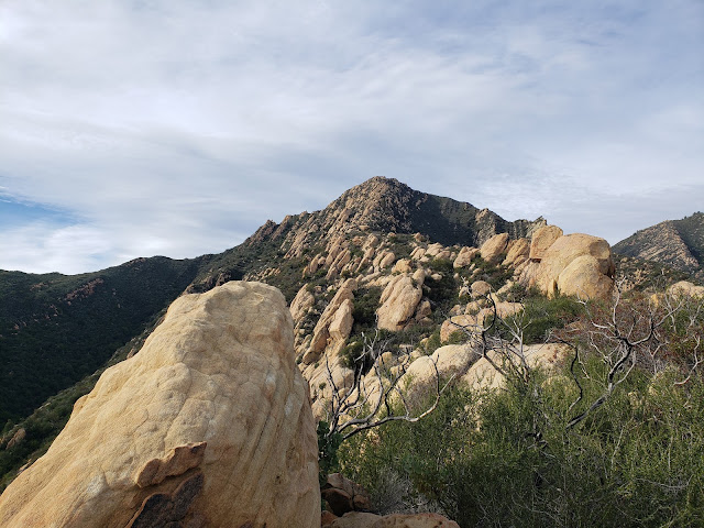
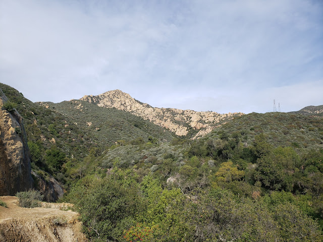
In the foothills overlooking what is sometime hyped as the American Riviera, there’s a pyramidal-shaped sandstone peak that dares you to climb it. Back in the olden days, the locals apparently referred this peak as Cathedral Peak and its loftier neighbor to the northwest Cathedral Rock. Then, the U.S. Board of Geological Names rechristened Cathedral Peak as Arlington Peak and Cathedral Rock became the new Cathedral Peak. The “Arlington” nomenclature purportedly originated from staff at the luxurious Arlington Hotel who called the various peaks in the vicinity the Arlington Crags.
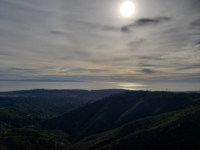
A few years ago, I took up the gauntlet that Arlington had dismissively hurled at my feet and made an attempt at its summit. I failed. I took the standard route up the southeast ridge by way of Mission Canyon, veering right on a faint use path immediately after crossing the creek and then clawing my way up to gain the ridge. Once there, I followed the route along the ridgeline as it wound its way around, over, under, and through the blocky sandstone for which Arlington is known. It was a warm winter day and I eventually bonked somewhere around the 2,500’ contour. Frustrated and tired, I sat on a gigantic boulder and salved my wounded ego with a warm beer. The magnificent views to Santa Barbara and the Channel Islands ended up being my participation trophy (which, in the grand scheme of things, really isn’t a bad participation trophy).
That failed attempt has been an itch in need of scratching ever since. That itchiness flared up again this past weekend as I was thinking about options for getting out into the hills before the next round of drenching started. The weather was perfect for another attempt, so I decided that I’d drive to Santa Barbara to take care of some unfinished mountaineering business.
Although I arrived late morning, cars were lining the street for almost a mile from the trailhead proper. I continued driving in hopes of scoring a spot closer up to avoid adding dreary road mileage to my day. I must have been living right that morning because as I approached road’s end without promise, someone pulled out leaving a spot for me right in the front row. I quickly took advantage, pulled on my boots, and started up the Tunnel Trail which initially is a deteriorating asphalt road. As I began to climb, I was astonished at the number of people I encountered both coming out and on their way in. Flowing water from the recent rains was bound to be big draw, but the Covid/Instagram-fueled assault on the outdoors continues unabated.
A short distance up the road, the path splits and the asphalt turns to dirt. The right fork follows the Tunnel Trail to the Mission Crags and the Rock Garden; the left fork parallels Mission Creek to the junction with the trail leading to Inspiration Point. I followed the left branch into the canyon where I rock-hopped the creek which held a nice flow. On the adjacent side of the creek, I tacked hard right following an informal, yet well-beaten use path that climbs to Arlington’s southeast ridge.
This is where the work really starts. The climb to the ridge is steep and physically demanding. It has also become deeply eroded and braided as a consequence of intense use. The various route options seemingly all get you to the same spot on the ridge, but as you’re ascending, you can never be quite certain that you’re on the “right” braid. To assist with navigation, someone has painted a series of white dots on the sandstone that is common here. Sometimes you see them, sometimes you lose them. Those damned dots are both a blessing and a curse.
On the ridge, things level off for a bit and the views to the coast really open up nicely. Here you get to do a fair amount of scrambling over sandstone features as the path switches back and forth between the north and south side of the ridge. It’s a fun and entertaining alternative to ordinary hiking, but I wished that I had brought a pair of gloves along. The sandstone is unsurprisingly like, well sandpaper, and by the end of the day my hands were raw from the constant contact.
I was making decent progress for an old guy until right around the 2,800’ level where the pitch steepens before the final summit push. As the route switched over again to the south side, there was a white dot painted on a rock just above a white arrow pointing to the left. From the looks of things, folks had been going left at this spot so I followed suit. Not long after that, I found myself at the base of a rocky wall in a steep chute with no white dots. The only way forward was up the rock face which was probably 20 feet high with a couple of class 3 moves. I felt fairly confident about my ability to scamper up, but getting back down was another matter altogether. Being solo, I didn’t think it wise to give it a go, so I back-tracked to the arrow to see if I had missed something. There I saw the last white dot but no real alternative to the route I had already followed.
Frustrated once again, but recognizing that discretion is the better part of summiting, I decided to turn back. If the price for achieving Arlington was notoriety for being the dumb ass that had to be rescued, I wanted no part of that. I’ve made enough poor decision in my life. I don’t need to compound that at this stage.
On the way down, my dogs were barking so I stopped for a snack and a cold malt and grain beverage I had stowed in my pack for just such an emergency. As I sat on a rocky outcrop enjoying the panoramic sight of the Santa Barbara coastline, I almost forgot what a loser I was. But I was quickly reminded of that as soon as I started moving again when I missed a white dot and ended up sliding down a steep, overgrown drainage. After descending that drainage further than was really advisable, and realizing the potential peril of continuing, I crab-crawled back up to the ridge where I relocated the track marked by multiple and obvious white dots that mocked my embarrassing lack of awareness.
On the ride home, I assessed the situation. I’ve attempted Arlington two times now and both times I’ve failed. I don’t need to experience strike three to know when I’ve been vanquished. Some things are just not meant to be. And for under-achievers like me, summiting Arlington by the southeast ridge is apparently just one of those things. If I ever get there, it’s going to have to be top down by way of La Cumbre Peak.
I know, I know. Soy un perdedor. I’m a loser baby, so why don’t you kill me?


