The next big event after retiring is dying. And I'm not going to volunteer for that one yet.
~Bobby Bowden
~Bobby Bowden
We ain't going out like that, we ain't going out like that.
~Cypress Hill, I Ain't Going Out Like That
Legendary Florida State football coach Bobby Bowden continued to work long into the sunset of his life. His philosophy, often repeated, was that once you retire, there is only one major life event remaining. And he was determined to stave that event off by avoiding the immediately preceding life event (retirement) as long as possible. How successful that strategy was we'll probably never know for certain. But death found Bobby despite his efforts and he was escorted into the mysterious beyond on August 8, 2021.
I don't know how Bobby lived his life, but the subtext of his philosophy is to just keep grinding until you ultimately slump over a stack of paper on your desk, a tie around your neck, and the fluorescent lights reflecting in your vacant stare. Fuck that. As DJ Muggs and the boys said, "I ain't going out like that." I know the stage of life I'm at. I know what the actuarial tables say. I know the knock could come any day. So I'm not going to waste opportunity on the mere possibility that continuous toil is the path to Ponce de Leon's mythical spring. If living instead of working costs me a couple of extra years, I'll happily make that Faustian bargain.
So when the chance to walk a stretch of the famed John Muir Trail (JMT) was placed in front of me, I wasn't going to demur. Even if that meant spending a precious few days away from the never-ending stream of emails that I knew would be pooling to unfathomable debts in my absence.
I'm a spur-of-the-moment kind of guy. It drives my wife crazy. She's a meticulous planner. Every detail must be accounted for beforehand. There is little room for variation in the finalized agenda. Me, I too often approach things with only a sketch of a plan and then figure I'll ad-lib the rest. I like the not knowing. I like the spontaneity. I like the surprise. I like the freedom. Sometimes that approach bites me in the rear. Most of the time things works out. But as a result, if it was left up to me, I'd probably never walk the JMT. That's because it requires thinking about the trip months in advance. It requires researching when and how to obtain permits (and then actually getting those permits). It requires a fair amount of thought and planning. I find that whole process tedious and aggravating. I just want to show up and go. It's one of my many flaws.
Fortunately, I have a friend that is pretty good at doing those types of things and will tolerate me mooching off of his administrative efforts. So back at the beginning of the year, when the night sky still lingered long on the landscape, my friend, who was already dreaming about summer backpacking, secured permits for the the JMT with entry at Lyell Canyon in Yosemite National Park. Being the swell guy that he is, and knowing that I'd want in on the action, he made sure there was a spot for me to tag along.
Our adventure started on a Saturday in Mammoth Lakes where we left a car. Early the next morning, we jumped on a Tuolumne-bound YARTS bus in front of the Shiloh Inn. We were joined by a couple of young lads from Rotterdam, Netherlands who had just finished the entire 222 miles of the JMT, had hitched a ride back up the 395, and were now headed for the Yosemite Valley. Talking to these young guys, who couldn't have been more than 21 or 22, I was impressed by their adventurous spirits, their infectious energy, their youthful fearlessness, and their ability to communicate with us fluently in the native tongue. Thinking back on my own youth, I would never have had the courage to go traipsing off to some foreign land with nothing but a pack on my back and a wild idea in my head. Hell, that wasn't even on my radar when I was their age. So I have great admiration for these guys. They are everything that I wasn't in my youth.
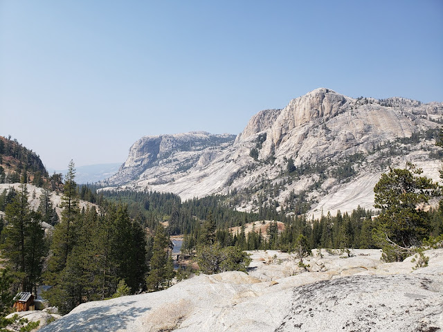
At Tuolumne Meadows, we, along with a rag-tag assemblage of other backpackers, secured our permit after receiving the obligatory ranger lecture about bears, poo, and fire. We then started up Lyell Canyon where we planned to stay the first night. The term "up" in this context is somewhat of a misnomer as the trail through Lyell Canyon is relatively level for the first 7-8 miles before it finally begins climbing toward Donahue Pass. That makes for an easy first day and provides the ability to acclimate some before the air thins out and your lungs begin to burn as you walk.
It was high season along the JMT so we continually passed, or more frequently were passed by fellow travelers. That's the thing about hiking in the Sierra Nevada. The range can conceal an incredible number of hikers and backpackers. There are folks everywhere in these mountains. To the casual observer, it might no be evident. But they are there. By the lakes, along the ridgelines, and under cover of the forest canopy. So even when you're alone on the trail, you're never really alone. And there were quite a few folks alone on the trail. Most of them we encountered were women which was counter-intuitive. In the olden days, when we were all forced to walk to and from school bare-foot in the snow, and it was uphill both ways, you wouldn't have seen that. Too dangerous. Or at least that was the commonly-accepted wisdom. Now? I suppose safety in numbers has mitigated that concern some. And/or maybe contemporary women are just sick of that shit and are like "fuck it! I'm going." Either way, the "fairer sex" is killing it out there.
Youth was the other common denominator. Schlepping a backpack full of gear at elevation, battling pesky mosquitoes, and sleeping in the dirt is mostly a young man's game. And the trekkers we encountered along the trail substantially, although not exclusively, bore that out. As old guys, we were definitely an outlier. Maybe even a curiosity. As we walked along, I couldn't help imagining the youngsters we met thinking how cute it was that a couple of old men were still out there doing it. Of course, no one said that or even hinted at it. Still, I'd be lying if I told you I never felt that we didn't belong. But that probably says more about me than it does the youth brigade we shared the trail with.
The day began gray and continued to get grayer the deeper in we went. By late afternoon, with the sky darkening, we reached the 9,700' contour and decided to camp just below the footbridge that crosses Lyell Fork. A ranger we met earlier informed us that there had been bear activity at this location for the last few nights, so I was a little on edge. Shortly after we set up camp, the sprinkles began and we took refuge in our tents. I didn't bring anything to read in an effort to cut bulk and weight, so I just laid there in my nylon cocoon listening to rain spattering the fly and awaiting a visit from Ursus Americanus Californiensis. That never happened, and I ultimately drifted off around 8 p.m., awakening early the next morning well before they sky began to lighten.
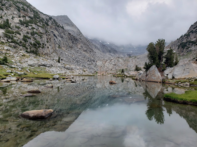
Back on the trail, we climbed to a beautiful tarn at 10,200' that is fed by what remains of the Lyell Glacier. There are several campsites here which would make an outstanding place to stay for a night or two. As we admired the camping opportunities, we lost the trail when we followed a social path that skirted the eastern bank of the tarn and then ultimately fizzled out. Backtracking, we realized our error when we saw another JMTer crossing the tarn outlet and then follow the correct path along the western bank instead.
Higher up, the trail crossed a stream before reaching another tarn that sat above treeline. Low clouds were smothering Mt. Lyell which made for an ethereal and foreboding landscape. We stopped to collect some of the cold, delicious water at the stream whose source was a pool higher up in the glacial cirque. One-half mile or so later, we crested barren Donahue Summit where I surprisingly, but briefly had cell reception.
The clouds that hung high in the sky earlier were now at ground level. Maybe they moved lower or we moved higher, but suddenly we were in them. And they began dropping moisture. It started as an innocent mist that morphed into drizzle. That drizzle then turned to rain which quickly became a malevolent torrent. We donned rain jackets and ponchos, but it was futile. The rain was drenching and relentless. Dropping into the Rush Creek drainage, we took refuge under a gigantic granite overhang to ride out the rest of the storm.
Afternoon thunderstorms are a regular occurrence in the mountains. They are one of those things that you just expect at elevation in the summer. But as we cowered under that slab of protective granite, the irony of it suddenly raining after 8 months of bone dry weather struck hard. Perhaps, I thought, I could single-handedly solve California's drought situation by seeding the clouds through backpacking all the time. I'd be happy, you'd be happy, the farmers would be happy, everyone would be happy. Win-win-win-win.
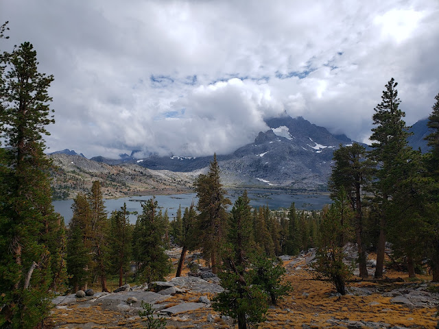
When the rain tapered off, we began moving again, but the skies did not look friendly. We had targeted the Marie Lakes as our destination for night 2, but when we got to the trail junction leading into the basin, we could tell that location was going to be stormy. So we continued descending until we reached the junction with the trail leading to Gem Lake where the deluge began once again. We joined a couple of young ladies under a tree in an effort to stay dry and made idle chit chat. One of them was on the finishing leg of a solo JMT trek northbound; the other, her friend, had joined her for the last few miles of the journey. Eventually, they got up and wandered off in the still-falling rain as we continued hiding under the tree boughs until the storm died down some and the trail stopped flowing like river. Then it was up and over Island Pass and down to Thousand Island Lake where we camped for the night. We had been warned by others on the trail that Thousand Island was crowded, noisy, and not very pleasant, but the place was pretty much empty. We had a very enjoyable evening there.
The following morning, the sun was shining and Mt. Ritter gleamed gold in the alpenglow. The air was warm, birds were chirping, and I'm pretty sure I heard a chorus of angels heralding in the new day. Convinced we'd survived the worst Mother Nature had to throw at us, and ahead of schedule, we decided to tack on some extra mileage and head for Rosalie Lake that night with an eventual exit at Reds Meadow.
The trail that morning led us past the precious stone lakes - Emerald, Ruby, and Garnett. The water at Thousand Island tasted somewhat swampy so we stopped to pump at inviting little Ruby Lake that sits in a small, confined basin backed rocky cliffs. The scenery here is really spectacular and the water was superior to Thousand Island so we were glad we waited. Then it was down to sapphire-hued Garnett Lake (another misnomer) where we stopped briefly at the footbridge at the lake's outlet to dunk our heads in the cool water.
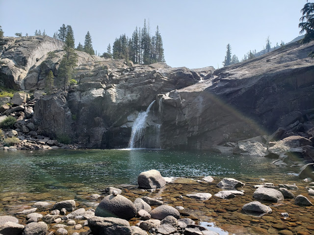
Here again, we briefly lost the trail when we mistakenly followed an alternate path that apparently leads to Altha Lake. The JMT, which we relocated quickly, hews closely to Garnett's southern shore before climbing over a low divide and dropping into the Shadow Creek drainage. As we descended off the rocky divide, the surroundings suddenly changed and we found ourselves wandering a pleasant path through a shady, evergreen forest.
Where the JMT intersects with the Shadow Lake Trail, we stopped to talk to a young fellow from Alabama who was going solo southbound. He told us he'd never been to California before and this being only the third day of his journey, he was still acclimating. That gave us pause. We were on day 3 of our trip too and we started at Tuolumne. This Golden State newbie was at the same place, yet he started at Happy Isles in the Yosemite Valley. To add insult to injury, he was headed for Red's that day while we were only aiming for Rosalie. He was averaging about 25 miles per day to our 10. That was a bit of a sobering slap that reaffirmed our lowly place in the backpacking pecking order.
After we parted ways, the drips started again. As we followed the Shadow Creek Trail east, it continued to pick up intensity until we reached the footbridge at the inlet to Shadow Lake. Then, the heavens opened up and the rain came pouring down with impressive intensity. We sheltered under another tree and considered our options. We had originally planned to exit at Agnew and only altered that agenda because we were ahead of schedule. But with the rain now falling hard, the prospect of hiking further in soaking conditions and then setting up a soggy camp wasn't terribly appealing. And when we weighed the potential misery of sitting in the rain at Rosalie against the guaranteed pleasure of sitting at Mammoth Brewing Company with a hoppy pint before us, the decision was easy. We decided against continuing onto Red. "We ain't going out like that, we ain't going out like that."
As we walked out, the sky dried up some but the clouds still looked sinister and foreboding. Finally at Agnew, we awaited a shuttle ride out with a pleasant group of fellow gray hairs from Oregon. Since Agnew is the last stop on the exit route, every shuttle that came by was already full. So it was a long and frustrating wait. After a while, I got impatient and resorted to flashing cash at passing cars in an effort to catch a ride. Unsurprisingly, I got no takers. Few folks are interested in picking up a pair of stinky axe-murderers even if the reward is $30. After what seemed an eternity, one of the shuttle drivers going into Reds Meadow radioed ahead that there were riders that needed out. And we successfully caught a ride on the very next shuttle heading up the hill.
Back at Mammoth Mountain Resort, we boarded the last free shuttle of the day into town. As luck would have it, that shuttle dropped us immediately adjacent to the brewery where we plunked down our heavy packs and consumed a bit of craft beer with enthusiasm and affection. As the warming influence of the alcohol began to take hold, I felt pleased with the trip, even though we abandoned the last leg to Reds. And of course I was happy to have snuck in one more adventure before experiencing what Bobby Bowden euphemistically called the last major life adventure. Especially because my way of avoiding that event seems much more fun than the utter drudgery of Bobby's way.


