Tuesday, May 26, 2020

Red Mountain - Over the Hills and Far Away


Red Mountain

Red! I want red, there's not substitute for red
Red! Paint it red, green ain't mean compared to red.
~Red, Sammy Hagar

The Memorial Day weekend. The traditional start of summer. You know, the 3-days in May when folks that don't usually spend time outdoors unpack their tents and sleeping bags and propane stoves and massive coolers and firewood and boom-boxes and other camp-life accouterments and head for the mountains or forests to temporarily squat in the dirt in close proximity to others, stay up drinking and hollering into the wee hours of the morning before passing out, and rising badly hung-over at the break of dawn to repeat the cycle. Yeah, that weekend. It's typically an unpleasantly frenetic time to be out as "irregulars" swarm the great outdoors, finally unrestrained by the cool, dim days of winter. That communal need to break out is particularly acute this year. For this is the year of COVID. Thus, and either because of self-restraint or governmental edict, most people have not ventured too far from their home turf for the last couple of months. Now their feet are itchy. And Memorial Day weekend is an opportune time to finally scratch that itch. 

Like every red-blooded, patriotic American, I wanted to scratch too. My conundrum was that I wanted none of baggage and risk that comes with rubbing feet and shoulders with a gaggle of my potentially virus-infected citizens. Or perhaps that's just an excuse. Maybe I'm really an anti-social, elitist that is just using the pandemic to justify my isolationist tendencies. I admit that possibility. Either way, what it meant for me was once again finding a place that very few people want to visit. After scouring the maps, that place appeared to be Red Mountain. 

At 3,996', Red Mountain is a relatively unsexy peak located in a sort of no-man's land of the Angeles National Forest. Sandwiched between Elizabeth Lake and San Francisquito Canyons, Red Mountain sits sentinel high above the Fish Arm of Castaic Lake which is visible to the south. There are no established trails or fire roads leading to its summit. Trip reports are difficult to find. But satellite imagery shows an obvious firebreak carved into Red's steep southern ridge that ultimately tops out on the summit. That firebreak must be courtesy of the Powerhouse Fire that burned a good chunk of the forest to the immediate north in 2013.
 

The ridge route begins from a dirt parking area along Dry Gulch Road about 0.6 miles to the east of Lake Hughes Road. It starts as a jeep road that immediately ascends a short, steep hill and then morphs into the firebreak. Shot-gun shells and sparkling broken glass litter the area which has been abused like many other easily-accessible areas of the Angeles. 

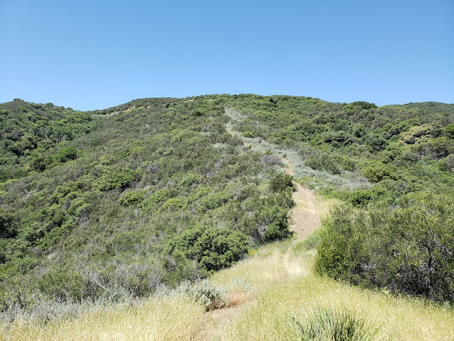
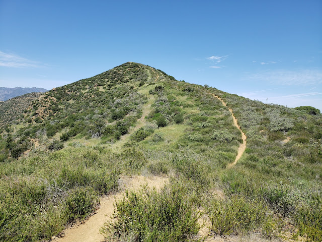
The firebreak itself is slowly being reclaimed by mother nature. Brush impedes the way forward or encroaches onto the path in several locations, although it is easily manageable. For now, a rogue motorcycle track is keeping a narrow path open and visible. In a few years or less, that track will inevitably vanish under a thick carpet of wild grasses, chamise, black mustard, yucca, and other unfriendly flora. Unless, of course, another wildfire torches the area which, in Southern California, is always a possibility.

Given its southern exposure, the route up Red's firebreak is a hot and shadeless march. It's also a steady climb from bottom to top that begins modestly, but then gets serious quite quickly. In a number of places, the slope is so mercilessly and relentlessly steep that it is difficult to maintain your footing. It's truly impressive to think about the guys who ran a dozer up this damn ridgeline to create the break.

That is not to say that it is all up. The firebreak continually roller-coasters up and down all the way to the 3,600' contour where it intersects with Red's eastern ridgeline. As a result, the track drops sharply in a number of spots before resuming its upward trajectory. Consequently, the climbing isn't done once you reach Red's summit. You get approximately 400-500' of climbing on the return as well which is a bit demoralizing. 

Red Mountain Ridge Route
Lower Section of the Firebreak

Red Mountain Ridge Route
One of several drops along the ascent 

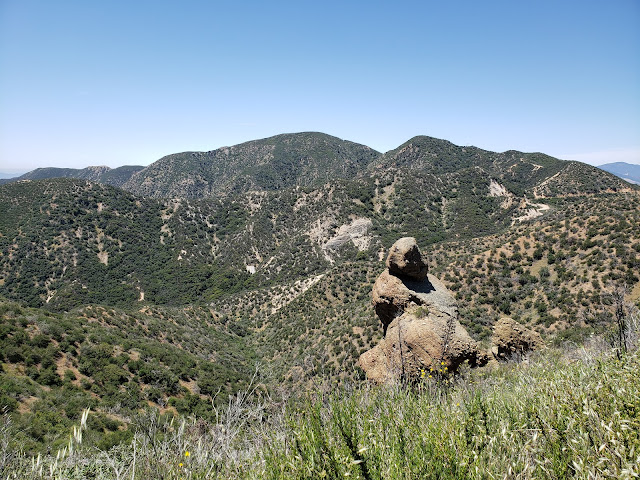
Red Mountain
About the mid-way point. Red in the background.

Red Mountain Ridge Route
One of the steeps climbs on the way "down."

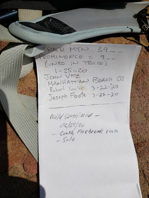
So with all of that glamour, who could possibly resist the allure of Red Mountain as a destination hike? As it turns out, pretty much everybody. The day I went I didn't see a single soul which was fine by me. And that appears to be the norm with this particular peak. On the flat summit, there is a large cairn that houses a summit register. That register, which dates to January, 2020 only had two other entries. One in January by the climber who originally placed the register, and a second in March of 2020. My entry made it a total of three in a five month period. Not much action for a peak that is within spitting distance of 15 million or so folks.

And in a sense, that is unfortunate because of the somewhat unique views that Red affords of the surrounding area. Looking south from Red's summit you get nice views of Castaic Lake and lower San Francisquito Canyon. To west you can see Warm Springs Mountain and its associated ridge. To the north, Lake Hughes is visible at the head of Lake Elizabeth Canyon.

Based upon the USGS and Forest Service topographic maps, there are two benchmarks on the summit of Red: "VABM 3996" and "Red." They are both supposed to be in close proximity to one another near the high point, but I wasn't successful in locating either of them. Then again, I wasn't that terribly diligent in my search either. I suppose finding those benchmarks will have to await my next visit.

After a half-hour on the summit, I started back down the eastern ridge, lost in thought and dreading the several steep climbs I knew were still ahead. Then, the terrain suddenly began to look unfamiliar and Red looked considerably more distant over my shoulder than it should have been. Trying to make sense of situation, it finally occurred to me that while I was day-dreaming, I had over-shot the firebreak. So I had to back-track up the ridge to the firebreak junction adding some additional, gratuitous climbing to the outing.

I don't normally keep stats, but on this outing I used my snazzy View Ranger app. According to it, the trek to Red is roughly 7.7 miles with approximately 2,680 feet of elevation gain. It took me 4.5 hours to make that journey which probably sounds slow, but I wasn't out to make time. I was out to spend time. Alone.  Far from the madding crowds. And you can accomplish both of those lofty objectives on the trek to Red Mountain. 

Red Mountain Summit
Summit Cairn

Red Mountain Summit Register
Summit Register

Warm Springs Mountain
View West to Warm Springs Mountain

Lake Castaic
View South to Castaic Lake

Red Mountain Summit
View North to Lake Hughes

Elevation Profile


Friday, May 15, 2020

Coming Back to Life - Whitaker Peak


Whitaker Peak

Lost in thought and lost in time
While the seeds of life and the seeds of change were planted
Outside the rain fell dark and slow
While I pondered on this dangerous but irresistible pastime
I took a heavenly ride through our silence
I knew the moment had arrived
For killing the past and coming back to life.
~Coming Back to Life, Pink Floyd

Like most everyone else, I've been hibernating during these dark and uncertain times of fear and death and viruses and hoarding, making more effort than usual to avoid my fellow countrymen and countrywomen. My natural anti-social tendencies and crowd-avoidance inclinations have made this less difficult for me than perhaps others, but even I've been getting the itch to get out and experience something other than my garage. The treadmill is useful and all, and I'm grateful that my wife had the foresight and the tenacity to provide for that outlet, but walking and running on a rotating belt at a maximum 10% grade while staring at a shelf stacked with unused camping gear is a sad and depressing affair. It just doesn't have the same allure as the real deal. As good as innovation and technology are, they can't replicate the sights, sounds, smells, feel, and, most importantly, the exhilaration of the trail. Bashing through thick and unforgiving brush, swatting annoying flies and ticks, dodging dangerous rattlesnakes, cursing un-Godly steep ridges, cursing the oppressive heat, cursing the bitter cold, finding a route where there is no route, worrying about whether you brought enough water, worrying about whether you'll make it back to the car before the sky goes dark, and enjoying a well-deserved summit beer after all of that are experiences that are unique to actually being out of doors. And damn do I miss every aspect of that.

So with some local governments cracking the door slightly ajar this past weekend, I took advantage and made a dash for the hills. Recognizing that literally everyone else in the greater Los Angeles metropolitan area was probably going to do the same, I strategically looked for a location that didn't have high "ooh-ahh"allure to keep away, what an acquaintance of mine disparagingly calls, the "filthy casuals." If it was shadeless, waterless, scrubby, involved some off-trail travel, and was reasonably proximate, those were all additional, positive considerations I took into account. So, after considering all of those factors, and pouring over CalTopo, I settled on Whitaker Peak near the far eastern boundary of the Angeles with the Los Padres. At just around 10 miles round trip and 1,600 feet of gain, this seemed like a decent selection to ease me back into the game.

There are actually two "Whitakers," east and west that are separated by a low ridge. At 4,102', "west Whitaker" is the location of the former Whitaker Peak Fire Lookout and is reputed to experience some of the most ferocious winds in the Angeles National Forest. Today, the summit is the unattractive host to a radio communication tower and related equipment. At the opposite end of the ridge is "East Whitaker," the actual high point at 4,148'. This eastern bump would be my destination.


The standard route to Whitaker involves a bunch of road-walking. From Templin Highway, paved Whitaker Peak Road (6N53) climbs to the ridge to intersect with another road, 6N53B. That road (partially paved, but mostly dirt) tacks southwest and ultimately takes you to the summit of "West Whitaker." An alternate route follows a single-track out of Camp Verdugo Oaks at Oak Flat to the ridge where it joins 6N53B. From there, its a long road-slog out to "West Whitaker."

Fortunately, there is an alternative to the alternative that trims some of the road off the route and allows for more enjoyable travel by trail. Looking at aerial imagery of the area, I noticed a distinct track climbing to the ridge off Templin Highway just south of the entrance to the Whitaker Peak Road. That track cut through the chaparral to ascend a minor ridge before intersecting with  and joining 6N53. Shortly after that, the trail again diverges from the road, shaves the first big hairpin turn, the parallels 6N53 to the southwest along a ridgeline. It rejoins the road at the ridgeline where 6N53 and 6N53B become one.


The trail is not immediately evident as it leaves Templin Highway, but after sniffing around some I found it. It appears to be primarily a motorcycle or perhaps an MTB route that sees enough use to be established. The lower section is quite steep in places, but that steepness subsides after you intersect with 6N53. Above that, the trail climbs enjoyably to the ridgeline where views of Canton Canyon to the south and Whitaker to the west begin to open up. As I climbed this upper section, an endangered California Condor glided by, riding thermals in the cloudless sky.

Lower Whitaker Peak Trail
Lower Trail

Whitaker Peak Trail
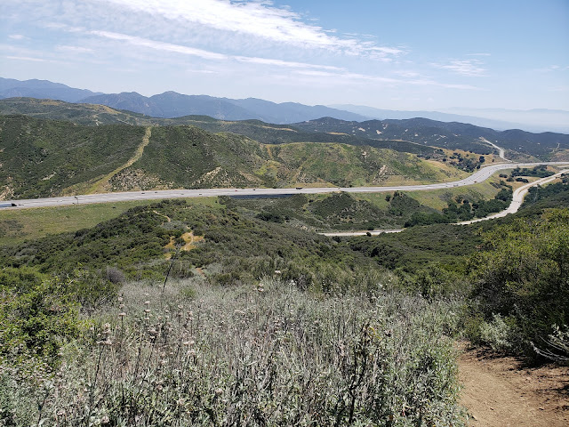
I-5 from Lower Trail

Upper Whitaker Peak Trail
Upper Trail

Whitaker Peak Trail
View South from Upper Trail

Here, the dull road walk began. The road, which is asphalt here, gently drops maybe 150' to a saddle, turns to dirt, and then starts a gradual climb toward "West Whitaker" to the south. Along the way, grand vistas to the west open up showing off Cobblestone Mountain, the Condor Sanctuary, and the seldom-visited areas of the Southern Los Padres. Turning back north, you can see Slide Mountain and the Fire Lookout tower perched atop it.

As the road nears its terminus, it skirts a low saddle along the ridgeline that separating the two Whitakers. Here, I scrambled up the embankment, attained the narrow ridge, and then bobbed and weaved my way cross-country to the summit of Whitaker proper. There is brush here and it is generally negotiable, but I did need to drop beneath the ridgeline in several places to find the path of least resistance. 

Atop the summit, I located a summit register and signed in. Whitaker doesn't see much action, and the signatures dated back to January, 2011 when the current register was first placed there. There is reputedly a benchmark at the summit as well, but I did not see it. I later learned that it is immediately adjacent to the rock pile housing the register, but that it is counter-sunk. Had I known that at the time, I probably would have put in some effort to clear the dirt away and locate it. Oh well.

The summit of Whitaker itself isn't terribly interesting or inviting. It is broad, flat, shadeless, rockless, and brushy. I borrowed a rock from the summit cairn as a seat, stripped off my sweaty shirt, and sat in the sun brushing pesky flies away as I rehydrated and enjoyed a snack. Then I retraced my steps back to my car that was parked on the wide shoulder along Templin Highway. On my way out, I passed the only person I saw all day going in my opposite direction on 6N53B.

I didn't keep stats for the day. I rarely do that as that is not my primary objective when I go out. But AllTrails says it's 9.4 miles round-trip to "West Whitaker" with 1,617 feet of elevation gain. Based upon my day out, that feels like it's in the general ballpark.

Cobblestone Mountain
Cobblestone and the Condor Sanctuary

Whitaker Peak Summit
Whitaker from the Ridgeline

Whitaker Peak Summit Register
Summit Register

Whitaker Peak Radio Tower
"West Whitaker"

Slide Mountain
Cobblestone (L) and Slide (R)

Whitaker Peak Summit
Whitaker's Summit