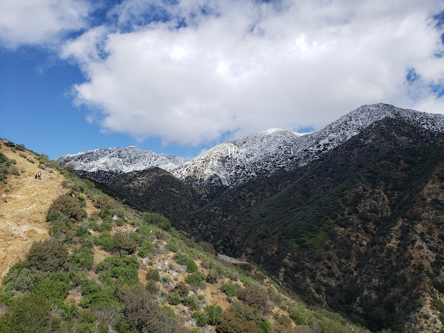
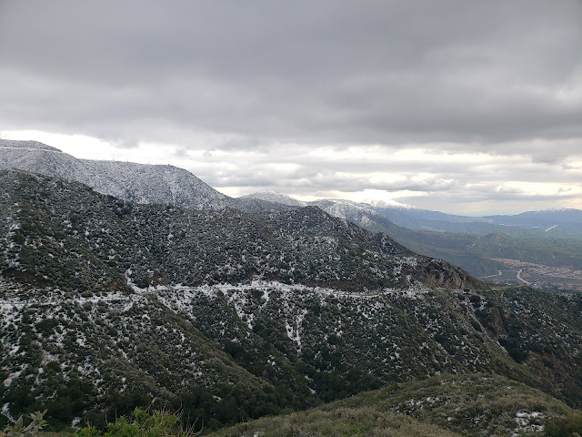
Showing posts with label Angeles National Forest. Show all posts

Friday, January 5, 2024

The True Way to Burnt Peak


Excerpt from The True Way by Lizzie Miller (p. 213)

Lizzie E. Miller was a 19th century evangelist who traversed the country sharing the good word with anyone who would listen to it. In 1889, her travels brought her to Southern California where she had occasion to visit historic Switzer’s Camp in the San Gabriel Mountains and proselytize to patrons of that wooded establishment. Lizzie’s course to Switzer took her up the Arroyo Seco from Pasadena, over Burnt Peak, across the “Backbone,” around the foot of Mt. Washburn with its view of dramatic Rose Peak, and then down into the upper stretches of the shaded Arroyo. Her route to Switzer’s and her evangelizing sojourn are memorialized in a book that she self-published in 1895 titled “The True Way.” 

Despite some confusing narrative about the location of Burnt Peak, my friend and fellow adventurer Sean “Cucamonga Man” Green was convinced that Peak 3,221, a point that sits just south of Mt. Washburn sandwiched between Long Canyon and the Arroyo Seco, was Lizzie’s Burnt Peak. So early on New Year’s Day, we, joined by our compatriot JeffH, set out for Peak 3,221 to see if we could confirm Sean’s suspicions. Expecting to encounter a sea of unruly manzanita and buckthorn, we came prepared for battle armed with loppers, clippers, silky saws, and booze. 

We started the day at the popular Lower Switzer parking area which was comfortably empty when we arrived. The hung-over hordes of celebrants from the previous night would arrive later in the morning when the sun finally broke through, snapping up the remaining spots and generally creating a traffic snafu. But for the time being it was quiet and we had the cool canyon bottom to ourselves as we rock-hopped back-and-forth across the Arroyo which held decent flow for this time of year. At the site of Commodore Switzer’s celebrated camp which sits at the precipice of the upper falls, we stopped briefly to admire and test a finely constructed outdoor sofa and coffee table that some creative soul had assembled from fallen tree branches. 


From here, we climbed out of the canyon and onto the east flank for Mt. Washburn, following the well-worn and defined Gabrieleno Trail to its junction with 12W08 which dips back into the Arroyo and continues up Bear Canyon. We stayed high and continued along the Gabrieleno which affords sublime looks into Bear Canyon, neighboring Little Bear Canyon, and the rugged recesses of the Royal Gorge. Identifiable peaks abound from this stretch of trail including Rose Peak, Mt. Markham, Mt. Lowe, and Brown Mountain (named for notorious abolitionist John Brown).

A short distance later we arrived at the southern toe of Mt. Washburn. Here, the Gabrieleno doubles back in a north-westerly direction as it drops into adjacent Long Canyon. Wahsburn’s ridgeline continues in a southwesterly orientation across the trail, over a bump, and then out to what we surmised was Burnt Peak. We stopped briefly to retrieve machetes and other tools and to put on armor in preparation for the anticipated brush battle ahead. Then we dove into the head-high chaparral, loppers at the ready. But about ten yards in, we were surprised to discover that a path had already been carved through the dense brush all the way to our objective. So we happily sheathed our tools and ambled easily along the ridgeline that Lizzie called the “backbone” until we reached the top of the first bump where the track suddenly petered out. Something wasn’t right. We could see the path continuing all the way to Burnt Peak below us, but the terrain was crumbly and steep on all sides and there didn’t seem to be an obvious way to connect where we were to where we wanted to be. Going directly over the front lip looked like the least dangerous option so that is the option we took, slipping and sliding and cutting and trimming unruly Sumac and Chamis as we went. After a brief yet exhilarating down-climb, we arrived at a shallow saddle where we were able to rejoin the existing use path. 


From this point, it was a relatively short jaunt to the summit. The path held, but was slightly overgrown in places so we manicured as we went. Along the way we found some old wires, cables, and an anchor suggesting that at one time telephone poles may have run along the ridgeline. Atop Burnt, there was a clearing of sorts with two different rock piles. There was no register and no discernable benchmark. We identified the slightly higher of two rock piles and then cleared the area to make it more accommodating. That’s when the booze came out. It was a New Years hike after all. I had carried a bottle of Pennsylvania Dutch Eggnog in my pack and Sean brought individual cans of Screwball, a dangerous cocktail of peanut butter flavored whiskey.

Containers open, we sat in the shade getting “tight” as Ernest Hemingway or F. Scott Fitzgerald might say, shooting the shit, and trying to imagine what this place was like back in Lizzie Miller’s time. Ironically, the area may be more remote now than it was back in Lizzie’s day when the route to Switzer’s from Devil’s Gate apparently traversed this ridgeline.  

Eventually the ethanol ran dry and the three of us, now slightly inebriated, started our way back. When we arrived at the low saddle between Burnt Peak and the first bump, we discovered that the use path that we followed in actually circumvented the hillock to the west. So we stayed the course of lesser resistance which ultimately deposited us just north of the bump’s top. The “junction” here was over-grown and not immediately evident which explains how we missed it on the way in. To prevent that mistake by others, we trimmed the “entrance” to make it more discernable, at least until the fast-growing chaparral conceals it from view once again. 


Back at the Gabrieleno’s junction with 12W08, Sean and Jeff dropped into the Arroyo to see the falls. Having done that a couple of times previously, I continued back to the original Switzer’s camp location and climbed to the promontory above the gorge where the chapel once stood. Religious fervor is a powerful motivator and the planning, labor, and tenacity it must have taken to construct the chapel is quite impressive to think about, particularly given the mechanical and technological limitations of the time. Not much remains of the original structure which was destroyed by the Forest Service in 1943 because it was deemed unsafe. I was able to find some of the foundation and floor, but none of the arch remnants that have probably been swallowed up by brush and time.

Image from the Pasadena Historical Society

About an hour later I reconnected with Sean and Jeff and we walked out. On the way, a B-2 Stealth Bomber flew overhead on its way to or back from a fly-over of the Rose Parade. It was apropos as there was also a parade of sort happening along the Gabrieleno as throngs of people and dogs now clambered and clamored down the draw. A short distance from the picnic area, a natural spring emerges from a pipe at the base of a rocky embankment and flows across the trail. A nearby Forest Service sign warns “Water Unsafe For Drinking.” Not one to be told what to do by faceless, government functionaries, Jeff retrieved a water bottle from the depths of his pack, defiantly filled it to the brim, and then took a deep, long pull as passer-bys eyed him with bemusement. Jeff is a seasoned backpacker who has sampled unfiltered water many times over years of tramping the trails, so I’m certain that he was fine. At the same time, I have neither seen nor heard from him since so who knows? But if he is now no longer with us, at least he proudly left with his middle finger stuck high in the air. Lizzie Miller would probably not approve. But it is the true way to go out.


Thursday, June 29, 2023

Copter Ridge Lateral - Bitterroot Point


Another outing with Sean "Cucamonga Man" Green and DavidR to an obscure point in the San Gabriel Range. This time, the goal was Pt. 7,296 at the terminal end of a lateral finger coming off the southeast side of Mt. Hawkins. The USGS topographic maps reference this point simply by its elevation. It apparently has not been formally christened. Because we found Bitterroot growing along the ridgeline, I'm calling the finger Bitterroot Ridge and its related fingernail Bitterroot Point.

Photo courtesy of Sean "Cucamonga Man" Green

The day started at the Windy Gap trailhead in Crystal Lake Recreation Area. A shorter route is possible from Dawson saddle, but with the Angeles Crest Highway closure, this was the only realistic option. I pulled into the spacious parking area at 7 a.m. and was fortunate to get a spot. The lot was crammed full as was the surrounding campground. I've never seen the forests like this. There's people everywhere. And with them has come trash and graffiti and vandalism and break-ins. Every sign post, bathroom, rock, and tree trunk has either been defaced or destroyed. My car has been broken into twice. You can say what you want about increased access, and sling all the insults like "elitist" or "gate-keeper" you want, but objectively the democratization of the outdoors has not been a net positive overall. 

Fortunately, the blue morning was clear and beautiful and as we made the gentle climb away from the huddled masses, we were treated with stunning looks into the Crystal Lake basin. The tread here is in decent shape except a couple of spots that have been washed out by this season's heavy snow melt. About 2.5 miles and 1,800' later, we topped out at the notch where it was refreshingly breezy. They don't call it Windy Gap for nothing.


The path here intersects the Pacific Crest Trail as it traverses the San Gabriel range in an east-west orientation. Just west of this point, the PCT passes by reliable Little Jimmy spring and trail camp before descending to Islip Saddle. This is the route north-bound PCTers follow. We tacked east and followed the PCT against the grain for approximately 2 additional miles to the summit of Mt. Hawkins at 8,850'. Along the way, we encountered a couple of late season snow patches as well as a few downed trees blocking the way, but nothing that wasn't easily navigable. This is classic high-country territory dominated by conifers and sublime views of the Hawkins Ridge and the high desert to the north. The absence of distant road noise from the closed ACH was an extra-added bonus.

At Hawkins, we took a break, fueled up, and prepared ourselves for the drop down Copter Ridge and then into the unexplored. From the summit of Hawkins, the views are quite good and we spent a few moments identifying familiar landmarks like the Hawkins Ridge, the Islip Ridge, Mt. Waterman, the Twin Peaks, Triplets, Mt. Lawlor, Mt. Deception, Mt. Disappointment, San Gabriel Peak, Mt. Markham, Occidental Peak, Mt. Wilson, and the Ivy League Peaks (Harvard and Yale). We then cached some water and started down Copter Ridge which is now dotted with cairns and scarred by a not so faint use trail.


The standard route to Copter Ridge takes you straight south down the ridgeline to its terminus as Pt. 7,499. Around the 8,200' contour, we abandoned that trajectory and branched left (southeast) to follow the subsidiary ridge leading to Bitterroot Point. This is the point of no return. This is where you need to decide whether you have the juice to climb back out or not. Because if you commit, there is no easy way out. From this point, it's an additional 1,000' of elevation loss that is quite steep in places. Fortunately, the terrain is hospitable and open which makes travel less difficult than it might otherwise be. As you make your way toward the point, the Ross ridge looms in the immediate foreground while Pine Mountain, Dawson Peak, and the north side of Mt. Baldy sit sentinel in the rear-ground. 

The ridge bottoms out at a grassy depression before a rocky outcropping that sits atop a small rise. This is Pt. 7,296 aka Bitterroot Point. Although the point is obvious and distinct, the ridge continues gently downward past this point into the depths of the Iron Fork. We paused here for a spell to enjoy the accomplishment, take in some food and water, and place a register. Then reluctantly started to retrace our steps back up the ridge.

Similar to upside-down hikes like Ross Mountain and Copter Ridge, the crux of this route is on the return trip. From Bitterroot Point, it's 1,000' of gain back to Copter Ridge and then another 600' back to Hawkins. The climb is mellow to start but then steepens significantly as you continue upward. The steepest section is immediately before you reclaim Copter Ridge. DavidR charged up the ridge like a big horn sheep, but I found myself having to stop every 25-50 yards to gain my breath and let the lactic acid in my legs dissipate. Back on Copter Ridge, the terrain moderates some, but I found that the last 600' of gain getting back to Hawkins to be the most physically demanding portion of the day. 


Back on top Hawkins, we reclaimed our cached water and lounged in the brilliant high country sunlight. When we were good and ready, we took the "shortcut" off the summit and rejoined the PCT for an easy, yet long stroll back to the trailhead. To finish the day, we stopped at the Crystal Lake CafĂ© to drink carbonated beverages laced with caffeine and sugar in the shade, shoot the shit, and exaggerate the details about the day's exploits. 

Stats for the day: ~13 miles, 4,600'


Sunday, June 11, 2023

In Search of Black Jack


In 1887, Owen and Jason Brown, the sons of famed abolitionist John Brown, climbed an unnamed peak in the front country of the San Gabriel Mountains which they christened Black Jack Peak. The appellation simultaneously referenced the black porphyritic rock of which the peak was composed as well as the 1856 Battle of Black Jack during which John Brown attacked the camp of pro-slavery forces led by Henry C. Pate near Baldwin City, Kansas. The Battle of Black Jack is considered by many to be the first unofficial battle of the Civil War. 

Historian Hiram Reid described Black Jack Peak as a "spur" from Strawberry Peak with a sharp, distinct pinnacle that is composed of "black spar." Beyond that general description, he does not identify the specific peak to which reference is being made.


The Hundred Peaks Section of the Sierra Club claims that nearby Mt. Lawlor is Black Jack. According to them, what is now known as Mt. Lawlor was originally named Black Jack, but the name never stuck because of its negative associations with John Brown's bloody Kansas raid. So in 1958, the U.S. Forest Service, at the suggestion of Lloyd Austin of Switzer's Camp, renamed the peak Mt. Lawlor to honor prominent Los Angeles attorney Oscar Lawlor. 


The problem with the Sierra Club's conclusion that Lawlor and Black Jack are one and the same is that aside from the black rock, the former doesn't match Hiram Reid's description. Lawlor has a flat, table-top summit whereas Black Jack has a "distinct pinnacle of its own, very steep, rugged and sharp." Depending upon vantage point, it's also somewhat of a stretch to call Lawlor a mere "spur" of Strawberry. Regardless, the Sierra Club view (which echoes that of famed historian John Robinson) has managed to carry the day and is now the commonly-accepted truth.

Unless you're an adventurous and intellectually-curious fellow named Sean "Cucamonga Man" Green. If you're that guy, you're suspicious. You've scoured the topographic maps and looked through the historical record (such as it is) and you think that John Robinson and the Sierra Club may have gotten it wrong. Instead, you think it possible the sub-peak 5,521 on the south face of Strawberry is in actuality Black Jack. Unlike Lawlor, it can rightfully be characterized as a spur of Strawberry given its location and proximity. It also more closely hues to Reid's description of the peak as a sharp pinnacle, especially if viewed from the Colby Canyon side. The only question is whether 5,521 is composed of black, porphyritic rock. So you organize an exploratory outing to 5,521 to find out and invite a bunch of your old pals to tag along.

We met at Red Box at 6:00 a.m. and started up the Strawberry Peak trail. The group of seven was led by Sean, and included Nate, JeffH, the Iron Hiker, Guy, and Scoops (who sported a bow-tie around his neck in a nod to the hardy hikers of old who trod these trails in wool sport coats and top hats). We followed the Strawberry Peak Trail past the Lawlor saddle to roughly the 5,400' contour where we then left the beaten path and started cross country.  

Peak 5521 from Strawberry Peak Trail

Bush Whacking

Black Jack Peak

This is where things got a bit spicey. There is no path proper to peak 5,521. Between us and our objective stood a sea of thorny ceanothus, woody manzanita, deadfall from the 2009 Station Fire, and other spikey shrubbery. This is tough and inhospitable country, a place John Muir appropriately described as "most ruggedly, thornily savage." The only way forward was to create a way forward. So we donned body armor, pulled out the loppers and machetes, and started hacking and clawing our way through the dense overgrowth. As the crow flies, it was only about one-half mile to the summit of 5,521, but the going was slow and sometime painful as we stumbled and were repeatedly stabbed by chaparral yucca that proliferate here. 

Ultimately we reached a minor spur ridge beneath Strawberry where the brush subsided and the way forward became a bit easier. We gratefully sheathed the machetes and then followed some faint game trails all the way to the narrow summit. There Nate informed us that perhaps one-third of the rock was porphyritic, but most of it wasn't overtly black. The views, however, were quite good, especially of Strawberry that loomed over us to the immediate north. 

So is 5,521 the peak the Brown boys named Black Jack? It still isn't clear. The peak matches Hiram Reid's description in many respects, but it is clearly not "composed entirely of a porphyritic rock called 'black spar.'" But Lawlor isn't a perfect match either. Although its level summit does have a significant amount of black rock, it typically wouldn't be described as a sharp pinnacle. Confirmation therefore must await further research and/or new information.

Josephine Peak from Black Jack Ridge

Strawberry Peak's South Face

View from Black Jack Peak

Despite the residual uncertainly, we christened 5,521 "Black Jack Peak" anyway. If it is the original Black Jack, then its rightful name has been restored. If it isn't the original Black Jack, then it is Black Jack now. Sean came prepared with a jar and register that we all signed and left on the summit for other intrepid explorers. Meanwhile, the path the we hacked through the thick brush is already being reclaimed by mother nature and will shortly be lost to time like much of the history of Black Jack. 

Thursday, March 16, 2023

Snow Day L.A.

Pt. 4,003 - Fernando 2

With luck, it might even snow for us.

~Haruki Murakami, After Dark
 
The snow doesn’t give a soft white damn whom it touches.
~e e Cummings

Folks around these parts are fond of saying that L.A. is a desert. It’s a misconception that gets perpetuated through the inertia of perpetuation. Although the climate here is generally warm and dry, Los Angeles is more accurately characterized as a coastal sage and chaparral environment with a Mediterranean climate. In practical terms, that normally means hot, dry summers, and cool, rainy winters. But regardless of whether L.A. can be accurately described as a desert or by some other descriptor, the one constant is that snow in the local hills is a rarity. I’m not talking about the high country peaks of the San Gabriels like Baldy, Ontario, Cucamonga, and Baden-Powell. Those summits frequently see some level of snow every winter. I’m talking about the low elevation, front-country peaks like Rocky Peak, Oat Mountain, Mission Peak, Los Pinetos, Mendenhall, Sister Elsie, and the Verdugos. Although they may get an occasional dusting, significant snow accumulation on these afterthought peaks is quite unusual. 

We’re only two-plus months in, and 2023 has turned out to be an anomaly, at least as far as the weather is concerned. Back in the fall, when the hillsides were scorched brown and the skies were barren, the weather gods were predicting a triple-dip La Niña. In common-speak, that meant a third year of below-average rainfall and continuing drought for thirsty Southern California. As often happens when it comes to the meteorological sciences, however, all that prognosticating was just that: prognostication. The triple-dip never really materialized. Instead, since early January, California has been pummeled by a series of “atmospheric rivers” (the new vernacular for what was once known as the “pineapple express”) that have blanketed the Sierra in an unfathomable amount of snow and showered the state with record rainfall. 

Low-lying areas have not been spared nature’s climatological wrath. A flurry of recent storms left snow falling in the San Fernando Valley, the Inland Empire, and the hills above Ventura and Santa Barbara. It even snowed at the Unhappiest Place on Earth. We’re not talking hail or graupel or whatever glorified else that typically gets hyped for the white stuff when it “snows” in Southern California. This was the real deal. Fluffy white snow that fell from the sky like manna from Heaven and then stuck.

The day after one of these recent storms, I figured I needed to get out for a romp in the hills. It had been raining for days and I was beginning to feel caged. The plan, to the extent I had one, was to make my way to the Santa Monica range where I figured the trails would be more passable. As I was filling my gas tank, however, I glanced east and could see snow capping the Santa Susanas. Right then and there, I decided to abandon my prior plans and make my way into the San Fernando Valley instead. I didn’t really have an identifiable objective yet. I’d figure that out as I went. I just knew that this was a once-in-a-lifetime opportunity that I would later regret passing up if I didn’t take advantage of it.

As I rode the 118 east I could see that the entire range encircling the Valley was blanketed white. In the distance, San Gabriel, Markham, Lowe, and Wilson were all covered. I really wasn’t outfitted for snow – shorts, a base-layer, a light mid-layer, and a hiking stick - so I figured it best to avoid these higher elevations where temps were likely to be low and the snow deep. Mission Peak was a possibility but it struck me as somewhat dull. I could see that Los Pinetos and May Peaks both had some coverage so I made my way to Veteran’s Park in Sylmar where I figured I could get to the snow by way of May Canyon Road (3N54).

Someone once told me that the hike out of Veteran’s Park was the North Valley’s equivalent of Runyon Canyon. Other than the absence fit, beautiful people in tight neon garments, I found that to be a fairly accurate description. As I started up the paved fire road, I was joined by throngs of folks making the same pilgrimage that I was making. And most of them looked to be as ill-prepared for the foul weather as me. 

The walk up May Canyon Road to the saddle at the crest is a 5 mile road walk on deteriorating asphalt that sees almost 2,000 feet of gain. As hikes go, it isn’t terribly exciting even though the surrounding terrain is quite nice and the view exceptional. Fortunately or unfortunately depending upon your perspective, there is a more direct alternative. Just beyond where the road leaves Veteran’s Park, a steep firebreak follows a ridgeline north all the way to May Peak. Strangely, the vast majority of folks on the trail this day took this more challenging route even though it appeared to be a significant physical  struggle for most of them. As I climbed the very steep break, I was joined by dog-walkers, young children in Sketchers, little old abuelas, macho guys in smooth-soled engineer boots, and large, extended families. The most direct and challenging route did not discriminate against hikers on the basis of sex, age, race, ethnicity, sexual preference, fecundity, experience, preparedness, or ability. 

Lower May Canyon Ridge Route

May Canyon Ridge

Santa Clara Ridge with Snow

A short distance up, the ridge crossed May Canyon Road at a nice vista point. A good portion of the crowd dropped off here. I crossed the road and continued along the ridge route that is comprised of a series of very sharp climbs interrupted by short level sections. As I continued upward, patches of slush began to dot the ground making the path wet and sloppy. That slush then became a thin sheet of snow that covered the ground. 

At the base of a steep section of the ridge, I contemplated how much farther I should go. I was in shorts, didn’t have spikes, and really wasn’t prepared for serious winter travel. But from this vantage point, it felt as if I this was the last climb before the route finally topped out. I could see that a few other hearty souls had made their way up before me, so I determined to carry on despite the fact that the slope angle was high and the footing questionable.  

At the crest of the climb where things leveled off a bit, I discovered that my figuring was all wrong. Ahead, the firebreak continued up yet another steep climb. And the depth of the snow on the ground had increased to about 10-12.” Going forward would involve plowing through this shin-deep snow in shorts. Going back would require a sketchy descent down a steep, slick slope. Deciding that hypothermia was probably better than serious injury, I continued upward, making sure to step in the virgin snow along the edges instead walking the slippery footsteps of those that came before me.   

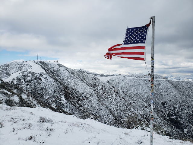
When I reached the top, I finally found myself at the top which was adorned with a shredded American flag fluttering in the icy wind. The pure white landscape was ethereal and surreal and aesthetic. I sat down briefly on a bare rock to absorb both the unique scene and the can of beer stowed in my pack, but found sitting idle to be uncomfortably cold. So I threw on the only additional warmth I had and picked my way through the knee-deep snow and driving wind to the May Canyon Saddle where 3N54 tops out and intersects with Santa Clara Road (3N17.0).

Upper May Canyon Firebreak with snow

May Canyon Ridge Flagpole

View East from May Peak

I again momentarily thought about stopping at the saddle for a snack and a drink, but by this point, my feet were wet and my fingers numb. I needed to get off the breezy ridgeline and gain warmth by losing some elevation. Since returning the way I came wasn’t a realistic option given my state of ill-preparedness, that left a 5 mile walk down slushy May Canyon Road. 

Somewhat surprisingly, the snow clung to the ground quite tenaciously as I descended. I found that escaping it, even on this south-facing slope, took longer than I expected. It wasn’t until I reached roughly the 3,000’ contour that the road was finally snow-free and things began to warm up some. At that stage, I pulled the can of Sierra Nevada Celebration Ale that I had brought out of my pack and walked along with my open container predictably provoking the side-eye from a number of people that I passed. 

After what seemed an interminable amount of time, I was back at the vista point where the ridge route first crosses the road. Here, I retraced my steps down the steep fire break to Veteran’s Park. As is typically the case, the descent on tired legs and old knees was much more difficult than the climb up. That reality reinforced for me that the decision I had made earlier in the day to continue up the ridge when I first encountered snow was the correct one. 

Anyway, it was a rare and beautiful snow day in Los Angeles. Regardless of how you choose to describe the climate and ecosystem here, the snow this season has brought us is anything but ordinary for this glitzy, mid-latitude metropolis that folks are fond of calling a desert.
May Canyon Fire Road (3N54)

North San Fernando Valley from May Canyon Fire Road


Sunday, December 5, 2021

Crescenta View Trail

Crescenta View Trail

 Tip the world over on its side, and everything loose will land in Los Angeles.
~Frank Lloyd Wright

L.A. is the loneliest and most brutal of American cities.
~Jack Kerouac

The final story, the final chapter of western man, I believe, lies in Los Angeles.
~Phil Ochs

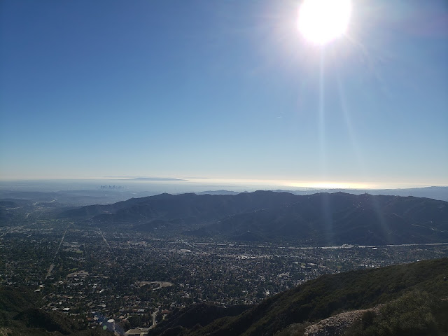
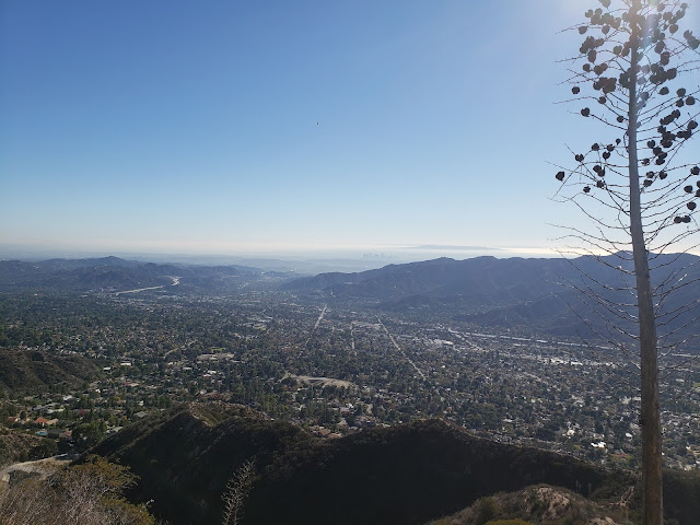
Roman Polanski once said "Los Angeles is the most beautiful city in the world, as long as its seen at night and from a distance." Obviously, Mr. Polanski never hiked the Crescenta View Trail on crystal clear, sunny day in November. If he had, he would have known that viewed from on high and afar, with the island-studded, gleaming Pacific as a backdrop, the City of Angels is a spectacular, if not messy, sight to behold.

How do I know this you ask? Because I recently hiked the Crescenta View Trail on a crystal-clear, sunny day in November. And from a perch at 4,400' feet, Los Angeles, in all its frenetic, sprawling, chaotic glory is quite a beautiful thing. This despite what all those sneering east coast elites and raffish midwestern outsiders might say otherwise.

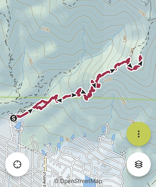
The Crescenta View Trail starts at Deukmejian Regional Park which is technically in Glendale. As far as trailheads go, Deukmejian is somewhat unique in that it has plentiful free parking, water, and full bathroom facilities. Bueno! The track begins at the rear of the parking area and gently ascends Dunsmore Canyon adjacent to the dry creek bed. A short distance up-canyon, a trail branches off to the right and crosses over to the east side of Dunsmore Creek before continuing northward. A similar connector intersects the Dunsmore Canyon Trail further up the canyon. Wanting to get off the more heavily-traveled main trail, I took the first branch which was a mistake as the path has been completely washed away where it crosses to creek. I had to scramble up a steep and brushy bank on the other side to regain the trail. I did not repeat that mistake on the return trip, following the second connector further up canyon.   

A short distance later, the climbing begins as the path switch-backs up the ridge that separates Shields and Dunsmore Canyons. The climbing isn't particularly steep, but it is sustained and really doesn't let off until you reach the saddle where the Crescenta View Trail ultimately intersects the Mt. Lukens fireroad. From that point, you can traverse the dirt road a short distance west to the summit of Mt. Lukens, the highest point in the Los Angeles proper at 5,074 feet.

There is apparently some controversy over the name "Mt. Lukens." According to the Sierra Club HPS Section, the peak was previously named "Sister Else (or Elsie) peak. Nobody seems to remember or know who the original female namesake was, but as part of the 1875 Wheeler Survey, a chap named "McLain" decided "Lukens" was a more appropriate appellation and so renamed the peak in honor of Theodore Lukens, a former Supervisor of the Angeles National Forest. McLain ostensibly did this because "mountains should be monuments to the men who have treasured and protected them," gratuitously observing "what did Sister Elsie ever do for the mountains?" 

Crescenta View Trail

Crescenta View Trail

Crescenta View Trail

Anyway, my objective this day was not the summit of Sister Else Peak. Instead, my plan was to simply hike to the Redoubt, a circular rock enclosure on one of the ridge's promontories accessorized with a flagpole. There, I figured I'd take in the views, have a snack, lollygag a bit, and then return to the parking lot. But as alluring as that might sound, the Redoubt is an exposed and shadeless place, and sitting there baking in the direct sunlight for any appreciable amount of time is not ideal. So I continued another 3/4 mile up the trail to the Pickens Spur water tank which is also a shadeless and exposed spot, although perceptibly cooler. Plus, the flat concrete there affords an opportunity to lounge about without having to roll around in the dust and dirt.

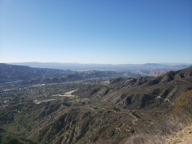
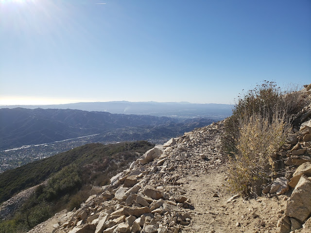
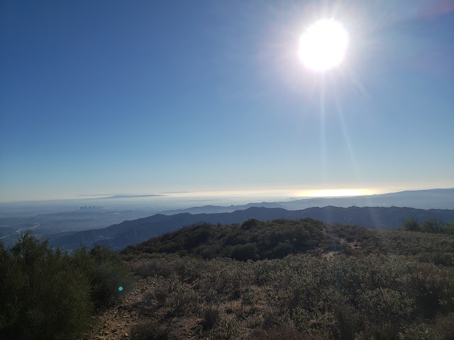
From this spot high on the ridgeline, the entire Los Angeles basin is observable. Downtown, midtown, Century City, Santa Monica, the Palos Verde Peninsula, the Valley, and the Verdugos are spread out before you like a crazy metropolitan quilt. To the distant east, you also get impressive looks at all the celebrities of the San Gabriel front country: Mt. Deception, San Gabriel Peak, Occidental Peak, Mt. Markham, Mt. Wilson, Mt. Lowe, and Brown Mountain. 

Pickens Spur water tank
  

Crescenta View Trail

Crescenta View Trail

I stripped my sweaty shirt off here, exposing my embarrassing corpulence to no one, and lingered for a while. Shortly after that, things got amazingly hazy so I packed up and started back down the way I came.

Stone Amazingly Hazy IPA

Total mileage for this one came in at 5.20 with an elevation gain of just shy of 3,000 feet.      

Crescenta View Trail

Crescenta View Trail Elevation Profile