Live, travel, adventure, bless, and don't be sorry.
~Jack Kerouac
It is the experiences, the great triumphant joy of living to the fullest extent
in which real meaning is found. God it's great to be alive!
~Alexander Supertramp aka Christopher McCandless
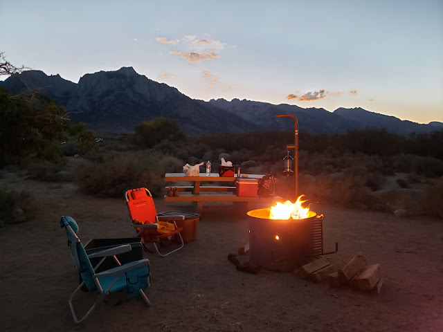
I tended to the campfire as the sun dipped behind Owens Peak and the shadows moved cat-like across the valley floor. The only fragments of day were the pink and purple that stained the Inyo Mountains to the east. It really wasn't quite campfire weather yet. The night was warm and the hour still early, but fire is obligatory on outings like this. The radiating warmth, the alluring scent of burning pine, the snap-crackle-pop of combustion, the hypnotizing dance of the flame. There's something primal and ancient and ritualistic about it all. A vestigial connection to ancestors and the past.
Late September is high season in the Sierra so we'd driven up earlier in the day to ensure that we'd have a decent camp spot. Up the El Camino Sierra and across the high desert, through Pearsonville, Coso, Dunmovin, Grant, Olancha, Cartago, and all the other bleak little outposts littered with sun-bleached single-wides, dilapidated buildings, and junky automobiles slowly disintegrating in the scorching heat. This is the land of stolen water and murdered dreams. What Marc Reisner called the "Cadillac Desert."
Our weekend objective was Kearsarge Pass out of Onion Valley. If we were feeling frisky, we might give Mt. Gould a go once at the pass. Kearsarge Pass and its namesake peak were named after the Union battleship USS Kearsarge. In June of 1864, the Kearsarge destroyed the CSS Alabama, a Confederate cruiser that sunk 64 American merchant ships in the Atlantic. The nearby Alabama Hills were named by Confederate sympathizers after the Alabama. Local Unionists then named the pass and peak after the Kearsarge as a kind of "fuck you!" in response.
We got a bit of a late start Saturday morning because we lollygagged around camp too long. The start then got delayed further when we made a mandatory stop for caffeine. Lone Pine has a cute independent coffee house called the Lone Star Bistro, but we didn't go there. The last time I visited, the older guy behind the counter (who I surmise was the owner) was kind of a surly wiener. When he asked me what I wanted, I jokingly told him in my worst Anglo-Spanish that I wanted coffee - enormous, gigante, grande! He got triggered by the word "grande" and barked back at me "this isn't Starbucks!" before begrudgingly getting me a "large." So on this trip we went to McDonald's where the dick factor is much lower and the coffee better.
It's a curious thing. Lone Pine is a small, rural place. It really isn't self-sustaining. It relies on "big city" tourists for survival. Or at least to bolster the local economy. And yet, several establishments there appear to revile the tourist hand that feeds them. Jake's Saloon is such a place. Right next to the Lone Star Bistro, Jake's recently had a sign posted over the bar warning "No Hipsters! Don't be coming in here with your hairy faces, your vegan diet, your tiny feet & your sawdust bedding." Maybe they were kidding. Maybe they weren't. I don't really care. I don't patronize Jake's. Not because I consider myself a hipster. At my age, literally no one would make that mistake. I don't patronize Jake's because the last time I went there it was unbearably hot and the bartender reminded me of the pawn shop keeper in Pulp Fiction. And then there was the large Confederate flag hanging prominently over the bar. 150 plus years and counting and the scourge of the Confederacy is still with us. So, local rednecks only at Jake's I guess.
Leaving Lone Pine, we drove north to Independence where the road to Onion Valley leads west following a gash in the mountains where Independence Creek spills out onto the arid plain. Along the way, we passed the Manzanar National Historic Site where the United States forcibly relocated and then detained Japanese-Americans during World War II. With the stunning backdrop of the Sierra crest, Manzanar is austere and starkly beautiful. We could have done Americans of Japanese descent worse. But it is a prison nonetheless. The old guard towers sitting along 395 attest to that.
Onion Valley Road, which begins in Independence as Market Street, is an impressive bit of engineering and road-building. As you climb away from town and begin to gain elevation, you can't help but wonder who it was that first ascended the canyon and established the route that thousands now follow. That same thought pops into my mind whenever I drive up to Horseshoe Meadows, the Whitney Portal, Glacier Lodge, and all the other roads that breach the mountainous bulwark that protects the inner sanctum of the range. In the case of Kearsarge, the first ascent up Independence Creek was probably by natives following game trails. But apparently the first documented crossing of Kearsarge Pass was accomplished in 1864 by eleven prospectors looking to strike it rich.
At the trailhead, we found the parking lot jammed to capacity. The Kearsarge Pass Trail has always been a popular route, but not this popular. A sign of the times I suppose. So we parked along the road and started up, following a conga-line of about 18 hikers on a group outing. Over the course of the day, we would play leap-frog with this group as we passed them and then they passed us until we all finally arrived at the pass 5 miles later at about the same time.
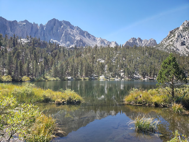
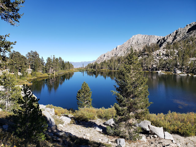
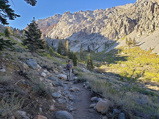
It's been a dry few years in the Sierra, but Independence Creek was coursing, presumably still being fed by what remains of the glacier that sits beneath impressive University Peak. That glacier, along with snow-melt, also nourishes the chain of stunning lakes that stud the basin. The trail climbs right out of the parking lot to the first of these lakes, Little Pothole, where you get a very brief respite before the climb resumes. Comparatively speaking, Little Pothole is the ugly step-sister of the other lakes. It is diminutive and decidedly unpretentious. But it is also infused with minerals from glacial melt that makes it gleam a brilliant aquamarine.
Further up trail, after a number of switch-backs and past the rock garden, is pretty Gilbert Lake. There's a big, flat granite boulder on the west side of the lake immediately trailside that I'm pretty certain is a mandatory stop for everyone hiking the trail. The boulder sits above blue Gilbert and affords a perfect Instagramable photo-op. Being the social media influencers that we are (or at least, imagine ourselves to be), we stopped briefly for some pictures that would instantly make everyone covet our perfect, adventurous life and hate there own. Then it was a short stroll to languid Flower Lake where nice campsites dot the eastern shore. This is the jumping off point if you plan on visiting the Matlock Lakes to the south.
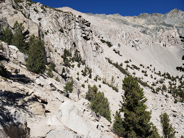
We, of course, continued up the main trail that proceeds to climb to tree-line with additional urgency. Along the way, we passed sapphire-hued Heart Lake and Big Pothole Lake, both of which sit well below the trail at this point. Despite that, both of these lakes are reachable. And I spied a couple of perfect tent sites on Heart's eastern shore. Further reconnaissance required. Big Pothole on the other hand, sits in a barren, exposed depression surrounded by nothing but boulders and scree. Pitching a tent here really doesn't look feasible or enjoyable.
We were in the home stretch now. Right at tree-line. 11,200 feet. We could now plainly see the pass ahead, but stopped briefly on a big old slab of granite for water and snacks before the final push. It's easy to forget to eat at altitude. At least it is for me. I have no appetite when I'm up high. Even foods that I normally love are unappealing. So I too often don't eat enough while I'm in the Sierra. Same with hydration. With all the lakes, gurgling streams, trees, and peaks, it's easy to get lulled into the false sense that you're not actually traipsing through what amounts to a humongous food dehydrator. The environment here is harsh. If you don't take in enough water, the intense aridity, solar radiation, and wind will punish you without remorse.
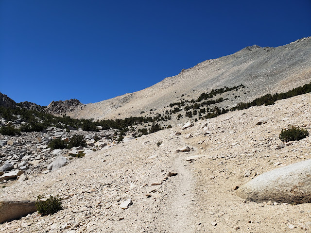
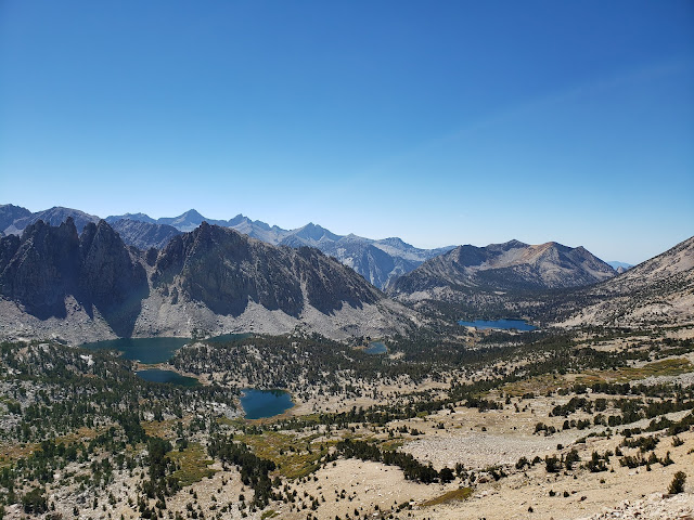
Moving again, we followed the final segment of trail as it made a couple of big, lazy switchbacks across the scree slope of Mt. Gould's south face before topping out at the pass at 11,760 feet. From this aerie, you have panoramic views of the ragged Kearsarge Pinnacles and the cerulean Kearsarge Lakes, both of which sit in Kings Canyon National Park.
We found an available spot on a rocky prominence that afforded grand views of both sides of the divide and sat amongst the crowd to take it all in. In any other circumstance, I'd probably be annoyed. I'm a bit of a misanthrope and don't appreciate other impinging on "my" space and solitude. I come to the mountains to get away from folks, not to be with them. But the mountains change people. It infects them with what Kim Stanley Robinson described in a recent Backpacker Magazine article as "crazy love." It's the mystical feeling of pure freedom and boundless joy one has when in the mountains or on the trail. Anyone who hasn't experienced it probably won't understand, but it's almost religious in nature. I realize that sounds hyperbolic, but you see it manifest in people you encounter on the trail. Everyone you come across is happy, friendly, engaging, and helpful. Like you, they are all elated to be out. Nature has unbridled them. It has stripped away the heavy encumbrances put upon them by the rules, regulations, expectations, and responsibilities of the culture. So you get to see folks in their pure, original, blissful state. You can't get that at the local shopping mall.
From the pass, the route to Mt. Gould takes you immediately north up a steep Class 2 scree field to the summit. We briefly considered making an attempt, but decided against it as the hour was later than we had anticipated. So we retraced our steps to Onion Valley where the madding crowds in the parking area had dissipated somewhat. It was then a relatively quick drive back to our camp in the Alabama Hills for one more precious night of crackling fire, black skies, and brilliant stars.


