Showing posts with label John Muir Wilderness. Show all posts

Friday, September 30, 2022

Coffee and Kearsarge

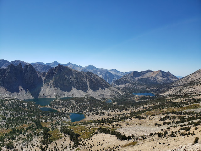
View West from Kearsarge Pass

 Live, travel, adventure, bless, and don't be sorry.
~Jack Kerouac

It is the experiences, the great triumphant joy of living to the fullest extent
 in which real meaning is found. God it's great to be alive!
~Alexander Supertramp aka Christopher McCandless

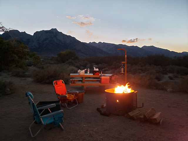
I tended to the campfire as the sun dipped behind Owens Peak and the shadows moved cat-like across the valley floor. The only fragments of day were the pink and purple that stained the Inyo Mountains to the east. It really wasn't quite campfire weather yet. The night was warm and the hour still early, but fire is obligatory on outings like this. The radiating warmth, the alluring scent of burning pine, the snap-crackle-pop of combustion, the hypnotizing dance of the flame. There's something primal and ancient and ritualistic about it all. A vestigial connection to ancestors and the past. 

Late September is high season in the Sierra so we'd driven up earlier in the day to ensure that we'd have a decent camp spot. Up the El Camino Sierra and across the high desert, through Pearsonville, Coso, Dunmovin, Grant, Olancha, Cartago, and all the other bleak little outposts littered with sun-bleached single-wides, dilapidated buildings, and junky automobiles slowly disintegrating in the scorching heat. This is the land of stolen water and murdered dreams. What Marc Reisner called the "Cadillac Desert."

Our weekend objective was Kearsarge Pass out of Onion Valley. If we were feeling frisky, we might give Mt. Gould a go once at the pass. Kearsarge Pass and its namesake peak were named after the Union battleship USS Kearsarge. In June of 1864, the Kearsarge destroyed the CSS Alabama, a Confederate cruiser that sunk 64 American merchant ships in the Atlantic. The nearby Alabama Hills were named by Confederate sympathizers after the Alabama. Local Unionists then named the pass and peak after the Kearsarge as a kind of "fuck you!" in response. 


Owens Valley

Sierra Alpenglow


We got a bit of a late start Saturday morning because we lollygagged around camp too long. The start then got delayed further when we made a mandatory stop for caffeine. Lone Pine has a cute independent coffee house called the Lone Star Bistro, but we didn't go there. The last time I visited, the older guy behind the counter (who I surmise was the owner) was kind of a surly wiener. When he asked me what I wanted, I jokingly told him in my worst Anglo-Spanish that I wanted coffee - enormous, gigante, grande! He got triggered by the word "grande" and barked back at me "this isn't Starbucks!" before begrudgingly getting me a "large." So on this trip we went to McDonald's where the dick factor is much lower and the coffee better. 

It's a curious thing. Lone Pine is a small, rural place. It really isn't self-sustaining. It relies on "big city" tourists for survival. Or at least to bolster the local economy. And yet, several establishments there appear to revile the tourist hand that feeds them. Jake's Saloon is such a place. Right next to the Lone Star Bistro, Jake's recently had a sign posted over the bar warning "No Hipsters! Don't be coming in here with your hairy faces, your vegan diet, your tiny feet & your sawdust bedding." Maybe they were kidding. Maybe they weren't. I don't really care. I don't patronize Jake's. Not because I consider myself a hipster. At my age, literally no one would make that mistake. I don't patronize Jake's because the last time I went there it was unbearably hot and the bartender reminded me of the pawn shop keeper in Pulp Fiction. And then there was the large Confederate flag hanging prominently over the bar. 150 plus years and counting and the scourge of the Confederacy is still with us. So, local rednecks only at Jake's I guess. 

Leaving Lone Pine, we drove north to Independence where the road to Onion Valley leads west following a gash in the mountains where Independence Creek spills out onto the arid plain. Along the way, we passed the Manzanar National Historic Site where the United States forcibly relocated and then detained Japanese-Americans during World War II. With the stunning backdrop of the Sierra crest, Manzanar is austere and starkly beautiful. We could have done Americans of Japanese descent worse. But it is a prison nonetheless. The old guard towers sitting along 395 attest to that.   

Onion Valley Road, which begins in Independence as Market Street, is an impressive bit of engineering and road-building. As you climb away from town and begin to gain elevation, you can't help but wonder who it was that first ascended the canyon and established the route that thousands now follow. That same thought pops into my mind whenever I drive up to Horseshoe Meadows, the Whitney Portal, Glacier Lodge, and all the other roads that breach the mountainous bulwark that protects the inner sanctum of the range. In the case of Kearsarge, the first ascent up Independence Creek was probably by natives following game trails. But apparently the first documented crossing of Kearsarge Pass was accomplished in 1864 by eleven prospectors looking to strike it rich.  

Kearsarge Pass Trail

Flower Lake

Kearsarge Pass Trail

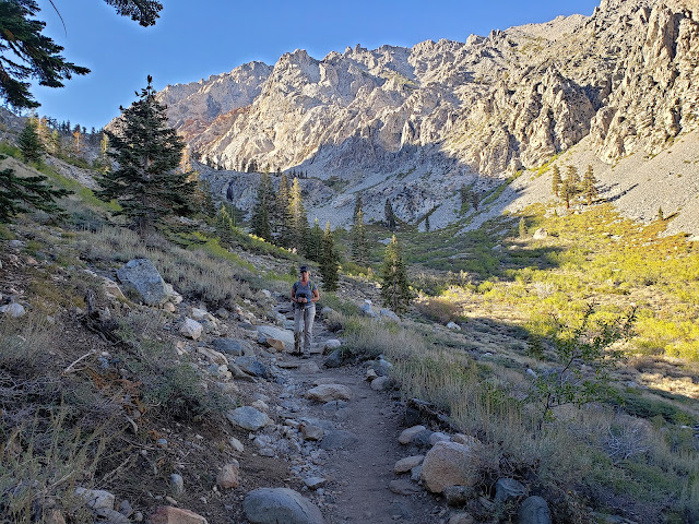
At the trailhead, we found the parking lot jammed to capacity. The Kearsarge Pass Trail has always been a popular route, but not this popular. A sign of the times I suppose. So we parked along the road and started up, following a conga-line of about 18 hikers on a group outing. Over the course of the day, we would play leap-frog with this group as we passed them and then they passed us until we all finally arrived at the pass 5 miles later at about the same time. 

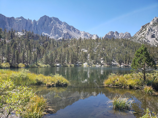
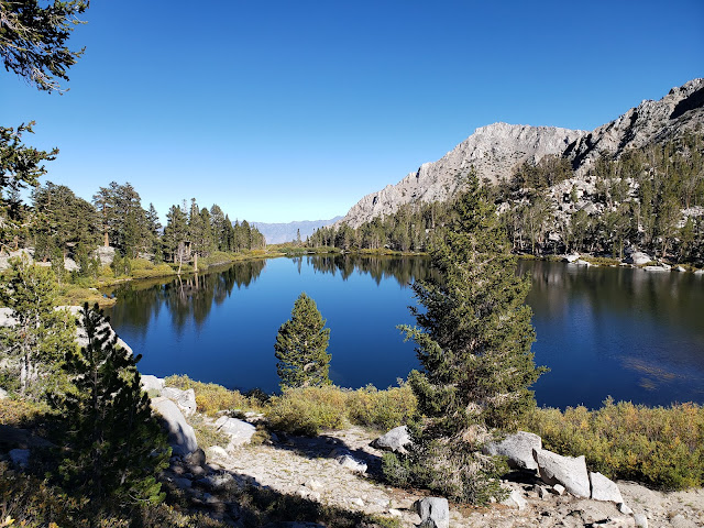
It's been a dry few years in the Sierra, but Independence Creek was coursing, presumably still being fed by what remains of the glacier that sits beneath impressive University Peak. That glacier, along with snow-melt, also nourishes the chain of stunning lakes that stud the basin. The trail climbs right out of the parking lot to the first of these lakes, Little Pothole, where you get a very brief respite before the climb resumes. Comparatively speaking, Little Pothole is the ugly step-sister of the other lakes. It is diminutive and decidedly unpretentious. But it is also infused with minerals from glacial melt that makes it gleam a brilliant aquamarine.  

Further up trail, after a number of switch-backs and past the rock garden, is pretty Gilbert Lake. There's a big, flat granite boulder on the west side of the lake immediately trailside that I'm pretty certain is a mandatory stop for everyone hiking the trail. The boulder sits above blue Gilbert and affords a perfect Instagramable photo-op. Being the social media influencers that we are (or at least, imagine ourselves to be), we stopped briefly for some pictures that would instantly make everyone covet our perfect, adventurous life and hate there own. Then it was a short stroll to languid Flower Lake where nice campsites dot the eastern shore. This is the jumping off point if you plan on visiting the Matlock Lakes to the south. 

We, of course, continued up the main trail that proceeds to climb to tree-line with additional urgency. Along the way, we passed sapphire-hued Heart Lake and Big Pothole Lake, both of which sit well below the trail at this point. Despite that, both of these lakes are reachable. And I spied a couple of perfect tent sites on Heart's eastern shore. Further reconnaissance required. Big Pothole on the other hand, sits in a barren, exposed depression surrounded by nothing but boulders and scree. Pitching a tent here really doesn't look feasible or enjoyable.

Heart Lake

Kearsarge Lakes Basin

Approaching Kearsarge Pass

We were in the home stretch now. Right at tree-line. 11,200 feet. We could now plainly see the pass ahead, but stopped briefly on a big old slab of granite for water and snacks before the final push. It's easy to forget to eat at altitude. At least it is for me. I have no appetite when I'm up high. Even foods that I normally love are unappealing. So I too often don't eat enough while I'm in the Sierra. Same with hydration. With all the lakes, gurgling streams, trees, and peaks, it's easy to get lulled into the false sense that you're not actually traipsing through what amounts to a humongous food dehydrator. The environment here is harsh. If you don't take in enough water, the intense aridity, solar radiation, and wind will punish you without remorse.

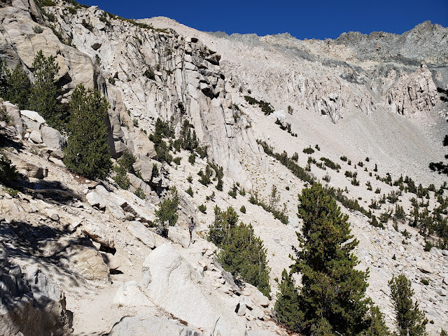
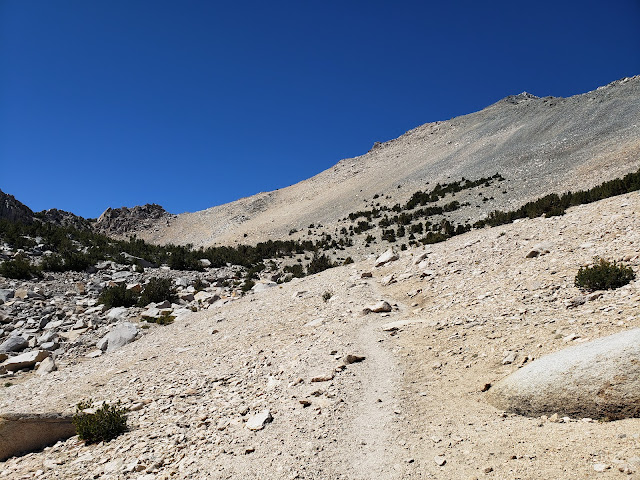
Moving again, we followed the final segment of trail as it made a couple of big, lazy switchbacks across the scree slope of Mt. Gould's south face before topping out at the pass at 11,760 feet. From this aerie, you have panoramic views of the ragged Kearsarge Pinnacles and the cerulean Kearsarge Lakes, both of which sit in Kings Canyon National Park.

We found an available spot on a rocky prominence that afforded grand views of both sides of the divide and sat amongst the crowd to take it all in. In any other circumstance, I'd probably be annoyed. I'm a bit of a misanthrope and don't appreciate other impinging on "my" space and solitude. I come to the mountains to get away from folks, not to be with them. But the mountains change people. It infects them with what Kim Stanley Robinson described in a recent Backpacker Magazine article as "crazy love." It's the mystical feeling of pure freedom and boundless joy one has when in the mountains or on the trail. Anyone who hasn't experienced it probably won't understand, but it's almost religious in nature. I realize that sounds hyperbolic, but you see it manifest in people you encounter on the trail. Everyone you come across is happy, friendly, engaging, and helpful. Like you, they are all elated to be out. Nature has unbridled them. It has stripped away the heavy encumbrances put upon them by the rules, regulations, expectations, and responsibilities of the culture. So you get to see folks in their pure, original, blissful state. You can't get that at the local shopping mall.

View West from Kearsarge Pass

Big Pothole Lake


From the pass, the route to Mt. Gould takes you immediately north up a steep Class 2 scree field to the summit. We briefly considered making an attempt, but decided against it as the hour was later than we had anticipated. So we retraced our steps to Onion Valley where the madding crowds in the parking area had dissipated somewhat. It was then a relatively quick drive back to our camp in the Alabama Hills for one more precious night of crackling fire, black skies, and brilliant stars.

Gilbert Lake

Kearsarge Pass Trail

Alabama Hills Camp


Thursday, November 7, 2019

The Dying Season


My, my, hey, hey
Rock and roll is here to stay
It's better to burn out
Than to fade away
My, my, hey, hey
~Out of the Blue, Neil Young (Rust Never Sleeps)

I'd been thinking about the Sierra and how I hadn't gotten a trip in this summer. And it was bumming me out. The southern Sierra is a relatively easy weekend, but somehow I'd allowed summer to slip into fall while my overnight gear sat unused in the closet. Now, Pacific Standard Time with its short days, cold nights, and long hours of darkness was on the horizon. Opportunity was fading away. It was time to act.

So last Friday afternoon, I stole away from the office early and started for Lone Pine with plans to explore the lakes of the North Fork of Big Pine Creek. This drainage holds the Palisades Glacier, the largest in the Sierra Nevada. Glacial powder from this melting icy giant is reputed to turn the Big Pine Lakes a striking turquoise. I needed to see that. 

But of course, the world conspired against me first and did it best to prevent that from happening. October is fire season in Southern California and as if on cue, a wind-whipped conflagration broke out in the hills above Santa Clarita promptly closing down the 14 freeway to both north and southbound traffic. But, as Donkey said in Shrek, "Never fear! Where there's a will, there's a way. And I have a way." That way involved traveling north on the 5 and then east on the 138 to the ultimate junction with the 14 in Lancaster. Then it was business as usual along the lonely desert highway all the way into Lone Pine.

When camping in the Alabama Hills, I'm always immediately drawn to Tuttle Creek. Candidly, it's not that spectacular of a place, but it has everything I want and need. And for some reason the place just seems to embrace me. I'm at peace there and always sleep really well when I camp there.

We pulled in as the last light faded from the horizon and were a bit surprised to see the place packed to the gills. Who knew that late October was high season in the southern Sierra? We grabbed one of the few remaining spots, set up camp in the dark, and then started a fire. The night was clear, cool, and pleasant. A million stars twinkled and the Milky Way splashed across the ink black sky.


The next morning we headed north fueled by large cups of caffeine courtesy of McDonald's. Say what you will about the ubiquitous fast food giant, but their coffee is always hot, tasty, and inexpensive. 40 minutes or so later, we turned west on Crocker Avenue (which becomes Glacier Lodge Road) in Big Pine and awhile thereafter arrived at the trailhead adjacent to Glacier Lodge. Along the road, we scared up a couple of handsome deer out for breakfast who viewed us suspiciously before bounding off into the underbrush.

We were now in the midst of the dying. All around us the end of season and the imminence of winter was on full display. From the floor of the Owens Valley, you only catch a glimpse of the colors of death. But here, up canyon at 8,200', you're enveloped in the vibrant reds, warm oranges, brilliant yellows, and muted browns of the changing seasons. There's no escaping it. Here, you can literally smell the vegetation as it decays. Here, you can feel life slipping away. It's a full-body sensory experience.


For we humans, death and dying is generally an ugly, morose, and sad affair. We don't know how to do it with style. Not so the Aspen, Alder, Maple, Oak, Birch, Willow, and Cottonwood. They do not go gentle into the good night. They rage against the dying of the light as Dylan Thomas taught. Summoning all they have left, they go out in one final and exuberant explosion of glory and beauty. Oh to be like them. 

As we climbed into the drainage, the scenery gradually returned to the familiar stone gray and ever green of the Sierra. The path into the basin parallels the North Fork of Big Pine Creek that was still coursing strongly late into the season. At about the 10,000' contour, we crested a rocky prominence and were gobsmacked by the stunning emerald beauty of Lake 1. Further up-trail, Lake 2 did the same thing to us. We thought about stopping to just absorb what we were already seeing, but the drugs had taken hold. We were now Big Pine lake junkies in need of more. So we pushed on toward Lakes 4 and 5.

That decision proved worth the effort. Lake 5, set as it is against the backdrop of towering Two Eagle Peak, was an idyllic and scenic spot to have a snack and rejuvenate in the warm, late-season sunshine. Physically and spiritually fulfilled, we then retraced our steps back to the the golden trailhead as the shadows got long and the light began to dim. In the car again, we drove down canyon out of the blue and into the black as the final sputterings of day disappeared with the sun behind the darkened Sierra crest.

My, my, hey, hey.


Saturday, August 4, 2018

Chased Out of the Miter Basin

The Miter Basin
I’ve got a Tom Harrison map of the Whitney Zone that I unfurl now and then so that I can daydream about all of the nooks and crannies on that map that I still need to visit. One of the places I’ve stared at and imagined for a long time is the Miter Basin. Surrounded by an assemblage of white granite peaks, spires, and domes, and dotted with lakes with names like “Sky Blue” and “Iridescent,” I always found this trackless and relatively remote area irresistibly alluring. And I wanted to visit it.

So I finally conceived a plan and convinced my daughter and a friend from Utah to join me on a romp into the heart of the basin. The loose itinerary involved a loop of sorts beginning at the Cottonwood Pass trailhead. The plan was to spend the first night a lower Soldier Lake, a second night a Sky Blue Lake, and a third night in the Cottonwood Lakes Basin. We’d make the short walk out and back to the car on the morning of the fourth day.

So on a Wednesday afternoon we loaded up and headed for the Alabama Hills where we car-camped at Tuttle Creek. The next morning we were up early for coffee and permits. We didn’t actually have permits reserved, so we had to wait until the Eastern Sierra Interagency Visitor Center opened at 8 a.m. for the lottery. When we got there around 7:45 a.m. there was already a line of about 30 folks doing the same. I sauntered up to the entrance and was innocently milling about when a dude with his girlfriend barked at me for trying to cut the line. I told the guy that there was no line, and that we’d all draw numbers from a hat to determine our order. Shortly after that, a Ranger appeared with a bucket and made me look like a sage. We then all drew numbers. I pulled number 3; the guy that barked at me pulled something much worse. We got permits no problem. I don’t know about the other guy.

Car Camping in the Alabama Hills
Forty-five minutes later we were on the trail and making our way up to Cottonwood Pass. If you’re an old man living at sea level, one of the nice things about the trails departing from Horseshoe Meadow is that you’re already at elevation. You of course still end up climbing with a fully-loaded pack, but it’s a kinder, gentler climb that allows your body a bit of time to acclimate to both the weight of the pack and the less oxygen-nutrient air.

At Cottonwood Pass, we paused briefly for snacks and to snap pictures for a group that had spent a week or so making the circuit around the Big Whitney Meadow area. We then jumped onto the PCT and made our way to Chicken Spring Lake to tank up on water since it wasn’t evident whether we’d have another chance before we reached lower Soldier Lake.

Horseshoe Meadow
Cottonwood Pass

PCT
Chicken Spring Lake
From Chicken Spring Lake, the PCT climbs briefly out of a shallow cirque and then remains relatively level at about the 11,300’ contour until it crests a low rise and begins a slow descent into the vast Siberian Outpost. Here we stopped briefly to admire the stark landscape and the interplay of sun and shadows being cast by storm clouds to the west. A harbinger of things to come.

A mile or so beyond this is a well-marked trail junction. Going south will take you up over the Siberian Pass and into the Big Whitney Meadow area. Continuing west along the PCT leads to Rock Creek and beyond. We veered north on the pleasant connector which ultimately intersects with the path that leads east up over New Army Pass and northwest to lower Soldier Lake. Just before that intersection, the connector crosses a stream which was running strongly and could serve as a good source for replenishing water supplies. We were still good in that regard, so we pushed on to our destination.

The spur leading to lower Soldier Lake is dotted with campsites and a single bear box. There are additional sites immediately adjacent to the lake as well, but we didn’t know when we first arrived. As we inched along the spur, we were somewhat surprised to find that every single site was occupied. One large site housed a group of ten 20-somethings from Ohio State who told us they’d been on the trail for 26 days. The last site before the lake was taken by a sole older gentleman who offered to split the site with us. We gratefully accepted and shared our whiskey with him as recompense. Turns out our camp host was enjoying his first night of a solo hike of the JMT. The following day he was headed for Guitar Lake so that the day after he could summit Mt. Whitney and officially begin his through-hike.

PCT Views

Rock Field

Siberian Outpost
Connector to Lower Soldier Lake

Camp View at Lower Soldier Lake
The next morning we had planned to penetrate the Miter Basin. The intended route was the “short-cut” which follows a use trail that skirts the west side of lower Soldier Lake and then climbs the low rise on the north-west end of the lake. Upon seeing the route, my daughter expressed a bit of trepidation so we back-tracked to the main trail and tacked southwest to the mouth of the Rock Creek drainage.

There is supposed to be an obvious use trail leading up drainage, but it wasn’t obvious to us. We ran into a couple of young ladies looking to do the same thing we were doing and we all fumbled around a bit looking for the non-existent use trail. Finally, we forded Rock Creek and began ascending the west side on something that kinda, sorta resembled a faint use path or game trail. After bashing through brush for a bit and climbing obstacles, our female companions apparently called it quits because we didn’t see them again. Determined or obstinate, we continued forward for about ¼ mile when we burst into a wide, open meadow bisected by Rock Creek. One the east side of the creek, we finally saw the well-trod use trail we’d been searching for and jumped the creek to beat its path.

Meadow Near Rock Creek Junction

Rock Creek as it Flows Out of the Miter Basin

The Meadow - Use Trail to the Right
From here, the route forward was pretty simple: continue up the basin. We occasionally lost then relocated the use trail, but it’s pretty hard to get truly lost here as there is only one way in and one way out. Ok, that’s not entirely true, but practically speaking it is for most mortals, and that included us.

The scenery here is as sublime and glorious as I had imagined it. The Major General sits high on your right. Mt. Corcoran, Mt. LeConte, and the Shark Tooth, all 13,000’+ dominate the skyline to the northeast. The spikey Miter scrapes the sky to the north. And an unnamed granite spire and 12,000’ solid granite walls hem you in on the west. Our intended destination Sky Blue Lake, sits in a bowl above a series of cascades sandwiched between the Miter and Peak 13,221’.

But about ½ mile out, as we approached the final ascent to Sky Blue Lake, the sky after which the lake is named became ominous. The wind, which had been still throughout the day, began to howl. The temperature dropped. We started to hear the crack of lightning and the rumble of thunder. And then the heavens opened up and it began to rain. Then it hailed hard enough to coat the ground with tiny balls of ice. Then it rained again, harder this time.

We stopped to evaluate the situation and ponder the night ahead. My trail companions looked dubious. My daughter, the more level-headed of the two of us, was reluctant and urged retreat to lower ground. Dejected, I relented and we started to beat a retreat back to Soldier Lake.

On the way out, we bumped into a young lady that was part of the Ohio State contingent. She had gone into the basin on a day exploration and was retreating to Soldier Lake as well. When we discovered that she was returning via the “shortcut,” we stalked her all the way back to the lake which in fact shaved off a fair amount of distance and time.

Granite Cliffs Abound

Pushing Deeper Into the Basin

Typical Basin Views
Lower Soldier Lake from Atop the Shortcut
Back where we started the day, we set up camp lakeside on the peninsula of sorts that juts into the lake on its south side. As soon as our tents were up, the rain began and we took shelter. And then it rained, and it rained, and it rained. And it hailed again. And then it rained again. For three straight hours, the rain relentlessly pummeled our sad little fabric shelters which finally wetted out despite a valiant struggle to keep us dry. At dusk, the precipitation finally subsided and the clouds gradually began to move along and ruin someone else’s party.

The next morning was brisk and clear. We took our time breaking camp in order to allow our gear to dry some. Then we were back on the trail ascending the stunningly gorgeous valley that climbs to New Army Pass from the east. As the climb stiffened, and the suffering began in earnest, the beauty of my surroundings began to fade. Actually, the surroundings didn’t change at all. It was just my frame of mind. The Buckeyes were in front of us, and I tried to use them as my rabbit, but I couldn’t keep pace with the youngsters, including my daughter who blasted the ascent with no problems. Finally atop the 12,310’ pass, we stopped to refuel and to immerse ourselves in the moment. It was chilly and breezy at the pass and billowy clouds were starting to accumulate on the horizon.

The climbing for the trip complete, we descended the spare cirque that cradles appropriately-named High Lake. A fair number of hikers were struggling up as we came down, including a guy attempting to prod, poke, and cajole a group of adolescent boys up to the pass. We offered encouragement, but the boys just looked at us with utter contempt. I laughed because I knew how they felt. At Long Lake, we stopped again to pump water and solidify our plans for the evening. Charcoal gray thunderheads were now boiling up over the peaks to the northwest and the skies to the east and south were darkening. Remembering the onslaught we endured the night before, we determined to admit defeat and walk the rest of the way out. Midway back it began to rain again.

Back in Lone Pine, we figured we’d salvage the remainder of the trip by getting eats, beer, and firewood for another night of car-camping at Tuttle Creek. But even here, the weather refused to cooperate. While we were in town, the wind kicked up and the sky turned black. Lightning cackled and thunder thundered in the distance. We knew our fate was sealed. So we jumped in the car and made the long drive back to predictably and reliably dry civilization. 

Lower Soldier Lake Campsite

Climbing to New Army Pass

Approaching Near New Army Pass

Mt. Langley from the New Army Pass Trail
High Lake, Long Lake, and South Fork Lakes from New Army Pass

Descending the East Side of New Army Pass

Stunning Rock Formations
Long Lake

Cottonwood Lakes Basin