Showing posts with label San Gabriel Mountains. Show all posts

Sunday, October 31, 2021

Wright Mountain Hootenanny and Grilled-Cheese Extravaganza


Gobblers Knob Summit

I'm into grilled cheese. Grilled cheese makes me feel beautiful.
~Emma Stone

The poets have been mysteriously silent on the subject of cheese.
~Gilbert K. Chesterson

Men only need two things: grilled cheese and sex.
~Emmy Rossum

Ruminations on Grilled Cheese

The grilled-cheese sandwich. Two slices of white bread, butter, and cheese. A gastronomic staple of childhood and the culinary stuff of adulthood nostalgia. I never really thought that much about how enjoyable the combination of hot cheese and toast could be. And I certainly never considered the absolute epicurean genius one must possess to imagine, and the actually grill, grilled-cheese sandwiches on a mountain top. But a recent group outing to Wright Mountain in the San Gabriel Mountains brought me cheesy enlightenment about these important subjects. 

The event that set the table for this sudden understanding was the 14th anniversary of the San Gabriel Mountains Discussion forum. The forum is a San Gabriel Mountains-focused on-line board for posting trip reports, photos, information, questions, nonsense, and other valuable (and invaluable) whatnot. To celebrate the forum's 14 circle around the sun, Sean (aka Cucamonga Man), one of the board mucky-mucks, planned a ramble to the summit of Wright Mountain from the east starting from PCT mile marker 356 at the end of Forest Road 3N31. The plan was to arrive Saturday afternoon, car-camp at road's end beneath Gobblers Knob, and then hike westward along the Pacific Crest Trail ("PCT") to the summit of Wright Mountain.

Meet Up Beneath Gobblers Knob

After a slow and bumpy ride up 3N31 from Lone Pine Canyon, I arrived at the designated spot late Saturday afternoon. It was the middle of deer hunting season in Zone D11, so I passed several armed hunters in full camo on my way in. David and Elwood were already there when I arrived so I settled in with them as a heavy blanket of clouds began to broil up the ridge from the valley below. It was an ethereal scene reminiscent of the Ten Commandments when the Lord sent the breath of pestilence to kill the first born of the Egyptians. Fortunately, none of us perished as the fog passed-over while we drank beer and waited for Cucamonga Man, our Moses, to arrive so he could lead us to the promised land on the morrow. Much later, as the fog retreated and darkness replaced it, Dima and Sondra arrived to join the group. 

We were still above the cloud bank the following morning as the sun began to rise in the crystalline blue sky.  In an over-used word, it was spectacular. While we waited for Cecelia and JeffH to arrive to round out the group, I made a quick dash to the summit of Gobblers Knob. There is no trail to the summit, so I just gutted it out up a steep and loose old firebreak the follows the eastern ridge. The top of Gobblers Knob is wide and flat so it wasn't immediately apparent where the actual high-point was. But on the far western side of the summit I found a rock-pile which, officially or not, marks the spot. I could locate neither a register nor benchmark on Gobblers Knob, but I did find one of those ubiquitous triangular signs known as "witness posts." And it was the only time the entire trip that the back-side of Mt. Baldy would be visible.


North Fork Lytle Canyon
North Fork Lytle Creek Canyon

Lone Pine Canyon
Lone Pine Canyon

PCT Sunset
Sunset Over the PCT

Moon Over Lone Pine Canyon
Night Vision

Sunrise over Lone Pine Canyon
Sunrise Over Lone Pine Canyon

Gobblers Knob Summit
Views from Gobblers Knob

Gobblers Knob Summit
View West from Gobblers Knob - L to R: Baldy, Dawson, and Pine

PCT West to Wright Mountain

Shortly after I descended from the Knob, Cecelia and JeffH arrived and we headed out, jumping onto the PCT which transects the parking area. The well-maintained trail skirts Gobblers Knob to the north as it climbs gently toward the Blue Ridge and Wright Mountain. As you go along, the transition from a more scrub-dominated environment to a lush evergreen plant community is obvious and striking. You also get good looks at Dawson and Pine which dominate the southern skyline. Ultimately, the trail tops out and joins an old fire road that wraps around the south side of Wright Mountain. Here, we stopped at a window above the slide area at the head of Heath Canyon for snacks and the sublime scenery. Wrightwood and the high desert were visible in the foreground, while the southern Panamints could be seen on the northern horizon.

The final push had us ascending a faint, old road bed of some sort to the summit of Wright. Like Gobblers Knob, the forested crown of Wright is broad and flat and the actual high-point is not immediately obvious or intuitive. To complicate matters further, a series of use trails criss-crosses the summit plateau in a sign that a good many others have also spent time and energy wandering around in search of the actual "top" of Wright. But Cucamonga Man knew the way and led us to a rock-pile on the north end that apparently qualifies as the official summit. 

Grilled Cheese Sammies on the Summit

As we settled in to luxuriate in our achievement with our bland old trail mix, beef jerky, and granola bars, chef de cuisine JeffH dug into his stash of secret goodies and pulled out all the makings for grilled-cheese sandwiches. In a flash of mad-scientist brilliance, he had packed a loaf of bread, slices of American cheese, a container of butter, a frying pan, a spatula, and his stove. He then went about grilling sammies one at a time for everyone. It was candidly delicious and we all sat around in the warm sun extolling the awesomeness of Jeff's gastronomical creativity and licking butter and melted cheese off our grimy fingers. 

Afterwards, we hoisted our packs back onto our backs and started the 4.5 miles back to where we started. On the way out, a few of our party climbed Gobblers Knob via its north ridge. That route looked much more accessible than the east ridge that I climbed previously, and I then wished I had waited to ascend the Knob using that approach. Back at the parking area, we cracked cold beers as Cecelia broke out chips, salsa, and guacamole. Another stroke of inspiration. That probably sounds a bit over-stated, but I rarely bring post-hike food and drink to enjoy (mostly because I'm generally solo), so this was a really tasty treat. 
On the way out, I took the long way down 3N31 out of Lytle Creek just because. Although considerably longer, the road out this way was an easier drive than the access from Lone Pine Canyon.

All in all, a fun day in a really nice part of the San Gabriel range.  

Pacific Crest Trail
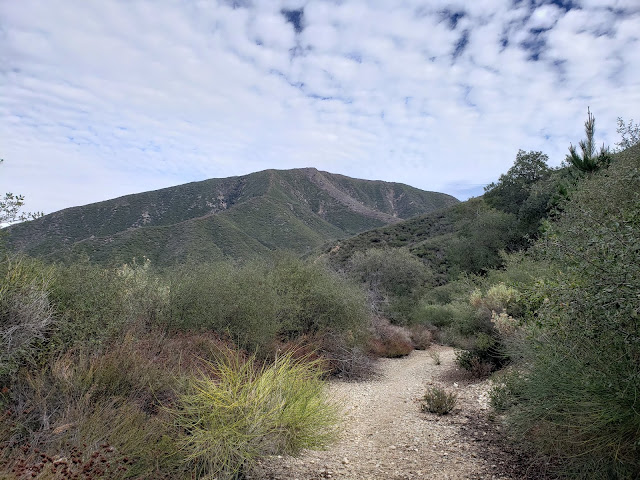
Along the PCT

Pacific Crest Trail
Nearing Wright Mountain

Dawson Peak and Pine Mountain
Dawson Peak (L) and Pine Mountain (R)

High Desert from PCT
To Infinity and Beyond

Wright Mountain Summit
Wright Mountain Summit Cairn

Grilled Cheese Sammies on Wright Mountain
The Mad Scientist at Work

Memorial on Wright Mountain
Wright Mountain Beautiful Child
 
PCT Views
Views East to San Gorgonio and San Jacinto

Monday, April 6, 2020

In the Footsteps of Grizzlies and Banditos

Dark Canyon

From a town known as Wheeling, West Virginia
Rode a boy with a six-gun in his hand
And his daring life of crime
Made him a legend in his time
East and west of the Rio Grande
~Billy Joel, The Ballad of Billy the Kid

As far as I know, legendary outlaw and bank-robber extraordinaire Billy the Kid was never in the San Gabriel Mountains. He was too busy shooting up saloons and rustling cattle and killing lawmen in Nuevo Mexico to bother coming further west. And even if he did have aspirations to visit the Golden State, those were cut short on July 14, 1881 when Lincoln County Sheriff Pat Garrett ambushed Billy in a house in Fort Sumner, New Mexico and put a bullet in his brain. Thus came the swift end for Henry McCarty aka William H. Bonney aka Billy the Kid.

But the San Gabriels didn't need Billy the Kid. It had a robust assemblage of banditos and gun-slingers and desperados all its own. One of the more notorious was the gentleman and chivalrous outlaw Tiburcio Vasquez who claimed that his crime spree was to avenge the numerous injustices committed by invading Anglos against native Californios. Vasquez and his gang were all over the San Gabriel range and several places memorialize or bear witness to that fact (e.g., Bandido and Horse Flat Campgrounds, Vasquez Creek, Vasquez Rocks).

One of Vasquez's more infamous exploits was the raid on the Repetto ranch which was located in southeast Los Angeles in what is now Monterey Park. Alexander Repetto was an Italian sheepherder who Vasquez was informed was flush with cash after having recently sold one of his flocks. So Vasquez and his boys hatched a plan to relieve Mr. Repetto of his burden. Claiming to be sheep-shearers, they came to the Repetto ranch looking for work. But Repetto was a sharp cookie with a keen eye who saw through the ruse and called Vasquez out. Admitting that he was in fact not a sheep-shearer, but a gangster, Vasquez tied Repetto to at tree, demanded $10,000 of him, and threatened to hang him if he did not comply. But Repetto didn't have the money. He had spent most of it. And what remained was on deposit at the Temple and Workman Bank in downtown Los Angeles. So an alternate plan was conceived. Vasquez would force Repetto to write a check that his nephew would carry to the bank, negotiate, and then return with the proceeds. In a piece titled "The Hunt for Tiburcio Vasquez: A Chase Through a Californio's L.A., " Robert Peterson describes what happened next:

"When Repetto's nephew arrived at the bank, he was so nervous that the banker, Francis Temple, became suspicious and contacted the Sheriff. Upon further questioning the nephew broke down and tearfully revealed the whole story. The Sheriff immediately started assembling a posse to capture Vasquez. At this point, the nephew became worried that the Sheriff's involvement might result in his uncle's death. He managed to convince the banker to give him 500 dollars in gold and returned to Repetto's house, before the posse, to give the money to Vasquez. When the Sheriff's posse approached Repetto's house, Vasquez and his men mounted up and started racing north towards present day Pasadena."

Vasquez's escape route took him up the Arroyo Seco, into Dark Canyon, up to the old Soledad Road grade at the crest (present day Grizzly Flat Road), and then down into Big Tujunga Canyon via Grizzly Flat and Vasquez Creek (roughly, the present-day Grizzly Flat Trail). The ride down to Big Tujunga was rough, steep, and overgrown with Buckthorn, and Vasquez lost a horse and his revolver on the way down. Years later, a 16-year old kid named Phil Begue from the City of Tujunga, found Vasquez's saddle and his revolver still bearing the initial "T V" cut into the barrel.

For a nice write-up of the raid by Vasquez on the Repetto ranch by legendary Southern California historian John Robinson, go here: http://www.lawesterners.org/wp-content/uploads/2013/10/149-DECEMBER-1982.pdf


Given its historical significance, I've wanted to see Grizzly Flat and the trail leading to it up Dark Canyon from Big Tujunga for awhile, but all the reports I had seen were that is was impassable and/or choked with poison oak. Me and poison oak ain't friendly. So I never went. Then one day, I read a report that the Grizzly Flat trail had been worked and was clear all the way to the divide. That was all the motivation I needed.

I started from Stoneyvale at Vogel Flats. The parking lot was empty save for one van near the trailhead. Two ladies in hiking gear had just come down trail and were loading their gear into the van. A good omen. As I passed them, they asked me where the trail went. They had followed it a short distance until it petered out in a tangle of growth at the stream and then turned back not seeing a way forward. A bad omen. I pushed on having to see for myself.

A short distance later I saw for myself. The path seemingly ended abruptly in a boggy, overgrown mess along Big Tujunga creek. This wasn't right. The reports I had read indicated the trail was passable. So I rock and log-hopped across the creek to left-hand side, bashed through a stand of Arundo donax, and the trail magically reappeared. From this point until the path tacks south at Silver Canyon and begins the climb to Grizzly Flat it was easy and open walking.

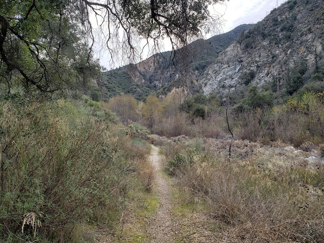
Lower Grizzly Flat Trail

Lower Grizzly Flat Trail

Grizzly Flat Trail

Then things began to get more interesting. As the trail starts to climb what I suppose is technically Dark Canyon, it gets steep, rocky, and narrow. Not impossibly steep, but steep enough to make you work. As the climb began, I looked for the Windsor benchmark (2094) without luck. It must be buried in the very thick brush that blankets the hillsides here.

Further up, stiff brush began to encroach on the trail poking and grabbing me as I passed. Then there were a number of fallen trees that had to be negotiated. Again, nothing too difficult, but enough to add some spice to the outing. But the higher I climbed, the more ducking and bending and crawling on, over, and around vegetation I had to do. Fortunately, none of it was of the poisonous oak variety. Just below and west of Grizzly Flat, in the dark and cool drainage that must be Dark Canyon (none of the maps that I've looked at are labeled), I heard rustling in the underbrush ahead. Since I was just shy of Grizzly Flat and in the deep recesses of the San Gabriels, I immediately assumed Ursus americanus californiensis. So I started hooting, hollering, and clapping my hands in a pathetic attempt to scare off the unseen beast. Then two guys came around the bend on the descent making me the fool. They didn't say anything but they knew. And I knew they knew. I asked them if they had gone all the way to the ridge, but they demurred. They said they got tired of bush-whacking so were beating a retreat back to the trailhead. Another bad omen.

Then I popped out into the clear and the sunshine at Grizzly Flat, named after the Grizzly Bears that once called the Angeles National Forest home and reputedly favored the Big Tujunga region. I've heard that before the Station Fire, Grizzly Flat was nice. Now, it is not much more than wide-spot on the trail. I stopped for a spell, investigated the water tank, hydrated, then pushed on.

Grizzly Flat Trail

Grizzly Flat Trail

Grizzly Flat

Grizzly Flat Water Tank

Here, the trail morphs into Grizzly Flat Road so I was optimistic that the traveling would become easier. But while the way did in fact open up, and the path did become wider, forward progress definitely did not become more effortless or simple. It seems Spanish Broom, a beautiful, non-native invasive, has a particular affinity for the area and it has aggressively colonized the place. It crowded the road to the point of being almost impassable at times, and I spent the next half-hour or so ducking under, around, and through massive clumps of the offending stuff.

Finally, I reached the divide separating Big Tujunga Canyon from the Arroyo Seco. This was the exact spot where 100+ years earlier, Tiburcio Vasquez finally shook Sheriff Rowland from his tail after the Repetto Ranch raid. The spot offers expansive views down Dark Canyon and into the Big Tujunga Creek drainage. Here, I found a spot to admire the fine scenery, shed my sweat-soaked top, dry out, and contemplate the historical significance the piece of ground on which I was sitting. After I had my fill, I hoisted myself up and then retreated back into the wilds of Dark Canyon that was once the haunt of both bandits and grizzlies.

Upper Grizzly Flat Trail

Upper Grizzly Flat Trail

Big Tujunga Creek

Wednesday, July 24, 2019

Reconnecting with the Forest of Angels


I was born on this mountain, this mountain's my home
She holds me and keeps me from worry and woe
Well they took everything that she gave, now they're gone
But I'll die on this mountain, this mountain's my home.
~The Mountain, Steve Earle

There was a time in the not-to-distant past that I was making the trek to the Angeles National Forest almost every weekend for an adventure. I'd take one weekend day to attend to domestic responsibilities and save the other day for the forest. My compulsion, if you want to call it that, was my desire, nay need, to explore all of the places I hadn't seen and to walk all of the trails I hadn't walked. In my past, I felt that I'd squandered time, place, and opportunity and I wasn't about to repeat that mistake in the present. So I'd find at a blank experience spot on my map each weekend and then head off to fill in that gap.

Over the course of a couple of years, those blank spots on my maps became fewer and farther between as I covered most of the established trails in the ANF and a good number of off-trail locations. That's not to say I've been "everywhere." I haven't and can't even pretend that is feasible. But within my physical limits, and considering the framework of my initial objectives, finding a new or unexplored spot did start to become more of a challenge. Drive times and distances to locations worthy of experience begin to stretch out. Days in the forest necessarily got longer. Not necessarily days "on the trail," but days getting to and from the trail. So subconsciously, I scaled back my efforts. My forays into the ANF became more of a drip campaign. I stayed local instead. After all, the Santa Monica Mountains are virtually in my backyard and afford endless miles of fun.

Heading into this past weekend, I reviewed where I had been in 2019. I had an inkling that review would show that I was being a little bitch. I guess I just didn't realize how much of a bitch. Three times into the Angeles in the first seven months of the year (Colby Canyon, Islip Ridge, Lone Tree Trail). I can do better.

So I broke out my Tom Harrison and scanned for destinations I still hadn't been. My buddy Keith Winston over at the Iron Hiker recently made a visit to Bobcat Knob and Goodykoontz from Buckhorn Campground which reminded me that I hadn't yet visited Will Thrall Peak. A friend and me made the cross-country trek from Mt. Williamson to Pallett Mountain and out the Burkhart Trail to Buckhorn Campground a couple of years back, but we didn't have the time or the energy to tag Will Thrall once we arrived at Burkhart Saddle. I've also come up to the saddle from the Devil's Punchbowl on the north side, but again didn't go further than that. So Will Thrall Peak it would be.

The day was warmer than it was supposed to be when I arrived at Buckhorn around 10:00 a.m. Traffic on the Angeles Forest Highway "detour" was lighter than expected so I was surprised to see both the parking areas at Cloudburst Summit for Cooper Canyon and the Buckhorn Day Use Area already packed to the gills. Buckhorn Campground itself was also stuffed to capacity which didn't bode well for finding a place to park at the trailhead for the Burkhart Trail. But I scored a spot right up front nonetheless and was tromping down the trail in short order.

The first mile and a half of the trail is quite spectacular as it descends through a lush evergreen canopy to gurgly Little Rock Creek roughly 800 feet below. Thanks to the rainy and snowy winter we had, the trail is still wet in places where water springs forth from trailside springs. Along one short stretch of trail, I passed an explosion of gorgeous Lemon Lilies (Lilium parryi) which the California Native Plant Society classifies as rare and endangered. I didn't know at the time what I was looking at, but I knew it was special. Others on the trail seemed oblivious and/or completely disinterested in what they were seeing (or not seeing, as the case may be).

The Burkhart Trail

Lemon Lily (Lilium parryi)

Lemon Lilies Growing Trailside
Speaking of others on the trail, there's was a lot of them and most of them did not appear to be regular outdoor folks. Groups of ill-prepared millenials wearing Vans, toting towels, and blasting bad music; families with tired, small children in tow looking lost and asking "which way to the falls?"; large congregations dragging feed bags and beverages to the canyon bottom that will invariably will end up clogging the creek bed. Cooper Canyon Falls has definitely been "discovered" by the social media set and they were out in full force to get the perfectly "grammable" selfie on this sunny, summer Saturday.

The good news is that beyond the use trail to the falls, the herd thinned to one: me. From the creek crossing at Little Rock Creek to the Burkhart Saddle, I had 3.3 miles of glorious trail all to my lonesome. I realize that makes me sound like an anti-social, selfish bastard, but that's only because I'm an anti-social, selfish bastard. At the saddle, I stopped for water and to take in the stunning view of the sprawling Mojave Desert to the north before the final push to the summit of Will Thrall. As I was mustering my strength, a couple of different groups came down off of the big, flat whale-back that is Pallet Mountain to the east. The first folks I'd seen in an hour and a half.

The use trail to the summit of Will Thrall is well defined and regularly used. It wiggles steeply and relentlessly up the west side of Will Thrall gaining about 800 feet in perhaps a half-mile. Along the way, sublime views of the desert to the north and Kratka Ridge and Waterman to the south come into focus. About a third of the way up, I encountered a group of three that were descending from the summit. They were familiar with trail etiquette, so they stopped and moved out of the way to let me continue my upward trajectory without having to break stride. Curse them! I was feeling the burn at that particular stage and could have used a breather. But I was too damn proud to show weakness so I staggered on until they were out of sight before I stopped for a rest.

Finally on the summit, I encountered a group of four taking a group shot before continuing on to the Pallet benchmark another half-mile or so to the west. I plunked down in a splotch of shade to evaluate my water and energy supply. Both were running a bit lower than I would have liked, particularly given the 800 foot climb I still had to make out of Cooper Canyon on the return trip. It was then that I realized that although I might be in hill shape, I was definitely out of mountain shape. All those weekends staying local had caught up to me. Discretion being the better part of valor (or, stated differently, not wanting to become an embarrassing rescue statistic), I decided the Pallet benchmark would unfortunately have to await another day.

Passing Through Cooper Canyon

Will Thrall in the Distance

Mts. Waterman and Winston
Kratka Ridge
But it wasn't all bad news. I had stashed a cold Grapefruit Hop Nosh IPA in my pack in case of an emergency. I figured this was an emergency in the broadest sense of the term, so I broke it out and cracked it open. I don't know what it is, but there is something about a cold beer on a mountain top that is just so dang enjoyable. Beer, it seems, always tastes better in the thin air of the outdoors than it does in oxygen-rich, low-land, indoor air for some reason. But that is a universal truism I suppose. Everything is better in the thinner, leaner, outdoor air.

The can dutifully emptied, I made my retreat to the saddle and then back down the Burkhart Trail. Back where the teeming masses were congregating in the sylvan canyon bottom, the trail steepens as it begins the climb back to Buckhorn Campground. My water was very low at this point which validated my decision to forego the Pallet Benchmark. Back at the truck, the parking lot at the trailhead was now over-flowing with vehicles which were strewn hither and yon, every conceivable nook and cranny put to good vehicular use. One was inches from my passenger-side. I marveled that the driver was even able to exit his/her car. A few feet away, a family was playing soccer in the parking lot in front of the smelly outhouse. On the drive home, traffic came to a sudden stop in upper Big Tujunga Canyon as emergency personnel worked to scrape another motorcyclist off the asphalt. Packs of dangerous fools on bullet bikes scream up and down these canyons on the weekend so this was not unusual for these roads. Ultimately, I was forced to back-track to Clear Creek and descend the ACH in order to gain access to the 210.

Ah yes, it was good to be back in the forest of angels.

High Desert from Burkhart Saddle
Pallett Mountain

Goodykoontz
Desert View from Will Thrall

Sunday, December 16, 2018

Looking for Lookout Mountain


If I throw myself off Lookout Mountain
No More for my soul to keep
I wonder who will drive my car
I wonder if my Mom will weap
~Lookout Mountain, Drive By Truckers

The other morning, I found myself out in Pomona during the work-week which is not a typical occurrence. So after taking care of business, I decided to leverage the unusual situation and go hunting for an alternate cross-country route to Lookout Mountain that David R and dima, two characters I know, had blogged about on the San Gabriel Mountains Discussion Forum. I don't know whether I was doing the route correctly or not, but I didn't achieve the objective. So at least on one level, I was doing it wrong. On the other hand, you really can’t do the outdoors “wrong,” especially when the alternative is sitting behind a desk.

I parked in the village in front of the visitor's center and started up Bear Canyon. Along the way, I admired the quaint cabins and day-dreamed about what daily life was like there. I followed the road until it became a footpath and then followed that to the point where it begins the short series of switchbacks climbing eastward just below where the last two cabins in the canyon are situated. Immediately adjacent to this spot, a lateral drainage enters the main canyon from the west. Here, I crossed the creek bed and started up the drainage which had been traveled by others as I saw blue tape and rock cairns along the way. So I figured if I wasn't on the right route, at least I was on a route.

I rock-hopped up the drainage to a point where a subsidiary drainage entered from the west. I figured this couldn't be the right drainage because it appeared too narrow and its entrance obstructed with deadfall. So I continued my up the "main" channel passing and posing for a trail cam mounted to a tree along the way. Beyond that point, I noticed that the blue tape and rock cairns had disappeared. Ignoring that, I pushed on and finally came to a dry waterfall that was probably 20 feet high. The falls were climbable and there appeared to be a steep bypass on the right, but since I was solo, I figured discretion was the better part of adventure and so I turned tail here. I also reasoned that there was a good chance I was on the wrong trajectory anyway, so I backtracked to the junction with the subsidiary canyon and began my way up that drainage instead. 


"Lookout" Canyon

Ascending the Main Branch


The Main Branch After the Split

Waterfall Obstacle
Ascending this drainage, I saw signs of travel by others so I was optimistic I was now where I was supposed to be. There was deadfall and rocks to negotiate, but nothing insurmountable. Then I came to a huge tree that had fallen across the creek bed. This is where I think things went awry. Instead of going under or around this tree and continuing upward in the channel, I climbed on top of the fallen behemoth and used it to cross to the south side of the gully as the going looked easier there. And I saw discernable signs that others had done the same. So I left the drainage and began ascending the steep, forested slope, following in the footsteps of previous visitors as best as possible.

But where others had been was apparently not where I wanted to be. As I neared what appeared to be ridgeline leading north from Pt. 5696, the brush got thicker. Then it became an impenetrable wall at every turn so I finally abandoned the fool’s effort. Reflecting on it now, I probably should have made my way back to the channel and continued upward, but figured I'd save that for another day. Marveling at how much easier it was descending then ascending, I retreated back to the main trail and decided to go to Bear Flats to see if I could locate the beginning of another fabled cross-country route to Lookout Mountain. 


Mouth of the Lateral Drainage

Drainage Ascending to the Saddle Just North of Pt. 5696
Bear Flats seems like a misnomer to me. I didn't see any bears and it’s not particularly flat. I also didn't see any trace of a use trail that could be used as an access point for a cross-country route to Lookout Mountain. All I saw was more brush. Since I’d already had enough of that for the day, I found a rock to sit on and have a snack while I licked the wounds to my ego and contemplated my navigational loserdom.


View South from the Bear Canyon Trail

Ontario Peak Dressed in Winter Finery

The LBC from the Bear Flats Trail