Showing posts with label Strawberry Peak. Show all posts

Sunday, June 11, 2023

In Search of Black Jack


In 1887, Owen and Jason Brown, the sons of famed abolitionist John Brown, climbed an unnamed peak in the front country of the San Gabriel Mountains which they christened Black Jack Peak. The appellation simultaneously referenced the black porphyritic rock of which the peak was composed as well as the 1856 Battle of Black Jack during which John Brown attacked the camp of pro-slavery forces led by Henry C. Pate near Baldwin City, Kansas. The Battle of Black Jack is considered by many to be the first unofficial battle of the Civil War. 

Historian Hiram Reid described Black Jack Peak as a "spur" from Strawberry Peak with a sharp, distinct pinnacle that is composed of "black spar." Beyond that general description, he does not identify the specific peak to which reference is being made.


The Hundred Peaks Section of the Sierra Club claims that nearby Mt. Lawlor is Black Jack. According to them, what is now known as Mt. Lawlor was originally named Black Jack, but the name never stuck because of its negative associations with John Brown's bloody Kansas raid. So in 1958, the U.S. Forest Service, at the suggestion of Lloyd Austin of Switzer's Camp, renamed the peak Mt. Lawlor to honor prominent Los Angeles attorney Oscar Lawlor. 


The problem with the Sierra Club's conclusion that Lawlor and Black Jack are one and the same is that aside from the black rock, the former doesn't match Hiram Reid's description. Lawlor has a flat, table-top summit whereas Black Jack has a "distinct pinnacle of its own, very steep, rugged and sharp." Depending upon vantage point, it's also somewhat of a stretch to call Lawlor a mere "spur" of Strawberry. Regardless, the Sierra Club view (which echoes that of famed historian John Robinson) has managed to carry the day and is now the commonly-accepted truth.

Unless you're an adventurous and intellectually-curious fellow named Sean "Cucamonga Man" Green. If you're that guy, you're suspicious. You've scoured the topographic maps and looked through the historical record (such as it is) and you think that John Robinson and the Sierra Club may have gotten it wrong. Instead, you think it possible the sub-peak 5,521 on the south face of Strawberry is in actuality Black Jack. Unlike Lawlor, it can rightfully be characterized as a spur of Strawberry given its location and proximity. It also more closely hues to Reid's description of the peak as a sharp pinnacle, especially if viewed from the Colby Canyon side. The only question is whether 5,521 is composed of black, porphyritic rock. So you organize an exploratory outing to 5,521 to find out and invite a bunch of your old pals to tag along.

We met at Red Box at 6:00 a.m. and started up the Strawberry Peak trail. The group of seven was led by Sean, and included Nate, JeffH, the Iron Hiker, Guy, and Scoops (who sported a bow-tie around his neck in a nod to the hardy hikers of old who trod these trails in wool sport coats and top hats). We followed the Strawberry Peak Trail past the Lawlor saddle to roughly the 5,400' contour where we then left the beaten path and started cross country.  

Peak 5521 from Strawberry Peak Trail

Bush Whacking

Black Jack Peak

This is where things got a bit spicey. There is no path proper to peak 5,521. Between us and our objective stood a sea of thorny ceanothus, woody manzanita, deadfall from the 2009 Station Fire, and other spikey shrubbery. This is tough and inhospitable country, a place John Muir appropriately described as "most ruggedly, thornily savage." The only way forward was to create a way forward. So we donned body armor, pulled out the loppers and machetes, and started hacking and clawing our way through the dense overgrowth. As the crow flies, it was only about one-half mile to the summit of 5,521, but the going was slow and sometime painful as we stumbled and were repeatedly stabbed by chaparral yucca that proliferate here. 

Ultimately we reached a minor spur ridge beneath Strawberry where the brush subsided and the way forward became a bit easier. We gratefully sheathed the machetes and then followed some faint game trails all the way to the narrow summit. There Nate informed us that perhaps one-third of the rock was porphyritic, but most of it wasn't overtly black. The views, however, were quite good, especially of Strawberry that loomed over us to the immediate north. 

So is 5,521 the peak the Brown boys named Black Jack? It still isn't clear. The peak matches Hiram Reid's description in many respects, but it is clearly not "composed entirely of a porphyritic rock called 'black spar.'" But Lawlor isn't a perfect match either. Although its level summit does have a significant amount of black rock, it typically wouldn't be described as a sharp pinnacle. Confirmation therefore must await further research and/or new information.

Josephine Peak from Black Jack Ridge

Strawberry Peak's South Face

View from Black Jack Peak

Despite the residual uncertainly, we christened 5,521 "Black Jack Peak" anyway. If it is the original Black Jack, then its rightful name has been restored. If it isn't the original Black Jack, then it is Black Jack now. Sean came prepared with a jar and register that we all signed and left on the summit for other intrepid explorers. Meanwhile, the path the we hacked through the thick brush is already being reclaimed by mother nature and will shortly be lost to time like much of the history of Black Jack. 

Thursday, April 13, 2017

Up, Over, and Around Strawberry Peak

Strawberry Peak from Colby Canyon
Start a new chapter
I find what I'm after
Is changing every day
The change of the season
Is enough of  reason
To want to get away.
~Rush, Fly by Night

Early October, 2005. My first foray into the San Gabriels. A friend and I drove up the Angeles Crest with mountain bikes strapped to the car. Into the unknown. We stopped at Clear Creek, unloaded our gear, and began to ride. Our 16.5 mile route took us up the Josephine Fire Road (2N64), over to the junction with the Colby Canyon trail, onto the spectacular single-track that descends to Strawberry Portrero, out and up the slow grind to the Lawlor saddle, around and down Lawlor's southern flank to Red Box, onto the wondrous Gabrieleno Trail down to Switzer, and then up the short, steep, and miserable pavement climb to Clear Creek. We thought we were all that until a fellow bi-pedal easily pedaled past us on a fully rigid, skinny-tired cyclocross bike as we inched our way up the Josephine Fire Road. As we were San Gabriel newbs, he rode with us for a spell to act as our navigator, sensing perhaps that we were search and rescue candidates in the making. But at the Lawlor saddle, he finally left us after causally drinking a beer he pulled from his pack, exasperated I'm sure with our snail's pace.

That was kind of a watershed moment for me in terms of the San Gabriel Mountains. It opened my eyes to the vastness, the ruggedness, the immensity, and the sublimity of the range that John Muir called "ruggedly, thornily savage" and "more rigidly inaccessible" than the Sierra. That's high praise or low praise for these mountains depending upon your viewpoint and disposition. 

Since that day I've revisited this same area on a number of occasions to scale the local peaks. But what I hadn't done for over a decade was repeat my original circumnavigation of Strawberry Peak. I also hadn't scaled Strawberry Peak via a scamper up its steep and rocky western ridge. This past weekend, I set out to rectify this latter gap in my experience and ended up also accomplishing the former.  

I started my day at the entrance to Colby Canyon. The skies were gray, the temperatures cool, and the parking area full. Dropping into Colby Canyon from the Angeles Crest, I found water still trickling over the falls and coursing through the creek bed. Crossing over into Daisy Canyon, I discovered water still running in that drainage as well. Further up the trail, high above the channel now, the serpentine twists and turns of Colby Canyon came into view behind me. Here, I stopped momentarily to admire my surroundings before making the push up the boulder-strewn, south-facing slope to Josephine Saddle. The sour sky and cool air that I bemoaned earlier were my good friends here.

The tip of the tongue of Strawberry's western ridge licks Josephine Saddle at the intersection with Colby Canyon. Here I met a couple from San Diego who had come north to explore the San Gabriel Mountains. They had started earlier that morning at Red Box, dashed up Strawberry's eastern ridge, retraced their steps to the Lawlor saddle, and then circled Strawberry in a counter-clockwise direction. We all sat on the adjacent water tank eating snacks, taking in water, and chatting about hiking before they dropped into Colby Canyon to connect up with the Gabrieleno Trail and I began the off-trail scramble toward Strawberry's summit.
Labyrinthine Colby Canyon 

Backside of Josephine Peak from the Josephine Saddle

View Into Upper Tujunga Canyon

Strawberry Peak from the Western Ridge Route

Water Tank at Josephine Saddle from the Western Ridge Route
Ok, to be honest, there was some scrambling along the way, but really not a whole lot. And the route up Strawberry's western ridge is only "off-trail" in the most nominal and technical of senses. Immediately north of Josephine Saddle, there is a well-worn and obvious use trail that zig-zags up the western ridgeline. The path is steep in places, but not technically difficult. There are two locations that involve what I imagine is Class 2 or 3 scrambling. At the first "obstacle," it was not immediately apparent whether the "formal route" veered left, right, or straight up and over. From the looks of things, folks had gone every which-way. I tacked right as others obviously had, climbing a short, slippery, and exposed chute that I had reservations about descending.

Beyond the first scramble, the path arcs around the head of Colby Canyon to the base of Strawberry's western face. This is the crux of the climb which involves picking your way up a series of steep, blocky gashes on the rocky mountainside. Route-finding is not really an issue as someone has marked the way with a series of spray-painted arrows which point you in the right direction (Ugh!). Here again, going up was really not terribly intimidating, but being solo, I did have second-thoughts about wanting to descend the same way I came up.

Finally atop Strawberry, I shared the summit with 4 pretty young ladies who were busy taking selfies and lazing about in the sunshine that had finally broken the cloud-cover. A register box was securely chained to a nearby boulder, but I found no register. The register-ripper strikes again.

The Western Route up Strawberry Peak

View North from Strawberry's Summit

View East from Strawberry's Summit

The San Gabriel Complex of Peaks from Strawberry Peak
The return trip was now before me and the prospect of down-climbing what I had just ascended wasn't really that appealing to me. Going up is always much easier than getting down, I had the time, and a couple of attractive alternative were readily available, so I made the decision to continue east from the summit and down to the Lawlor Saddle. Much like the route up Strawberry's western ridge, the use trail from the east is well-worn and easy to follow. In fact, it is so heavily used it almost doesn't qualify as a "use" trail anymore. It is that well established. 

At the saddle, I briefly considered veering south, skirting Lawlor's southern flank, dropping down to Red Box, and then following the San Gabrieleno trail back to Colby Canyon, but that was comfortable territory that I visit more regularly. So I opted for the northern route which circumnavigates Strawberry and would ultimately return me to the Josephine Saddle. This would allow me to replicate on foot the first excursion I made into the San Gabriel Mountains by bike almost 12 years ago. 

The trail north from the Lawlor Saddle (the Strawberry Peak trail I believe) is a pleasure to walk. It has a gentle drop, is well maintained, and it affords nice looks into Coldwater Canyon and the upper Big Tujunga drainage. And because it probably doesn't see as much use as the front side, it has retained its character as a "single track" instead of what otherwise passes for a "trail" in other parts of the forest that sees heavy mountain bike use. That's not to say that mountain bikers don't use this trail--they most certainly do--but they have not yet managed to destroy this fine back-country track. 

Strawberry Peak Trail to Strawberry Potrero

Strawberry Spring. There's More Water Here Than it Appears

Looking North from the Strawberry Peak Trail

Remnants of the Station Fire
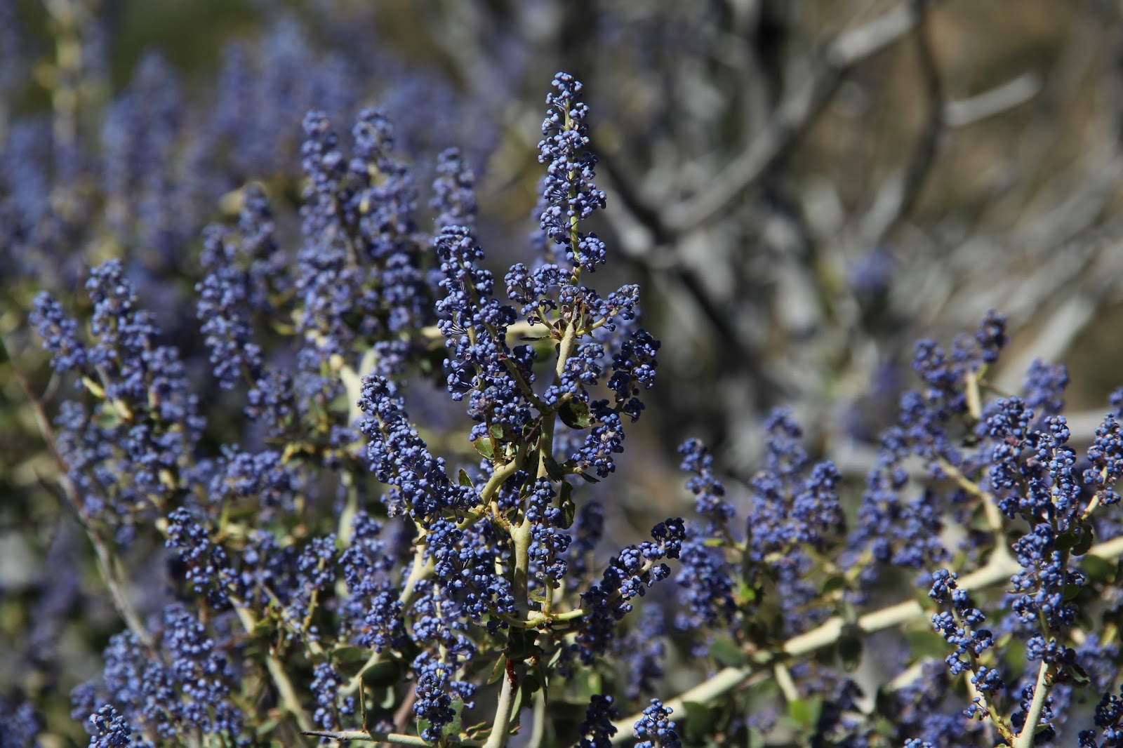
Ceanothus in Bloom
The character of the land here is a bit schizophrenic. Like many places in the San Gabriels, it can't quite decide if it wants to be mountain or desert. Evergreens growing on the cool and shady north-facing slopes cohabitate with yucca and manzanita that dot the warm hillsides with a more southern exposure. The damage done by the Station Fire is still evident, but the area is recovering nicely. And like the front side, there are surprises here like water trickling from Strawberry Spring.

The trail bottoms out at Strawberry Potrero just south of Colby Ranch. Here, the trail splits in two different directions. The fork north terminates at Colby Ranch; the other fork (now technically the Colby Canyon trail) passes through Strawberry Portrero before tracking back to the Josephine Saddle. Unique and fanciful trail signage here is helpful and makes it impossible to get lost.

Strawberry Portrero is a very pleasant spot, but appeared to be quite dry with the grasses already gold instead of green. The real star of the show here, however, is not the meadow, but the dramatic north face of Strawberry Peak that stands silent sentinel over the little valley. I'm too old to be much of a rock-climber, but if I was, Strawberry's stony north face would be high on my must-visit list.

Beyond the meadow, the trail climbs softly over a low ridge before it winds lazily along Strawberry's western side. Like it's counter-part on the east, the path here, which sometimes clings precariously to the steep hillside, is fine and easy walking that allows views into lower Tujunga Canyon and beyond. It's easy to get lost in your thoughts and the scenery here. Distances seem much shorter than they ought to be. Time becomes irrelevant. This is a path I hoped continued forever.

Unfortunately it doesn't and before I had time to even enjoy my hiking-induced stupor, I was at the Josephine Saddle. Roused back to reality, I clamored atop the water tank for one last survey of area. Unlike when I started, the sun was now shining brightly and the skies were a deep blue. Mt. Wilson and the peaks of the San Gabriel complex were plainly in view. So I lounged a bit on the cool concrete tank and dined on peanut butter pretzels and warm water before reluctantly retreating down Colby Canyon and back to the trailhead along the noisy Angeles Crest.

Trail Signage Near Strawberry Meadow

First Glimpse of Strawberry's North Face

North Face of Strawberry

Another View of Strawberry's Impressive North Face

Zoom of Strawberry's North Face

Josephine Saddle and Water Tank from the Colby Canyon Trail

Sitting Atop the Josephine Saddle Water Tank

Last Look at Strawberry from Atop the Water Tank. Start of Western Ridge Route Visible Left Frame.
My Route for the Day


Monday, January 19, 2015

Respecting Mt. Lawler

Nobody hikes Mt. Lawlor. Everybody hikes its neighbor Strawberry Peak. Because Strawberry Peak is taller. And sexier. And better looking. Strawberry Peak is Santa Barbara while Mt. Lawlor is Bakersfield. The Rodney Dangerfield of the San Gabriels. It is so disrespected that apparently, the peak-naming Gods couldn't even get the spelling of its namesake right--Lawler instead of Lawlor.

I'm not really sure why. I've been to Strawberry Peak and the route is fun and the views are good, but still. How much better could it be than Lawlor, especially if you're coming from the east? On Sunday, I set out to answer that question.

View West down the ACH from 12W05.2 at Lawlor's South Ridge

Mt. Lukens to the West

Josephine Peak from 12W05.2
By the number of folks scaling Strawberry that day, you would assume the answer would be "a lot." The parking lot at Red Box was stuffed with cars. A steady stream of folks populated the well-maintained and gently ascending trail between the trailhead and the Strawberry-Lawlor saddle. The saddle itself was crowded with about twenty or so hikers from a Korean hiking club who had just come off Strawberry's east ridge and were yammering away, presumably about their adventure.

Trail 12W05.2 Cutting Across Lawlor's Rugged South Face

Looking North from the Strawberry-Lawlor Saddle
Beginning of Route Up Lawlor's West Ridge
But I didn't find Lawlor to be less worthy of attention. The faint use trail from the saddle that haphazardly zig-zags its way up the steep west ridge offers some fun class 2 scrambling. The flat summit, offers unobstructed views into the West Fork watershed, north to Barley Flats, and east toward Mt. Baldy and beyond. And the summit offers relative sanctuary far from the madding crowds who congregate on Strawberry to the immediate west. The register, which is located in the only visible cluster of rocks on the summit, revealed that it had been a week since the last hiker had visited.

Apparently, there is an alternate route to Lawlor's summit that involves ascending (or descending) Lawlor's steep south ridge. Looking at that supposed route on Google Earth, you can see what looks like a faint firebreak leading along Lawlor's south spine from the summit to its intersection with trail 12W05.2. I looked at that ridge from up top and again from below and I'm not inclined to go that way as it is very steep and choked with a lot of sharp, pointy plant thingies that would make this option a suffer-fest. I spoke to a Korean hiker back at Red Box who had broken from the group to ascend Lawlor and descend this route and he confirmed that it was a steep, loose, brushy slog.

Mt. Baldy from Lawlor's Summit

Mt. San Jacinto in the Distance

Telescopes Atop Mt. Wilson

Strawberry Peak, that Sexy Bitch

Pacifico to the North

Barley Flats with Waterman and the Twins in the Rearground

Twin Peaks from Lawlor's Summit

From L-R, Mt. Wilson, Occidental Peak, San Gabriel Peak, and Mt. Disappointment


Saturday, December 27, 2014

Colby Canyon Recon

Colby Canyon is a gash on the south side of Strawberry Peak in the Angeles National Forest. The canyon and the surrounding area was burned badly during the 2009 Station Fire and was closed for  years afterwards. Very recently, however, the "No Parking" and "Trail Closed" signs at the trailhead came down making the canyon accessible once again. So the day after Christmas I made a reconnaissance of the canyon to get a look at what I'd been missing. My route took me up Colby Canyon to Josephine Saddle, then to the top of the unnamed point just south of the water tower, west along the undulating ridgeline to the Josephine Peak fire road, down the dirt road to the ACH at Clear Creek, then back to the trailhead at Colby Canyon. Round trip distance is approximately 6.2 miles.

Looking North into Colby Canyon from the Trailhead
The trailhead for Colby Canyon (12W23.2) is at a wide turn-off along the north side of the Angeles Crest Highway about 0.5 miles just east of the Switzer Picnic Area. From the obvious trailhead, the path drops immediately into lush Colby Canyon tracking the canyon bottom for a short distance before jumping a ridge and descending into Daisy Canyon.

Both Colby and Daisy Canyons are cool, shaded, and gurgle-y. When I made my visit, the water was still flowing in the canyon bottoms which was a pleasant alternative to the dusty rock beds that have passed for streams during these past 4 years of drought. These two little canyons were so pleasant that I could have easily spent a few hours just hanging out in them and enjoying their cool embrace.


Colby Canyon Falls
Lower Colby Canyon
Beyond Daisy Canyon, the trail contours a ridge east of and high above the canyon bottom allowing for spectacular views down Colby's serpentine and wooded course. The trail then dips down and crosses the streambed one more time before is begins its steep upward climb on the south-facing slope to Josephine Saddle. Here, the trail becomes considerably more rocky while the flora morphs into the familiar and ubiquitous Southern California chaparral.  

Looking South Down Colby Canyon

Typical Conditions Along Upper Colby Canyon Trail
Eventually, the trail crests in the lap of massive Strawberry Peak at the Josephine Saddle. To the west, expansive views open up into upper Big Tujunga Canyon. To the southeast Mt. Wilson and the San Gabriel cluster are visible. To the south, you can peer over the front range and into the vast Los Angles basin. On a clear day, you can even see Santa Catalina Island shimmering in the distant sea.

Strawberry Peak's Massive South Face 

View West Down Lucas Creek into Upper Big Tujunga Canyon
Mt. Wilson

San Gabriel Peak (L) and Mt. Disappointment (R)

City of Angels and Beyond
At Josephine Saddle, the trail intersects trail 12W23.1 and provides for a couple of alternatives. For a longer hike, one can follow 12W23.1 northeast as it wraps around the western edge of Strawberry Peak and then drops into Strawberry Potrero. The trail then ascends back up to the Strawberry-Lawlor saddle and descends to Red Box on a nicely maintained trail. At Red Box, you can follow the Gabrieleno Trail approximately 4 miles back to Switzer and then track back along ACH to the Colby Canyon trailhead.

You can also gain access to Strawberry Peak's west ridge route at the saddle. The faint use trail branches off of 12W23.1 a very short distance from the saddle. For a description of that route, see Keith Winston's report titled "Strawberry Peak West Ridge."

For a shorter hike, one can head west along 12W23.1 to the Josephine Peak fire road and then descend to Clear Creek. This option can be extended by continuing out to Josephine Peak before dropping down the fire road to the ACH.

And of course, you can always simply turn around a drop back down into verdant Colby Canyon.