Wednesday, February 15, 2023

The Pursuit of Awe


Just beyond the creek crossing, the Old Cabin Trail folds back onto itself like a protein molecule and begins climbing out of the cool green of Upper Sycamore Canyon. It’s a gorgeous winter morning so the trail is crowded, but the overwhelming majority of the hikers don’t make this hairpin turn. They don’t have much interest in what’s up the hill. They’re only here for the ephemeral waterfall that feeds the creek. A curiosity in this hyper-arid landscape to be certain. I’ve seen it myself. So the conga line continues in a straight trajectory toward the base of the falls just up canyon. I make the hard right and start ascending. Immediately the hordes fall away and I’m alone on the trail. As I prefer. 

I realize that might sound anti-social. I’m also aware of the potential danger of a solitary outing. I’m following in the footsteps of 22 year-old Zachary Zernick whose story is fresh on my mind. Zachary walked this exact same trail the week prior and never returned home. Search and Rescue found his body at the base of cliff where he is believed to have accidentally fallen to his death. It’s obviously sad and tragic that this kid was struck down before his life really even began. But I’d like to believe that Zachary knew and understood the risks of going it alone before he ever went out. Hopefully I’m not wrong about that, but most folks who have spent any appreciable amount of time hiking solo do. That doesn’t mean they have a death wish. Or that they are presumptively negligent. They simply accept, even if society doesn’t, that inherent risk of death or injury is the price of admission for a bit of solitude.

The trail is wonderfully damp and cool as I climb. A slight coastal breeze blows up canyon. That is not the typical experience. This is sharp and inhospitable country. For a good portion of the year, these hillsides are a tangle of thorny, skeletal chaparral. When the heat is up, the plant life here falls into a quiet dormancy. Leaves curl up, flower petals wither, and seeds drop to the ground in anticipation of the wet season to hopefully come. Muted olive, sandstone, slate, and rust, the favored palette of homeowners' associations everywhere, predominate. But when the winter months arrive with rain, the landscape transforms into something very different. The thirsty flora suddenly explodes in what John Muir called a “shaggy exuberance.” Soft green California Sage and its aromatic Black cousin spring to life. Orangey California poppies start popping. Chaparral Bush Mallow blooms a gorgeous pink and peach. Giant Coresopsis, which looks like a meth-addled minx ten months out of the year, unexpectedly becomes a beautiful and seductive temptress. It’s a super-bloom of visual and olfactory magnificence.

I pass a few pairs of hikers on their way down and nod to them as we file past each other. I do this instinctively and robotically because they’re just background noise. I see them, I am aware of their presence, but I filter them out. I’m too mesmerized by my natural surroundings to be concerned with social engagement and pleasantries. I have that every day. I’m here for escape from that. And escape I shall. 

A short distance further, the trail levels out and splits. The left branch descends to the old Danielson cabin site and memorial. The right fork continues to climb to the junction with the Old Boney Trail. Most folks that come this way turn left. I tack right and keep climbing through tunnels of California lilac that are humming with ravenous hornets and honey bees. I’ve arrived at a détente of sorts with these buzzing arthropods. I don’t interfere with their day-drinking of nectar and they don’t sting the shit out of me. It’s a fair accommodation that works reasonably well for both of us. One day, I hope to arrive at a similar understanding with ticks.


A half mile later, I hit the crest just below Pt. 1,918 where the path levels briefly. A short use trail here puts you on the high-point before continuing as the Western Ridge Trail to the summit of Tri-Peaks. The news reports don’t say, but my suspicion is that this was Zachary Zernik’s chosen path. I’ve been to Pt. 1,918 several times previously so don’t feel compelled to do it again. Instead, I commit to explore the Old Boney Trail as it descends the southern flanks of Sycamore Canyon.

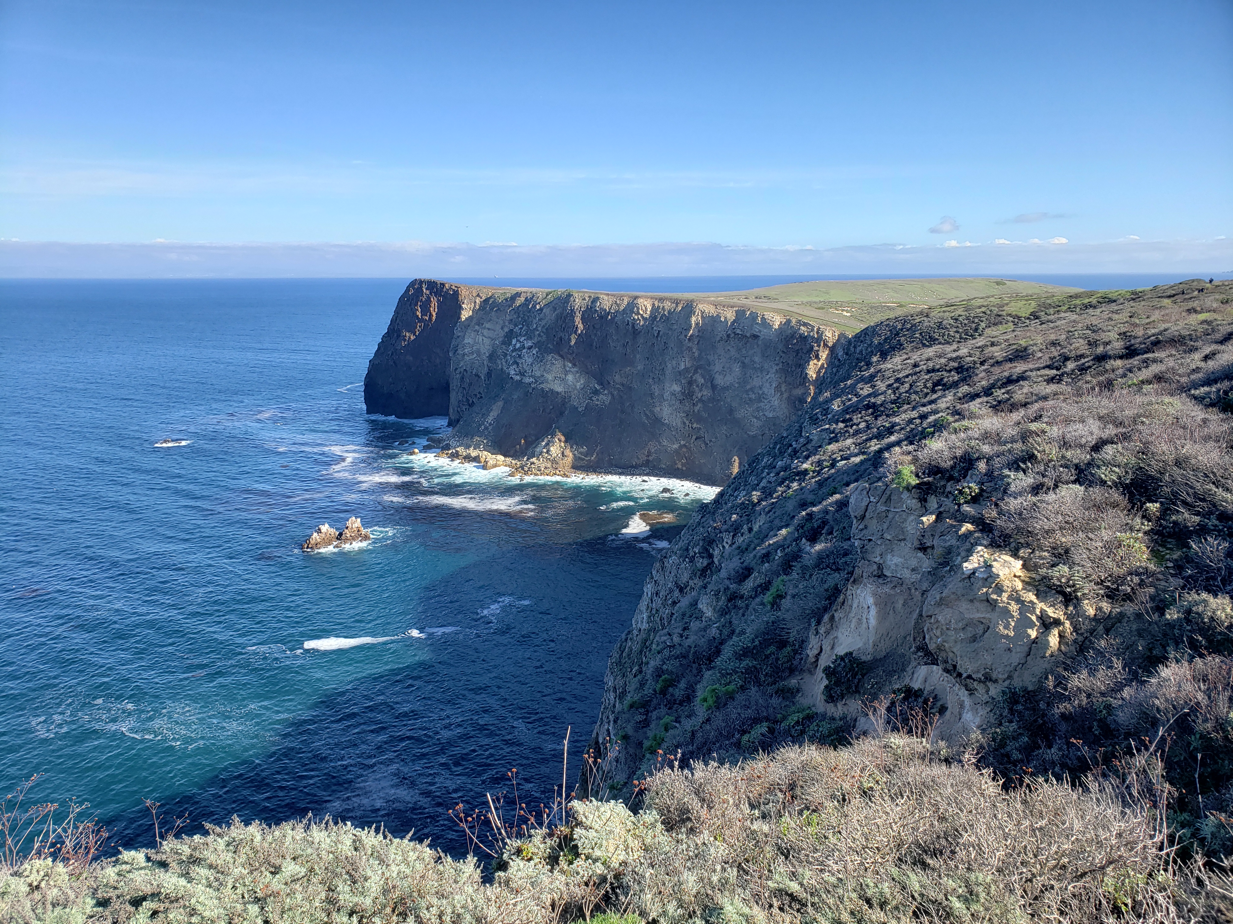
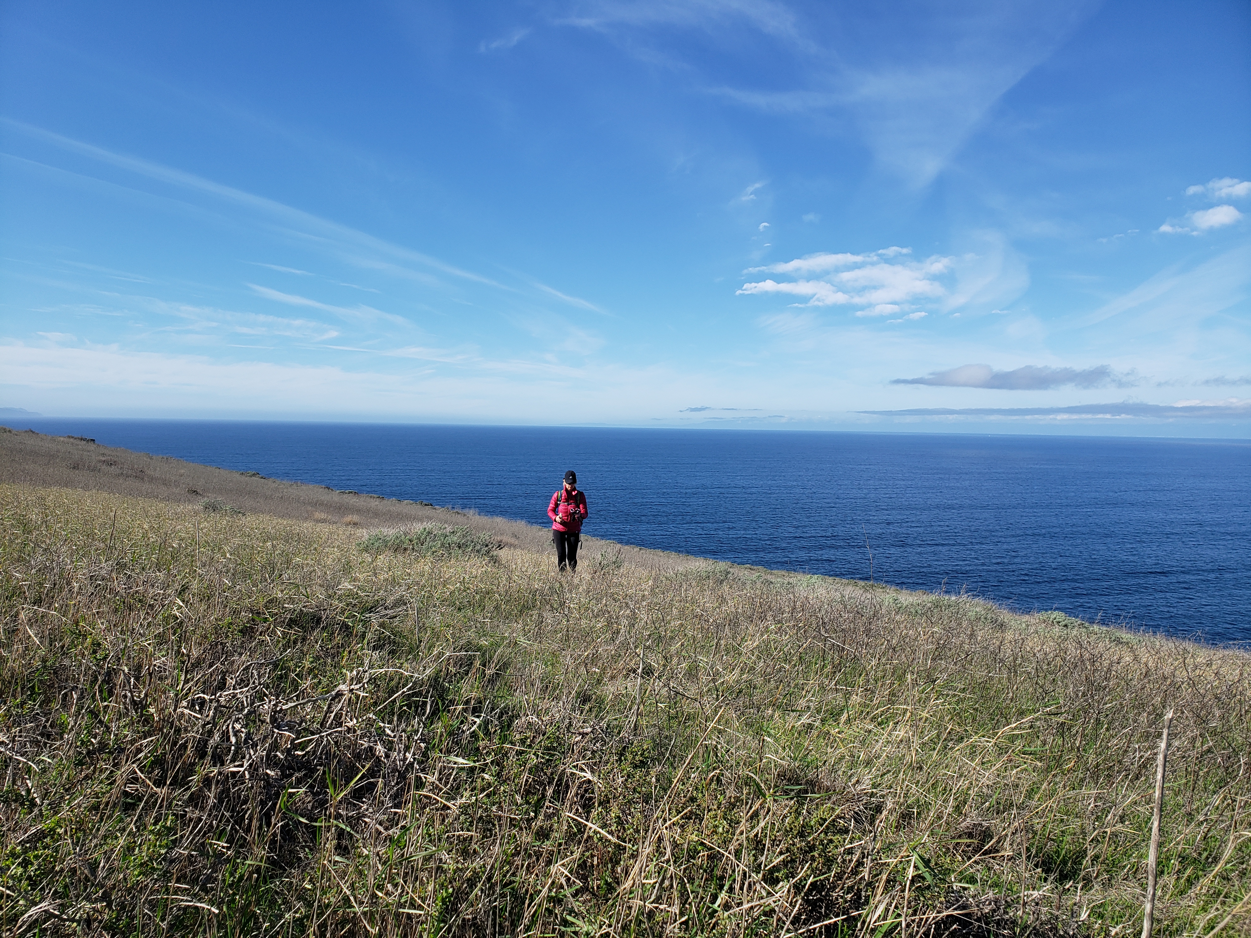
The climbing is done for now and as I continue west, I begin to give back some of the elevation I just gained. That means the walking is easy here and I’m able to move quickly as I descend to the junction with the Fossil Trail. Along the way, I get really nice looks at Sycamore Canyon, Mugu Peak, and the Oxnard Plain. I even get a peek-a-boo view of the Channel Islands. I pass a couple along this stretch and catch another, older couple where the Old Boney and the Fossil Trails intersect.

By its evocative name, the Fossil Trail sounds like a compelling and exciting romp. One immediately imagines coming upon the fossilized remains of all sorts of prehistoric creatures large and small. The reality is something significantly more mundane. The namesake fossils comprise a handful of shells embedded in a short rocky section in the middle of the trail. It’s cool. It’s just not spectacular by any measure. The promise is over-sold. 

I’ve never been beyond this point on the Old Boney Trail so ask the couple whether they are familiar with what lies ahead. They eye me suspiciously, grunt that they are taking the Fossil Trail, and then turn away to filter me out. I suppose I deserve it. They’re apparently not here for social engagement and pleasantries either. 

So I take the plunge and continue west to see what there is to see. The “plunge” metaphor here is appropriate in that the trail is somewhat overgrown and I find myself pushing through a bit of brush. This stretch of Old Boney clearly doesn’t see the same traffic as other sections of the trail and the native flora is taking advantage. But the brush begins to cede ground again when the trail tops out on a low ridge that begins a mellow descent to the Backbone Trail. From this point forward, it’s a pleasant downhill stroll.

Now the land feels wild and remote. I can no longer see Sycamore Canyon. It isn’t that far away, but it’s out of view, behind a larger ridge to the north. It may as well be a million miles away. To the immediate south is the sandstone escarpment of Boney Mountain and the Tri Peaks. And I’m alone on the trail. The only sound is the crunch of my feet on the path. There is no other noise to filter. Silence and solitude sit heavy on the landscape.

So does the thrum. That enigmatic and palpable trembling of the universe that rings in your ears and vibrates your soul. A subtle reminder that ultimate reality is very different than you imagine. I can’t hear the hum today, but I can feel it. Lurking beneath the silence in quivering anticipation. I embrace the rhythm and allow my personal waves to align with those around me. In the world of physics, they call that constructive interference and it results in wave amplification. I ride the amplified waves all the way to the junction with the Backbone Trail where California Poppies are starting to bloom. It’s such a stunningly beautiful sight that I prostrate myself on the trail for a bug’s compound-eye view.  


It hasn’t rained for weeks, but remarkably the water is still flowing down the unnamed drainage leading to the Danielson Group Camp. In all the years I’ve walked these hills, I never recall seeing conditions like this. But as I continue down the canyon, the reason becomes evident. The placid little stream that is currently making things so enjoyable must have been an angry torrent just weeks prior. The bottomlands are clogged with flood debris and large swaths of the trail have been obliterated. Route-finding isn’t terribly difficult, but I suspect it will be some time before he trail proper is restored to its former self.

At Danielson I sit at one of the many empty picnic tables to gear up for the long walk up the ribbon of asphalt that is colloquially known as the Black Bitch. A boisterous flock of feral Nanday Parakeets keeps me company. It sounds exotic I know. And it is if you’re using the term “exotic” as a pejorative. These bright-green birds don’t belong here. They’re invaders who have escaped captivity and are now procreating with the zeal of fecund Catholic couples who believe that birth control is sinful. As a result, these pretty birds from the interior jungles of South America are a noisy thing in the Mediterranean environment of the Santa Monica Mountains. 

I’m back with people as I begin my walk out. The thrum has gone mute. Or maybe it has just been forcibly drowned out by the white noise of hikers, bikers, and the occasional park ranger pick-up truck. Either way, no amount of filtering can change that dynamic. I accept that. Even welcome it. Because if the quivering of the universe was commonplace, it would be neither mysterious nor magical. Solitary treks to seldomly-visited places in search of it wouldn’t be so lustrous. I’m a selfish bastard that wants to hold onto that. So here, in the designated white noise zone, I’m quite accepting of the heterogeneous mixture of chatter, commotion, and hubbub. As long as the contagion doesn’t spread to become a white noise pandemic that murders the élan vitale, I can still trod these trails in the pursuit of awe.


Monday, January 9, 2023

The Agony of Defeat


Arlington Peak

Soy un perdedor
I’m a loser baby, so why don’t you kill me?
(Double-barrel buckshot)
Soy un perdedor
I’m a loser baby, so why don’t you kill me?
~Loser, Beck

In the foothills overlooking what is sometime hyped as the American Riviera, there’s a pyramidal-shaped sandstone peak that dares you to climb it. Back in the olden days, the locals apparently referred this peak as Cathedral Peak and its loftier neighbor to the northwest Cathedral Rock. Then, the U.S. Board of Geological Names rechristened Cathedral Peak as Arlington Peak and Cathedral Rock became the new Cathedral Peak. The “Arlington” nomenclature purportedly originated from staff at the luxurious Arlington Hotel who called the various peaks in the vicinity the Arlington Crags

A few years ago, I took up the gauntlet that Arlington had dismissively hurled at my feet and made an attempt at its summit. I failed. I took the standard route up the southeast ridge by way of Mission Canyon, veering right on a faint use path immediately after crossing the creek and then clawing my way up to gain the ridge. Once there, I followed the route along the ridgeline as it wound its way around, over, under, and through the blocky sandstone for which Arlington is known. It was a warm winter day and I eventually bonked somewhere around the 2,500’ contour. Frustrated and tired, I sat on a gigantic boulder and salved my wounded ego with a warm beer. The magnificent views to Santa Barbara and the Channel Islands ended up being my participation trophy (which, in the grand scheme of things, really isn’t a bad participation trophy). 

That failed attempt has been an itch in need of scratching ever since. That itchiness flared up again this past weekend as I was thinking about options for getting out into the hills before the next round of drenching started. The weather was perfect for another attempt, so I decided that I’d drive to Santa Barbara to take care of some unfinished mountaineering business. 

Although I arrived late morning, cars were lining the street for almost a mile from the trailhead proper. I continued driving in hopes of scoring a spot closer up to avoid adding dreary road mileage to my day. I must have been living right that morning because as I approached road’s end without promise, someone pulled out leaving a spot for me right in the front row. I quickly took advantage, pulled on my boots, and started up the Tunnel Trail which initially is a deteriorating asphalt road. As I began to climb, I was astonished at the number of people I encountered both coming out and on their way in. Flowing water from the recent rains was bound to be big draw, but the Covid/Instagram-fueled assault on the outdoors continues unabated. 

A short distance up the road, the path splits and the asphalt turns to dirt. The right fork follows the Tunnel Trail to the Mission Crags and the Rock Garden; the left fork parallels Mission Creek to the junction with the trail leading to Inspiration Point. I followed the left branch into the canyon where I rock-hopped the creek which held a nice flow. On the adjacent side of the creek, I tacked hard right following an informal, yet well-beaten use path that climbs to Arlington’s southeast ridge. 

Arlington Peak's Southeast Ridge

Mission Creek

This is where the work really starts. The climb to the ridge is steep and physically demanding. It has also become deeply eroded and braided as a consequence of intense use. The various route options seemingly all get you to the same spot on the ridge, but as you’re ascending, you can never be quite certain that you’re on the “right” braid. To assist with navigation, someone has painted a series of white dots on the sandstone that is common here. Sometimes you see them, sometimes you lose them. Those damned dots are both a blessing and a curse.   

On the ridge, things level off for a bit and the views to the coast really open up nicely. Here you get to do a fair amount of scrambling over sandstone features as the path switches back and forth between the north and south side of the ridge. It’s a fun and entertaining alternative to ordinary hiking, but I wished that I had brought a pair of gloves along. The sandstone is unsurprisingly like, well sandpaper, and by the end of the day my hands were raw from the constant contact. 

I was making decent progress for an old guy until right around the 2,800’ level where the pitch steepens before the final summit push. As the route switched over again to the south side, there was a white dot painted on a rock just above a white arrow pointing to the left. From the looks of things, folks had been going left at this spot so I followed suit. Not long after that, I found myself at the base of a rocky wall in a steep chute with no white dots. The only way forward was up the rock face which was probably 20 feet high with a couple of class 3 moves. I felt fairly confident about my ability to scamper up, but getting back down was another matter altogether. Being solo, I didn’t think it wise to give it a go, so I back-tracked to the arrow to see if I had missed something. There I saw the last white dot but no real alternative to the route I had already followed.

Frustrated once again, but recognizing that discretion is the better part of summiting, I decided to turn back. If the price for achieving Arlington was notoriety for being the dumb ass that had to be rescued, I wanted no part of that. I’ve made enough poor decision in my life. I don’t need to compound that at this stage. 

Mission Canyon Falls


Santa Barbara

On the way down, my dogs were barking so I stopped for a snack and a cold malt and grain beverage I had stowed in my pack for just such an emergency. As I sat on a rocky outcrop enjoying the panoramic sight of the Santa Barbara coastline, I almost forgot what a loser I was. But I was quickly reminded of that as soon as I started moving again when I missed a white dot and ended up sliding down a steep, overgrown drainage. After descending that drainage further than was really advisable, and realizing the potential peril of continuing, I crab-crawled back up to the ridge where I relocated the track marked by multiple and obvious white dots that mocked my embarrassing lack of awareness. 

On the ride home, I assessed the situation. I’ve attempted Arlington two times now and both times I’ve failed. I don’t need to experience strike three to know when I’ve been vanquished. Some things are just not meant to be. And for under-achievers like me, summiting Arlington by the southeast ridge is apparently just one of those things. If I ever get there, it’s going to have to be top down by way of La Cumbre Peak.  

I know, I know. Soy un perdedor. I’m a loser baby, so why don’t you kill me?

Thursday, January 5, 2023

Scorpions and Potatoes - East Santa Cruz Island


The Captain announced that the seas would be choppy that day as we crossed the channel from the mainland to Santa Cruz Island, a place 25 miles off the coast that the native Chumash called Limuw. If you were prone to sea-sickness, the crew advised that the rear deck of the boat was the most stable place to be. Locking yourself in the only bathroom on board was not only ineffective, but it would make things worse as there was no sight-line to the horizon. Plus it was rude to your fellow passengers. Don’t do it. Barf bags would be provided to anyone who found themselves in significant gastric distress. 

Out of the harbor just past the breakwater, the northwest swells hit and passengers squealed as the boat chugged to the crest of one swell and then dropped into the trough of the next. Those standing starboard or on the bow were forced to retreat into the cabin to avoid being subjected to continuous spritzing while those on the upper deck maintained watch for dolphins and migrating cetaceans. As the seaworthy vessel tossed and rolled in the turbulent ocean currents, I thought of the grit and courage of the Chumash who once rowed across these same cold waters in tomols hewed by hand from redwood and pine.  

For about an hour or so we plied the continuous surge until the pier at Scorpion anchorage came into view. Here, the sea faded from a deep midnight blue to a translucent turquois dotted by the dark green kelp forests that proliferate in these protected waters. It was a kaleidoscopic orgy for the eyes. I was feeling a bit oogy from the trip as the engines died and we moored against the newly-renovated pier, so appreciated getting my landlubber’s feet back onto terra firma. 


It isn’t quite clear how or why the anchorage and the historic ranch here were named “Scorpion.” The National Park Service speculates that the designation could refer to either the shape of the valley or the fact that small scorpions are present. Either way, the name certainly isn’t native. Long before Juan Rodriguez Cabrillo arrived in 1542, the Chumash called this place Swaxil. It was the largest of 10 Chumash villages scattered around the island that was home to approximately 1,200 native people. Xaxas (pronounced “hä’ häs”), located at what is now known as Prisoners Harbor, was the second largest village on the island. In total, there are an estimated 3,000 prehistoric native sites on the island ranging from small ephemeral camps to formal villages. But that is all that remains of the original inhabitants. The last of the Chumash islanders were either killed by disease or forced from their ancestral lands by European colonization.

A trip to this island used to be a family tradition. When the kids were young, we’d make the journey with them every New Year’s Day while the rest of the world slept off its hangover. Now visits are more sporadic although there really is no objectively good reason for that. Maybe it’s because from the coast, the islands only exist in a distant, dream-like haze. You can see them sitting on the horizon, but you never quite know whether they’re real or just apparitions. So they end up as nothing but familiar backdrop to the vast blue oceanscape, easy to look past when you’re immersed in everyday living. 

Off the boat and on the pier, we were all corralled by a Park Service docent for a mandatory briefing. One lady tried to sneak by without stopping to receive instructions, but the ever-vigilant docent barked her back into place. Most of what we were forced to listen to was common sense stuff that we’d heard multiple times previously. Don’t trample the native vegetation. Stay on the established trails. It’s a federal crime to take anything from or disturb midden sites. There’s potable water on the island, but not food. Carry out your trash. You’d think folks wouldn’t need to be told any of this, but there’s always that one guy who was either raised by animals or who just doesn’t give a shit. So the obvious needs to be repeated out loud to everyone just to make sure that this one dumb asshole hears it even though he still won’t abide.

When the lecture was finished, everyone scattered like fifth graders freed from school for the summer. We got out in front of the mad rush and started up the easy service road leading to Cavern Point. We typically go the other direction toward Montañon Ridge and Smuggler’s Cove, but opted for the north-side views this trip. About half-mile up the road, near the intersection with the North Bluff Trail, things started to get sloppy due to the recent rains. We looked at the path leading to Cavern Point, but declined the invitation. The footpath leading to the point was a muddy, mucky mess. 

Instead, we headed west along with North Bluff Trail, a relatively level path that parallels the escarpment for a couple of miles out to Potato Harbor. It was a blue bird day and the views north and west were satisfying. If you’re a plant nerd, the flora on the bluff was also quite interesting. We noticed Giant Coreopsis (aka Truffula Trees) on the cliff edges that had emerged from summer dormancy to show off its finest spring greenery. We also saw plump Live-Forevers (Dudleya), Lemonade Berry, and a few other native and non-natives that all looked quite robust and healthy. We kept eyes out for the endemic Island Jay and Island Fox, but got skunked. 


The closer we got to Potato Harbor, the sloppier the path (now a road) became. To avoid the slippery mud, folks were walking the edges and trampling the vegetation. This is how paths widen and erode. We refused to play that game and defiantly trudged along right in the middle of the road, allowing the gooey, sticky mud to accumulate on the soles of our shoes like heavy pancakes. Unsurprisingly, no one else followed our lead. If they understood the point we were trying to make, they didn’t’ care. Principle must always take a back seat to clean shoes, especially when hiking.  

A good deal of mud later, we arrived at the overlook for Potato Harbor, so named for its tuber-like shape. Over the cliffs here, you look right down into the aquamarine waters of the isolated harbor. You can also see a good portion of the western side of the island which is owned by the Nature Conservancy and thus off-limits to us commoners. Given the destructive and exploitative history of the place, that’s probably not a bad thing ultimately.

There are several bare patches of diatomaceous soil near the overlook. Diatomaceous earth is bright-white, chalky, sedimentary rock derived from single cell organisms made of silica called diatoms. When dissolved in water and recrystallized, diatomaceous earth forms a hard glass-like substance called chert. The native Chumash mined chert to make arrowheads, drill bits, and scraping tools. They also used it to bore holes in Olivella snail shells to create beads for trade. The abundance of chert on eastern Santa Cruz Island explains the several sites that archeologists have described as Chumash “bead factories.”

We grabbed a seat in the cherty dirt and had a snack while listening to the ocean raging against the island’s north shore. Several other folks were doing the same. When we were finished, we started back to Scorpion anchorage along the same route we used coming out, but dropped down to the campground by way of the trail adjacent to the service road. The campground was very nice and smelled of cool menthol from the grove of non-native Blue Gum Eucalyptus that was planted here as a windbreak back during the ranching era. Then it was a short stroll to the pebbly beach where we lounged around waiting for the boat ride back across the channel. 

Back on the boat, the crew opened up the snack bar and I contemplated a can of beer to smooth out the ride back, but decided against it. I didn’t feel like getting gouged for a can of weak, shitty beer only to be left more sleepy than I was already. When we pulled into Ventura Harbor, I noticed that the boat had a single tap handle from none other than Island Brewing Company and I immediately regretted my prior decision. Beer from Island Brewing is always worth the price you pay both in dollars and effect. So I guess I’ll just have to make another trip across the channel in the near future to have an Islands beer on my way back from the islands.


Friday, October 14, 2022

Gentiles on the Rim: a Goosefest Post-Mortem


 The Negroes in the forest brightly feathered
They are saying "forget the night
Live with us in forests of azure
Out here on the perimeter there are no stars
Out here we is stoned, immaculate.
~The WASP, Jim Morrison

We were desert mystics, my friends and I,
the kind who read maps as others read their holy books.
~How it Was, Edward Abbey

We camped on the rim of the mesa high above the hamlet of Apple Valley and the road east. On the near horizon, Smithsonian Butte rose abruptly from the desert floor like Babel's famed tower. To the north, the spectacular sandstone walls of Zion stood sentinel over the muddy Virgin River as it wends its way south to the confluence with the once-mighty Colorado. In 1869, where these waters meet, Maj. John Wesely Powell and his men emerged from a treacherous float trip through the uncharted chasm of the Grand Canyon. Back then, this was the land of the Shivwits band of the Paiute tribe. Now it is Promised Land where the saints gather. What the Mormons call New Canaan. 

Here we gathered too, although we could never be mistaken for saints. In fact most of us might be appropriately branded by the local faithful as "gentiles." I wasn't always a gentile. Through baptism, and perhaps descent, I was once, according to LDS lore, a member in good standing of one of the 12 tribes of Israel. I no longer recall which tribe specifically, but when I was a child, I received a patriarchal blessing from a holy man that revealed that important piece of genealogical trivia. Over time, however, through both choice and apostasy, I became persona non grata in the house of Israel. So I can no longer remember that critical piece of soul-preserving information.    

We were in the midst of what is euphemistically known as an Indian Summer. A periodic phenomenon when summer clings to power and refuses to cede authority to the fall. As night approached, and the heavens began to darken, a full moon replaced the warm sun that was dipping below the distant line where earth and sky merge. This particular lunar event is what they call the Hunter's Moon, a nod to both the season of slaughter and the impending winter. But it wasn't cold yet. It was quite pleasant. And there was fire anyway. There is always fire on these outings. There is something familiar and ancient and mystical about it. Even necessary. Something embedded in the intra-cellular sequences of adenine, thymine, guanine, and cytosine that conjures another time and reminds you that you were here 1000 years ago, staring into the flames with your tribesmen.   

The dogs had been here at some stage in the past too. It was programmed into their DNA. These weren't animals that you'd typically see dressed in matching sweaters and being carted around the grocery store in a purse. But they weren't seasoned outdoor dogs either. These canines were accustomed to a relative soft and comfortable life on the sofa. And yet, out here on the mesa, surrounded by pinyon and juniper and the howling of their coyote brethren, they instinctively settled into the natural rhythm of the place. They answered the call of the wild. The desert does that to a soul regardless of genus or species.


When the fire was nothing but bright orange embers and the conversation finally waned, we retreated to the camp spots we had each claimed as our own. I had selected a perfectly flat spot near the rim with unencumbered views to infinity and beyond. My compatriots sheltered in tents in the interstitial spaces between the ancient junipers. I too considered a tent. I even brought one along on the assumption that it would be used. But a tent only affords protection against rain, bugs, and an over-active imagination. The few millimeters of nylon that separates you from the outside won't help much if wild creatures decide to pay a visit. Even if you psychologically believe otherwise. And of course a tent impedes your ability to view the brilliant white moon, the glittering constellations, the dazzling array of visible celestial bodies, and the ethereal Milky Way. It also prevents you from seeing any nocturnal visitors whose aim is to maul you. I like to see the heavens when I camp. And I want to stare into the eyes of what is about to have me for dinner. The knowing is preferable to the not knowing. Even if the end result is the same. So I abandoned the tent in favor of a simple mat in the open and lay beneath Orion the Hunter while hoping to avoid his tragic, Scorpius-induced fate. 

The next couple of days and nights were perfect and gorgeous. We explored, hiked, biked, ate, drank, laughed, cursed like foul-mouthed sailors, bullshitted each other, recalled fallen compatriots, and generally relived our glory days. When it was over, I was sad it was done. As you might surmise, Goosefest isn't really about white-knuckled adventure. Even if we were still capable of that sort of thing. Instead, it's more about reconnecting with old friends, sharing stories, enjoying meals cooked out of doors, and communing with nature. Of course I like adventure as much as the next guy, but I'm already looking toward the fourth installment of this now semi-annual desert outing.