Sunday, December 5, 2021

Crescenta View Trail

Crescenta View Trail

 Tip the world over on its side, and everything loose will land in Los Angeles.
~Frank Lloyd Wright

L.A. is the loneliest and most brutal of American cities.
~Jack Kerouac

The final story, the final chapter of western man, I believe, lies in Los Angeles.
~Phil Ochs

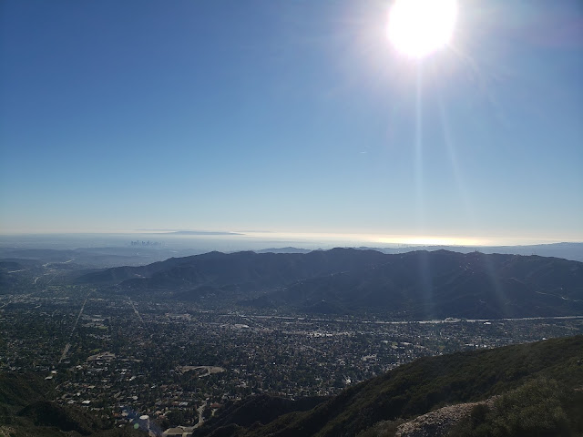
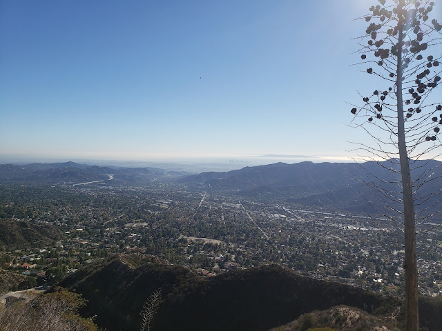
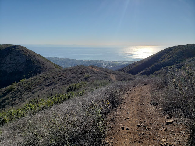
Roman Polanski once said "Los Angeles is the most beautiful city in the world, as long as its seen at night and from a distance." Obviously, Mr. Polanski never hiked the Crescenta View Trail on crystal clear, sunny day in November. If he had, he would have known that viewed from on high and afar, with the island-studded, gleaming Pacific as a backdrop, the City of Angels is a spectacular, if not messy, sight to behold.

How do I know this you ask? Because I recently hiked the Crescenta View Trail on a crystal-clear, sunny day in November. And from a perch at 4,400' feet, Los Angeles, in all its frenetic, sprawling, chaotic glory is quite a beautiful thing. This despite what all those sneering east coast elites and raffish midwestern outsiders might say otherwise.

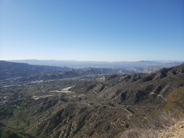
The Crescenta View Trail starts at Deukmejian Regional Park which is technically in Glendale. As far as trailheads go, Deukmejian is somewhat unique in that it has plentiful free parking, water, and full bathroom facilities. Bueno! The track begins at the rear of the parking area and gently ascends Dunsmore Canyon adjacent to the dry creek bed. A short distance up-canyon, a trail branches off to the right and crosses over to the east side of Dunsmore Creek before continuing northward. A similar connector intersects the Dunsmore Canyon Trail further up the canyon. Wanting to get off the more heavily-traveled main trail, I took the first branch which was a mistake as the path has been completely washed away where it crosses to creek. I had to scramble up a steep and brushy bank on the other side to regain the trail. I did not repeat that mistake on the return trip, following the second connector further up canyon.   

A short distance later, the climbing begins as the path switch-backs up the ridge that separates Shields and Dunsmore Canyons. The climbing isn't particularly steep, but it is sustained and really doesn't let off until you reach the saddle where the Crescenta View Trail ultimately intersects the Mt. Lukens fireroad. From that point, you can traverse the dirt road a short distance west to the summit of Mt. Lukens, the highest point in the Los Angeles proper at 5,074 feet.

There is apparently some controversy over the name "Mt. Lukens." According to the Sierra Club HPS Section, the peak was previously named "Sister Else (or Elsie) peak. Nobody seems to remember or know who the original female namesake was, but as part of the 1875 Wheeler Survey, a chap named "McLain" decided "Lukens" was a more appropriate appellation and so renamed the peak in honor of Theodore Lukens, a former Supervisor of the Angeles National Forest. McLain ostensibly did this because "mountains should be monuments to the men who have treasured and protected them," gratuitously observing "what did Sister Elsie ever do for the mountains?" 

Crescenta View Trail

Crescenta View Trail

Crescenta View Trail

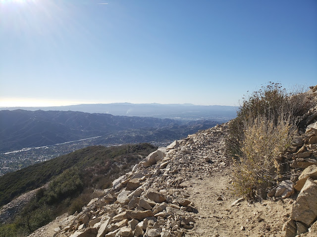
Anyway, my objective this day was not the summit of Sister Else Peak. Instead, my plan was to simply hike to the Redoubt, a circular rock enclosure on one of the ridge's promontories accessorized with a flagpole. There, I figured I'd take in the views, have a snack, lollygag a bit, and then return to the parking lot. But as alluring as that might sound, the Redoubt is an exposed and shadeless place, and sitting there baking in the direct sunlight for any appreciable amount of time is not ideal. So I continued another 3/4 mile up the trail to the Pickens Spur water tank which is also a shadeless and exposed spot, although perceptibly cooler. Plus, the flat concrete there affords an opportunity to lounge about without having to roll around in the dust and dirt.

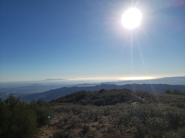
From this spot high on the ridgeline, the entire Los Angeles basin is observable. Downtown, midtown, Century City, Santa Monica, the Palos Verde Peninsula, the Valley, and the Verdugos are spread out before you like a crazy metropolitan quilt. To the distant east, you also get impressive looks at all the celebrities of the San Gabriel front country: Mt. Deception, San Gabriel Peak, Occidental Peak, Mt. Markham, Mt. Wilson, Mt. Lowe, and Brown Mountain. 

Pickens Spur water tank
  

Crescenta View Trail

Crescenta View Trail

I stripped my sweaty shirt off here, exposing my embarrassing corpulence to no one, and lingered for a while. Shortly after that, things got amazingly hazy so I packed up and started back down the way I came.

Stone Amazingly Hazy IPA

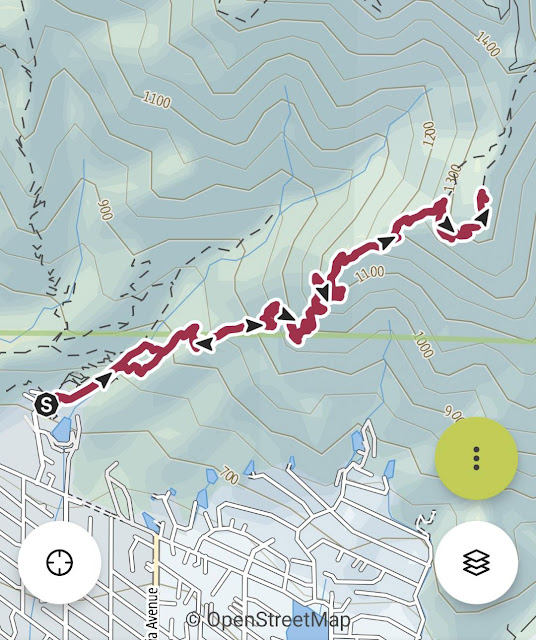
Total mileage for this one came in at 5.20 with an elevation gain of just shy of 3,000 feet.      

Crescenta View Trail

Crescenta View Trail Elevation Profile


Saturday, November 27, 2021

Looping Through the Ventura River Preserve


Ventura River Preserve

The core of mans' spirit comes from new experiences.
~Christopher McCandless (aka Alexander Supertramp)

Old age should burn and rave at close of day.
~Dylan Thomas, Do Not go Gentle into that Good Night

Preliminaries - Old Man Walking

The other day I was stopped at a red light in my suburban neighborhood. As I was waiting for the light to change, a silver-haired gentlemen walking a fluffy white pooch passed in front of me in the cross-walk. It wasn't exactly an unusual site. I see it regularly and usually give it no mind. The sidewalks where I live are alive both morning and afternoon with 50 and 60-somethings in relaxed-fit trousers sedately walking lap dogs and carrying little plastic bags of poo. I guess it's all part of the normal and expected progression of things. Go to college, get a job, have kids, achieve some sort of professional success, bid farewell to your kids as they fledge from the nest, buy a cute little Shih Tzu or Yorkie or Maltese or Chihuahua to fill the void, and then start sauntering around the neighborhood with your canine companion as you slide toward retirement and a more dormant existence.

Unfortunately, I've now joined this baggy pants-wearing, dog-walking demographic. Or, perhaps it would be more accurate to say that I've been "conscripted" into this army-of-the-aged. Because I'm certainly not itching to voluntarily join this club any time soon. It feels like giving up. A death sentence that involves rusting away at the kitchen table with a crossword puzzle in front of you while staring at the world through a double-pane of glass. Or, as old Captain Bildad did in Moby Dick as he piloted the Pequod out of Nantucket and into the open Atlantic as it embarked on a multi-year journey in quest of the white whale, forlornly lingering about the deck and delaying good-byes before reluctantly returning to the tranquility, safety, and boredom of the harbor. Fuck that. I don't want to feel Captain Bildad's sad tug of desire and twinge of regret. I watched my father and father-in-law voluntarily relinquish their passion to the quiet life and it murdered their spirits. 

That is to say that I don't plan to give up so easily. When I go down, I'm gonna go down swinging. Or, to put it in less hyperbolic terms, I plan to hike trails, bag peaks, swim icy mountain lakes, and sleep on a mat beneath the glittering heavens until the laws of the physical world tell me that I can no longer do that. That doesn't necessarily mean that every outing will or even has to be an epic, white-knuckled, risk-filled adventure. At 58, I recognize my limitations. So for me, it involves simply exploring as many outdoor places as I am able in the time I have.
  

The Ventura River Preserve

To that end, last weekend, I decided to check out the trails of the Ventura River Preserve. The Preserve, which is owned and managed by the Ojai Valley Land Conversancy ("OVLC"), sits on land adjacent to the Ventura River that was once part of the historic Rancho El Nido. Seemingly like every other big parcel of undeveloped property worth saving in Southern California, the Preserve was once slated to be developed as an exclusive community and golf course for the well-heeled until it was rescued from that abhorrent fate by OVLC in the late 90s.

Now, Rancho El Nido is a place for outdoor enthusiasts instead of wealthy duffers wearing loud pants and berets. And for the hiker, there is a variety of short and medium-length options to choose from. I had read recommendations to ascend Willis Canyon and then return by way of Rice Canyon for the views the latter affords. But I wanted something longer so decided to loop counter-clockwise through the Preserve on a route that allowed me to see as much of it as possible in one big swoop. 

Rice Canyon

Rice Canyon

Rice Canyon

The Loop

There are three trailheads for the Preserve - the Old Baldwin Trailhead, the Riverview Trailhead, and the Oso Trailhead. I started at the latter midday and began my way up Rice Canyon. Almost immediately, I scared up three deer that bounded off into the brushy hillside at my approach. Although it was late November, it was warm. Sitting in the low foothills of the kiln that is the Ojai Valley, these are hot trails. But in the inner sanctum of the canyon where oak and sycamore proliferate, there was shade. And there was a surprising amount of lush green. The hibernating plant life in drought-stricken California yearns for moisture, and with the recent rains we received has exploded in a lusty and joyous celebration of renewed life. When, if ever again, we get normal winter precipitation, I can imagine these canyons transforming into a verdant Shangri-La. 

I had originally planned to take the Kennedy Ridge Trail as a detour before rejoining Rice further up canyon. But the bottom-lands were so pleasant and inviting, I just stayed the course. Ultimately, the path (really an old ranch road) climbs to a saddle before loosing elevation again as it descends to El Nido Meadow, which I think is a bit of a misnomer. It's not really a "meadow" in the traditional sense of the word, or at least it didn't look like one to me. But whatever you want to call El Nido, it is shady, beautiful and inviting, and I lingered here a bit before starting the stout climb westward toward the Preserve high point. 

At the top of the climb, the path levels out as you make a semi-circle to the junction with the Oso Ridge Trail. Along this stretch, I noticed Hummingbird Sage (Salvia spathacea) growing on the cool north-facing slopes in great proliferation. Later on, I would see the same thing along the Fern Grotto Trail and in the bowels of Willis Canyon. In all my years trodding the trails, I never recall seeing such an orgy of Hummingbird Sage. It must be a stunning site when it is all in bloom.

Willis Canyon

White Ledge Peak

Lake Casitas


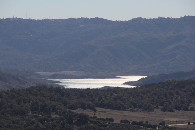
At the Preserve high point, you get expansive looks at Rancho Matilija and Lake Casitas to the south and the Ojai Valley to the east. The trail then follows the undulations of the Oso Ridge downward to the junction with the Allan Jacobs Trail named for none other than Allan Jacobs. Here, the path tacks north as it gently zig-zags back up to the Chaparral Crest Trail before returning once again to the floor of Willis Canyon by way of the leafy Fern Grotto Trail. You close the loop by following verdant Willis Canyon to its mouth, and then returning to the trailhead following the flat Orange Grove Trail north along the river.

Back at the car, I decided to return home by way of idyllic upper Ojai Valley instead of the citified 101 corridor. On my way in a few hours earlier, everyone who fled to Santa Barbara from Los Angeles for the weekend was already returning south, snarling traffic through Ventura and The Nard. I had no interest in being a part of that. Bad juju for the soul. Plus, taking the alternate route provided the perfect excuse to stop at The Summit for a Pineapple Coconut milkshake. I don't know if The Summit makes the world's best milkshakes, but it sure seems that way after spending a couple of hours wandering the hills. 

Ojai Valley

Fern Grotto Trai

The Summit Drive In


Total mileage for this loop was 8 miles with an elevation gain of 1,538 feet.

Ventura River Preserve Loop Route

Ventura River Preserve Elevation Profile


Saturday, November 20, 2021

Zuma Canyon Loop: Hiking the Bu


Zuma Ridge Trail

It seems of late that I perhaps have wandered off path some. From a focus perspective, I've found myself bush-whacking and rock-hopping through a tangle of posts that stray from the original vision of this blog. That's not necessarily a bad thing. As Neil Young famously quipped after the success of his tune Heart of Gold, "this song put me in the middle of the road. Traveling there soon became a bore so I headed for the ditch. A rougher ride, but I met more interesting people there." So sometimes following an odd strand and allowing things to develop organically instead of by deliberate design has its rewards. Even if it means plowing through dead-fall and poison oak and yucca. Other times, doing that just gets you dehydration, ticks, and an itchy rash. 

I've had enough ticks and poison oak in my time that I'm going to avoid that and get out of the proverbial ditch, at least for today, Instead, I'm staying in the middle of the road and sticking to a plain, vanilla trail report. No navel-gazing (or at least limited navel-gazing). No asides (or at least limited asides). No pontificating (or at least limited pontificating). No curse words (or at least limited curse words). And no bitching (is that a curse word?). Well, I may do some bitching. As a grumpy, old curmudgeon that's my job.

So anyway, there was a time when I was going to the Angeles National Forest every single weekend to explore. The ANF was new to me then so every outing was an exciting adventure. But eventually, all the driving wore me down and I finally hit a wall. If hiking meant a 70 mile drive to the trailhead, I wasn't interested. So I stopped going, opting instead for more hyper-local, yet ultimately shorter trails. Sometimes those "trails" even ended up being the NordicTrack elliptical sitting in my garage. Physically satisfying, yet soul-crushing.

On Sunday, I sought to change that dynamic a bit by getting out for a good, long jaunt in the hills. But because it was one of those hot, summer November days we have here in Southern California, going inland wasn't that appealing. So I looked to the Santa Monica Mountains where I figured it would be cooler. It was, but not by much.

The track I settled on was the "Zuma Canyon Loop." The route starts at the top of Busch Drive in Malibu, ascends the Zuma Ridge Trail, drops into Zuma Canyon via the Zuma-Edison Road, climbs back out to the Zuma Canyon Connector trail, descends and joins Kanan-Edison Road, returns to the bottom of Zuma Canyon by way of the Ocean View Trail, and then returns to the trailhead on the Zuma-Loop Trail. Total mileage for the loop is approximately 10.6. The app I use (View Ranger) registered 4,100 feet of gain. AllTrails says total gain is 2,755 feet. Neither is probably accurate, but the gain did feel like it was significantly greater than 2,755.

There is very little shade on this route. There is a bit in the bowels of Zuma Canyon along the dry creek-bed where Sycamore trees grow, and then there's the occasional Laurel Sumac that you can shelter beneath. Otherwise, it's an dry, hot slog. For that reason, it isn't an optimal summertime day-hike. It's also not one of those hikes where you carry nothing but a single 20 oz. plastic water bottle that you discard trailside. I carried a bladder containing 3 liters and essentially drained it.

Zuma Canyon Loop

Zuma Canyon Loop Elevation Profile

Zuma Ridge Trail

The Zuma Ridge Trail is somewhat of a misnomer. The term "trail" normally conjures up images of narrow single-track, but in this particular instance, the trail is actually a roadbed that climbs steadily northward out of the small parking area at the trailhead. The climb isn't particularly steep at any point in time, but it is sustained, and flat areas before the junction with the Zuma-Edison Road are few and far between. If the climb isn't enough for you, opportunity exist along the way to bag a couple of unnamed "peaks" (e.g., Peak 1260, Peak 1791, and a few other unmarked bumps).  

As you continue to climb, the views of the mighty Pacific get more impressive. On a clear day, the Palos Verdes Peninsula, Santa Catalina Island, Santa Barbara Island, San Nicholas Island, and the remaining Channel Islands are all visible. On the day I went, you could also see a number of container ships sitting in the Santa Barbara Channel waiting their turn to off-load containers full of iPhones and automobiles and television sets and clothing and other "stuff" at the Port of Los Angeles. A number of squid boats were also congregated just off the coast where the soft-bodied molluscs were apparently boiling. 

At approximately 3.2 miles, you reach the intersection with the Zuma-Edison Road that comes in from the right. Here, you have a couple of options. You can continue up the Zuma Ridge Trail to Buzzard's Roost. You can turn around,  return to your car, and go have a cold beer. Or you can continue with the loop by descending Zuma-Edison Road. If you choose the latter option, make sure you have enough juice in both the tank and your water bottles. This is the point of no return. There is no way out of the canyon bottom that doesn't involve either a 1,000 climb or an off-trail sufferfest. 

Zuma Ridge Trail

Squid Boats in Santa Barbara Channel

Sandstone Peak

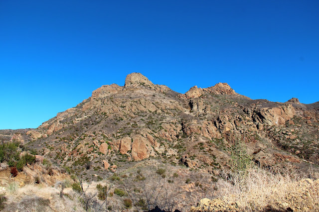
Buzzard's Roost

Zuma-Edison Road

The Zuma-Edison Road descends quickly into Zuma Canyon as you give back most of the elevation you just gained. Once again, you're walking a maintained fire road that is used to access Edison's towers that host the high-tension wires that hang across the canyon. As you continue to loose elevation, you get more nice looks at the Buzzard's Roost, this time from the east. At the last tower on the descent, the maintenance stops and the road deteriorates into a defacto trail until you reach the next tower on the other side. At the bottom of the canyon, the path crosses dry Zuma Creek where Sycamore trees provide some shade relief from the unrelenting sun. There is no established trail along the creek in the canyon-bottom, but it is feasible to rock-hop and brush-bash down-canyon back to the trailhead at Bonsall Drive. Not knowing the conditions, I decided against launching off on such an exciting adventure, opting instead for the long, boring road walk up the other side to the junction with the Zuma Canyon Connector Trail.  

Zuma Edison Road

Zuma Canyon

Peak 1984

Zuma Canyon

Zuma Canyon Connector Trail

Just beyond the crest of the high-point on the other side of the canyon, the Zuma Canyon Connector Trail intersects the road. The trail is obvious, and the junction is marked with a sign telling you dogs and motorcycles are not permitted, but there are no other marking telling you that this, in fact, is the Zuma Canyon Connector. Even though I wasn't entirely certain that was the correct route, the single-track was so inviting after all the road-walking I'd done, that I didn't really care. The trail was heading generally in the right direction so I crossed my fingers, hoped for the best, and launched off down the path. This is a really enjoyable stretch of the route as you roller-coaster along the undulating ridgeline and catch nice views of the Malibu coastline.

Down trail, I ran into a pleasant young lady that was on her way up. Because it was late afternoon and I told her she still had a long way to go, she turned around and we walked back to the bottom of Zuma Canyon together. We continued along the trail until it merged with and became the Kanan-Edison Road. About 1.3 miles later, we branched off and descended dusty Ocean View Trail which is heavily used by equestrians. In fact, on the descent, crossed paths with a train of about 10 equestrians who were coming up trail as we were going down.

When the trail ultimately bottoms out in Zuma Canyon, you might hope and think you're finished. But you'd be mistaken if you believed that. That's because you still have another half-mile to go. And it's all uphill which is disheartening. It's isn't steep, but after grinding for 10 miles, it's not necessarily what you want to encounter.

Here, my hiking companion, who was parked at the Zuma Canyon trailhead, offered to give me a lift back to my car where I started. That was an enticing offer and I briefly contemplated accepting. But I figured that would be cheating (because it would be cheating), so I graciously declined and began the crawl up the Zuma Loop Trial back to where I started. Ultimately, that was a good decision because the trail is well maintained and the ascent gentle, so the climb really wasn't as bad as I had imagined. 

A short while later I was back at the trailhead as the afternoon shadows began to get long. My total time out was about 4.5 hours which included a few stops along the way to goof around and explore.

Zuma Canyon Connector Trail

Zuma Canyon Connector Trail


Saturday, November 13, 2021

Magical Wildwood

Arroyo Conejo Creek

Fairies, come take me out of this dull world
For I would ride with you upon the wind
Run on top of the disheveled tide
And dance upon the mountains like a flame!
~William Butler Yeats (The Land of Heart's Desire)

Looking for Fog in All the Wrong Places

It's the season of fog. That time of year when blankets of dense mist steal into the coastal canyons and valleys while the world sleeps to envelope the landscape in a veil of monochromatic opacity. It's also the season of darkness. That time of year when we all determine (or somebody determines) that daylight isn't worth saving anymore. So we unceremoniously cast it aside in favor of a late afternoon drive home from work with the headlights on. 

I have conflicted feelings about what we call this "Standard Time." I bristle at being forced by celestial bodies and government functionaries out of the blue and into the black before I'm ready. And I abhor what the premature darkness portends: incessant devil winds and the unseasonable heat and predictable wildfires they bring. On the other hand, autumnal blue skies and cool morning air are something to be relished. And then there's the fog that makes driving a challenge, but transforms familiar ground into a surreal and oddly disconcerting playground of mystery and enchantment. 

On the Sunday morning that we all "fell back," the cloud bank clung close to the ground, obscuring views and transforming familiar landmarks into strange apparitions. It was a perfect moment to go wander the in the hills. But I surmised that I had an extra hour in the bank, so I squandered it on caffeine and the news. My dallying aside, visibility was still poor by the time I finally left the house and started for the Nicholas Flat trail deep in the Santa Monica Mountains. I've trod that trail alone in the silent murk before and it's a ethereal experience. But as I began the climb into the Santa Monicas on State Road 23, the cloud cover thinned and began to dissipate. I'd lingered too long at home. Aggravated, I doubled-back into the pea soup skies that hung over the Conejo Valley naively believing that I still had a chance at a ghost walk.

Heading for Wildwood Regional Park

I figured the canyon-bottoms would cling to the fog the longest, so I headed for the ravines of Wildwood Reginal Park. But as I raced toward my destination, visibility improved as the cloud bank began to lift. By the time I pulled into the crowded parking lot along Avenida de Los Arboles, the heavens were still gray, but the canyons were completely clear of the cottony sky candy I came to play in.  

Determined, I alighted from my car and headed into the canyon. I knew the masses would be amassed along the mesa, at the teepee, and down by the falls, so I avoided those areas. Instead, I dropped into the cool green of the Indian Creek drainage where I knew I could find some solitude. There, I found a decent amount of water flowing in the creek-bed. The water is disgusting mind you as it is mostly residential run-off that is full of chemical pollutants, dog shit, and other suburban refuse. But when you're in the bowels of the canyon sitting creek-side, listening to the squirrels chattering and the brook babbling, its easy to ignore all that. Certainly the crawfish and the ducks don't seem to mind. 

As I strode down-canyon, something large and gray flashed near the water's edge to my right. A Great Blue Heron perhaps. Or maybe a gnome. Neither likes to be seen. Further on, I found a pleasant glade guarded by Sycamore and Oak trees where I stopped and imagined that I had inadvertently stumbled into Mirkwood. Above, voices of excited children sitting in the "Indian Cave" punctuated the silence. The Chumash inhabited these canyons for 8,000 years before the white man arrived which explains some of the current park nomenclature (Indian Cave) and motifs (the tee pee).      

Indian Creek

Further into the canyon, I veered off the beaten path and onto the Lynnmere connector trail. The North Fork of the Arroyo Conejo runs adjacent to this path here so I made my way down to the water's edge to see what I could see. In the dark shade of the canyon I found a placid pool surrounded by luxurious and colorful foliage, proof that Southern California does in fact have a fall season. It was a marvelous spot that I'm fairly certain is inhabited by fairies and unicorns.  

After indulging my over-active and phantasmagoric imagination, I started back the way I came. I was still disappointed that I'd missed the early morning mist, but was quite satisfied to have experienced a little bit of the mystery and magic of Wildwood.

North Fork Arroyo Conejo


Sunday, October 31, 2021

Wright Mountain Hootenanny and Grilled-Cheese Extravaganza


Gobblers Knob Summit

I'm into grilled cheese. Grilled cheese makes me feel beautiful.
~Emma Stone

The poets have been mysteriously silent on the subject of cheese.
~Gilbert K. Chesterson

Men only need two things: grilled cheese and sex.
~Emmy Rossum

Ruminations on Grilled Cheese

The grilled-cheese sandwich. Two slices of white bread, butter, and cheese. A gastronomic staple of childhood and the culinary stuff of adulthood nostalgia. I never really thought that much about how enjoyable the combination of hot cheese and toast could be. And I certainly never considered the absolute epicurean genius one must possess to imagine, and the actually grill, grilled-cheese sandwiches on a mountain top. But a recent group outing to Wright Mountain in the San Gabriel Mountains brought me cheesy enlightenment about these important subjects. 

The event that set the table for this sudden understanding was the 14th anniversary of the San Gabriel Mountains Discussion forum. The forum is a San Gabriel Mountains-focused on-line board for posting trip reports, photos, information, questions, nonsense, and other valuable (and invaluable) whatnot. To celebrate the forum's 14 circle around the sun, Sean (aka Cucamonga Man), one of the board mucky-mucks, planned a ramble to the summit of Wright Mountain from the east starting from PCT mile marker 356 at the end of Forest Road 3N31. The plan was to arrive Saturday afternoon, car-camp at road's end beneath Gobblers Knob, and then hike westward along the Pacific Crest Trail ("PCT") to the summit of Wright Mountain.

Meet Up Beneath Gobblers Knob

After a slow and bumpy ride up 3N31 from Lone Pine Canyon, I arrived at the designated spot late Saturday afternoon. It was the middle of deer hunting season in Zone D11, so I passed several armed hunters in full camo on my way in. David and Elwood were already there when I arrived so I settled in with them as a heavy blanket of clouds began to broil up the ridge from the valley below. It was an ethereal scene reminiscent of the Ten Commandments when the Lord sent the breath of pestilence to kill the first born of the Egyptians. Fortunately, none of us perished as the fog passed-over while we drank beer and waited for Cucamonga Man, our Moses, to arrive so he could lead us to the promised land on the morrow. Much later, as the fog retreated and darkness replaced it, Dima and Sondra arrived to join the group. 

We were still above the cloud bank the following morning as the sun began to rise in the crystalline blue sky.  In an over-used word, it was spectacular. While we waited for Cecelia and JeffH to arrive to round out the group, I made a quick dash to the summit of Gobblers Knob. There is no trail to the summit, so I just gutted it out up a steep and loose old firebreak the follows the eastern ridge. The top of Gobblers Knob is wide and flat so it wasn't immediately apparent where the actual high-point was. But on the far western side of the summit I found a rock-pile which, officially or not, marks the spot. I could locate neither a register nor benchmark on Gobblers Knob, but I did find one of those ubiquitous triangular signs known as "witness posts." And it was the only time the entire trip that the back-side of Mt. Baldy would be visible.


North Fork Lytle Canyon
North Fork Lytle Creek Canyon

Lone Pine Canyon
Lone Pine Canyon

PCT Sunset
Sunset Over the PCT

Moon Over Lone Pine Canyon
Night Vision

Sunrise over Lone Pine Canyon
Sunrise Over Lone Pine Canyon

Gobblers Knob Summit
Views from Gobblers Knob

Gobblers Knob Summit
View West from Gobblers Knob - L to R: Baldy, Dawson, and Pine

PCT West to Wright Mountain

Shortly after I descended from the Knob, Cecelia and JeffH arrived and we headed out, jumping onto the PCT which transects the parking area. The well-maintained trail skirts Gobblers Knob to the north as it climbs gently toward the Blue Ridge and Wright Mountain. As you go along, the transition from a more scrub-dominated environment to a lush evergreen plant community is obvious and striking. You also get good looks at Dawson and Pine which dominate the southern skyline. Ultimately, the trail tops out and joins an old fire road that wraps around the south side of Wright Mountain. Here, we stopped at a window above the slide area at the head of Heath Canyon for snacks and the sublime scenery. Wrightwood and the high desert were visible in the foreground, while the southern Panamints could be seen on the northern horizon.

The final push had us ascending a faint, old road bed of some sort to the summit of Wright. Like Gobblers Knob, the forested crown of Wright is broad and flat and the actual high-point is not immediately obvious or intuitive. To complicate matters further, a series of use trails criss-crosses the summit plateau in a sign that a good many others have also spent time and energy wandering around in search of the actual "top" of Wright. But Cucamonga Man knew the way and led us to a rock-pile on the north end that apparently qualifies as the official summit. 

Grilled Cheese Sammies on the Summit

As we settled in to luxuriate in our achievement with our bland old trail mix, beef jerky, and granola bars, chef de cuisine JeffH dug into his stash of secret goodies and pulled out all the makings for grilled-cheese sandwiches. In a flash of mad-scientist brilliance, he had packed a loaf of bread, slices of American cheese, a container of butter, a frying pan, a spatula, and his stove. He then went about grilling sammies one at a time for everyone. It was candidly delicious and we all sat around in the warm sun extolling the awesomeness of Jeff's gastronomical creativity and licking butter and melted cheese off our grimy fingers. 

Afterwards, we hoisted our packs back onto our backs and started the 4.5 miles back to where we started. On the way out, a few of our party climbed Gobblers Knob via its north ridge. That route looked much more accessible than the east ridge that I climbed previously, and I then wished I had waited to ascend the Knob using that approach. Back at the parking area, we cracked cold beers as Cecelia broke out chips, salsa, and guacamole. Another stroke of inspiration. That probably sounds a bit over-stated, but I rarely bring post-hike food and drink to enjoy (mostly because I'm generally solo), so this was a really tasty treat. 
On the way out, I took the long way down 3N31 out of Lytle Creek just because. Although considerably longer, the road out this way was an easier drive than the access from Lone Pine Canyon.

All in all, a fun day in a really nice part of the San Gabriel range.  

Pacific Crest Trail
Along the PCT

Pacific Crest Trail
Nearing Wright Mountain

Dawson Peak and Pine Mountain
Dawson Peak (L) and Pine Mountain (R)

High Desert from PCT
To Infinity and Beyond

Wright Mountain Summit
Wright Mountain Summit Cairn

Grilled Cheese Sammies on Wright Mountain
The Mad Scientist at Work

Memorial on Wright Mountain
Wright Mountain Beautiful Child
 
PCT Views
Views East to San Gorgonio and San Jacinto