Showing posts with label La Cresenta. Show all posts

Sunday, December 5, 2021

Crescenta View Trail

Crescenta View Trail

 Tip the world over on its side, and everything loose will land in Los Angeles.
~Frank Lloyd Wright

L.A. is the loneliest and most brutal of American cities.
~Jack Kerouac

The final story, the final chapter of western man, I believe, lies in Los Angeles.
~Phil Ochs

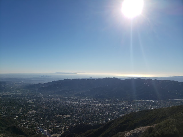
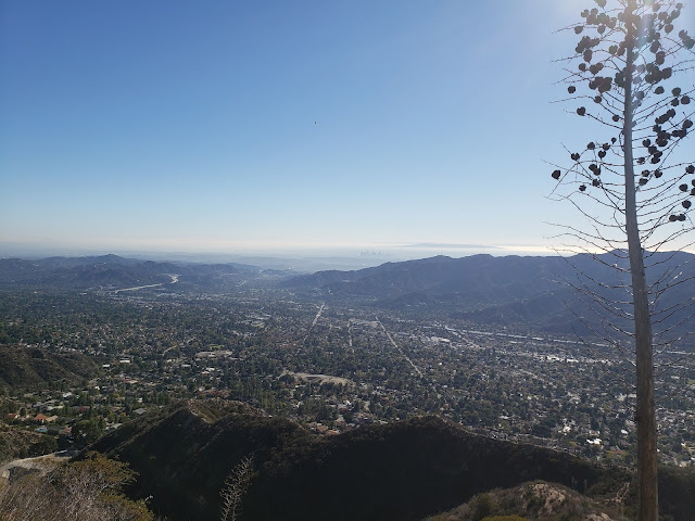
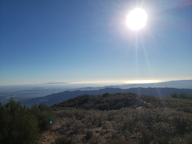
Roman Polanski once said "Los Angeles is the most beautiful city in the world, as long as its seen at night and from a distance." Obviously, Mr. Polanski never hiked the Crescenta View Trail on crystal clear, sunny day in November. If he had, he would have known that viewed from on high and afar, with the island-studded, gleaming Pacific as a backdrop, the City of Angels is a spectacular, if not messy, sight to behold.

How do I know this you ask? Because I recently hiked the Crescenta View Trail on a crystal-clear, sunny day in November. And from a perch at 4,400' feet, Los Angeles, in all its frenetic, sprawling, chaotic glory is quite a beautiful thing. This despite what all those sneering east coast elites and raffish midwestern outsiders might say otherwise.

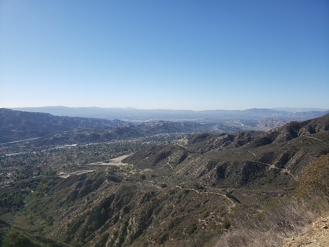
The Crescenta View Trail starts at Deukmejian Regional Park which is technically in Glendale. As far as trailheads go, Deukmejian is somewhat unique in that it has plentiful free parking, water, and full bathroom facilities. Bueno! The track begins at the rear of the parking area and gently ascends Dunsmore Canyon adjacent to the dry creek bed. A short distance up-canyon, a trail branches off to the right and crosses over to the east side of Dunsmore Creek before continuing northward. A similar connector intersects the Dunsmore Canyon Trail further up the canyon. Wanting to get off the more heavily-traveled main trail, I took the first branch which was a mistake as the path has been completely washed away where it crosses to creek. I had to scramble up a steep and brushy bank on the other side to regain the trail. I did not repeat that mistake on the return trip, following the second connector further up canyon.   

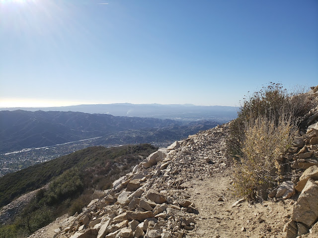
A short distance later, the climbing begins as the path switch-backs up the ridge that separates Shields and Dunsmore Canyons. The climbing isn't particularly steep, but it is sustained and really doesn't let off until you reach the saddle where the Crescenta View Trail ultimately intersects the Mt. Lukens fireroad. From that point, you can traverse the dirt road a short distance west to the summit of Mt. Lukens, the highest point in the Los Angeles proper at 5,074 feet.

There is apparently some controversy over the name "Mt. Lukens." According to the Sierra Club HPS Section, the peak was previously named "Sister Else (or Elsie) peak. Nobody seems to remember or know who the original female namesake was, but as part of the 1875 Wheeler Survey, a chap named "McLain" decided "Lukens" was a more appropriate appellation and so renamed the peak in honor of Theodore Lukens, a former Supervisor of the Angeles National Forest. McLain ostensibly did this because "mountains should be monuments to the men who have treasured and protected them," gratuitously observing "what did Sister Elsie ever do for the mountains?" 

Crescenta View Trail

Crescenta View Trail

Crescenta View Trail

Anyway, my objective this day was not the summit of Sister Else Peak. Instead, my plan was to simply hike to the Redoubt, a circular rock enclosure on one of the ridge's promontories accessorized with a flagpole. There, I figured I'd take in the views, have a snack, lollygag a bit, and then return to the parking lot. But as alluring as that might sound, the Redoubt is an exposed and shadeless place, and sitting there baking in the direct sunlight for any appreciable amount of time is not ideal. So I continued another 3/4 mile up the trail to the Pickens Spur water tank which is also a shadeless and exposed spot, although perceptibly cooler. Plus, the flat concrete there affords an opportunity to lounge about without having to roll around in the dust and dirt.

From this spot high on the ridgeline, the entire Los Angeles basin is observable. Downtown, midtown, Century City, Santa Monica, the Palos Verde Peninsula, the Valley, and the Verdugos are spread out before you like a crazy metropolitan quilt. To the distant east, you also get impressive looks at all the celebrities of the San Gabriel front country: Mt. Deception, San Gabriel Peak, Occidental Peak, Mt. Markham, Mt. Wilson, Mt. Lowe, and Brown Mountain. 

Pickens Spur water tank
  

Crescenta View Trail

Crescenta View Trail

I stripped my sweaty shirt off here, exposing my embarrassing corpulence to no one, and lingered for a while. Shortly after that, things got amazingly hazy so I packed up and started back down the way I came.

Stone Amazingly Hazy IPA

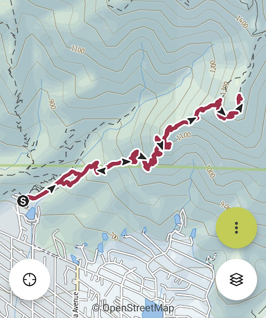
Total mileage for this one came in at 5.20 with an elevation gain of just shy of 3,000 feet.      

Crescenta View Trail

Crescenta View Trail Elevation Profile


Wednesday, February 24, 2016

Mt. Lukens: Crescenta View - Rim of the Valley Loop

Mt. Lukens from the Rim-of-the-Valley Trail
About nine years ago, a couple of friends and I climbed Mt. Lukens via the Stone Canyon Trail as part of training regimen for Mt. Whitney. It was my very first foray into the San Gabriel Mountains and candidly I wasn't all that impressed. As a transplant from greener and more lush climes, I was accustomed to trails and peaks that were a bit more alpine-y. I didn't find Mt. Lukens to fit that bill. Moreover, the day we went gray fog clung to the mountainside like a dreary blanket, the trail was overgrown, and the summit was cluttered with radio towers and other transmission paraphernalia. To someone with my pre-conceived ideas about what a summit was supposed to look like, Lukens was, well, disappointing. To sour my mood even more, I found a tick deeply embedded in my shoulder when we got back to Wildwood in Tujunga Canyon. I must have subconsciously decided that Lukens wasn't worthy of my time so for years I didn't go back.

That changed this weekend when I paid Lukens another visit, this time from the La Crescenta side of the mountain. Parking at Deukmajian Wilderness Park in La Crescenta, I climbed the Crescenta View Trail to Lukens' summit and then looped back down to the trailhead in Dunsmore Canyon via the Haines Canyon Motorway/Rim-of-the-Valley Trail. I'd like to attribute it to my maturation as a hiker and my greater familiarity with, and appreciation for the San Gabriel Mountains and the Angeles National Forest (others might call it my naivete), but this visit to Lukens was nothing like my previous trip years ago. To the contrary, this trip, dare say, was downright enjoyable.

I arrived a Deukmajian around 11:30 a.m. because climbing a steep south-facing slope is always more enjoyable in the mid-day sun. Surprisingly (or maybe not surprisingly) I had no problem finding a place to park. In all seriousness, temps were only in the mid to high-70s so it really was quite pleasant out. But climbing this trail during the heat of a mid-summer day could be brutal.

From the parking area, I made my way up the main fire road in Dunsmore Canyon for approximately 0.5 miles. Here, the La Crescenta View Trail branches to the right where it begins its ascent up the rugged ridge on the east side of Dunsmore Canyon. The climb here is fairly gently, but it becomes more aggressive the higher up you go. In fairly short order, over-the-shoulder views of the Verdugos, the Los Angeles Basin, and the San Fernando Valley really start to pop.

Start of the Crescenta View Trail
Over-the-Shoulder Look Into Dunsmore Canyon
Crescenta View from the Crescenta View Trail
Trailside Bench
You of course pay for these expanding views with elevation, which you gain rapidly as the path zig-zags its way up the very steep slope. The work you’re putting in, however, is made easier by the condition of the trail which is in really fine shape thanks to the efforts of the trail crews who have done a nice job maintaining this track.


After about 2 miles of climbing, you reach a level spot along the ridge where folks have constructed a large stone circle reminiscent of the wind-breaks one sees atop Mt. Baldy and some of the other local peaks. Looking southwest from this vantage point, the switch-backs of the Rim-of-the-Valley Trail can be seen slicing across the west side of Dunsmore Canyon. If you do this hike as a loop, this trail will be your descent route.
The Path Weaving Its Way Up the Steep Slope
Hair-Pin Turn
Typical Trail Conditions
Rock Circle
Rock Circle View
Beyond the stone circle, the path makes one final climb up the steep and rocky ridgeline before intersecting with the Pickens Spur (2N76C), an unmaintained lateral that branches from the Mt. Lukens fire road approximately 0.5 miles beyond. The walk here is easy all the way to the Lukens’ summit and the vistas are quite grand. At the junction with the Mt. Lukens Fire Road, you can peer north into the entire desolate-looking drainage of Big Tujunga Creek backed by the prominent Mt. Gleason ridgeline. Looking east affords a nice look at the peaks and peaklets that comprise the Wilson cluster.
Ascending the Steep Ridgeline
Big Tujunga Canyon from Mt. Lukens Fire Road
Josephine, Strawberry, Lawlor, Deception, Disappointment, San Gabriel, Markham, Lowe, Occidental, and Wilson
From this point, the path to the summit involves a fairly uninteresting and tame fire road walk of about 1 mile to the summit which is crowded with unattractive radio towers and other structures. The day I went, it was also more crowded with other hikers than I expected given the fact I saw only one other person on my ascent (and that person was descending). I struck up a conversation with some of these folks and discovered that most of them had come up from Haines Canyon. One couple and their small dog had come up Stone Canyon and planned to descend via Grizzly Flats. When I queried them about conditions on the latter trail, they assured me that it had been recently brushed-out and was clear.

After locating the benchmark on the far northwest corner of the flat summit, I spent a bit of time lounging about, taking in the view, and plotting my descent down the Haines Canyon Motorway which is plainly visible to the southwest. Nobody I spoke to on top could confirm the existence of a junction with the Rim-of-the-Valley Trail back to Dunsmore Canyon, but both Tom Harrison and Google Earth told me it was there, so I threw caution to the wind and dropped off the south side of the summit to begin my downward trek.

The Very Scenic Summit of Lukens
Survey Marker Atop Lukens
Lukens View
The path here is basically a single-track on an abandoned fire road that nature is trying to reclaim. The road swoops widely back and forth, alternating between the sun and shade, as it slowly descends between Haines Canyon and Cooks Canyon. Approximately 3 miles from the summit, the Rim-of-the-Valley Trail branches south into Cooks Canyon at a pretty obvious trail junction. I was expecting this junction to be more difficult to locate based upon my conversations with folks on the summit, but there is no missing or mistaking it unless you’re just no looking for it.

Descending Haines Canyon Motorway
Deer Tracks
Cooks Canyon Water Tank
View Across Cooks Canyon to Crescenta View Trail
Trail Junction for the Rim-of-the-Valley Trail
After the junction, the trail descends into Cooks Canyon fairly rapidly in a series of switch-backs that ultimately take you to the canyon bottom. Here, unlike everything that came before, the forest is lush and the trail nicely shaded. Water was still flowing in the creek which was a pleasant surprise. I stopped to splash around in the stream and to appreciate the unexpected magic of this place. Soon I started encountering others doing the exact same thing. Everyone was nice and happy to be out and I completely understood the force that compelled them to visit here.

A short distance downstream, you climb a small ridge which is not that difficult, but it is a bit of a disappointment because your mindset at this stage is that you're already down. The pain is brief, however, and in no time you're back in Dunsmore Canyon and headed for the trailhead which is nicely stocked with real restrooms, a water fountain with decent and cool water, and a grassy area with picnic tables where you can chill and relish the day you just spent in the amazing local mountains. I recognize I'm late to the party, but check this place out if you haven't already. It's muy bueno.

Lovely Cooks Canyon
Blessed Water in Cooks Canyon
Trail Through Cooks Canyon