Friday, September 30, 2022

Coffee and Kearsarge

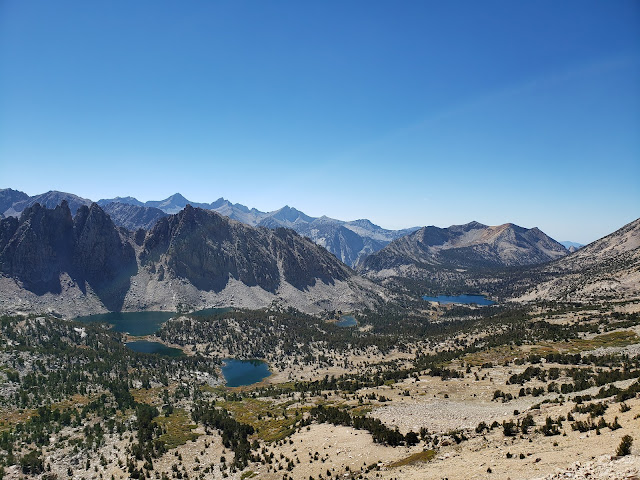
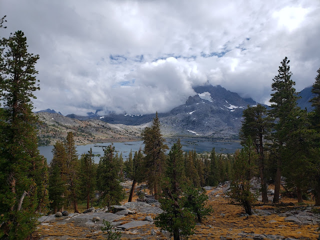
View West from Kearsarge Pass

 Live, travel, adventure, bless, and don't be sorry.
~Jack Kerouac

It is the experiences, the great triumphant joy of living to the fullest extent
 in which real meaning is found. God it's great to be alive!
~Alexander Supertramp aka Christopher McCandless

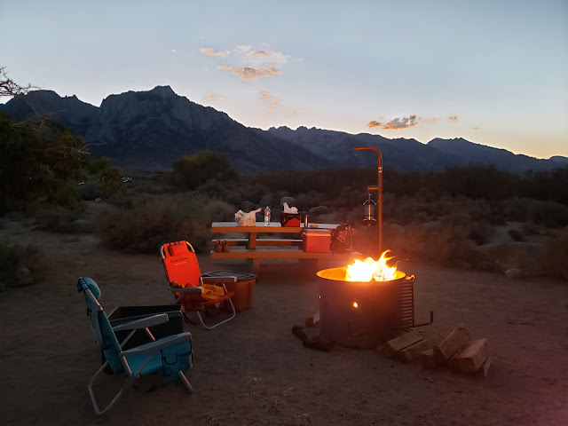
I tended to the campfire as the sun dipped behind Owens Peak and the shadows moved cat-like across the valley floor. The only fragments of day were the pink and purple that stained the Inyo Mountains to the east. It really wasn't quite campfire weather yet. The night was warm and the hour still early, but fire is obligatory on outings like this. The radiating warmth, the alluring scent of burning pine, the snap-crackle-pop of combustion, the hypnotizing dance of the flame. There's something primal and ancient and ritualistic about it all. A vestigial connection to ancestors and the past. 

Late September is high season in the Sierra so we'd driven up earlier in the day to ensure that we'd have a decent camp spot. Up the El Camino Sierra and across the high desert, through Pearsonville, Coso, Dunmovin, Grant, Olancha, Cartago, and all the other bleak little outposts littered with sun-bleached single-wides, dilapidated buildings, and junky automobiles slowly disintegrating in the scorching heat. This is the land of stolen water and murdered dreams. What Marc Reisner called the "Cadillac Desert."

Our weekend objective was Kearsarge Pass out of Onion Valley. If we were feeling frisky, we might give Mt. Gould a go once at the pass. Kearsarge Pass and its namesake peak were named after the Union battleship USS Kearsarge. In June of 1864, the Kearsarge destroyed the CSS Alabama, a Confederate cruiser that sunk 64 American merchant ships in the Atlantic. The nearby Alabama Hills were named by Confederate sympathizers after the Alabama. Local Unionists then named the pass and peak after the Kearsarge as a kind of "fuck you!" in response. 


Owens Valley

Sierra Alpenglow


We got a bit of a late start Saturday morning because we lollygagged around camp too long. The start then got delayed further when we made a mandatory stop for caffeine. Lone Pine has a cute independent coffee house called the Lone Star Bistro, but we didn't go there. The last time I visited, the older guy behind the counter (who I surmise was the owner) was kind of a surly wiener. When he asked me what I wanted, I jokingly told him in my worst Anglo-Spanish that I wanted coffee - enormous, gigante, grande! He got triggered by the word "grande" and barked back at me "this isn't Starbucks!" before begrudgingly getting me a "large." So on this trip we went to McDonald's where the dick factor is much lower and the coffee better. 

It's a curious thing. Lone Pine is a small, rural place. It really isn't self-sustaining. It relies on "big city" tourists for survival. Or at least to bolster the local economy. And yet, several establishments there appear to revile the tourist hand that feeds them. Jake's Saloon is such a place. Right next to the Lone Star Bistro, Jake's recently had a sign posted over the bar warning "No Hipsters! Don't be coming in here with your hairy faces, your vegan diet, your tiny feet & your sawdust bedding." Maybe they were kidding. Maybe they weren't. I don't really care. I don't patronize Jake's. Not because I consider myself a hipster. At my age, literally no one would make that mistake. I don't patronize Jake's because the last time I went there it was unbearably hot and the bartender reminded me of the pawn shop keeper in Pulp Fiction. And then there was the large Confederate flag hanging prominently over the bar. 150 plus years and counting and the scourge of the Confederacy is still with us. So, local rednecks only at Jake's I guess. 

Leaving Lone Pine, we drove north to Independence where the road to Onion Valley leads west following a gash in the mountains where Independence Creek spills out onto the arid plain. Along the way, we passed the Manzanar National Historic Site where the United States forcibly relocated and then detained Japanese-Americans during World War II. With the stunning backdrop of the Sierra crest, Manzanar is austere and starkly beautiful. We could have done Americans of Japanese descent worse. But it is a prison nonetheless. The old guard towers sitting along 395 attest to that.   

Onion Valley Road, which begins in Independence as Market Street, is an impressive bit of engineering and road-building. As you climb away from town and begin to gain elevation, you can't help but wonder who it was that first ascended the canyon and established the route that thousands now follow. That same thought pops into my mind whenever I drive up to Horseshoe Meadows, the Whitney Portal, Glacier Lodge, and all the other roads that breach the mountainous bulwark that protects the inner sanctum of the range. In the case of Kearsarge, the first ascent up Independence Creek was probably by natives following game trails. But apparently the first documented crossing of Kearsarge Pass was accomplished in 1864 by eleven prospectors looking to strike it rich.  

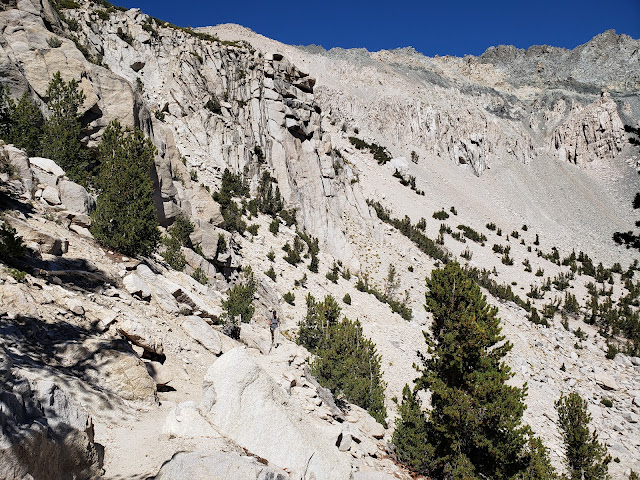
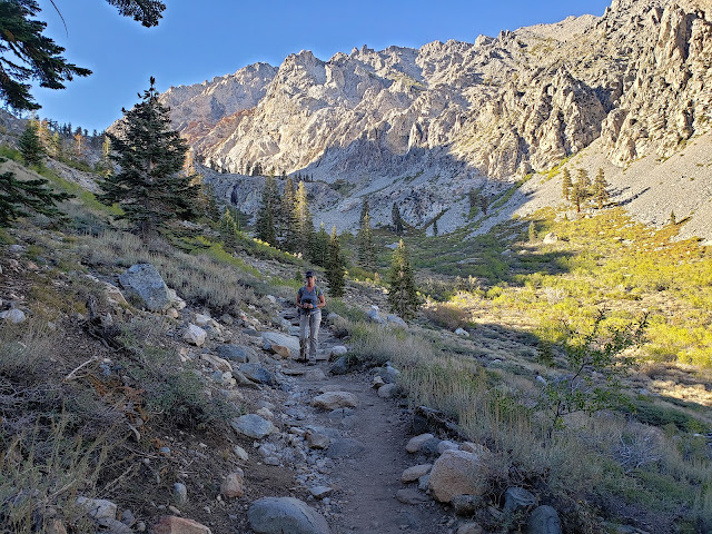
Kearsarge Pass Trail

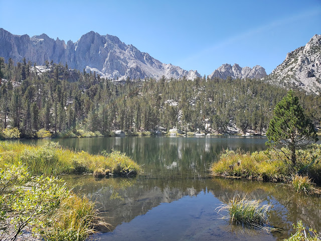
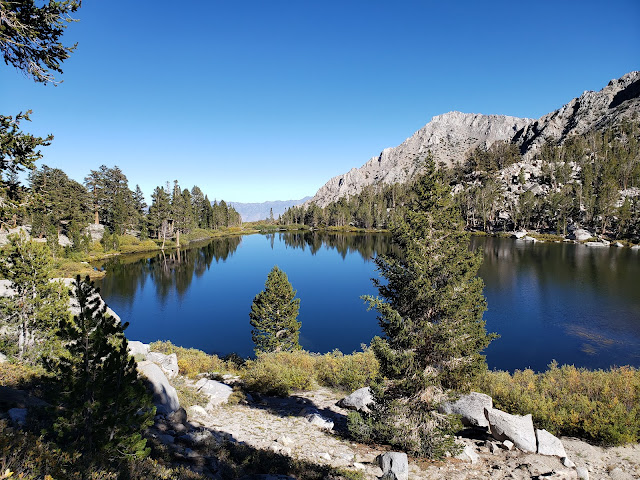
Flower Lake

Kearsarge Pass Trail

At the trailhead, we found the parking lot jammed to capacity. The Kearsarge Pass Trail has always been a popular route, but not this popular. A sign of the times I suppose. So we parked along the road and started up, following a conga-line of about 18 hikers on a group outing. Over the course of the day, we would play leap-frog with this group as we passed them and then they passed us until we all finally arrived at the pass 5 miles later at about the same time. 

It's been a dry few years in the Sierra, but Independence Creek was coursing, presumably still being fed by what remains of the glacier that sits beneath impressive University Peak. That glacier, along with snow-melt, also nourishes the chain of stunning lakes that stud the basin. The trail climbs right out of the parking lot to the first of these lakes, Little Pothole, where you get a very brief respite before the climb resumes. Comparatively speaking, Little Pothole is the ugly step-sister of the other lakes. It is diminutive and decidedly unpretentious. But it is also infused with minerals from glacial melt that makes it gleam a brilliant aquamarine.  

Further up trail, after a number of switch-backs and past the rock garden, is pretty Gilbert Lake. There's a big, flat granite boulder on the west side of the lake immediately trailside that I'm pretty certain is a mandatory stop for everyone hiking the trail. The boulder sits above blue Gilbert and affords a perfect Instagramable photo-op. Being the social media influencers that we are (or at least, imagine ourselves to be), we stopped briefly for some pictures that would instantly make everyone covet our perfect, adventurous life and hate there own. Then it was a short stroll to languid Flower Lake where nice campsites dot the eastern shore. This is the jumping off point if you plan on visiting the Matlock Lakes to the south. 

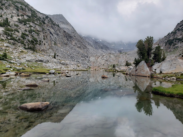
We, of course, continued up the main trail that proceeds to climb to tree-line with additional urgency. Along the way, we passed sapphire-hued Heart Lake and Big Pothole Lake, both of which sit well below the trail at this point. Despite that, both of these lakes are reachable. And I spied a couple of perfect tent sites on Heart's eastern shore. Further reconnaissance required. Big Pothole on the other hand, sits in a barren, exposed depression surrounded by nothing but boulders and scree. Pitching a tent here really doesn't look feasible or enjoyable.

Heart Lake

Kearsarge Lakes Basin

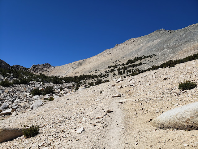
Approaching Kearsarge Pass

We were in the home stretch now. Right at tree-line. 11,200 feet. We could now plainly see the pass ahead, but stopped briefly on a big old slab of granite for water and snacks before the final push. It's easy to forget to eat at altitude. At least it is for me. I have no appetite when I'm up high. Even foods that I normally love are unappealing. So I too often don't eat enough while I'm in the Sierra. Same with hydration. With all the lakes, gurgling streams, trees, and peaks, it's easy to get lulled into the false sense that you're not actually traipsing through what amounts to a humongous food dehydrator. The environment here is harsh. If you don't take in enough water, the intense aridity, solar radiation, and wind will punish you without remorse.

Moving again, we followed the final segment of trail as it made a couple of big, lazy switchbacks across the scree slope of Mt. Gould's south face before topping out at the pass at 11,760 feet. From this aerie, you have panoramic views of the ragged Kearsarge Pinnacles and the cerulean Kearsarge Lakes, both of which sit in Kings Canyon National Park.

We found an available spot on a rocky prominence that afforded grand views of both sides of the divide and sat amongst the crowd to take it all in. In any other circumstance, I'd probably be annoyed. I'm a bit of a misanthrope and don't appreciate other impinging on "my" space and solitude. I come to the mountains to get away from folks, not to be with them. But the mountains change people. It infects them with what Kim Stanley Robinson described in a recent Backpacker Magazine article as "crazy love." It's the mystical feeling of pure freedom and boundless joy one has when in the mountains or on the trail. Anyone who hasn't experienced it probably won't understand, but it's almost religious in nature. I realize that sounds hyperbolic, but you see it manifest in people you encounter on the trail. Everyone you come across is happy, friendly, engaging, and helpful. Like you, they are all elated to be out. Nature has unbridled them. It has stripped away the heavy encumbrances put upon them by the rules, regulations, expectations, and responsibilities of the culture. So you get to see folks in their pure, original, blissful state. You can't get that at the local shopping mall.

View West from Kearsarge Pass

Big Pothole Lake


From the pass, the route to Mt. Gould takes you immediately north up a steep Class 2 scree field to the summit. We briefly considered making an attempt, but decided against it as the hour was later than we had anticipated. So we retraced our steps to Onion Valley where the madding crowds in the parking area had dissipated somewhat. It was then a relatively quick drive back to our camp in the Alabama Hills for one more precious night of crackling fire, black skies, and brilliant stars.

Gilbert Lake

Kearsarge Pass Trail

Alabama Hills Camp


Saturday, September 17, 2022

Prologue: Goosefest and the Prophet of Stoke


It's better to burn out than it is to rust.
~My, my, hey, hey (Into the Black), Neil Young

You must live in the present, launch yourself on every wave,
find your eternity in each moment.
Fools stand on their island of opportunities
and look toward another land.
There is no other land; there is no other life than this.
~Henry David Thoreau

"What day is it?" asked Pooh.
"It's today," squeaked Piglet.
"My favorite day," said Pooh.
Winnie the Pooh, A.A. Milne

Preface to the Prologue - A Goose is Born

In the southwest corner of southern Utah, just east of the town of Hurricane, there's a sandstone plateau sandwiched between Utah State Route 9 and Utah State Route 59. The former parallels the Virgin River and takes you to the entrance to Zion National Park at Springdale. The latter tracks southeast and routes you through the polygamist enclaves of Hildale and Colorado City on the Arizona border. The island-in-the-sky sitting in the middle, which bears the moniker Gooseberry Mesa, occupies land managed by the Bureau of Land Management, and has become a mecca of sorts for the mountain-biking set. The famed Red Bull Rampage is held on the north side of the mesa annually.

In early 2021, when Covid was having its own rampage, my old pal Buzz and I decided to connect for a bit of camping under the stars. We figured even with the unending doom and gloom of the pandemic, we could pretty much stave off the rona if we were outdoors. Since my friend is in Salt Lake City and I'm in Southern California, we settled on Gooseberry Mesa as a sort of mid-point. But geography wasn't the sole determining factor. Amenities, or the lack thereof, was also important. And "The Goose" has (or doesn't have as the case may be) what we were looking for: no hassles, no authoritarian rangers, no fees, rudimentary yet acceptable bathroom facilities, grand views, big skies, good weather, campfires, and lots of open space for recreating. Perfecto!

So in April, we joined up on the mesa for a few days and nights of fraternity, outdoor indulgence, and general degeneracy. You know, all the standard stuff: biking, exploring, corn-holing, drinking, playing with fire, shooting the shit, and stuffing ourselves with epicurean delights. My daughter and a couple of our other old buddies from the past joined us and we all had a swell old time. When there was a lull in the action, Buzz kept us entertained with his humorous anecdotes, folksy mannerisms, and impersonations of famous rock-n-roll guitarists. Once the final day of the trip arrived, we had such a good time we committed to do it again the following spring. And thus, Goosefest was birthed. 

A Gathering of the Tribe

Wildsouthland and Progeny

Gray Hairs

Corn-holing on the Mesa with Dan-o

The Prophet of Stoke

Buzzard and I go back four-plus decades. We were both skiers in high school. Later in college we worked together at the Sports Stocker in Trolley Square tuning and waxing other people's skis. I never knew Buzz by any name other than Buzz and was convinced that is what his parents christened him. My wife called bullshit on that a couple of years ago and directly asked him his real name to which he replied "Brett." Then she gave me the knowing look. I was both stunned and deflated. I had never asked him the question before mainly because I had no reason to question what I otherwise knew to be true. And it never dawned on me that his name could be anything else. For 40 years I held fast to the belief that the name on his birth certificate, baptismal certificate, high school diploma, passport, and driver's license was "Buzz." And contradictory evidence aside, I'm not about abandon that fervent belief now. I'm digging in. Old fantasies die hard I suppose. 

The endearing thing about Buzzard is his sunny, gushing enthusiasm. He gets stoked about everything. Especially if it involves outdoor activities. Camping? Oh, fuck yeah! Biking? Let's get it! Skiing? Hells yeah Dude! New propane stove? Woohoo, score!!! Stone IPA in a 19.2 oz. can? Totally stoked! His reservoir of enthusiasm is deep. It's refreshing and infectious. It's not in my nature, but I find myself getting totally amped about rather ordinary things when I'm hanging out with the Prophet of Stoke.

He's also a well of wisdom. On our most recent Goosefest, we were sitting around the campfire talking about age because Buzz's birthday was right around the corner. The big 6-0. Entrance to the Golden Years. Buzz told us that every time he turns another year older, he let's go of some baggage that he's been carrying around with him. Just let's it go. Figures as he ages, he doesn't need that shit dragging him down any longer. I'd really never thought of that. I don't tend to hold onto the past. Or at least I don't think I do. From my perspective, the past is dead. No need to continually re-live it. As Tom Petty crooned, "it's time to move on, it's time to get going." I don't want or need dead grass not growing under my feet. Still, I've taken the teachings of Buzz to heart and now consciously try to let things just wash over me and then disappear down the drain. I don't always succeed, but I'm trying.

Church Services - Buzzard at the Pulpit

The Prophet Dispensing Advice to his Disciples

Goosefest 2 - Snow and Tequila

A year after the inaugural Goosefest, we returned to the scene of the crime. Some of the prior participants dropped off for this one, but we picked up the O.G. aka Super Dave to fill the gap. Buzz went down the night before we arrived to secure a site as the mesa has become quite popular and finding a good place to camp can be a challenge, even in early season. Fortunately, as Buzz was out scouring the area the following morning, he crossed paths with a group that was moving out of a very spacious site right on the rim. So as they moved out, Buzzard moved in and we were set for the weekend.

Sitting right on the rim has its advantages. The most obvious is the sublime views you get from the plateau's edge. Staring out over southern Utah's tablelands from on high really is the locus classicus of redrock desert camping. But the mesa's edge also has the breeze. That's great if your a raptor that likes to soar on thermals. It's also great when its warm as that breeze takes the hot edge off. But when its cool, the wind doesn't do anything but just makes it colder. 

And on this trip, unlike our first outing, it was cool and the weather unsettled. The desert can be fickle this time of year so I suppose it's to be expected even though we didn't expect it. But we were reminded of this the first afternoon when it snowed. Or maybe it was hail. Or sleet, whatever that is. To be honest, it was hard to tell exactly because what fell from the dark sky was kind of a mongrel form of precipitation. But regardless of its meteorological definition, we weren't prepared for it. So when the frozen pellets began dropping from the sky, we all dashed to our cars to take refuge while the storm pelted our camp. When it was finally over and safe to come outside to play again, we found the ground littered with white stuff. The snow/hail/sleet wasn't particularly wet and it didn't last long, but the warmth really never returned. It was chilly the rest of the time. 

But if the worst that can be said about your camp outing is that was it was a tad cool, how bad can it really be? So despite the less than optimal temps and occasional downpour, we still busied ourselves with riding and hiking and exploring and all manner of the typical camping whatnot. The task was made easier (or maybe harder) by the bottle of tequila that D brought along to lubricate our activities and sedate our souls. Later on while sitting around the fire, we sampled peach cobbler that Buzz cobbled together in a dutch oven. 

After the Storm

Mas Tequila

Burning Ring of Fire

Strawberry Canyon

Old Guys

October is Coming and the Goose(fest) is Getting Fatter

On the last day, we decided that an annual trip probably wasn't sufficient to scratch the itch. At our age, you have to get as much in as you can as many times as you can. Because there are no guarantees in this life. One day you're here, the next day it's done. That's happening with concerning frequency now in my demographic. People I grew up and went to school with are starting to drop. Out of the blue and into the black. It's sobering. So we decided to double our efforts and make the trip a bi-annual thing: one trip in the late spring, another in the early fall. I haven't had the chance to see these boys much over the years on account of geography, work, kids, life. So Goosefest is a fun platform to do just that. It's a reunion masquerading as a camping trip. 

Goosefest 3, the next installation of the Goose, will happen on October 6-9. A post-mortem will probably be forthcoming, but may have names changed to protect the innocent.   

Tuesday, August 30, 2022

I Ain't Going Out Like That

 John Muir Trail

The next big event after retiring is dying. And I'm not going to volunteer for that one yet.
~Bobby Bowden

We ain't going out like that, we ain't going out like that.
~Cypress Hill, I Ain't Going Out Like That

Legendary Florida State football coach Bobby Bowden continued to work long into the sunset of his life. His philosophy, often repeated, was that once you retire, there is only one major life event remaining. And he was determined to stave that event off by avoiding the immediately preceding life event (retirement) as long as possible. How successful that strategy was we'll probably never know for certain. But death found Bobby despite his efforts and he was escorted into the mysterious beyond on August 8, 2021. 

I don't know how Bobby lived his life, but the subtext of his philosophy is to just keep grinding until you ultimately slump over a stack of paper on your desk, a tie around your neck, and the fluorescent lights reflecting in your vacant stare. Fuck that. As DJ Muggs and the boys said, "I ain't going out like that." I know the stage of life I'm at. I know what the actuarial tables say. I know the knock could come any day. So I'm not going to waste opportunity on the mere possibility that continuous toil is the path to Ponce de Leon's mythical spring. If living instead of working costs me a couple of extra years, I'll happily make that Faustian bargain.

So when the chance to walk a stretch of the famed John Muir Trail (JMT) was placed in front of me, I wasn't going to demur. Even if that meant spending a precious few days away from the never-ending stream of emails that I knew would be pooling to unfathomable debts in my absence.

I'm a spur-of-the-moment kind of guy. It drives my wife crazy. She's a meticulous planner. Every detail must be accounted for beforehand. There is little room for variation in the finalized agenda. Me, I too often approach things with only a sketch of a plan and then figure I'll ad-lib the rest. I like the not knowing. I like the spontaneity. I like the surprise. I like the freedom. Sometimes that approach bites me in the rear. Most of the time things works out. But as a result, if it was left up to me, I'd probably never walk the JMT. That's because it requires thinking about the trip months in advance. It requires researching when and how to obtain permits (and then actually getting those permits). It requires a fair amount of thought and planning. I find that whole process tedious and aggravating. I just want to show up and go. It's one of my many flaws.

Fortunately, I have a friend that is pretty good at doing those types of things and will tolerate me mooching off of his administrative efforts. So back at the beginning of the year, when the night sky still lingered long on the landscape, my friend, who was already dreaming about summer backpacking, secured permits for the the JMT with entry at Lyell Canyon in Yosemite National Park. Being the swell guy that he is, and knowing that I'd want in on the action, he made sure there was a spot for me to tag along. 

Our adventure started on a Saturday in Mammoth Lakes where we left a car. Early the next morning, we jumped on a Tuolumne-bound YARTS bus in front of the Shiloh Inn. We were joined by a couple of young lads from Rotterdam, Netherlands who had just finished the entire 222 miles of the JMT, had hitched a ride back up the 395, and were now headed for the Yosemite Valley. Talking to these young guys, who couldn't have been more than 21 or 22, I was impressed by their adventurous spirits, their infectious energy, their youthful fearlessness, and their ability to communicate with us fluently in the native tongue. Thinking back on my own youth, I would never have had the courage to go traipsing off to some foreign land with nothing but a pack on my back and a wild idea in my head. Hell, that wasn't even on my radar when I was their age. So I have great admiration for these guys. They are everything that I wasn't in my youth. 

At Tuolumne Meadows, we, along with a rag-tag assemblage of other backpackers, secured our permit after receiving the obligatory ranger lecture about bears, poo, and fire. We then started up Lyell Canyon where we planned to stay the first night. The term "up" in this context is somewhat of a misnomer as the trail through Lyell Canyon is relatively level for the first 7-8 miles before it finally begins climbing toward Donahue Pass. That makes for an easy first day and provides the ability to acclimate some before the air thins out and your lungs begin to burn as you walk.

Lyell Canyon

John Muir Trail

Lyell Canyon Yosemite National Park

It was high season along the JMT so we continually passed, or more frequently were passed by fellow travelers. That's the thing about hiking in the Sierra Nevada. The range can conceal an incredible number of hikers and backpackers. There are folks everywhere in these mountains. To the casual observer, it might no be evident. But they are there. By the lakes, along the ridgelines, and under cover of the forest canopy. So even when you're alone on the trail, you're never really alone. And there were quite a few folks alone on the trail. Most of them we encountered were women which was counter-intuitive. In the olden days, when we were all forced to walk to and from school bare-foot in the snow, and it was uphill both ways, you wouldn't have seen that. Too dangerous. Or at least that was the commonly-accepted wisdom. Now? I suppose safety in numbers has mitigated that concern some. And/or maybe contemporary women are just sick of that shit and are like "fuck it! I'm going." Either way, the "fairer sex" is killing it out there.  

Youth was the other common denominator. Schlepping a backpack full of gear at elevation, battling pesky mosquitoes, and sleeping in the dirt is mostly a young man's game. And the trekkers we encountered along the trail substantially, although not exclusively, bore that out. As old guys, we were definitely an outlier. Maybe even a curiosity. As we walked along, I couldn't help imagining the youngsters we met thinking how cute it was that a couple of old men were still out there doing it. Of course, no one said that or even hinted at it. Still, I'd be lying if I told you I never felt that we didn't belong. But that probably says more about me than it does the youth brigade we shared the trail with.

The day began gray and continued to get grayer the deeper in we went. By late afternoon, with the sky darkening, we reached the 9,700' contour and decided to camp just below the footbridge that crosses Lyell Fork. A ranger we met earlier informed us that there had been bear activity at this location for the last few nights, so I was a little on edge. Shortly after we set up camp, the sprinkles began and we took refuge in our tents. I didn't bring anything to read in an effort to cut bulk and weight, so I just laid there in my nylon cocoon listening to rain spattering the fly and awaiting a visit from Ursus Americanus Californiensis. That never happened, and I ultimately drifted off around 8 p.m., awakening early the next morning well before they sky began to lighten.  

Back on the trail, we climbed to a beautiful tarn at 10,200' that is fed by what remains of the Lyell Glacier. There are several campsites here which would make an outstanding place to stay for a night or two. As we admired the camping opportunities, we lost the trail when we followed a social path that skirted the eastern bank of the tarn and then ultimately fizzled out. Backtracking, we realized our error when we saw another JMTer crossing the tarn outlet and then follow the correct path along the western bank instead. 

Higher up, the trail crossed a stream before reaching another tarn that sat above treeline. Low clouds were smothering Mt. Lyell which made for an ethereal and foreboding landscape. We stopped to collect some of the cold, delicious water at the stream whose source was a pool higher up in the glacial cirque. One-half mile or so later, we crested barren Donahue Summit where I surprisingly, but briefly had cell reception.

Lyell Canyon Yosemite National Park

Lyell Canyon Yosemite National Park

Lyell Canyon Yosemite National Park

Donahue Pass Yosemite National Park

The clouds that hung high in the sky earlier were now at ground level. Maybe they moved lower or we moved higher, but suddenly we were in them. And they began dropping moisture. It started as an innocent mist that morphed into drizzle. That drizzle then turned to rain which quickly became a malevolent torrent. We donned rain jackets and ponchos, but it was futile. The rain was drenching and relentless. Dropping into the Rush Creek drainage, we took refuge under a gigantic granite overhang to ride out the rest of the storm. 

Afternoon thunderstorms are a regular occurrence in the mountains. They are one of those things that you just expect at elevation in the summer. But as we cowered under that slab of protective granite, the irony of it suddenly raining after 8 months of bone dry weather struck hard. Perhaps, I thought, I could single-handedly solve California's drought situation by seeding the clouds through backpacking all the time. I'd be happy, you'd be happy, the farmers would be happy, everyone would be happy. Win-win-win-win.

When the rain tapered off, we began moving again, but the skies did not look friendly. We had targeted the Marie Lakes as our destination for night 2, but when we got to the trail junction leading into the basin, we could tell that location was going to be stormy. So we continued descending until we reached the junction with the trail leading to Gem Lake where the deluge began once again. We joined a couple of young ladies under a tree in an effort to stay dry and made idle chit chat. One of them was on the finishing leg of a solo JMT trek northbound; the other, her friend, had joined her for the last few miles of the journey. Eventually, they got up and wandered off in the still-falling rain as we continued hiding under the tree boughs until the storm died down some and the trail stopped flowing like river. Then it was up and over Island Pass and down to Thousand Island Lake where we camped for the night. We had been warned by others on the trail that Thousand Island was crowded, noisy, and not very pleasant, but the place was pretty much empty. We had a very enjoyable evening there.

Ritter Range John Muir Trail

Island Pass John Muir Trail

Thousand Island Lake

The following morning, the sun was shining and Mt. Ritter gleamed gold in the alpenglow. The air was warm, birds were chirping, and I'm pretty sure I heard a chorus of angels heralding in the new day. Convinced we'd survived the worst Mother Nature had to throw at us, and ahead of schedule, we decided to tack on some extra mileage and head for Rosalie Lake that night with an eventual exit at Reds Meadow.

The trail that morning led us past the precious stone lakes - Emerald, Ruby, and Garnett. The water at Thousand Island tasted somewhat swampy so we stopped to pump at inviting little Ruby Lake that sits in a small, confined basin backed rocky cliffs. The scenery here is really spectacular and the water was superior to Thousand Island so we were glad we waited. Then it was down to sapphire-hued Garnett Lake (another misnomer) where we stopped briefly at the footbridge at the lake's outlet to dunk our heads in the cool water. 

Here again, we briefly lost the trail when we mistakenly followed an alternate path that apparently leads to Altha Lake. The JMT, which we relocated quickly, hews closely to Garnett's southern shore before climbing over a low divide and dropping into the Shadow Creek drainage. As we descended off the rocky divide, the surroundings suddenly changed and we found ourselves wandering a pleasant path through a shady, evergreen forest.

Where the JMT intersects with the Shadow Lake Trail, we stopped to talk to a young fellow from Alabama who was going solo southbound. He told us he'd never been to California before and this being only the third day of his journey, he was still acclimating. That gave us pause. We were on day 3 of our trip too and we started at Tuolumne. This Golden State newbie was at the same place, yet he started at Happy Isles in the Yosemite Valley. To add insult to injury, he was headed for Red's that day while we were only aiming for Rosalie. He was averaging about 25 miles per day to our 10. That was a bit of a sobering slap that reaffirmed our lowly place in the backpacking pecking order.

After we parted ways, the drips started again. As we followed the Shadow Creek Trail east, it continued to pick up intensity until we reached the footbridge at the inlet to Shadow Lake. Then, the heavens opened up and the rain came pouring down with impressive intensity. We sheltered under another tree and considered our options. We had originally planned to exit at Agnew and only altered that agenda because we were ahead of schedule. But with the rain now falling hard, the prospect of hiking further in soaking conditions and then setting up a soggy camp wasn't terribly appealing. And when we weighed the potential misery of sitting in the rain at Rosalie against the guaranteed pleasure of sitting at Mammoth Brewing Company with a hoppy pint before us, the decision was easy. We decided against continuing onto Red. "We ain't going out like that, we ain't going out like that."

Banner Peak Thousand Island Lake

Garnet Lake John Muir Trail


As we walked out, the sky dried up some but the clouds still looked sinister and foreboding. Finally at Agnew, we awaited a shuttle ride out with a pleasant group of fellow gray hairs from Oregon. Since Agnew is the last stop on the exit route, every shuttle that came by was already full. So it was a long and frustrating wait. After a while, I got impatient and resorted to flashing cash at passing cars in an effort to catch a ride. Unsurprisingly, I got no takers. Few folks are interested in picking up a pair of stinky axe-murderers even if the reward is $30. After what seemed an eternity, one of the shuttle drivers going into Reds Meadow radioed ahead that there were riders that needed out. And we successfully caught a ride on the very next shuttle heading up the hill. 

Back at Mammoth Mountain Resort, we boarded the last free shuttle of the day into town. As luck would have it, that shuttle dropped us immediately adjacent to the brewery where we plunked down our heavy packs and consumed a bit of craft beer with enthusiasm and affection. As the warming influence of the alcohol began to take hold, I felt pleased with the trip, even though we abandoned the last leg to Reds. And of course I was happy to have snuck in one more adventure before experiencing what Bobby Bowden euphemistically called the last major life adventure. Especially because my way of avoiding that event seems much more fun than the utter drudgery of Bobby's way.

Shadow Creek Trail

Agnew Meadows

Mammoth Mountain Brewing


Wednesday, January 5, 2022

Fire Canyon Wash


Fire Canyon Wash

In the first place, you can't see anything from a car; you've got to get out of the goddamned contraption and walk, better yet crawl, on hands and knees, over the sandstone and through the thornbush and cactus. When traces of blood begin to mark your trail, you'll begin to see something, maybe. ~Cactus Ed 

As you drive north on I-15 out of Las Vegas, you pass through the Moapa Valley, a broad and arid expanse of high desert populated by screwbean mesquite and creosote. From the windshield of a speeding automobile, it presents as a hot, desolate and rather uninviting place. Which of course is why the United States government forcefully relocated the Moapa Bank of Paiutes here in 1869. At first blush, it was the shittiest and least useful land we could find to "give" to them as a reservation. But the U.S. government has a history of taking back what it gives to the natives. So although the land originally assigned to the Paiutes consisted of the entire Moapa River watershed (including lands along the Colorado River), in 1875 that allotment was reduced to a paltry 1,000 acres. Today, the reservation stands at approximately 75,000 acres in total, but given the government's abysmal record on taking back from the natives what they have given, it is more than ironic that the offensive appellation "Indian-giver" somehow inexplicably became associated with the supposed dishonesty and treachery of natives as opposed to the white man.

I've driven this stretch of road innumerable times on my way to Utah. I've seen the sign for the colorfully-named Valley of Fire which conjures up images of an inhospitable Dantean hellscape, but I had never once exited the freeway to take journey to the Inferno. Embarrassingly, the closest I ever came was when I exited the freeway once to patronize the Moapa Paiute Travel Plaza for fire water and explosives.

But on a recent trip across the desert, I had the luxury of a few extra hours, so I decided to see what I was missing. At the appropriate exit, I got off the freeway and started south-east across the desert following the winding 2-lane ribbon of asphalt approximately 15 miles to the park entrance. There, I tried without success to convince the attendant that I was a Nevada resident and thus entitled to a discounted entry fee, but he was shrewd and wasn't having any of it. So I coughed up the obligatory $15 charge and proceeded into the park. 

Fire Canyon Wash

Fire Canyon Wash

Fire Canyon Wash

Knowing that my time was limited, I had done a bit of research in advance and had targeted the Petroglyph Canyon Trail leading to the Mouse Tank. Although it's quite a short trail, on its face it appeared to provide maximum bang for both the dollar and hour. Beyond that, looking at Google Earth I discerned that it might be possible to continue down Fire Canyon Wash at the terminus of the trail proper for additional off-trail scampering and exploration. So that was my aim.    

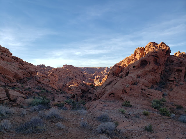
There was a fair number of cars at the trailhead as I started off down upper Fire Canyon Wash and into the maze of redrock fins, spires, pinnacles, hoodoos, hobgoblins, and other fanciful formations. But the path itself fortunately wasn't as crowded as I thought it might be, so I strode along in reverent awe of both the landscape and the various petroglyphs scratched into the black patina on the adjacent sandstone walls by the ancient Basket maker and Anasazi people who inhabited this place some 2000 years prior.  

A short distance later, the trail abruptly terminated at the Mouse Tank (or more accurately, at a precipice looking down onto the Mouse Tank). "Mouse" (or more appropriately, "Little Mouse") was apparently the name of a renegade Southern Paiute who used the Valley of Fire as a hideout in the late 1800s. The "Tank" is a natural basin where precious water collects after the rains. Thus, the Mouse Tank.

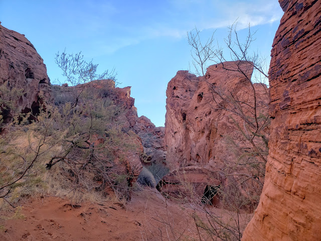
Not willing to end my exploration so early, I scampered up a rocky bypass to the left and then dropped down into the Mouse Tank. I then continued down canyon following the sandy stream bed further into the bowels of fantastic Fire Canyon Wash. Initially, the wash was broad and the going easy. But as I penetrated further into the canyon, the path narrowed, the walls closed in, and the going got considerably more interesting. Here I found myself scampering around, crawling over, straddling, and ducking under large sandstone blocks that clogged the drainage and impeded the path forward. It was both fun and challenging and I was enjoying the serenity of the gorge which I had to myself. Ultimately, however, I reached a blockade that choked off further access to the drainage without a bit of down-climbing. It was potentially a point of no return. Being solo, and uncertain whether I could climb back out if I committed, I reluctantly decided to become a SAR statistic another day and retraced my steps back up canyon. 

On my initial descent, I noticed another drainage entering from the right as I came down canyon. I still had time and daylight, so on my way out, I decided to explore this drainage as well. This ended up being less of a gorge and more of a shallow valley with a dry creek bed running up its center. I followed a faint use or game trail for awhile until I topped out at a flat saddle. To the east, there was an endless jumble of more sandstone. To the north and south the same. An endless playground for rock-hopping and off-trail scrambling. This was no country for old men.

Coming back down the valley I could see in the distance exactly where I needed to end up, but navigation in the redrock desert is tricky because everything looks the same. So ultimately I found myself in a slot of sorts that I knew was unfamiliar. Obviously on the descent, I'd failed to pay close enough attention to what I was doing and had veered off track. This is both the thrill and peril of desert hiking. It's very easy to get disoriented and lose your way. And when the temperatures are scorching, such an error can easily prove fatal. 

Recognizing what I'd done, I doubled-back to the point where I zigged when I should have zagged, and then returned to the Mouse Tank wiser but without incident.

Fire Canyon Wash

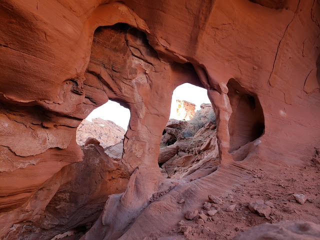
Sandstone Windows

Fire Canyon Wash

Back on the established trail, I noticed another side drainage with a sort of use trail entering again from the right (or the left if you are returning to the trailhead). Figuring I might as well leverage my limited time in the park as much as possible, I tacked hard left. Initially, the drainage was a flat and sandy walk. But a short distance in, I hit a crag where the path continued up a crack that split the rocky monolith. The climb up wasn't terribly challenging although it did add nice variety to the outing. And when I topped out, I was rewarded with more outstanding looks at the surrounding area.

It was now late afternoon, the shadows were creeping across the landscape, and the air was getting noticeably cooler. Time to leave.  But on my way out, the Valley of Fire gave me one last gift. Just outside the park entrance, the handful of cars in front of me all came to a sudden stop. For a moment, I thought perhaps there had been an accident of some sort. But then I saw what all the commotion was about. A solitary desert big horn sheep was foraging immediately roadside, unfazed by the crowd of gawking onlookers. As I pulled along side to snap a picture out the passenger-side window, the sheep glanced at my without any apparent interest and then continued crunching away on the local grasses. 

Back at the I-15, I pulled into the Moapa Travel Plaza thinking I'd pick up a nice six-pack of craft beer before crossing into the land of Zion where the selection is limited and the prices are high on account of "sin" taxes. I have heard Mormons jokingly refer to this governmental levy of additional taxes on the "Gentiles" (anyone who is not a Mormon and therefore, in theory, doesn't drink) as "bleeding the Beast." Ha, ha. Yeah, totally hilarious. All those drinkers and smokers subsidizing the Utah educational system for the benefit of all the hyper-fecund Mormon couples. Bleeding the beast indeed.

Anyway, I was surprised and dismayed to find that the Travel Plaza had a pretty uninspiring selection of beer to choose from. Coors, Miller, Budweiser - mostly just shitty, mass-produced American lager in gigantic quantities. Pass. I drank that swill growing up as a young apostate in Utah and I wasn't going there again. So I continued up the road to Mesquite where I stopped at Lee's Discount Liquor instead for my weekend supply of adult malt and grain beverages.  

Having got a sample of what the Valley of Fire has to offer, I'm now all hot to return on my next pass through Moapa for further exploration. Although it's a relatively small park, there's still quite a bit of territory left unexplored. 

Valley of Fire Petroglyphs

Desert Big Horn Sheep - Valley of Fire