Monday, November 23, 2020

Ain't No Cure for the Pandemic Blues

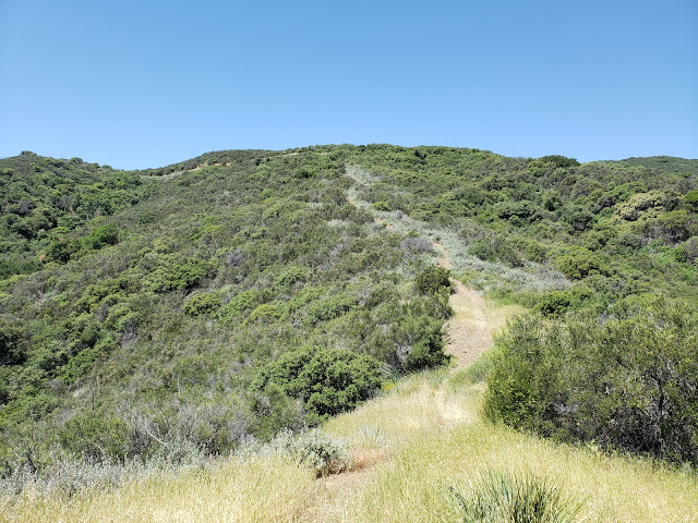
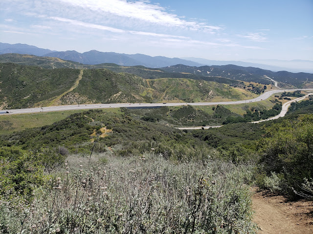
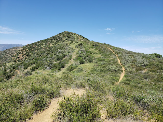
Muau Flat Thorn Point
Thorn Point and Mutau Flats

Sometimes I wonder what I'm gonna do
But there ain't no cure for the summertime blues
~Summertime Blues, Eddie Cochran

So I'll meet you at the bottom if there really is one
They always told me when you hit it you'll know it
But I've been falling so long it's like gravity's gone and I'm just floating
~Gravity's Gone, Drive By Truckers

As you can tell from looking at the large gap between posts here, I haven't been inspired to write much lately. The process has always been a laborious challenge for me, but now it's a real struggle to even put pen to paper. Being the opinionated bastard that I am, it's not that I don't have anything to say. Just ask the people around me. They know that I'm rarely at a loss for words. And they're probably grateful for the respite from my constant yammering and bloviating. But the whole thing weighs on me. The muse has abandoned me without notice and everything I try to write now feels forced and inauthentic.

But these are strange and frightening times we're living through. People are fucking dropping dead from an enemy that can't be seen or fought. We're all wearing face-masks at the grocery store for fear of contagion. I haven't shaken a stranger's hand or given someone outside of my bubble a hug in months. I'm maxed out on vacation accrual, but can't go anywhere to use it. The restaurants and malls are empty, but the trails are packed with people, graffiti, and trash. And politicians' promises notwithstanding, it don't look too much like things are going to get materially better for the average person any time soon. So yeah, things are kind of fucked up right now. For that reason, I guess my muse can be forgiven for perhaps having a case of the pandemic blues.

In an effort to get out of my funk, I decided a day in the woods would be good for my soul. So last Friday, I played hooky from work and headed for San Rafael Peak, a seldom-visited summit deep in the Sespe Wilderness. 

The Iron Hiker joined me on this adventure. The original plan, devised by the ferrous one, was to hike Hines Peak and Cream Puff from the eastern terminus of the Nordhoff Ridge fire road. To do that, we needed a permit from the Forest Service. But that plan was foiled when fires closed the entire Los Padres for a spell and permits became unavailable. Then, the normal, seasonal closure of the Nordhoff Ridge road went into effect guaranteeing that we would not be doing Hines Peak the easy way until next spring. So we went searching for a remote, uncrowded, and challenging alternative. San Rafael checked all of those boxes nicely. 

Grade Valley Road
Morning Commute

Cattle Drive

We met early at the entrance to Grade Valley Road and then drove the 10+ miles south on a washboard dirt road to the Johnston Ridge Trailhead. Sunlight peaked through the forest canopy as we went and I kept an eye out for wildlife as the conditions seemed ripe for a sighting or two. Unfortunately, all we encountered was a herd of bovine blocking the road that weren't in any particular hurry to cede ground to us. But being the superior beings that we are, we dispatched the dumb beasts with a couple of blares of the horn and we were on our way. 

The trailhead parking area was vacant. We were the only ones in the forest. We gathered our gear and started off, heading southeast on a well established trail that skirts Mutau Flats to the south as it drops about 200' in elevation to Mutau Creek. The word "Mutau" features prominently in this part of the forest. Although linguistically it sounds like it could be Chumash in derivation, it's actually the last name of a cantankerous old horse rustler who homesteaded these parts. Old Man Mutau, who settled in the area that is now the flats, was a known ally to horse thieves who moved stolen horses along the Horse Thief Trail from southern Ventura County to Kern County. Mutau, whose homestead sat right along the trail, permitted rustlers to use a canyon on his homestead (appropriately named "Horse Thief Canyon") to graze purloined horses before they were moved off to Tehachapi to be sold to work crews who were constructing the railroad from San Francisco to Los Angeles. Old Man Mutau met his maker at the flats that now bear his name when was ultimately shot and killed there.

Little Mutau Creek Trail
No Country for Old Men

Mutau Creek Sespe Wilderness
Mutau Creek

Little Mutau Creek Trail
Breathing Room

Mutau Flat
Moo-tau

Mutau Creek was still flowing some, so we splashed through and started up a minor drainage that climbed to an obvious saddle at 5,729'. Along the way, we found a mylar balloon with a bright pink boa that we would retrieve on our way out. (PSA: stop releasing mylar balloons into the air people!) At the saddle, the trail continues east, dropping into the Little Mutau Creek drainage. Here, however, we abandoned the trail, opting to go cross-county in a southerly direction over a serious of bumps that lead to San Rafael Peak. 

The Sierra Club says that the navigation along this part of the route is "difficult," but we found it to be pretty straight-forward. At one stage, we wandered slightly off-track, going too low on the northeast flank of Pt. 6,408, but we quickly righted ourselves by making a steep climb back to the ridgeline which has expansive views of Hot Springs Canyon and the Sespe Creek drainage. We then traversed one final minor bump and made the steep climb to the summit. 


San Rafael Peak Route
Going Off the Grid

San Rafael Peak Route
Dragon's Back

San Rafael Peak
St. Raphael

Hot Springs Canyon
Home of Hot Springs

Atop San Rafael we had 360-degree views of the entire Ventura County backcountry. Cobblestone, Topa Topa, Devil's Heart, Hines, Chief, Thorn Point, Haddock, Reyes, and Pinos are all clearly visible from summit. We logged our appearance in the summit register which dated back to 1974 and then lollygagged in the warm sun and tried not to share our snacks with a bunch of insistent hornets that magically appeared every time a plastic baggie or foil was opened.  

Then it was time to go. Days are short this time of year and light a precious commodity. We were well equipped with lighting, but really didn't want to have to rely upon it. So we retraced our steps back to the trailhead and began the long drive back to the reality of life in a pandemic. I can't say that this little adventure cured my pandemic blues or broke my writer's block, but as the old saying goes, "sometimes you just need to go off the grid and get your soul right." And my soul was right on this day. 

Cobblestone Mountain
Cobblestone Views

Devil's Heart Peak
Topa Topa and Devil's Heart

Summit Pano

Thorn Point
Thorn Point, Haddock and Reyes

San Rafael Peak Route
Going Back Home

Saturday, August 8, 2020

Eustace Bagge Joins the Trail Crew


Wheeler Gorge Visitor's Center

Sentiment without action is the ruin of the soul.
~Edward Abbey, A Voice Crying in the Wilderness

Get away from me!
~Eustace Bagge, Courage the Cowardly Dog

I've never been much of a "joiner." What I mean is that I've never been terribly fond of becoming part of some collective "we" that assembles sporadically or regularly to accomplish some task or to engage in a communal activity. I've done that type of thing before in my life, but it's always felt unnatural, inauthentic, and slightly forced. And if I'm honest with myself, it has almost always been the consequence of some self-imposed social pressure and the silly desire to fit in, to be accepted, to be one of the "cool kids." Even if that meant suppressing my natural inclinations and/or tempering my instinctive nerdiness and unconventional world-view.

So as a young lad, I participated in scouting, first as a Cub Scout, then a Webelo, and finally a full-fledged Boy Scout. I liked the actual scouting piece of it, but not so much the group dynamic. I also found the cozy admixture of knot-tying and religious indoctrination troubling if not downright repugnant. What in God's name did staking a tent or starting a fire have to do with Jesus anyway? Nothing as far as I could tell other than keeping me in-line and on the straight-and-narrow. But I didn't really care to be on the straight-and-narrow. And neither the scouts nor "the brethren" appreciated doubters, independent-thinkers, or trouble-makers. After all, there were rules to be followed, flags to be saluted, invisible Gods to be worshipped, and serious oaths to be taken. And that wasn't me. So before I ever achieved my Eagle, I drifted away a scouting loser much to the dismay of my poor mother who must have regularly asked herself "why can't he just be like all the other good Mormon boys?"

When I got older and entered college, I followed my childhood best friend into a frat house. Our friendship was waning some at that stage, but I still looked up to him. And I was a follower. So where he went, I went. And that was into Greek life. It was a fraternity for mostly white, good-looking, athletic and popular kids from the wealthy side of town. Lots of BMWs, loafers, Polo shirts and everything that went along with that. I was somewhat surprised they even let me in the door. I'm even more surprised that I knocked in the first place. With my long hair, VW Rabbit, aversion to golf, flannel shirts, and crunchy enviro-ethics, I was an anomaly. And as soon as I was permitted entrance into the the exclusive club, I regretted what I had done. I'm sure my fraternal brothers harbored some regrets of their own. So I slunk away from the whole ridiculous scene to spend time with the hippies, dorks, and dope-smokers in the Biology department who shared my nascent enthusiasm for evolution, ecology, and systemmatics. That afforded me the opportunity to spend part of a summer in independent study sitting in a lab picking microscopic nematodes off of root knots for a tenured professor who was researching how marigolds rebuff the parasitic little roundworms. 

You could be forgiven at this stage for thinking that perhaps I'm a loner. But it's not necessarily that I'm anti-social, or that I don't like people. It's just that I'm anti-social and don't like people. Or at least I don't like lots of people doing the same fucking thing that I'm doing at the same place and time that I'm doing it. I don't need that type of camaraderie or want the social stroking. And I don't fancy the associated chaos, complexities, and cacophony that comes with group projects and outings.  

My predilection for crowd-avoidance has carried over to my outdoor activities. I don't enjoy large group hikes so rarely participate in them. They typically involve too much disappointment and compromise. Somebody's late. Someone else bails at the last minute. There's the constant stopping and waiting for the group to reassemble at every conceivable trail junction lest someone gets lost because they didn't think to look at a damn map before going out. Then the group has to wait for me because I'm older and dragging the pace down. Fuck that. I don't want to be the subject of furtive glances and frustrated whispers.

Beyond all of this, at base level I'm just a selfish bastard with my limited outdoor time. I don't want to go where you want to go. I want, to go where I want to go. And when I want to go. And how long I'll stay there. Admittedly, that's not a particularly endearing quality, but at least it's honest. But honesty only gets you so much these days, so more often than not, my hiking companions are limited to me, myself, and I. No one else can stand to be around me. I am the Eustace Bagge of the hiking world.

Because of that, I'm not exactly a prime candidate for organized trail work parties. I've done trail work and trash pick-up before, but only as a solo, guerrilla undertaking. I've cleared both Russian Thistle and Black Mustard by myself from my local trail. I've hauled many a heavy load of broken glass from the slabs in the hills near my house where teenagers escape to get inebriated and then joyously fling their empties down the sandstone rock-face to explode into a millions glittering shards. And I've picked up and carried out of the hills more candy wrappers, cups, soda cans, water bottles, buger-encrusted tissues, sweat rags, pee rags, shit rags, dog shit in baggies, and dirty undies than I can remember. But it's always been a solitary effort.  

Until recently that is. Contrary to my natural predisposition to go it alone, I've recently tried my hand at some actual, organized and officially-authorized trail work. You know, the kind of work where some government functionary pre-clears everything you intend to do, dictates the number of people that can participate, approves the types of tools that can be used, and drafts the language of the release that you must sign to prevent you from suing when you stab a Pulaski into your shin or an unseen rattlesnake sinks its fangs deep into your calf. All while sitting in an idling truck in the parking area burning fossil fuel and just waiting to hand some poor slob a ticket.  

My first go at this was in Santa Paula Canyon shortly after it was closed to the public due to over-crowding. Santa Paula Canyon has been an abused and graffiti'd trash-heap for years, but with crowds swarming the place because of the pandemic, it had become a veritable sewer. Spray-paint marked every rock, stump, and branch. Garbage was strewn hither and yon. Used diapers, feminine products, and reproductive prophylactics were not an uncommon sight. New use trails all through the canyon bottom spontaneously appeared. In short, the place quickly went to hell, but the Forest Service, perpetually short on money and man-power, was ill-equipped and/or unwilling to assume the mantle of responsibility and do anything about it. 

Enter Santa Paula local Ellie Mora aka mtnbabe aka Los Padres badass who took control. She solicited and obtained the Forest Service's blessing, organized a clean-up, secured the necessary tools, and then recruited help. Fortuitously and fortunately, I ended up being part of that help. I was joined by a bunch of other like-minded, yet much younger forest regulars as well as local Boy Scout Troop 111. Over the course of several outings, the group scrubbed or covered-over graffiti, removed multiple dumpster loads of some of the most disgusting garbage imaginable, reconfigured and improved trails, trimmed evil poison oak, and broke down and removed rock dams from the creek-bed. Very dirty, difficult, yet immensely satisfying work. Especially when your regular routine is to sit behind a desk for nine hours a day staring at a screen and getting a pasty fluorescent light tan. Getting grimey is good for the soul.

Then this past weekend, Ellie organized another work party in conjunction with the Los Padres Forest Association. This time, we would be working the nature trail at Wheeler Gorge just north of Ojai along Highway 33. As I drove up Grimes Canyon at 7 a.m. and then began the swirly drop into the Santa Clara River valley I could already feel the heat coming on. The weather gods had guessed it was going to be 102 and it felt like they were going to be right. Clad in long pants, long sleeves, and work boots to keep the itchy and poisonous plants at bay, the dread began welling up in me.

Forty-five minutes later I was at Wheeler Gorge with the rest of the work crew. After demonstrating the the proper use of the mcleod, Ellie informed everyone that we would be segregating into two different groups: one group would work the upper trail in the scorching sun, and the other group would work creekside in the shade ripping out poison oak. Make your choice, heat or poison oak. I pondered this "damned if you do, damned if you don't" proposition and decided I'd take the heat. I had just recovered from a nasty bout with poison oak and I wanted no part of that again. Then Ellie said she also needed a couple of volunteers to walk the creek and bust rock dams. No one raised their hand so I jumped at it. A third option that didn't involve heat or poison oak? Mama didn't raise no fool. 
For the next three and half hours, my work companion (code name Bear Woman) and I splished and splashed through the N. Fork of Matilija Creek finding artificial rocks dams and then dismantling them. This involved lifting and moving an endless number of heavy rocks, tree trunks, and other material from the creek and redistributing it elsewhere so that the creek could again flow freely. It's surprising how much effort some folks will go to in order to build these annoying things in the first place. It involves some degree of engineering, a lot of time, and a lot of muscle power. Just for a trailside pool.

Anyway, when we finished our task, we committed to head up trail to let Ellie know we were done. At that moment, she suddenly appeared on the rise above us to tell us her crew was finished as well. So we all picked our way through the forest back to where we began and called it a day before the real sweltering heat set in.  

So does this mean that I'm now cured of my group-phobia? Am I jonesing to go on a hike with 20 others? Not really. I'm still pretty much a cranky old lone wolf. I'll continue to do my own, unauthorized thing. But when it comes to trail work, I definitely have no aversion to linking up with what I consider to be the next generation of local Los Padres hot-shots and stewards. When it comes to them, I've become a "joiner."


Sunday, July 26, 2020

They Can't All Be Winners


Cascade Canyon
Entrance to Cascade Canyon

Thurman: Have you seen my advent calendar?
Willie: What the fuck is it with the advent calendar?
Willie: What are you so obsessed with that goddamn thing? The story sucks anyway.
[Feels badly for yelling at Thurman]
Willie: I think I saw it out there in the hallway.
Thurman: Really?
Willie: I think so.
[Thurman retrieves calendar]
Thurman: Looks like someone messed with my advent calendar.
Willie: What are you talking about? Let me see.
Willie: Nobody messed with it. It looks fine.
[Thurman opens calendar]
Thurman: There's a candy corn in this one.
Willie: Well they can't all be winners, can they?
~Bad Santa (2003)

There's a discernible "wart," "bump," "protuberance," or whatever you want to call it along the dramatic ridgeline leading south from the summit of Ontario Peak. It's not a recognized "peak" in its own right, but it is prominent enough in relation to the rest of the ridge to be instantly recognizable from both near and far. Peakbagger refers to it as a "provisional" peak. Everyone I know just calls it the "Turtle's Beak,"  so named because (i) it does somewhat resemble a terrapins's schnozz, and (ii) the alter-ego of the first guy reputed to climb it was named "Turtle."  

When Turtle first climbed the beak, he approached it from the north. After scaling Ontario Peak, he then dropped along the ridgeline south, roller-coastering over a series of humps before finally achieving  the objective. It was an arduous overnight affair, and along the way he encountered a sea of buckthorn and other nasty flora.

Since that first ascent, a handful of other hardy souls I know have visited the Beak. But instead of following in Turtle's gigantic footsteps, these folks discovered an alternate route that avoids the impenetrable buckthorn of Ontario's south ridge. The approach also shaves miles off the "standard" route. This "shortcut" involves going right up the steep gut of Cascade Canyon to attain the ridge immediately north of the Turtle's Beak. It's a 3,000' scramble up a wild and trail-less canyon that involves some route-finding and class 3 exposure. 

  
Cascade Canyon is a notable destination for rock-hounds. Not only can corundum crystals be found here, but it is reputably one of the few places in the United States where one can find rare lapis lazuli. Getting to the veins of the uncommon mineral is quite a challenge, however because the deposits are located in the steep, remote, and rough upper stretches of the canyon. Mining for the semi-precious stone has occurred here in the past with limited degrees of success, but those days are now gone (although the north fork of the canyon supposedly still harbors the visible remnants of one of these operations). Amateur collecting is now all that occurs here.

The Iron Hiker, an accomplished peakbagging friend a mine, determined that it was time to visit the Beak and he invited me along. He'd done his due diligence and spoken to others who had ascended Cascade Canyon before, and his plan was to essentially repeat their efforts. Always game for an adventure in the forest, I agreed to the join in on the fun. 

We met at the parking area at Barrett-Stoddard Road at 6:00 a.m. and soon headed off for parts unknown. The morning was clear and cool as we walked easily along the well-maintained fire road, crossing the still-flowing creek at North Fork Barrett Canyon and passing the intriguing Gingerbread House. Beyond the last reclusive home in the canyon and a forest service gate, the road leaves the forest's protective canopy to burst out into the open, permitting unique views of San Antonio Canyon, Sunset Peak, and Lookout Mountain.   

Barrett-Stoddard Road
Views Along Barrett-Stoddard Road 

Barrett-Stoddard Road
The Beak (center-right) from Barrett-Stoddard Road

Cascade Canyon
Starting Up Cascade Canyon

A short distance later, we were at the obvious entrance to Cascade Canyon which didn't look particularly inviting. We paused briefly to double-check our bearings, put on our battle armor, and headed in. Initially, there were signs here and there that others had been in the canyon. Most likely rock-hounds. We followed their faint trails as best as we could until they eventually petered-out entirely. Then it was just a matter of following the drainage straight up the canyon. 

But this was no easy task. There is no established route so we were basically just feeling our way up the drainage. And the canyon is a continuous obstacle course of dislodged boulders, thick dead-fall, impenetrable brambles, spider webs, and poison oak. Progress slowed to a crawl as we climbed over and ducked under downed trees, hopped from unstable rock to unstable rock, and delicately danced and shimmied as best we could around, over and through the ubiquitous stands of poison oak. 

Cascade Canyon

Cascade Canyon

Cascade Canyon

Cascade Canyon

After what seemed like a couple of hours of moving but not making much progress, we hit a veritable wall of thorny blackberry bushes. To our right, the hillside opened up some affording an opportunity to leave the hostile canyon floor. We took that opportunity, optimistic that it would allow us to bypass the blackberry rampart. But not long after that, our hopes were cruelly dashed when we cliffed-out high above the canyon bottom. We could look down and see exactly where we wanted to be, but getting there was too treacherous. Back at the blackberry wall, we re-assessed our situation and decided it best to abandon the effort. Begrudgingly, we rock-hopped and brush-bashed our way back to Barrett-Stoddard Road.

Since it was still early and we felt the need to at least go home with a participation trophy, we continued south on Barrett-Stoddard Road to climb nearby Stoddard Peak. The road-walking was easy and chatter distracting and we were soon at the saddle that separates San Antonio and Stoddard Canyons. Here, a well-established use trail peels off to the right to ascend the short ridgeline on which Stoddard is the third knob to the south.

After passing some interesting rock formations near the middle bump, we arrived at Stoddard proper where we cooled for a bit, had some snacks, and absorbed the fine vista. There's a triangular witness post on the summit, but we didn't find a register. We did, however, find a red ant colony, some of which were of the flying variety. And the voracious little bastards didn't appreciate our presence and started stinging. Or at least they started stinging me. The Iron Hiker, apparently ill-tasting and immune from red-ant scorn, sat bemused as I stripped off clothing to rid myself of the demonic and cantankerous little pests. 

Eventually, he (and I) had had enough and we started back. The road walk went quickly, but less so than on the way out. Or so it seemed. It's always that way for some reason. Maybe it's the Christmas-Day excitement of going out that makes the miles pass so effortlessly, and the dread of returning to reality that makes them creep by so slowly. Regardless, back at the previously vacant parking area, cars now filled every available nook, cranny, crevice, space, and spot. A canyon resident was there sweeping the dirt off the "No Parking - Fire Zone" markings on the pavement and barking at scofflaws who responded with everything from indifference to disdain. I chatted with her some as she put her broom into the back of her SUV. She confirmed what I already knew: since the pandemic began, and bars, restaurants, movie theaters, bowling alleys, and other amusement establishments all closed, the canyon has been overrun by what a grumpy acquaintance of mine disparagingly calls the "filthy casuals." And it's having a real and negative impact on our open spaces. Trash, graffiti, and other urban and suburban-type fuckery is now a regular part of the outdoor experience courtesy of those who have spent the better part of their existence indoors. 

A vaccine for Covid can't be developed and deployed quickly enough so that these indoor refugees can finally get back where they belong and they really prefer to be: indoors.

San Antonio Canyon Road

Stoddard Peak

Stoddard Peak Summit


The almost "standstill" speed represents the time spent in Cascade Canyon. Very slow going.


Tuesday, May 26, 2020

Red Mountain - Over the Hills and Far Away


Red Mountain

Red! I want red, there's not substitute for red
Red! Paint it red, green ain't mean compared to red.
~Red, Sammy Hagar

The Memorial Day weekend. The traditional start of summer. You know, the 3-days in May when folks that don't usually spend time outdoors unpack their tents and sleeping bags and propane stoves and massive coolers and firewood and boom-boxes and other camp-life accouterments and head for the mountains or forests to temporarily squat in the dirt in close proximity to others, stay up drinking and hollering into the wee hours of the morning before passing out, and rising badly hung-over at the break of dawn to repeat the cycle. Yeah, that weekend. It's typically an unpleasantly frenetic time to be out as "irregulars" swarm the great outdoors, finally unrestrained by the cool, dim days of winter. That communal need to break out is particularly acute this year. For this is the year of COVID. Thus, and either because of self-restraint or governmental edict, most people have not ventured too far from their home turf for the last couple of months. Now their feet are itchy. And Memorial Day weekend is an opportune time to finally scratch that itch. 

Like every red-blooded, patriotic American, I wanted to scratch too. My conundrum was that I wanted none of baggage and risk that comes with rubbing feet and shoulders with a gaggle of my potentially virus-infected citizens. Or perhaps that's just an excuse. Maybe I'm really an anti-social, elitist that is just using the pandemic to justify my isolationist tendencies. I admit that possibility. Either way, what it meant for me was once again finding a place that very few people want to visit. After scouring the maps, that place appeared to be Red Mountain. 

At 3,996', Red Mountain is a relatively unsexy peak located in a sort of no-man's land of the Angeles National Forest. Sandwiched between Elizabeth Lake and San Francisquito Canyons, Red Mountain sits sentinel high above the Fish Arm of Castaic Lake which is visible to the south. There are no established trails or fire roads leading to its summit. Trip reports are difficult to find. But satellite imagery shows an obvious firebreak carved into Red's steep southern ridge that ultimately tops out on the summit. That firebreak must be courtesy of the Powerhouse Fire that burned a good chunk of the forest to the immediate north in 2013.
 

The ridge route begins from a dirt parking area along Dry Gulch Road about 0.6 miles to the east of Lake Hughes Road. It starts as a jeep road that immediately ascends a short, steep hill and then morphs into the firebreak. Shot-gun shells and sparkling broken glass litter the area which has been abused like many other easily-accessible areas of the Angeles. 

The firebreak itself is slowly being reclaimed by mother nature. Brush impedes the way forward or encroaches onto the path in several locations, although it is easily manageable. For now, a rogue motorcycle track is keeping a narrow path open and visible. In a few years or less, that track will inevitably vanish under a thick carpet of wild grasses, chamise, black mustard, yucca, and other unfriendly flora. Unless, of course, another wildfire torches the area which, in Southern California, is always a possibility.

Given its southern exposure, the route up Red's firebreak is a hot and shadeless march. It's also a steady climb from bottom to top that begins modestly, but then gets serious quite quickly. In a number of places, the slope is so mercilessly and relentlessly steep that it is difficult to maintain your footing. It's truly impressive to think about the guys who ran a dozer up this damn ridgeline to create the break.

That is not to say that it is all up. The firebreak continually roller-coasters up and down all the way to the 3,600' contour where it intersects with Red's eastern ridgeline. As a result, the track drops sharply in a number of spots before resuming its upward trajectory. Consequently, the climbing isn't done once you reach Red's summit. You get approximately 400-500' of climbing on the return as well which is a bit demoralizing. 

Red Mountain Ridge Route
Lower Section of the Firebreak

Red Mountain Ridge Route
One of several drops along the ascent 

Red Mountain
About the mid-way point. Red in the background.

Red Mountain Ridge Route
One of the steeps climbs on the way "down."

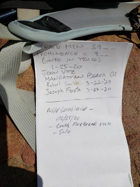
So with all of that glamour, who could possibly resist the allure of Red Mountain as a destination hike? As it turns out, pretty much everybody. The day I went I didn't see a single soul which was fine by me. And that appears to be the norm with this particular peak. On the flat summit, there is a large cairn that houses a summit register. That register, which dates to January, 2020 only had two other entries. One in January by the climber who originally placed the register, and a second in March of 2020. My entry made it a total of three in a five month period. Not much action for a peak that is within spitting distance of 15 million or so folks.

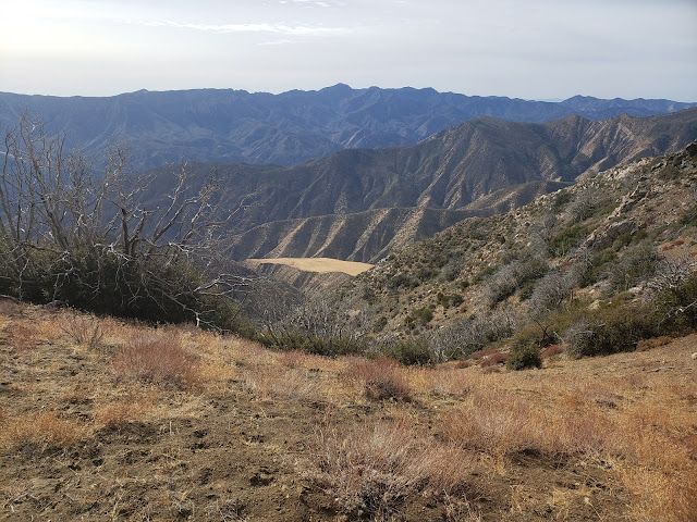
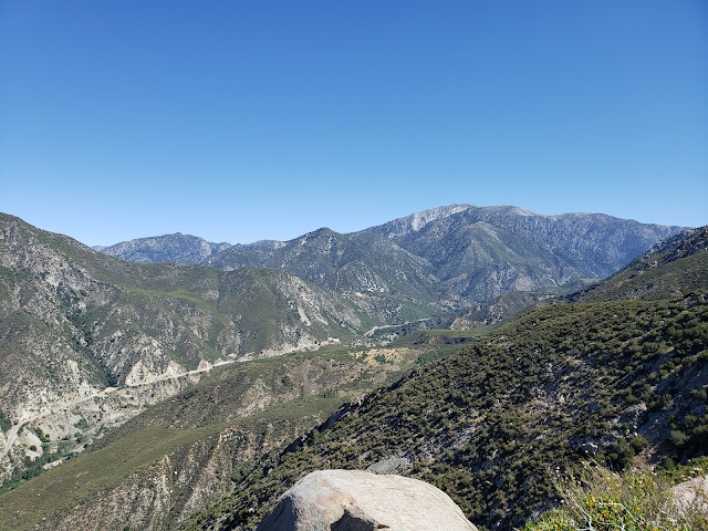
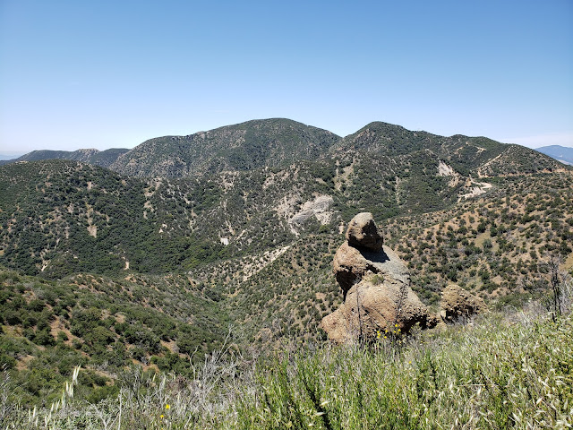
And in a sense, that is unfortunate because of the somewhat unique views that Red affords of the surrounding area. Looking south from Red's summit you get nice views of Castaic Lake and lower San Francisquito Canyon. To west you can see Warm Springs Mountain and its associated ridge. To the north, Lake Hughes is visible at the head of Lake Elizabeth Canyon.

Based upon the USGS and Forest Service topographic maps, there are two benchmarks on the summit of Red: "VABM 3996" and "Red." They are both supposed to be in close proximity to one another near the high point, but I wasn't successful in locating either of them. Then again, I wasn't that terribly diligent in my search either. I suppose finding those benchmarks will have to await my next visit.

After a half-hour on the summit, I started back down the eastern ridge, lost in thought and dreading the several steep climbs I knew were still ahead. Then, the terrain suddenly began to look unfamiliar and Red looked considerably more distant over my shoulder than it should have been. Trying to make sense of situation, it finally occurred to me that while I was day-dreaming, I had over-shot the firebreak. So I had to back-track up the ridge to the firebreak junction adding some additional, gratuitous climbing to the outing.

I don't normally keep stats, but on this outing I used my snazzy View Ranger app. According to it, the trek to Red is roughly 7.7 miles with approximately 2,680 feet of elevation gain. It took me 4.5 hours to make that journey which probably sounds slow, but I wasn't out to make time. I was out to spend time. Alone.  Far from the madding crowds. And you can accomplish both of those lofty objectives on the trek to Red Mountain. 

Red Mountain Summit
Summit Cairn

Red Mountain Summit Register
Summit Register

Warm Springs Mountain
View West to Warm Springs Mountain

Lake Castaic
View South to Castaic Lake

Red Mountain Summit
View North to Lake Hughes

Elevation Profile


Friday, May 15, 2020

Coming Back to Life - Whitaker Peak


Whitaker Peak

Lost in thought and lost in time
While the seeds of life and the seeds of change were planted
Outside the rain fell dark and slow
While I pondered on this dangerous but irresistible pastime
I took a heavenly ride through our silence
I knew the moment had arrived
For killing the past and coming back to life.
~Coming Back to Life, Pink Floyd

Like most everyone else, I've been hibernating during these dark and uncertain times of fear and death and viruses and hoarding, making more effort than usual to avoid my fellow countrymen and countrywomen. My natural anti-social tendencies and crowd-avoidance inclinations have made this less difficult for me than perhaps others, but even I've been getting the itch to get out and experience something other than my garage. The treadmill is useful and all, and I'm grateful that my wife had the foresight and the tenacity to provide for that outlet, but walking and running on a rotating belt at a maximum 10% grade while staring at a shelf stacked with unused camping gear is a sad and depressing affair. It just doesn't have the same allure as the real deal. As good as innovation and technology are, they can't replicate the sights, sounds, smells, feel, and, most importantly, the exhilaration of the trail. Bashing through thick and unforgiving brush, swatting annoying flies and ticks, dodging dangerous rattlesnakes, cursing un-Godly steep ridges, cursing the oppressive heat, cursing the bitter cold, finding a route where there is no route, worrying about whether you brought enough water, worrying about whether you'll make it back to the car before the sky goes dark, and enjoying a well-deserved summit beer after all of that are experiences that are unique to actually being out of doors. And damn do I miss every aspect of that.

So with some local governments cracking the door slightly ajar this past weekend, I took advantage and made a dash for the hills. Recognizing that literally everyone else in the greater Los Angeles metropolitan area was probably going to do the same, I strategically looked for a location that didn't have high "ooh-ahh"allure to keep away, what an acquaintance of mine disparagingly calls, the "filthy casuals." If it was shadeless, waterless, scrubby, involved some off-trail travel, and was reasonably proximate, those were all additional, positive considerations I took into account. So, after considering all of those factors, and pouring over CalTopo, I settled on Whitaker Peak near the far eastern boundary of the Angeles with the Los Padres. At just around 10 miles round trip and 1,600 feet of gain, this seemed like a decent selection to ease me back into the game.

There are actually two "Whitakers," east and west that are separated by a low ridge. At 4,102', "west Whitaker" is the location of the former Whitaker Peak Fire Lookout and is reputed to experience some of the most ferocious winds in the Angeles National Forest. Today, the summit is the unattractive host to a radio communication tower and related equipment. At the opposite end of the ridge is "East Whitaker," the actual high point at 4,148'. This eastern bump would be my destination.


The standard route to Whitaker involves a bunch of road-walking. From Templin Highway, paved Whitaker Peak Road (6N53) climbs to the ridge to intersect with another road, 6N53B. That road (partially paved, but mostly dirt) tacks southwest and ultimately takes you to the summit of "West Whitaker." An alternate route follows a single-track out of Camp Verdugo Oaks at Oak Flat to the ridge where it joins 6N53B. From there, its a long road-slog out to "West Whitaker."

Fortunately, there is an alternative to the alternative that trims some of the road off the route and allows for more enjoyable travel by trail. Looking at aerial imagery of the area, I noticed a distinct track climbing to the ridge off Templin Highway just south of the entrance to the Whitaker Peak Road. That track cut through the chaparral to ascend a minor ridge before intersecting with  and joining 6N53. Shortly after that, the trail again diverges from the road, shaves the first big hairpin turn, the parallels 6N53 to the southwest along a ridgeline. It rejoins the road at the ridgeline where 6N53 and 6N53B become one.


The trail is not immediately evident as it leaves Templin Highway, but after sniffing around some I found it. It appears to be primarily a motorcycle or perhaps an MTB route that sees enough use to be established. The lower section is quite steep in places, but that steepness subsides after you intersect with 6N53. Above that, the trail climbs enjoyably to the ridgeline where views of Canton Canyon to the south and Whitaker to the west begin to open up. As I climbed this upper section, an endangered California Condor glided by, riding thermals in the cloudless sky.

Lower Whitaker Peak Trail
Lower Trail

Whitaker Peak Trail
I-5 from Lower Trail

Upper Whitaker Peak Trail
Upper Trail

Whitaker Peak Trail
View South from Upper Trail

Here, the dull road walk began. The road, which is asphalt here, gently drops maybe 150' to a saddle, turns to dirt, and then starts a gradual climb toward "West Whitaker" to the south. Along the way, grand vistas to the west open up showing off Cobblestone Mountain, the Condor Sanctuary, and the seldom-visited areas of the Southern Los Padres. Turning back north, you can see Slide Mountain and the Fire Lookout tower perched atop it.

As the road nears its terminus, it skirts a low saddle along the ridgeline that separating the two Whitakers. Here, I scrambled up the embankment, attained the narrow ridge, and then bobbed and weaved my way cross-country to the summit of Whitaker proper. There is brush here and it is generally negotiable, but I did need to drop beneath the ridgeline in several places to find the path of least resistance. 

Atop the summit, I located a summit register and signed in. Whitaker doesn't see much action, and the signatures dated back to January, 2011 when the current register was first placed there. There is reputedly a benchmark at the summit as well, but I did not see it. I later learned that it is immediately adjacent to the rock pile housing the register, but that it is counter-sunk. Had I known that at the time, I probably would have put in some effort to clear the dirt away and locate it. Oh well.

The summit of Whitaker itself isn't terribly interesting or inviting. It is broad, flat, shadeless, rockless, and brushy. I borrowed a rock from the summit cairn as a seat, stripped off my sweaty shirt, and sat in the sun brushing pesky flies away as I rehydrated and enjoyed a snack. Then I retraced my steps back to my car that was parked on the wide shoulder along Templin Highway. On my way out, I passed the only person I saw all day going in my opposite direction on 6N53B.

I didn't keep stats for the day. I rarely do that as that is not my primary objective when I go out. But AllTrails says it's 9.4 miles round-trip to "West Whitaker" with 1,617 feet of elevation gain. Based upon my day out, that feels like it's in the general ballpark.

Cobblestone Mountain
Cobblestone and the Condor Sanctuary

Whitaker Peak Summit
Whitaker from the Ridgeline

Whitaker Peak Summit Register
Summit Register

Whitaker Peak Radio Tower
"West Whitaker"

Slide Mountain
Cobblestone (L) and Slide (R)

Whitaker Peak Summit
Whitaker's Summit