Sunday, October 31, 2021

Wright Mountain Hootenanny and Grilled-Cheese Extravaganza


Gobblers Knob Summit

I'm into grilled cheese. Grilled cheese makes me feel beautiful.
~Emma Stone

The poets have been mysteriously silent on the subject of cheese.
~Gilbert K. Chesterson

Men only need two things: grilled cheese and sex.
~Emmy Rossum

Ruminations on Grilled Cheese

The grilled-cheese sandwich. Two slices of white bread, butter, and cheese. A gastronomic staple of childhood and the culinary stuff of adulthood nostalgia. I never really thought that much about how enjoyable the combination of hot cheese and toast could be. And I certainly never considered the absolute epicurean genius one must possess to imagine, and the actually grill, grilled-cheese sandwiches on a mountain top. But a recent group outing to Wright Mountain in the San Gabriel Mountains brought me cheesy enlightenment about these important subjects. 

The event that set the table for this sudden understanding was the 14th anniversary of the San Gabriel Mountains Discussion forum. The forum is a San Gabriel Mountains-focused on-line board for posting trip reports, photos, information, questions, nonsense, and other valuable (and invaluable) whatnot. To celebrate the forum's 14 circle around the sun, Sean (aka Cucamonga Man), one of the board mucky-mucks, planned a ramble to the summit of Wright Mountain from the east starting from PCT mile marker 356 at the end of Forest Road 3N31. The plan was to arrive Saturday afternoon, car-camp at road's end beneath Gobblers Knob, and then hike westward along the Pacific Crest Trail ("PCT") to the summit of Wright Mountain.

Meet Up Beneath Gobblers Knob

After a slow and bumpy ride up 3N31 from Lone Pine Canyon, I arrived at the designated spot late Saturday afternoon. It was the middle of deer hunting season in Zone D11, so I passed several armed hunters in full camo on my way in. David and Elwood were already there when I arrived so I settled in with them as a heavy blanket of clouds began to broil up the ridge from the valley below. It was an ethereal scene reminiscent of the Ten Commandments when the Lord sent the breath of pestilence to kill the first born of the Egyptians. Fortunately, none of us perished as the fog passed-over while we drank beer and waited for Cucamonga Man, our Moses, to arrive so he could lead us to the promised land on the morrow. Much later, as the fog retreated and darkness replaced it, Dima and Sondra arrived to join the group. 

We were still above the cloud bank the following morning as the sun began to rise in the crystalline blue sky.  In an over-used word, it was spectacular. While we waited for Cecelia and JeffH to arrive to round out the group, I made a quick dash to the summit of Gobblers Knob. There is no trail to the summit, so I just gutted it out up a steep and loose old firebreak the follows the eastern ridge. The top of Gobblers Knob is wide and flat so it wasn't immediately apparent where the actual high-point was. But on the far western side of the summit I found a rock-pile which, officially or not, marks the spot. I could locate neither a register nor benchmark on Gobblers Knob, but I did find one of those ubiquitous triangular signs known as "witness posts." And it was the only time the entire trip that the back-side of Mt. Baldy would be visible.


North Fork Lytle Canyon
North Fork Lytle Creek Canyon

Lone Pine Canyon
Lone Pine Canyon

PCT Sunset
Sunset Over the PCT

Moon Over Lone Pine Canyon
Night Vision

Sunrise over Lone Pine Canyon
Sunrise Over Lone Pine Canyon

Gobblers Knob Summit
Views from Gobblers Knob

Gobblers Knob Summit
View West from Gobblers Knob - L to R: Baldy, Dawson, and Pine

PCT West to Wright Mountain

Shortly after I descended from the Knob, Cecelia and JeffH arrived and we headed out, jumping onto the PCT which transects the parking area. The well-maintained trail skirts Gobblers Knob to the north as it climbs gently toward the Blue Ridge and Wright Mountain. As you go along, the transition from a more scrub-dominated environment to a lush evergreen plant community is obvious and striking. You also get good looks at Dawson and Pine which dominate the southern skyline. Ultimately, the trail tops out and joins an old fire road that wraps around the south side of Wright Mountain. Here, we stopped at a window above the slide area at the head of Heath Canyon for snacks and the sublime scenery. Wrightwood and the high desert were visible in the foreground, while the southern Panamints could be seen on the northern horizon.

The final push had us ascending a faint, old road bed of some sort to the summit of Wright. Like Gobblers Knob, the forested crown of Wright is broad and flat and the actual high-point is not immediately obvious or intuitive. To complicate matters further, a series of use trails criss-crosses the summit plateau in a sign that a good many others have also spent time and energy wandering around in search of the actual "top" of Wright. But Cucamonga Man knew the way and led us to a rock-pile on the north end that apparently qualifies as the official summit. 

Grilled Cheese Sammies on the Summit

As we settled in to luxuriate in our achievement with our bland old trail mix, beef jerky, and granola bars, chef de cuisine JeffH dug into his stash of secret goodies and pulled out all the makings for grilled-cheese sandwiches. In a flash of mad-scientist brilliance, he had packed a loaf of bread, slices of American cheese, a container of butter, a frying pan, a spatula, and his stove. He then went about grilling sammies one at a time for everyone. It was candidly delicious and we all sat around in the warm sun extolling the awesomeness of Jeff's gastronomical creativity and licking butter and melted cheese off our grimy fingers. 

Afterwards, we hoisted our packs back onto our backs and started the 4.5 miles back to where we started. On the way out, a few of our party climbed Gobblers Knob via its north ridge. That route looked much more accessible than the east ridge that I climbed previously, and I then wished I had waited to ascend the Knob using that approach. Back at the parking area, we cracked cold beers as Cecelia broke out chips, salsa, and guacamole. Another stroke of inspiration. That probably sounds a bit over-stated, but I rarely bring post-hike food and drink to enjoy (mostly because I'm generally solo), so this was a really tasty treat. 
On the way out, I took the long way down 3N31 out of Lytle Creek just because. Although considerably longer, the road out this way was an easier drive than the access from Lone Pine Canyon.

All in all, a fun day in a really nice part of the San Gabriel range.  

Pacific Crest Trail
Along the PCT

Pacific Crest Trail
Nearing Wright Mountain

Dawson Peak and Pine Mountain
Dawson Peak (L) and Pine Mountain (R)

High Desert from PCT
To Infinity and Beyond

Wright Mountain Summit
Wright Mountain Summit Cairn

Grilled Cheese Sammies on Wright Mountain
The Mad Scientist at Work

Memorial on Wright Mountain
Wright Mountain Beautiful Child
 
PCT Views
Views East to San Gorgonio and San Jacinto

Friday, October 8, 2021

Takin' 'er Easy at Polly Dome Lake

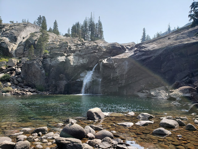
Polly Dome Lake

Lighten up while you still can
Don't even try to understand
Just find a place to make your stand
And take it easy.
~Take it Easy (Eagles)

The Dude abides.
I don't know about you, but I take comfort in that,
knowin' he's out there. The Dude.
Takin' 'er easy for all us sinners.
 ~The Stranger (The Big Lebowski)

Foiled by Fire - Tahoe Rim and Jennie Lakes


Several months back, when the hills were still rich with vegetation and the reverberating echoes of Spring deceived me into believing that fire season in California wasn't really a thing, I dreamed of taking a late-season, multi-day backpacking trip with my kids and some old friends. California's backcountry is immense, so the possibilities then seemed limitless. Thus, along with my backpacking co-conspirators, we began pouring over topographic maps, researching trail descriptions, and plotting potential routes through the forests and ranges that comprise the vast Sierra Nevada. Ultimately, we settled on a section of the Tahoe Rim Trail, a 165 mile path that circumnavigates the famous sapphire pool that straddles the California-Nevada border. That selection seemed to have everything that an outdoor enthusiast could possibly desire: scenery, easy access, scenery, adequate water, and scenery. Plus, it was proximate to post-adventure beer and tacos. That was the real clincher.  

And then in mid-August, as the date for our departure began to creep over the horizon, the Caldor Fire ignited and the El Dorado Forest near Lake Tahoe began to burn. As the conflagration raged out of control and evacuation orders forced locals to flee to wetter ground, smoke darkened the skies and ash rained down over the Tahoe Basin. The best laid plans...

So we scouted alternatives and settled on the Jennie Lakes Wilderness near Sequoia-Kings Canyon ("SEKI"). It hit all the same marks as the Tahoe Rim Trail save nearby tacos and beer. We decided we could adjust to that minor imperfection and major inconvenience. 

And then it happened again. The KNP Complex fire ignited and suddenly SEKI was ablaze too. The fire began in the south, but steadily marched northward threatening the world's largest tree by volume and closing the park. Foiled yet again, we scrambled for a back-up to our back-up and miraculously found enough available permits for the Murphy Creek Trail in Yosemite. If the Tuolumne Basin started to burn, we were done. We'd just stay home and pout.  

But Yosemite didn't burn. So on a Thursday afternoon, we all converged on the trailhead along Tioga Pass Road, strapped on our packs that were heavy with whiskey and other goodies that would make the ultra-light set squeamish, and headed into the wilderness. 

Murphy Creek Trail to Polly Dome Lake


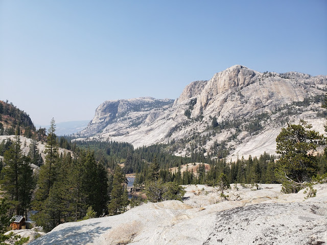
The Murphy Creek Trail is a short, flat, and pleasant walk through a lush coniferous forest that is occasionally interrupted by brilliant granite slabs that have polished smooth by the ancient glaciers that created this place. Classic Yosemite. About 2 miles in, a use trail branches to the right that takes you to the western edge of pretty Polly Dome Lake.  

The original plan, conceived when we were feeling ambitious about our adventure, was to hike to Polly Dome Lake for the first night, down to Glen Aulin along the Tuolumne River the second night, back to May Lake the third night, then out the morning of the fourth day. But after we arrived at Polly Dome Lake and set up camp, we decided to embrace our inner Dude and just take 'er easy. We'd use Polly Dome as our base the whole time and just day-hike to our planned destinations. That way, we could avoid the unnecessary hassle of repeatedly putting up and tearing down camp.  

Murphy Creek Trail

Polly Dome Lake

Polly Dome Lake

Polly Dome Lake Campsite

Day Hike to the High Sierra Camp at Glen Aulin


The following morning we brewed coffee in the cool mountain air. Inexplicably, the exact same coffee that you drink at home every single day suddenly becomes a gourmet experience when consumed from a titanium mug under a canopy of regal evergreens. If only I could say the same thing about food (Top Ramen excepted) which I find to be largely unappetizing at elevation. 

Anyway, sufficiently juiced up on caffeine, we then headed to Glen Aulin for the day which was a little less than 5 miles to our northeast. It was a slow descent on a beautiful, well maintained trail that permitted occasional looks at various peaks that stud the Tioga Pass area. At McGee Lake, a finger-like lake along the trail, we stopped for a brief spell to try our hands at swimming and fishing. Neither endeavor was particularly successful. We then made the final drop to Glen Aulin where the Tuolumne River comes spilling of the cliffside into a large, emerald pool. There's a High Sierra camp at Glen Aulin with bathrooms, water, and bear boxes, but all of it was locked tight and the camp was empty of campers. 

Ultimately, the nearby water proved too enticing, so we all gleefully stripped off our clothes and jumped into the waiting pool. A day-hiker nearby watched in bemusement. Almost immediately, we regretted our impulsiveness as the water was surprisingly frigid and major shrinkage ensued for all those with appendages that could shrink. We then sat like lizards in the sun, warming our now cold blood.  

On the way back to camp later that afternoon as my mind had wandered off as I wandered along, my friend suddenly exclaimed "bear!" I immediately snapped to attention, and sure enough, about 30 yards up-trail blocking our way was a very large black bear. When we checked in to obtain our permits, the ranger told us that bears were very active in the park and to expect a visit to camp every night, but that never happened. This was the only bruin we would see. As the bear ambled down trail toward us, we all started yelling and clapping our hands like fools to no avail. The bear was completely unfazed by our antics and continued slowly toward us. As we started to search the ground for projectiles, the bear moved off trail and we slid by without incident making it back to camp with a tale to tell.

Early Morning at Polly Dome Lake

Yosemite National Park

McGee Lake, Yosemite National Park

Glen Aulin

Grand Canyon of the Tuolumne

May Lake, the Geographic Center of Yosemite


The following day, we made the 4-mile trek to May Lake, the "geographic center" of the park. May Lake is a gorgeous high-country lake that sits in a basin beneath stark and towering Mt. Hoffmann. We briefly contemplated making an attempt at Hoffmann's summit, but consistent with our adopted Dude-aesthetic, we decided to simply sit shoreside and admire it from afar. 

There's also a High Sierra camp at May Lake replete with bathrooms, water, and bear boxes. Like Glen Aulin, the bathrooms and water here were non-functional. Unlike Glen Aulin, the bear boxes here were unlocked and stuffed to the gills. Loafs of bread, bottles of ketchup and mustard, and edibles of all types were crowded in, on, and under every box. And the camping area was congested with campers. It was a bit of a shit show even though it was late season. I suppose that is understandable given that May Lake is easily accessible from Tioga Pass Road via a mile and one-half trail. But as scenic and worthwhile as it was to visit for the day, we were quite happy to return to lonely Polly Dome for the night.

May Lake Trail

Mt. Hoffmann Yosemite National Park

May Lake Yosemite National Park

Yosemite National Park

Leaving Yosemite - the Last Day


On the final morning, we walked out, retracing our steps from day one. As always seems the case when you've been out a few days, we were both ready and reluctant to go. So we got moving early, but moved slowly, savoring the last moments of high-country bliss. Back at the trailhead, we unloaded our packs and retrieved the cans of malt and grain beverages that were stowed in the nearby bear boxes. We were going to just leave those in the trunk, but the ranger told us that bears can smell sealed beer through an aluminum can. Although we skeptically viewed that tidbit of information as nothing more than ranger scare-mongering, and despite the threat of theft by fellow hikers and hooligans, we ultimately were obedient little soldiers and stashed our stash in the bear boxes. And the beer survived the ordeal.

On the way down 395, we were hankering for some real food. After a couple of days of trial mix and tuna pouches and trail mix, we could think of nothing but burgers and fries and burgers, so stopped in Mammoth Lakes at the brewery to quell our hunger pangs and slake our thirst with a frosty mug. It was all very Dude and the perfect compliment to a good couple of days in the mountains.

Murphy Creek Trail

Murphy Creek Trail


Thursday, September 16, 2021

La Jolla Canyon: Those Were The Days


Tri Peaks Santa Monica Mountains

Yesterday
All my troubles seemed so far away
Now it looks as though they're here to stay
Oh, I believe in yesterday.
~The Beatles (Yesterday)

Think I'm going down to the well tonight
and I'm gonna drink till I get my fill
And I hope that when I get old
I don't sit around thinking about it
but I probably will
Yeah, just sitting back trying to recapture
a little of the glory of
Well time slips away and leaves you nothing mister
but boring stories of 
glory days.
~Bruce Springsteen (Glory Days)

Boy, the way Glen Miller played
songs that made the hit parade
Guys like us we had it made
those were the days.
~Those Were the Days (All in the Family theme song)

La Jolla Canyon Trail - Those Were the Days

You young whipper-snappers probably won't recall this, but way back in the olden times, well before the rona ruined everything, and we all had to walk to school and then back home again barefoot in the snow up hill both ways, you could hike into the La Jolla Valley by going straight up La Jolla Canyon. You heard my right. You could actually start at the parking lot near the Ray Miller trailhead and march right up the canyon past the falls, through what I called the Truffula Tree forest (a hillside covered with Giant Coreopsis - it was spectacular in the spring) and into the valley. There was an established trail and everything. There was no need to stitch together a long and circuitous route over fire roads. There was no ridiculously steep ascent up the over-crowded Chumash trail. And there was no illegal off-trail ridgeline hijinks required to get into the valley. You just went straight up the gut. Easy. Efficient. A thing of beauty.

One night back in those good old days when we were camping at the walk-in campsite, I realized that I had left my stove in the trunk of my car. So my boy and I strapped on headlamps and walked back via the La Jolla Canyon trail to retrieve it. An hour and one-half later we were slurping down piping hot ramen back in camp under an oddly purple sky. You could do stuff like that back then because the route through the canyon was open and passable. It allowed for those types of missteps.

But as Bob Dylan famously warned, the times they are a-changin.' And not for the better. I'm no Q-Anon conspiracy theorist or anything, but I've always had this uncomfortable suspicion that the California Department of Parks ("CDP") would rather see the recreating public recreate elsewhere. Thus, they continually take action (or no action as the case may be) that makes it more challenging if not downright impossible for folks to actually access and use the very public lands CDP is tasked with (mis)managing. You want to sit on the beach? That'll be $12 please. What's that you say? You'll just park along PCH and walk down the the beach instead? Ha! We had Cal Trans install "No Parking" signs all up and down the PCH. So hand over the cash. You want to walk that trail? Oh, so sorry, you can't do that. But it's all for your safety you know.  

The Hand of God Closes La Jolla Canyon

In terms of La Jolla Canyon, my distrustful little mind believes that permanently closing off that route has been a bureaucratic fever dream of the CDP for some time. The problem always was how to actually accomplish that without causing a total shit-storm by the public. And then during the winter of 2015 came a miracle, the hand of God from the skies. A drenching storm blasted the coast causing major flooding and scouring the canyon. In the process, portions of the La Jolla Canyon trail were obliterated thus making it impassable to the average hiker. And just like that, the trail was closed and access terminated. Six years running, and the trail remains closed with no apparent plans to re-open it any time in the foreseeable future.

La Jolla Canyon Trail

I've got mixed feeling about this. On the one hand, I'm annoyed to the point of apoplexy by CDP's administrative foot-dragging. In no reasonable scenario should it take six-plus fucking years to restore and re-open a trail. I don't care how damaged it is. And CDP's predictable and well-worn excuse that it lacks sufficient resources to get the job done is as tired as Trump's bullshit claims that the presidency was stolen from him. Even if CDP's whining about insufficient resources is true, a brigade of volunteers could probably bang the job out in a couple of months. The National Forest Service does this type of thing all the time with great success. And CDP already regularly relies upon volunteer organizations like the Santa Monica Mountains Trails Council ("SMMTC") for free labor. In fact, SMMTC has already been working the upper stretches of the La Jolla Canyon trail from the northern junction of the valley road to the junction with the Valley Loop Trail. So it would seem that what we have here is simply a lack of will by CDP. Or perhaps something more nefarious.

On the other hand, the continued closure has probably saved the canyon from destruction by the throngs of pandemic refugees who have just recently "discovered" places that the hiking community has known about for decades. It's a virtual certainty that had La Jolla Canyon been open the last 18 months, the area leading up to and around the falls would have been a hot mess of graffiti, discarded masks, beer cans, and used tissues. As I type this, I realize that probably sounds a tad elitist. Y'all probably are thinking "Oh, we see how it is Wildsouthland. You want the trail open for you, but not for anybody else." To which I might reply, "Well yeah!" But seriously, I don't mind other folks using their public lands. I just expect them to obey the Golden Rule that we are all supposed to live our lives by: Don't be trail dick! That means don't spray-paint your lame-ass name/initials/gang insignia/directional arrows/whatever on every available rock and tree. Don't cut switch-backs to save yourself 3 seconds on your way back to the car. If you're in that big of a rush to get back to your television, your couch and a bag of Doritos, maybe just stay home in the first place. Don't leave your nauseating pee rags/sweat rags/snot rags/shit rags along the trail for the rest of us to have to see and smell. This isn't your bathroom and your mommy isn't coming by later to pick up after you. Don't bring your dog on trails where dogs are not permitted and then leave little green plastic bags of poo trailside for the rest of us to clean up. God invented dog parks for this purpose. And if you happen to ride, stop being a self-indulgent asshole by poaching "hiking-only" trails. The vast majority of public lands are multi-use and already open to bikers. You don't need to fuck up the miniscule percentage of trails that are reserved for those who prefer to journey on two legs.

La Jolla Canyon Post-Mortem

So anyway, where was I? Oh yeah, waxing nostalgic about the La Jolla Canyon trail. I'd like to believe that the current state of affairs is not the new "normal." That at some point in time, CDP will demand that its rangers stop playing Paul Blart, exit their idling pick-up trucks, cinch their belts up over their substantial guts, and do some actual trail work. But I don't know whether that is going to happen. It certainly hasn't happened the last six years. So I guess that unless and until that time arrives, all we're unfortunately left with when it comes to the La Jolla Canyon trail is boring stories of the glory days


Sunday, May 30, 2021

Los Padres Double Delight


Hines Peak and Creampuff

The true delight is in the finding out rather than in the knowing.
~Isaac Asimov

Suck it up, cream puff!
~Captain Lee

I've spent a good amount of time over the past couple of decades exploring the backcountry of the southern Los Padres. I've also sat in my living room attentively pouring over maps of the Sespe, staring at peaks and trails and rivers and canyons and ridgelines and fantasizing about what it would be like to experience those abstract places that exist only on a Tom Harrison map and in my fertile imagination. Because of this, I've known for some time about Hines Peak and it's slightly shorter neighbor, Creampuff. I had just never actually been to either of them. This dereliction of exploratory duty certainly wasn't due to my disinterestedness. Instead, it was primarily the result of the challenge of actually getting to these two peaks which sit in a rather difficult-to-access corner of forest. The only two ways to reach these peaks is either by a very long and tortuous walk or, a long and tortuous drive along the Nordhoff Ridge Road to Elder Camp near the road's junction with the Red Reef Trail (permit and 4-wheel drive required).  

But as Isaac Asimov said, true delight isn't in the knowing. It's in the finding out. So when Keith (aka, the Iron Hiker) suggested that we drive to the end of the Nordhoff Ridge Road in his 4x4 Tacoma, and then scale both Hines and Creampuff, I jumped at the opportunity. Time to be delighted. 

Rose Valley and the Nordhoff Ridge Road

We met at Rose Valley early. Sean (aka Cucamonga Man) and Cecelia joined us there and we all piled into Keith's truck. As we began the long drive up 5N42, the marine layer hung thick and low in the air, blanketing the hillsides with an ethereal mist and obscuring the path forward. At one stage, the cloud-cover became so dense that I had to get out of the truck in order to tell Keith where the road was.

After a slow, bumpy, and foggy drive, we found a place to park just beyond Elder Camp and began our hike. At road's end, where the fire road intersects with the Red Reef Trail coming up from White Ledge, a couple was camped on a broad flat with magnificent views into upper Lion Canyon and the Sespe. Here, the mist finally began to burn-off as we climbed into the Thomas Fire burn zone which scorched this area in 2017. A Poodle Dog orgy was in full swing here, so we had to bob and weave and dance our way around the offending bush until it petered out near the saddle that separates Lion Canyon to the north and Santa Paula Canyon to the south. Here, we caught our first glimpse of the day's objectives piercing the pillowy cloud bank.

Red Reef Trail
How it began

Lion Canyon
Upper Lion Canyon

Red Reef Trail
Trudging Along the Backside of the Topatopa Bluffs

Cucamonga Man
The Cucamonga Man in his Natural Environment

Creampuff
Creampuff (foreground) and Hines (rearground) from the Saddle

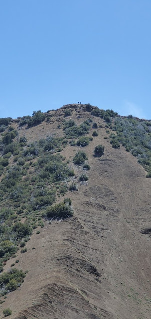
After we "ooh'd" and "ahh'd" for a spell at the grandeur of the scene before us, it was an easy stroll to the base of Creampuff. We stopped briefly to survey the steep route we would later be taking up Creampuff's north face, and then continued down the trail to climb Hines first. Dinner before sweets. 

The Climb to Hines Peak

The route up Hines begins at the shallow saddle between Hines and Pt. 6,403. The Red Reef Trail continues in a south-easterly direction dropping down to Ladybug trail camp and then continuing all the way to the Sespe where it intersects the creek near Oak Flat. Recent reports indicate that this trail is passable from Oak Flat to roughly the old Horsethief site. But between there and Ladybug, the path is apparently a tangle of overgrown brush that is difficult to follow. No bueno.


After gulping some water and a Shot Blok for a quick energy jolt, we began the slog upward. There is no formal path, but there is a visible use trail worn by others who came before. We tracked this use trail as closely as possible, but as these things typically go, it eventually frayed into a number of strands the higher we went, so each of us just picked our own way up. The north side of Hines is basically comprised of loose dirt over bedrock so it was steep and loose going. After scampering up a sketchy chimney which was the crux of the climb, we topped out on a false summit. A short distance later, we were on the actual summit where we found a register and two benchmarks, but limited views. Celebratory pictures were taken, obligatory entries were entered in the registered, and then we retraced our path back to the saddle. The retreat from the top was a quick and dirty affair, much easier than the climb.  

The Sespe
Sespe Views

Hines Peak
Creampuff (right) and Hines (left)

Creampuff Peak Route
The Spine Route to Creampuff

Hines Peak
Hines Awating Us

Hines Peak
The Route Up Hines

Hines Peak
The Cat Walk - Don't Slip Here

Climbing Hines Peak
Keith Attacking Hines

Ladybug Camp Sespe Wilderness
Looking Toward Ladybug and Beyond

Creampuff Peak
Creampuff from High on Hines

Hines Peak Summit Register
Hines Summit Register and Benchmark

Summit Pose - Iron Hiker, WildSouthland, and Cecelia

Hines Peak Route
Dropping Down from Hines

The Route up Creampuff

Cucamonga Man and Cecelia weren't feeling Creampuff, so Keith and I hurried ahead to tackle our second peak. Along the way, we passed the old Last Chance Trail which is mostly abandoned, but can still be seen coming up from Santa Paula Canyon. The route up Creampuff is very similar to the route up Hines, but steeper and looser. Much of the time, the process was two steps forward, one step back as the ground moved continuously beneath our feet. Fortunately, it's a shorter climb - a mere 400' in elevation gain -  and before long, we were atop the summit where we found a summit register and the lid of a cream puff container to mark the spot. Trolling through the register of this "Seldom Visited Site" we recognized a number of entries from Los Padres regulars, including Christopher Lord (Lost in the Los Padres) and Reece McCalister aka Red Tail aka Mupu Mac aka the Lost Padres Lost Boy. This is a superior summit to Hines in terms of views. From this 6,486' aerie, you get panoramic looks at Hines, the Topatopoa Bluffs, and all points south.


Creampuff Peak Route
Ascending Creampuff

Hines Peak
Hines from the Summit of Creampuff

Creampuff Summit Register
Summit Register - a "Seldom Visited Site"

Proof WildSouthland was There

Creampuff Peak Summit
Iron Hiker and WildSouthland on the Summit

How Creampuff Got it's Name

It is worth noting that the appellation "Creampuff" is not the actual, recognized name of this peak. In fact, I don't believe that it actually has a formal name. Which got us to thinking: how did this peak become colloquially known as "Creampuff?" David Stillman pondered this very same question and surmised that two guys christened it "Creampuff" after scaling it with a bag of weed and a container of Costco cream puffs. When I put the question to Bardley Smith, Los Padres legend and sawyer extraordinaire, he told me: "I thought it might be a case of Occam's razor. This was verified by legendary hiker Kim. C. As you found, the register is contained in a 'cream puffs' container." So there you have it. Mystery solved.

Back at the saddle between Lion and Santa Paula Canyon, I realized that I neglected to drink the summit beer I had brought along for the occasion. So I dug that out of my pack while the rest of the crew drank more healthy, but less enjoyable hydration alternatives. Then we all trudged back to the trailhead through the Poodle Dog minefield and the dense fog to end a truly delightful the day in the backcountry.